Ironman 70.3 in Indian Wells - Part 1

We spent a weekend away from the farm to hang out with Chris and Meryl at the Ironman 70.3 held in Indian Wells, near Palm Springs. They both signed up to do this event long ago but what with a move to Idaho and Life Complications they deferred to this year. Meryl is injured and didn’t compete but we all went to support Chris. Meryl flew to Palm Springs on Saturday morning and we picked her up before heading to the Ironman venue.

Grassy area with vendor booth and an arch that says Ironman Village.

This is a view of the entry to the Ironman Village. This staging area was at a huge tennis pavillion and is the location of the bike/run transition and the finish. The planning and infrastructure that is part of the Ironman event is astounding. As you look through these photos imagine all the work that happens behind the scenes prior to this event and all of the equipment needed to set up the venues. I wrote about the Sacramento Ironman in October here and mentioned some of the issues. They have held this event at Indian Wells for a few years now and they have eliminated all the pitfalls.

Chris spreading gear out on the parking area to attach stickers with his entry number.

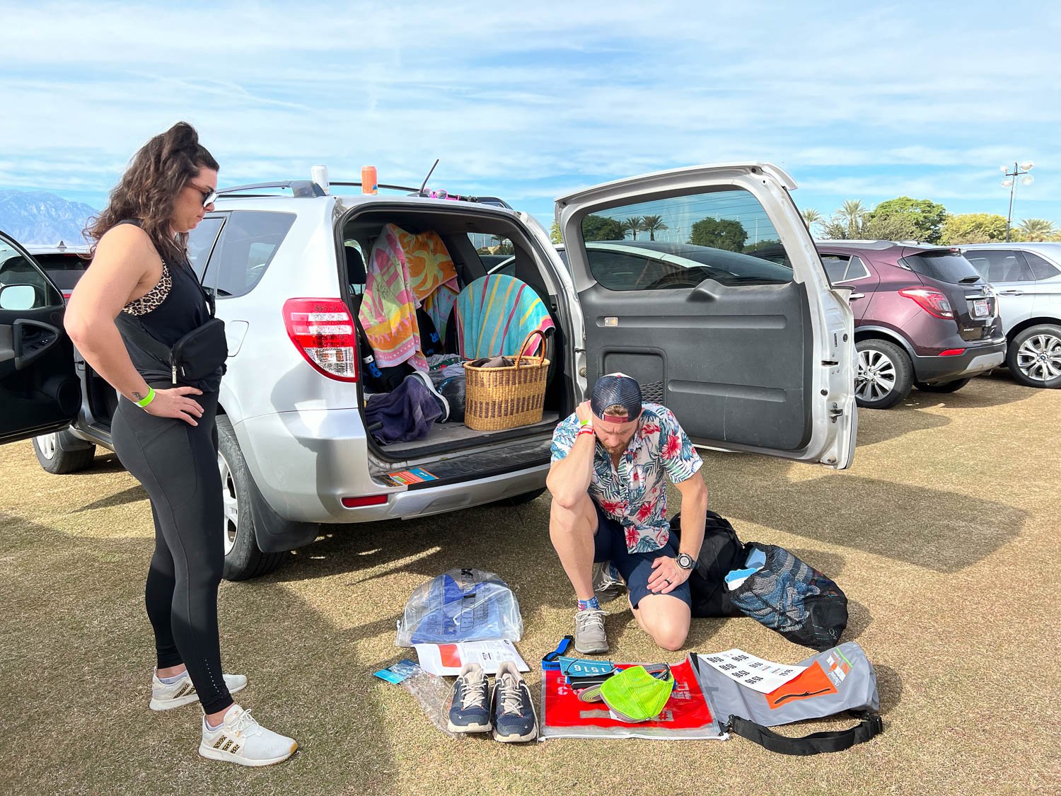
Chris picked up the transition bags and a page of stickers with his number. The order of events is always Swim, Bike, Run. and the athletes try to get through the transitions as smoothly and quickly as they can—it’s all part of the accumulated time. In the Swim/Bike transition they have to strip off the wetsuit and pick up the helmet and cycling shoes and any other clothing or gear needed for the bike. They may change into other shorts or wear what they were wearing under the wetsuit, but maybe add sleeves or legs for cold weather. There are gear bags to hold the next outfit and to stash what is being left behind. Chris has experience with this so has it pretty well planned out, but it is important to get everything right. Each bag has the athlete number. There were over 1800 participants—that’s a lot of bags if they get mixed up.

People standing around an above ground plastic pool filled with water.

An unusual addition for this event was the decontamination of the wetsuits. This was to prevent introduction of the quagga mussel into the lake.

Three rows of wetsuits on racks with mountains in the background.

Wetsuits were held in chlorinated water for 15 seconds and then hung to dry. Each athlete was given a tag to attach to the wetsuit to show it had been dunked. On race-day morning no one without that tag was to be allowed in the water.

Putting numbered stickers on bike and gear.

The next step was to leave the bike and gear bag, all properly numbered, at the racks set up in the swim-bike transition area.

Sign that says No Swimming in front of a reservoir with hills in the background.

Before we left the lake for the day I noticed this sign.

We went back to the hotel and, wanting to give Meryl and Chris a chance to relax (and me not wanting to watch football for 4 hours), Dan and I went off in search of something to explore.

Life size sculpture of big horn sheep ram.

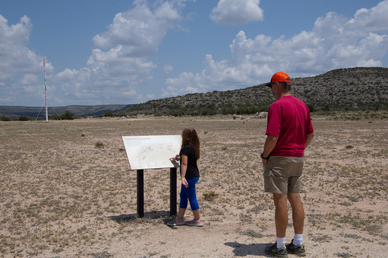
We drove not far out of town to the Visitor Center for the Santa Rosa and San Jacinto Mountains National Monument. This bighorn ram stands guard outside. The visitor center and the gates were closing in about 20 minutes so we did a brief walk along a nature trail nearby and then drove to a parking area where we could access another trail.

Highway sign of bighorn sheep along road against rocky slope.

The main road was far off but I was able to zoom in on this sign.

Sign on Rock that says Randall Henderson Trail with desert view in the background

We stopped at a 2.5 mile trail that makes a loop through the desert terrain.

Dan walking on dry sandy trail in the desert with dry hills in the background.

Starting out on the trail.

Desert trail with mountains in the background.

This is looking back towards the Visitor Center and the San Jacinto Mountains.

Close up of cactus with lots of spines.
Close up of cactus in desert landscape.

There are several varieties of cactus out here.

Sunset behind mountains with desert landscape in foreground.

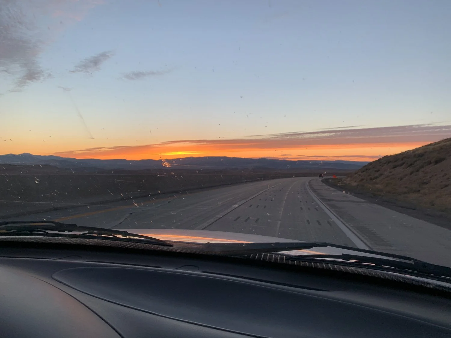
It was getting to be dusk by the time we were ending the hike.

Brilliant orange and pink sunset over mountain silhouette.

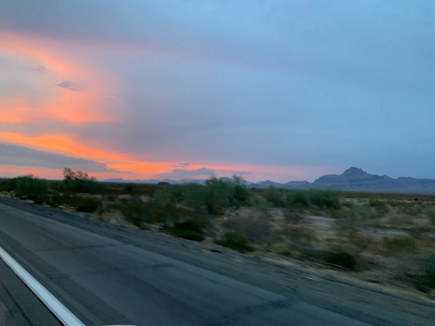
We were able to enjoy a beautiful sunset over the distant mountains.

TN-NC Adventure--Day 3

This was Friday, the last day we had for Great Smoky Mountains National Park. We were to be in Marshall, North Carolina by the evening for the next part of this trip. There is a main road through the park from north to south and Newfound Gap is half way across.

I cropped this photo from a sign that explained that the development of Great Smoky Mountains National Park was “led more by economic boosters than conservationists”. Auto clubs pushed hard for the park and in the late 1920’s crews from North Carolina and Tennessee worked to meet up at Newfound Gap and the road was completed in 1932.

Road sign about Newfound Gap in Great Smoky Mountains NP

This is cropped from the same photo of that sign.

Sign that indicates Tennesee and North Carolina State line.

The current state line marker.

Sign that marks the Appalachian Trail.

The Appalachian Trail follows the Tennessee/North Carolina State line almost all the way through the park from southwest to northeast borders. (At the western end the trail drops south off the state border before it reaches the Park boundary.)

Sign about the Appalachian Trail

I wanted to remember these details and photographing a sign is the easiest way for me to do that.

Entrance from parking lot to Appalachian Trail

According to that earlier photo we could have hiked all the way to Maine but this stop was our only experience with the Appalachian Trail.

We stopped at the trail to the observation tower on Clingmans Dome, at 6643’, the highest peak in the National Park and in Tennessee. The elevation is higher than the other parts of the park and the vegetation is different. We saw more flowers blooming here and plenty of pollinating insects.

Walking up the ramp to Clingmans Dome

There is a half mile trail up to the peak and then this ramp to the observation tower.

Katie and Kirby on the ramp to Clingmans Dome
Clingmans Dome in Smoky Mountains National Park.

From the tower there is a 360 degree view of the mountains in Tennessee and North Carolina .

Mountains and forest of North Carolina as seen from Clingmans Dome.
Selfie shot with mountains behind.

Selfie time.

Panorama view of ramp to Clingmans Dome.

A panorama view of the ramp.

Katie and Kirby walking down the ramp with the forest behind.

That’s Katie and Kirby heading down.

Closeup of bee on yellow flower.

More flowers and insects along the trail.

Wasps on yellow flowers.

Maybe there is such dense congregation of insects because it is too late in the season for flowers in the lower elevations.

Leave with pattern of yellow mixed with green.

Just an interesting leaf.

Sign for Blue Ridge Parkway.

By early afternoon we were on our way to Marshall, North Carolina.

North Carolina mountain and forest scenery with clouds overhead.

One last shot of the mountains near the park.

Idaho Trip - Day 3 - Part 2

At the end of Part 1 I asked a question about the Scottish bagpipers. Did you figure it out? See the next photo.

At first I thought it was just a few, but they all had sheep covers on their bagpipes.

The crowd was asked to be quiet while the sheep trailed through town. There are two sheep with halters at the front of the herd. The woman leading them was introduced as being part of this since being a little girl with her pet sheep. It helps sheep to have another sheep to follow so I assume that maybe at the staging area it was helpful to have these tame sheep be part of the plan. Maybe if we go again we’ll watch from that area—that would be interesting.

The sheep were followed by two more sheep camps, each a more modern version than the horse drawn camps.

I think this was an official part of the parade and he didn’t just sneak in to try and make a sale.

The last “entry” was the street sweeper.

After the parade we walked through a small outdoor vendor area. There were pushpins so that attendees could mark their locations on this map.

There were booths selling sheep and wool related items.

I stopped here because I thought I recognized the yarn. Not the actual yarn, but the style. Sure enough it was spun at Mountain Meadow Mill in Wyoming where my Timm Ranch yarn is spun. The wool comes from Nevada and one of the family members is working with this vendor to market the wool as yarn and as blankets.

They found a weaver in Boise. This made me anxious to get home and get my AVL loom up and running again. I’ve had glitches with the new compudobby (probably my fault and not the loom’s) and have been avoiding it. I have the yarn and I have the loom and I really want to get back to weaving blankets.

Seen on the way out of town.

Moving on from sheep, also seen on the way out of town.

This very cool set of bronze statues is at the south end of Hailey. I couldn’t get a decent photo of the whole thing. There is a herder with his horse, a dog, and several sheep. The artists’ portrayal of the animals’ body language and movement is just perfect. I can see my sheep turning like that to the dog, who crouches down to encourage the sheep to turn around (or in Ginny’s case, she’d bark and the sheep would turn around and stare).

In this view the dog and the herder are at the back.

On the long road to home. We hadn’t decided if we were going to stop along the way or just make it home.

A call from the Artery made that decision. I was supposed to work my shift Monday morning at 9:30. I think I hadn’t written in down because I knew that I should trade with someone for that day. Oops! We drove and made it home at 12:30 a.m.

Idaho Trip - Day 3 - Part 1

We ended the second day in Idaho by loading up Chris’ motorcycle and some other belongings that we would transport back to California. Then we hit the road and ended up in a motel sometime after dark. The next day we drove to Ketchum to catch the parade that is on the last day of the Trailing of the Sheep Festival.

We were rewarded for not driving this part of the route in the dark by seeing the fall colors along the way.

This is the town of Hailey and some of the Trailing of the Sheep Festival activities were here. Sheep played an important role in the economy and history of this part of Idaho. The amount of money represented by the sheep market from the mid 1800s to mid 1900s and beyond is in the billions in today’s dollars.

Now it’s not all about sheep, especially in this valley where winter sports and recreation have a large role. As you know if you follow my blog I keep myself amused by taking photos of things of interest along the way…things like a giant bicycle…

…and a colorful sheep.

Ketchum is just up the valley from Hailey. We parked outside of town and walked to the parade route. Like any other small town parade, people had staked out their spots with lawn chairs. We found a spot with a view and waited for about 45 minutes for the parade to begin. The sheep spend the summer grazing in the high mountains and are trailed down the valley to lower elevation for the winter. This festival was developed as a way to recognize this history and the people involved and promote the concept to the modern residents.

A mounted color guard. The horses were decorated with sparkly rumps, but I already have enough photos to share so I didn’t include that one.

The dignitaries of the town and the parade were transported in the first horse drawn wagon. This is the Lava Lake Lamb Camp wagon from Hailey.

Hook Lamb camp wagon pulled by miniature horses.

This is the Jones Sheep Camp. They call these wagons camps because they are the basis of the headquarters or camp for the shepherds who stay with the flocks in the mountains all summer.

The Ben Holland Sheep Camp, with a double wagon.

The parade included Basque and Peruvian dancers and musicians and the festival recognized the importance of those cultures to the sheep industry . Many of the original Basque herders settled in the valley and became sheep owners themselves. Today the industry relies on Peruvian herders.

This is Miss Lamb Chops and I don’t know the story about her.

It seems that where you find a wool celebration you often find a Scottish component. Scots settled in the valley and played an important role in the early days.

I saved way too many photos for this blog post so I’m going to make this Part 1 and finish it off with Part 2. While you’re waiting for that, take a look at these bagpipers. Do you notice anything odd?

To be continued…

2021 Road Trip to Texas - Back to California 2

It’s sure taking me a long time to tell the story of this trip. (The first installment is here and the fifth is here.) This is the second day of the return trip. We left the motel in Alamogordo and headed to White Sands National Park, only 15 miles away.

DSC_2816.jpg

The park borders the White Sands Missile Range and there is one road in and out with some parking areas and trails.

IMG_6971.jpg

We stopped at the first trail.

DSC_2817.jpg

The dunes are continually changing as the sand is blown into new shapes and this trail was marked by blue posts.

IMG_6972.jpg

I kept thinking that this is the little girl who, 5 years ago in Hawaii wouldn’t get off the beach towel and let her feet touch the sand.

IMG_6975.jpg

I have some great video clips of her rolling down these dunes like a kid rolls down a grassy slope but if I take the time to figure out how to post them here I’ll never finish this story.

DSC_2821.jpg

It’s not all sand. This is a darkling beetle.

DSC_2834.jpg

I looked this beetle up later and the “distinctive tracks” that we saw were described.

I have not identified these flowers—maybe primrose?

DSC_2819.jpg
IMG_6983.jpg

At the last place we stopped Kirby wasn’t too excited to get out of the truck. It was very hot by this time. I wanted to get a look over this dune so I walked up to get some photos while Dan and Kirby stayed in the truck. This view is looking back at our truck (with trailer) in the parking lot.

White Sands National Park protects about half of the largest gypsum dunefield in the world (275 square miles).

IMG_6987.jpg

It was designated a National Monument in 1933 and became a Park more recently. We checked out the visitor center, let Kirby choose something from the gift store, and then got back on the road about noon.

DSC_2846.jpg

The rest of this post is things seen along the road.

DSC_2847.jpg

Remember, I try to entertain myself by photographing things of interest. I really don’t know the significance of this chili pepper. ..

DSC_2848.jpg

…or this pink elephant.

IMG_6989.jpg

I don’t remember what kind of inspection or border patrol station we passed through here, but that had a huge array of cameras and other devices as the truck drove through.

Crossing the Continental Divide was exciting for us…

IMG_6993.jpg

…but a difficult concept to explain to a 6-year-old when there are no mountains in sight.

DSC_2860.jpg

More freeway art. I’m not sure where this is—maybe still New Mexico.

DSC_2863.jpg

We weren’t in New Mexico long though before reaching Arizona.

DSC_2873.jpg

Freeway art cotton fields.

The goal was to make it to California before we stopped so that it would be only one more day of driving to get home. I hoped to redeem myself with a better hotel room choice on this night. We made it to Blythe and found a motel that seemed to have good reviews. It turned out that the motel had been sold and was in escrow and no one much cared about the business anymore. We all slept OK but it was not the kind of place where you could luxuriate in your surroundings. But it was getting late already and we all went right to sleep after a bedtime story with Kirby.

2021 Road Trip to Texas - Back to California

We left home on a Friday (July 16) and got to my daughter’s house Saturday night. We spent four days there. If you have followed along this was the last blog post you saw.

DSC_2798.jpg

We started the long drive back to California on Thursday.

IMG_6948.jpg

This time the trailer was empty but we had a back-seat passenger. This is Kirby, age 6.

DSC_2801.jpg

As usual I entertained myself with photographing things I found interesting or amusing. Kirby entertained herself mostly with her tablet. Normally I’d object to hours of electronic entertainment, but there are exceptions. I was truly impressed with how Kirby handled the drive. Our truck doesn’t have a full back seat and Kirby was in a carseat, so she didn’t have much room. She was more patient that I was.

DSC_2803.jpg

I’ve lost track of where I took some of these photos.

DSC_2804.jpg

On the road in Texas.

We stopped more frequently for gas than we would have on our own. Usually we stop only when absolutely necessary for gas or for an interesting diversion of a historical marker or scenic overlook. The frequent gas stops allowed for more bathroom breaks and food. McDonald’s at the first stop was a big hit.

IMG_6952.jpg

I always follow along with the big map books. I found what looked like an interesting diversion that didn’t take us too far off of I-10. We had been driving about 3-1/2 hours and took Hwy 290 to Fort Lancaster State Historic Site. First there was a overlook with picnic tables and a wall to keep people (especially 6-year-olds) from falling down the steep drop-off onto the road below.

IMG_6953.jpg

The remnants of the Fort were in the flat land that you can see in the left of the photo. I always think about what it would have been like to be on a horse or in a wagon in “the olden days” and to travel over this kind of terrain.

DSC_2811.jpg

The State Historic Site “preserves the remnants of the only post established in 1855 to protect the Lower Road between San Antonio and El Paso”. There is a small museum and the remnants of some of the 25 buildings that had been constructed.

IMG_6955.jpg

Signs inside the museum told of the camel experiment in the mid 1850’s when it was thought that camels would be more suited to the area than horses and mules. As government attention turned to the more pressing issue of Civil War and Texas seceded from the Union in 1861 the camels were sold to private parties.

IMG_6958.jpg

We went outside to walk around the fort and saw this bug (dead) that was the size of…well, the size of a little girl’s hand.

DSC_2810.jpg

The site is 82 acres and includes remnants of officers’ quarters, a hospital, commissary, barracks, bakery, and more.

IMG_6959.jpg

This is what is left of Officers’ Quarters, each with two rooms separated by a double fireplace.

IMG_6960.jpg

The brochure I picked up says that by 1858 “Fort Lancaster housed approximately 150 enlisted men and three officers…opportunities for soldiers’ recreation were rare and frequently revolved around drinking and gambling.” The day was getting hot so our timing was good that we had stopped here in the morning. After walking around awhile we got back into the AC of the truck.

IMG_6961.jpg

This bug hung on to the windshield for quite awhile.

DSC_2812.jpg

More of Texas.

We saw three of these trucks over the course of several miles. Each carried one of the huge blades of the windmills that are prevalent between Sheffield and Fort Stockton.

IMG_6963.jpg

I have my big map books and I had bought a kids’ atlas for Kirby—it has maps of all the states and notes details (state bird, state animal, etc) for each.

IMG_6968.jpg

I was impressed with this tile mural in the ladies’ restroom at one of the rest stops.

We planned to visit White Sands National Park the next morning and we wanted to spend the night nearby. Some of you know that on our typical road trips our night-time stops are usually impromptu and “rustic” . I had packed the tent and camping gear with the hope that we would enlighten Kirby about what it’s like to travel with Mama Robin and Papa Dan (as we are called). But better sense prevailed. It was hot, even at night, it was difficult to find a suitable place that was not privately owned, and we had a 6-year-old with us. We decided on a motel. We stayed at Alamogordo, New Mexico, but didn’t get there until well after dark. My frugality overtook better sense and I got a one bed room thinking that since all we were doing was sleeping, what would be the problem. To be continued.

2021 Road Trip to Texas - Visiting Family

Its taken me awhile to get back to the Road Trip blog posts, but I know you’re waiting for the next chapter (at least I know of one person who is). As I said in the last blog post we got to Katie’s house just before midnight. We knew that it would be best to leave the goats in the trailer and get them out in their new surroundings the next day.

RoadTrip-TX-2021-55.jpg

They were glad to get out of the trailer. The new goat pen and shelter wasn’t finished yet so they went into the fenced area where the dog stays when everyone is gone. They particularly liked the big rocks that line the fence. The grandkids were told that they could each name a goat. Four-year-old, dinosaur loving Kasen named one of them Indominus (we thought of Indie for a nickname). Six-year-old Kirby chose Snowflake for the white yearling. Katie and Kurtis will name the kid.

IMG_6927.jpg

Who needs rocks when there is a picnic table?

IMG_6917.jpg

…or a dog house?

IMG_6929.jpg

I’m glad the goats finally made it to Texas.

IMG_6931.jpg

They will have good lives with our family there.

DSC_2772.jpg

2021 Road Trip to Texas - Day 2

It was daylight in the last photo I posted about Day 1, but we still hadn’t left California. We kept driving and now I don’t remember where we ended up, but it was somewhere along I-10 in Arizona.

RoadTrip-TX-2021-14.jpg

We had our camping stuff with us because usually on our road trips we find a spot to camp along the way. This was different. For one thing we just wanted to GET THERE. Another factor was that it was HOT. Sleeping bags and a tent weren’t appealing. I think we stopped here at about midnight. Dan decided to sleep in the cab with the seat back as far as it would go. I opted to get in the truck bed on top of the stall mats that we were taking to Katie for her new barn. I really needed to stretch out and not stay in the truck seat a moment longer than I had to. Neither were great options. I was comfortable enough lying on a sheepsking, but the trucks keep their generators on all night and other trucks go by on the freeway all night. We started up again about 4 a.m.

RoadTrip-TX-2021-15.jpg

When I used the map app on my phone to plan this trip it showed Home to Blanco, TX to be 24 hours. So after driving for probably 14-15 hours yesterday why did we still have 14 hours to go? That’s easy. We didn’t stop much but you do need to get gas and stop at the occasional rest stop along the way. Also, while pulling the trailer we weren’t staying at the posted limit, especially when it was 80 mph (in Texas).

RoadTrip-TX-2021-16.jpg

This was at 6:20 a.m. so it’s somewhere in Arizona between Phoenix and Tucson.

RoadTrip-TX-2021-20.jpg

Freeway Art somewhere around Tucson.

RoadTrip-TX-2021-22.jpg

I wouldn’t call this Freeway Art, but it was interesting. Does McDonald’s have a new item on it’s menu?

RoadTrip-TX-2021-24.jpg

Rest stop about 8:30 Saturday morning.

RoadTrip-TX-2021-23.jpg

I want to say “Dorothy, we’re not in Kansas anymore”. You get what I mean, right?

RoadTrip-TX-2021-28.jpg

9:30 a.m. Another state line to check off. One more to go.

RoadTrip-TX-2021-30.jpg
RoadTrip-TX-2021-31.jpg

View of the Organ Mountains/Desert Peaks outside Las Cruces.

RoadTrip-TX-2021-32.jpg

About 1 p.m. That didn’t take long.

RoadTrip-TX-2021-33.jpg

The phone showed about another 8 hours to our destination.

RoadTrip-TX-2021-37.jpg

More Freeway Art. This is near El Paso. I think the Freeway Art deserves a blog post of it’s own.

RoadTrip-TX-2021-38.jpg

This smoke plume, across the border in Mexico, was visible for miles. I tried to find out what was going on checking Google. No luck although I did find several links that brought up major fires over the last few years.

RoadTrip-TX-2021-39.jpg

Border Patrol station. The dog who sniffed our truck didn’t think twice about the goats.

RoadTrip-TX-2021-42.jpg

A Freeway Mural.

RoadTrip-TX-2021-44.jpg

Before we got to Ft. Stockton (about 5:30 p.m.) the “low fuel” light came on. UhOh. Ft. Stockton was the next place where we could find gas and fortunately we weren’t too far out.

RoadTrip-TX-2021-45.jpg

Both Dan and I are always very careful about not running too low on fuel, but around here it’s not that much of an issue. Town isn’t far away and even when traveling there is always a gas station nearby. That’s not the case when driving through the southwest. It turns out that we weren’t as close to empty as we thought when the warning light came on. I looked it up and our truck has a 25 gallon tank. However, we’d been driving with the trailer at elevation and into head winds and all of those things affected our gas mileage for the worse.

I called Katie from here and she had a Ft. Stockton story. That is where their truck broke down when she moved from California. They were stuck in town with a horse and a dog for a few days waiting for parts.

RoadTrip-TX-2021-46.jpg

In Ft. Stockton there is no excuse for getting lost.

I love the expression on this roadrunner’s face.

RoadTrip-TX-2021-48.jpg

Texas landscape from the truck. This is about a half hour past Ft. Stockton.

I took only==

I took only a few more photos after this or maybe I just deleted most.

RoadTrip-TX-2021-50.jpg

This isn’t Freeway Art but I think it is Inspiration for Weaving. Great colors and pattern!

We made it to our destination on this day but it was after 11:30 p.m.

Sheep Delivery Road Trip

I was excited to plan a sheep delivery trip and think that we could make it a Road Trip. Many have read the blog posts about our annual Road Trips. We camp along the way, visit National Parks, and stop at all the road side markers about historical events and natural wonders. Last year we visited Rocky Mountain National Park and ended the trip at Schacht Spindle Company’s 50th anniversary dealer weekend. I just looked back to find the posts about that one. I wrote the first in September not long after we got home, but got distracted by breeding season, Lambtown, and then a severe injury in October, and I did’t complete the stories until March, 2020.

It turns out that it doesn’t make much sense to combine sheep and the kind of road trip we like—back roads, through National Parks, hiking when we feel like it—especially when there are active wildfires and horrible air quality (and besides there is a pandemic going on). So the sheep part of the trip was successful—but I can’t really call it a Road Trip. I don’t have great photos of beautiful scenery, but there are photos of the experience.

IMG_0806.jpg

We were on our way at about 7:20 Wednesday morning, only 20 minutes after our planned departure. By this time we were used to seeing an orange sun in a gray sky.

Oregon-2020-2.jpg

This is not how the Sierras are supposed to look. It didn’t get any better. The majestic views we are used to just weren’t there.

Oregon-2020-3.jpg

We chose the route that was supposed to be the most direct to get to northeast Oregon—I-80 to Nevada, turn north at Winnemucca.

Driving across Nevada.

Oregon-2020-5.jpg

Air quality in Oregon wasn’t any better than Nevada and California. I assume that anyone who is reading this is aware of the devastating fires that have been burning all along the west coast.

Oregon-2020-6.jpg

My attempt at acting like this was a normal road trip. The map showed that there was the Vale Project Grazing Interpretive Site and Overlook. It amounted to this sign and a worn out shade where there probably used to be a picnic table. If there was an overlook I didn’t see it and there wouldn’t have been much to look over anyway.

Oregon-2020-7.jpg

This route took us into a sliver of Idaho. I had seen this sign last summer on the way to visit our smokejumper son in McCall. I don’t think there are any long-lost relatives here, but it’s sort of an unusual name. It would be interesting to pursue someday.

It was interesting to see hops growing in Oregon.

We knew that it would be well after dark when we arrived if we continued the drive all the way to our destination, and I really couldn’t face another three hours in the truck anyway. I always follow our route in those big map books and I found Farewell Bend State Park on the Snake River. We got there around dusk and were able to stretch our legs a bit after selecting a campsite. All we really needed was a place to park because we weren’t setting up a tent or cooking (cold homemade pizza for dinner). At home we decided that we wouldn’t both fit well in the trailer so Dan had fixed up a platform so that I could have a sleeping area in the trailer above the sheep and he would sleep in the bed of the truck.

This is the view from my sleeping bag. There were some unanticipated problems. There was kind of a tight fit with four sheep on the right and three on the left. The ewes on the right weren’t much problem once I figured out how to secure one of the loose gates so it didn’t clank against the wall every time one of them moved. The rams were another story. They didn’t fight but every time one of them moved his head a horn would clank on the wall or a gate. That gate that is separating two of them from another was NOT closed when the night started. With their movement the catch was released and it shut sometime during the night. There was continual clanking of horns against walls. There was pawing as they either were looking for food or trying to bed down. And they are actually pretty noisy when they are chewing. The clanking was the worst though. Needless to say I slept only on and off that night. I had planned to read and could have done to kill the time, but the light of the iPad drew all the bugs in the area. Does this sound like complaining? I know that there were a lot worse things going on in the world (and in all the fire zones) but I’m just telling the story they way it felt. I did like my special platform, but having sheep with horns below was the problem.

This is the view of our “camp” the next morning.

On the road again. heading to the Wallowa area. The last time I was in this part of Oregon I was on a camping trip with friends in college. I have always remembered that it was gorgeous country.

We got to our destination about 10:00. This is the ewe flock (and a goat) at Ruby Peak Farm.

I had brought three ram lambs with me so that Kate could choose which she liked best. It’s hard to choose a lamb from just looking at photos and they change quickly as they mature. I felt a lot better offering a choice. This is the lucky ram who got to stay in Oregon.

Oregon-2020-14.jpg

This is Ruby Peak Tamarisk, a yearling ram, who made the trip back to California with us.

Oregon-2020-15.jpg

Driving along the Wallowa River.

There were miles of hay fields with big barns. The smoke still hung over the landscape.

Oregon-2020-17.jpg

I am reminded of those postcards that say “Hawaii (or anywhere) at night” and they are black. This is driving right next to the Columbia River. You can barely see the other side of the river right across the middle of the photo.

We turned south at Portland and met up with another sheep buyer in Albany in the late afternoon. We transferred the ewes from our trailer to hers and then got on the road again. The original plan had been to be gone three full days, returning late on Friday. By this time we knew that conditions didn’t lend themselves to the leisurely trip I had thought about. There was smoke, less than perfect sleeping conditions, and covid concerns. We both decided that we really just wanted to be home. So we drove. Well, Dan drove. I slept a lot in the truck. We both slept for awhile at a rest stop near Redding, but for the most part just drove. We pulled into our driveway about 5:30 a.m. on Friday.

I’ve made a big deal about the smoke throughout this post. That was most obvious to us and was a major factor in decisions while we were on the road, but of course the most important aspect is that the smoke was there only because of the horrendous fires that were (are) burning. With two sons and a DIL on the fire lines and friends who were directly affected here in California I don’t forget that the fires are the real story.

I also hope that we’ll be able to take a real Road Trip next year and maybe focus on that beautiful part of Oregon in the northeast corner and make it to some National Parks along the way.

We slept a few hours and then unloaded sheep at home. I didn’t dare put Tamarisk with the other rams right away because they would fight. I found a wether to be his buddy and put him in a stall for a few days. This is Jade welcoming him to the flock. Tamarisk and the other rams will be turned out with ewes October 1. That will be another story