
Visiting Grandkids in Texas - Part 3
/Exploring with the grandkids in Texas—at a public natural area and at their home in the Texas hill country.
Read MoreA couple of years ago I started writing most of my blog posts on my original WordPress blog, but I’m back here now too (2026). I hope you’ll check out the farm stories and travel experiences at the other blog and sign up on that site for email updates.
Exploring with the grandkids in Texas—at a public natural area and at their home in the Texas hill country.
Read MoreA tour of the Texas State Capitol in Austin with my grandkids.
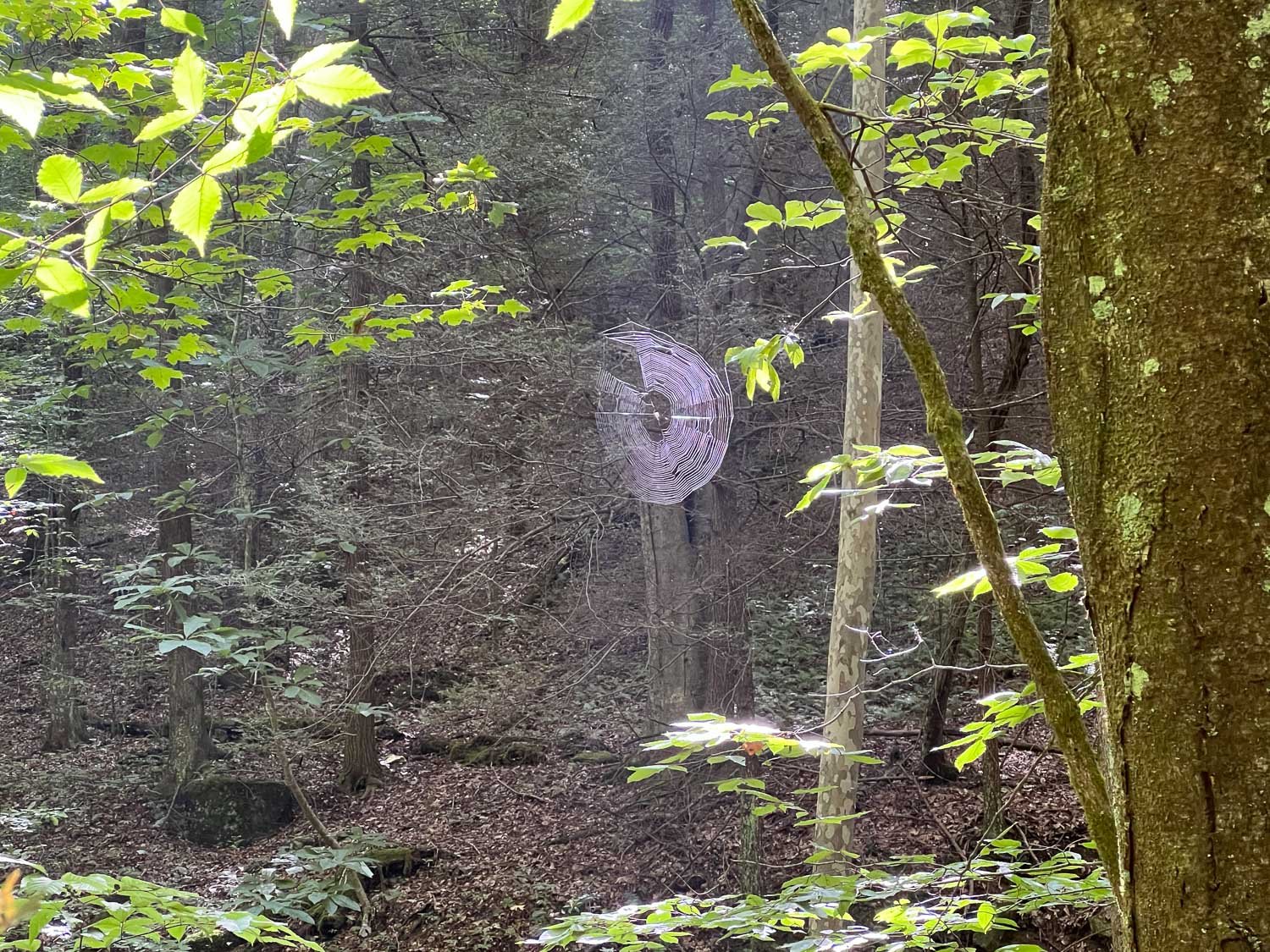
Read MoreVisiting the Science Mill in Johnson City, Texas on a recent trip to see my grandkids.
Read MoreI wrote about the last full day of our trip here. I mentioned that we looked up Taylor Swift’s favorite things to do in Nashville. On Tuesday afternoon we walked around Radnor Lake.

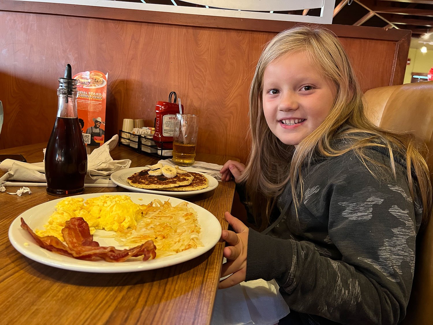
Wednesday morning we started with breakfast at Pancake Pantry.

Then we found Centennial Park. That wasn’t on the lists we found but it is mentioned in Taylor’s song, Invisible String. We started at the playground.

Kirby thought that she could swing higher than her mom.

I think it was a draw.

Then we saw the Parthenon. I have a friend who was just there…in Greece.

The sign says that this full-size replica was originally built for the Tennessee Centennial Exposition in 1897. It was intended to be temporary and built of wood, brick, and plaster. Nashville residents didn’t want it removed and the original remained in place until 1921 when the city began reconstruction, finished in 1931.

In 1987 the interior of the 1931 building was rehabilitated, including addressing accessibility issues. I had a plane to catch so didn’t have a chance to visit the galleries inside. Next time I’m in Nashville.

It is interesting to think of the ancient Parthenon in the same view as the modern office building downtown.

There were several statues throughout Centennial Park. This is the Tennessee Woman Suffrage Monument, recognizing the 19th Amendment.

I had a plane to catch and Katie and Kirby were heading back to Texas, about a 14-hour drive.

Nashville from the air.

I wish I knew what we were flying over. I thought of the Mississippi River, but I have no idea.

I don’t know what state this is, but I like seeing the circles made by the irrigation pivots.

I had a layover in Las Vegas and sent this photo to Kirby. This dog is trained to sniff out explosives.

I think this must be a finger of Lake Mead.

Look at the boat docks. Doesn’t it look like the boat ramp is well out of the water up and to the left of the waterline? The drought is real…and scary.

Lake Tahoe. Almost home.
I ended the last post on the way to Nashville on Monday afternoon. I was flying home Wednesday morning so the plan was to spend Tuesday night in Nashville but find something to do on Tuesday. I don’t remember where we stayed Monday night. I think it was somewhere around Knoxville, Tennessee but the motels on Monday and Tuesday night are less than memorable. You get what you pay for.

Katie had looked up things to do between Asheville and Nashville and found Frozen Head State Park . The criteria was somewhere we could hike in a place that Kirby would enjoy. She’d been a real trooper throughout this trip (and remember that she’d already been away from home for almost 4 weeks) and we didn’t want a hike that was too steep, too long, or where there was a body of water that was off limits (too deep, too rapid, etc).

Katie found Frozen Head State Park and we selected the Panther Branch trail.

This trail followed a creek that was accessible and fit the criteria above.


It would have been easier walking to stay on the trail, but Kirby liked picking her way along the rocks and in the water.

I saw a cluster of swallowtail butterflies in the wet dirt along the creek. Cluster? I googled a “group of butterflies”. The official word seems to be a Kaleidoscope, with other references to flutter, flight, swarm and wing. You learned something reading this blog post!

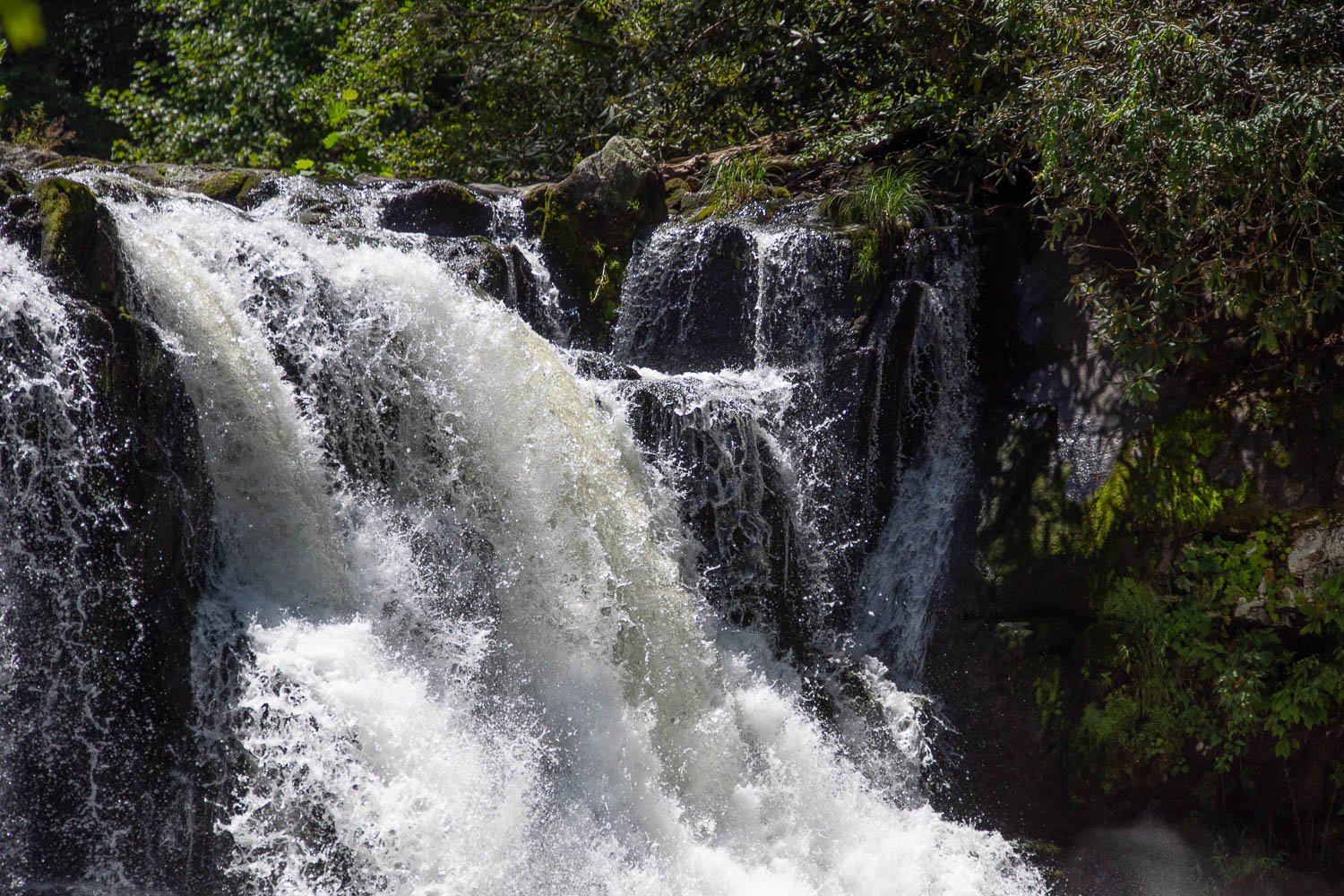
Eventually we were back on the trail to avoid a lot of branches and trees across the creek. We found that we weren’t alone. We made our was down to this waterfall and talked with a group of moms who meet here with their kids every so often. .

Kirby enjoyed the waterfall.


We spent an hour or so there and then walked back down the creek. I found the kaleidoscope of butterflies at the same place.

I read that adult butterflies consume only liquids and sometimes cluster in places that have extra minerals that they need. I don’t know if that’s the case here.

This is what happens when the photographer gets too close.

Katie and Kirby continued their hike down the creek and I took the trail.


We finished together on the trail. Then we headed for Nashville.
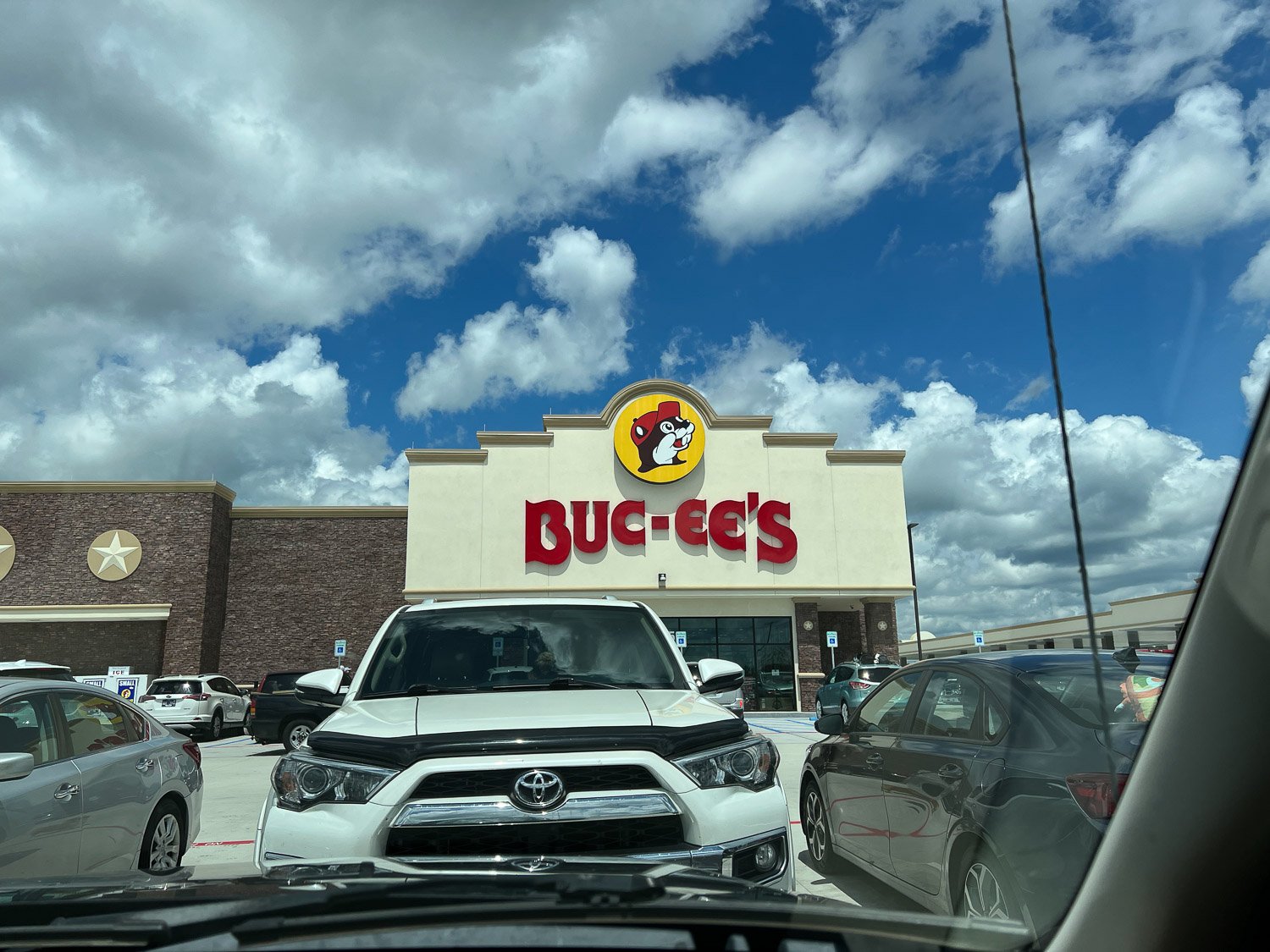
I had never stopped at a Buc-ee’s, but Katie is a big fan. We got gas and food here.
In the continuing theme of doing something that Kirby would find enjoyable we looked up Taylor Swift’s favorite things to do in Nashville. Kirby is a fan. We found a top five list and we visited three places.

It seems that Taylor likes to walk around Radnor Lake for some peace and quiet.

We walked the trail …


…and sat by the lake.

We found another less-than-memorable motel to spend the night. Katie went out for pizza which we ate in the room. I will remember the lightning storm that night—at least the motel was dry.
At the end of the last post I said that I’d probably revisit this later. I forgot that those photos were all just from the family’s living area and where they entertained. I have photos from the lower stories where there are recreation facilities and the servants’ domain. So here’s another post.
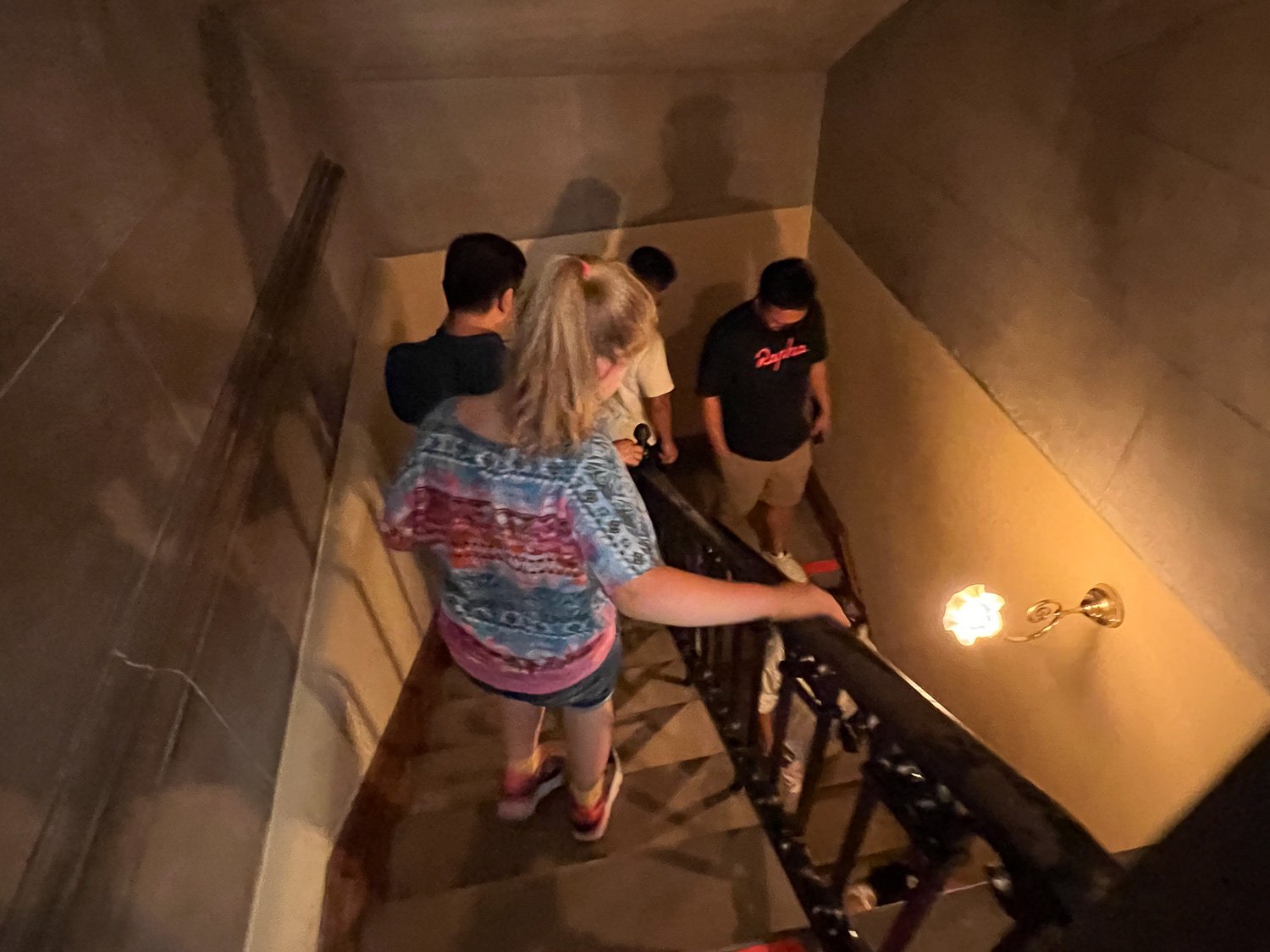
We followed instructions from our audio tour to go downstairs. This staircase is not as elegant as the staircases in the family area.

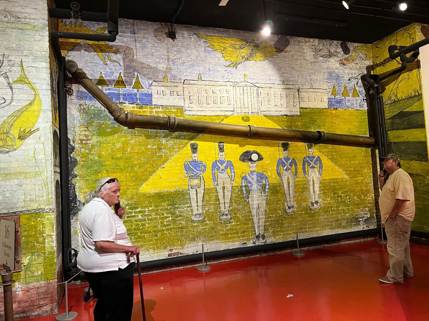
The Halloween Room is on the lowest level. The room was originally used for storage, but in the 1920’s Cornelia (daughter of George and Edith) and her husband painted the room for a New Year’s Eve Party. It became known as the Halloween Room because of the colors and some of the motifs painted on the walls.
It currently includes displays about building the Biltmore House.

There is a two-lane bowling alley on the lower level.

There is a hallway with several dressing rooms so that women guests could change into bathing costumes.

The pool was heated and still has the original underwater lighting.

This is a corner of the gymnasium.
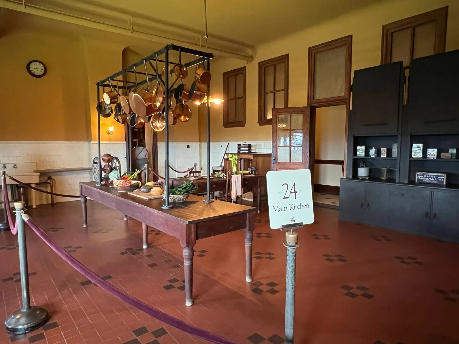
A view of the main kitchen.

The large stove in the corner of the kitchen.

This is one of several rooms off the main servants’ hall. In this room floral displays and plant decorations were prepared.

After touring the house we explored the grounds a bit more.

There were several trails around the gardens and going about 1/4 mile to the Bass Pond. This bridge is along that trail.

We drove to the area known as Antler Hill Village. There are farm animals, a playground, and demonstrations of some of the crafts practiced in the early 1900’s. We spoke to a blacksmith…
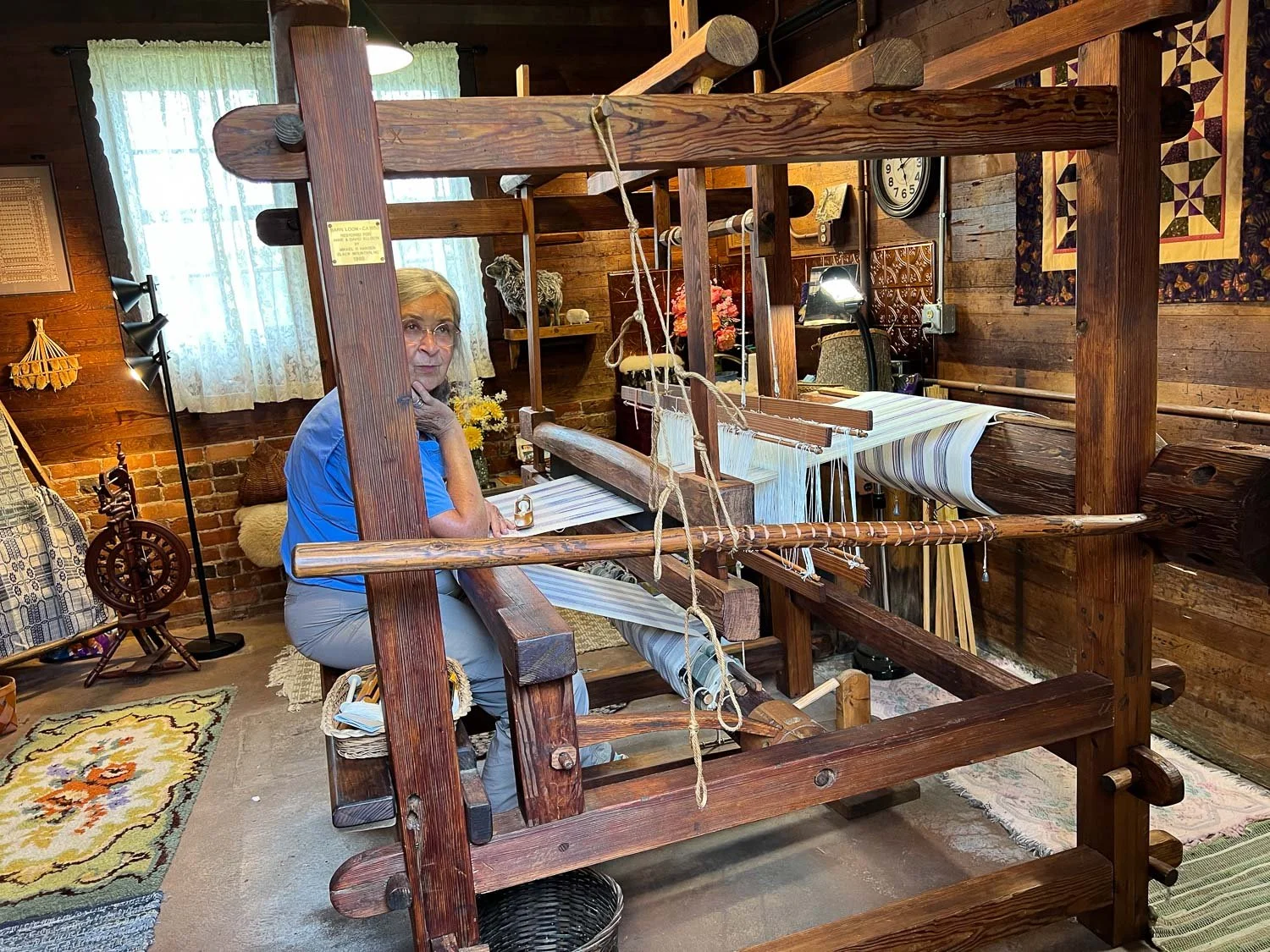
…and a weaver.

Our last stop before things closed was the Gardens Railway.

There were several model trains running through this garden. The buildings are models of famous landmarks around the world, all constructed of natural materials found on the estate.
There is so much more to see at the estate. If I ever go back to North Carolina, I wouldn’t mind stopping there again.

It was time to get on the road. We headed towards Nashville.
Touring the Vanderbilt house in Asheville North Carolina.
Read MoreHave you been waiting for the next installment of this Adventure? I have. There was not a program lined up on Sunday of the AGM, but a few people planned to meet at the organizer’s farm which happened to be just up the road from the place where we were staying.

This is Hobbyknob Farm, and some of the sheep were in the barn so we could get a close-up look

Kirby made friends with two goats and was amused by the “fairy house” behind her.
After visiting with AGM attendees at the farm we drove to Asheville. We stopped at the Botanical Gardens of Asheville adjacent to the University of North Carolina and walked a trail through the garden. Most plants are not blooming this time of year, but there were a few with flowers. I took photos but don’t have an ID for any of these.


We lost the main trail briefly and ended up in the creekbed. It was obvious that others had been there as well.

Back on the trail. We were here for a couple of hours and then drove to the River Arts District. I wanted to track down a business whose manager I had met at the AGM.

Our first stop at the River Arts District was a pizza shop. I admired the pizza oven.

After lunch we walked to Local Cloth , headquarters for the Blue Ridge Mountains Fibershed Affiliate.


This is a retail outlet, but there is also space for workshops.

There is clothing, yarn, fiber, and gifts for sale. I was intrigued by these “rocks” that look almost like the real thing.

We finished our time in the city with an ice cream treat.

We spent a relaxing evening “at home”, back at the AirB&B. I had originally reserved it for only two nights, but it was so much better than the motels and it was close enough to Asheville that I rented it for Sunday night also. The host started a fire in the fire pit and set us up with s’more fixings.

Here is the only view I took of the house. Our quarters are the first story of the house with sliding glass doors that open out to the patio under the deck. There is a table and chairs and a nice swinging bench. There are gardens all around and chickens off to the right. This is the link I shared in the last post—click there to see better photos of the house.
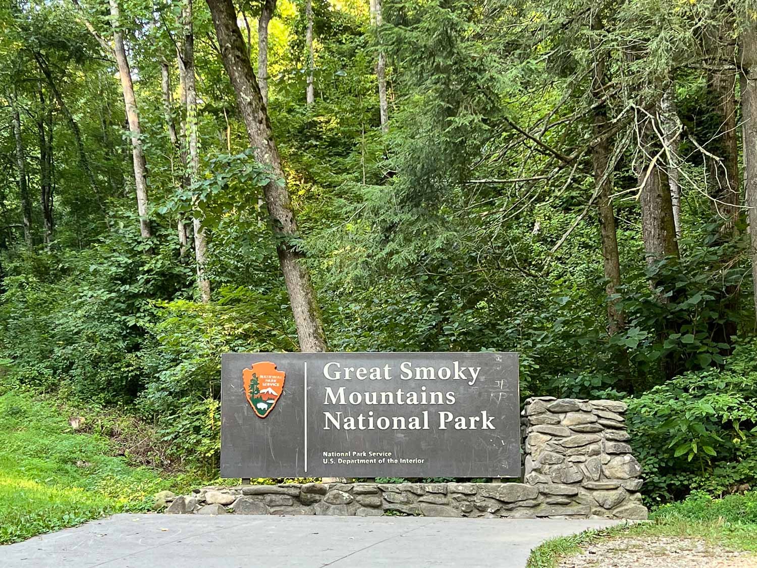
Here is Day 1 of this adventure. At this rate I won’t finish for months. I’d better speed up—there is lots more going on here to share. We had all of Thursday to spend at Great Smoky Mountains National Park. We chose to explore Cades Cove and hike a trail to a waterfall in that area. We tried to get an early start because we saw from the previous day how crowded the roads and parking areas could get as more visitors showed up.

We started the the Cades Cove loop drive. Our first stop was not a marked one, but we were on a one-way loop road with no traffic and there was a horse at the fence!
I like to follow a map as we explore and I learned new terminology. I was not familiar with points on the map called Bald or Gap or Cove. In the west I think Gregory Bald, Andrews Bald, Silers Bald would be called Mountain. Newfound Gap, Deals Gap, and Black Camp Gap would be called Pass. And a Cove might be called Valley. Maybe it all has to do with scale of the geographical features or it’s just something particular to this region.
We picked up the auto tour booklet for Cades Cove, and followed along while we drove, getting out of the car at the points of interest. According to the booklet the area was probably originally inhabited by Cherokee people, but “various conflicts, epidemics, and treaties made it difficult…to remain in Tennessee lands”. In the early 1800’s white families settled. They cleared land and built log homes. Corn was a major crop. The cove is encircled by an 11-mile one-way road. On Wednesdays this road is closed to vehicles and open only for bicycles and pedestrians—that’s a great idea! Fortunately we were there on Thursday.

John Oliver Place is one of 80 historic buildings in the park. We were interested in the construction of the various buildings. The materials range from round logs with notched corners to later frame buildings that use sawed wood. Katie, still trying to design a barn on her rocky Texas property, kept pointing out the “foundation”—piles of rocks that held up many of the structures.

I thought that I would remember everything I photographed, but of course I don’t, especially since it has now been a busy three weeks since this trip. I think I have everything identified correctly with the help of the tour booklet I kept. The booklet tells that a Methodist Church was built of logs in the 1820s and then replaced by this one in 1902. It pointed out the two front doors, indicated a custom of men and women sitting on different sides. However this church didn’t follow that custom, but used the building plans of a congregation that did.

Inside the Methodist Church.

We drove to the half way point on the loop road and parked at the beginning of the Abrams Falls Trail. The trail to the falls is about 2-1/2 miles through the woods.

The map indicates “moderate” difficulty. It is a well-maintained trail with a fair amount of uphill.

This bridge is over a creek that flows into Abrams Creek.

People were spread out on the trail and it didn’t seem too crowded, but there was a crowd at the falls.

It looks as though Kirby is about to dive, but she just enjoyed climbing on the rocks in the middle of the water. No diving.

Katie is photographing Kirby with a butterfly on her knee.


I often like to identify plants in my photos, but I it was a strange feeling here because I didn’t recognize anything…

…even the trees and shrubs. It is all so different than what I am used to. It would sure be interesting to see in the fall and spring.

After the hike we continued the Cades Cove loop drive. There are several buildings at the Cable Mill Historic area. This is a blacksmith shop.

I took photos of several interesting details of construction, but they aren’t all included here. I admire this horseshoe hinge.

Cantilever barn.

There is a long ditch and then earthen flume from a mill-pond to the wheel of the grist mill. It is still operating for demonstrations.

Inside the mill building is a grist mill where corn is ground.

Another large barn.

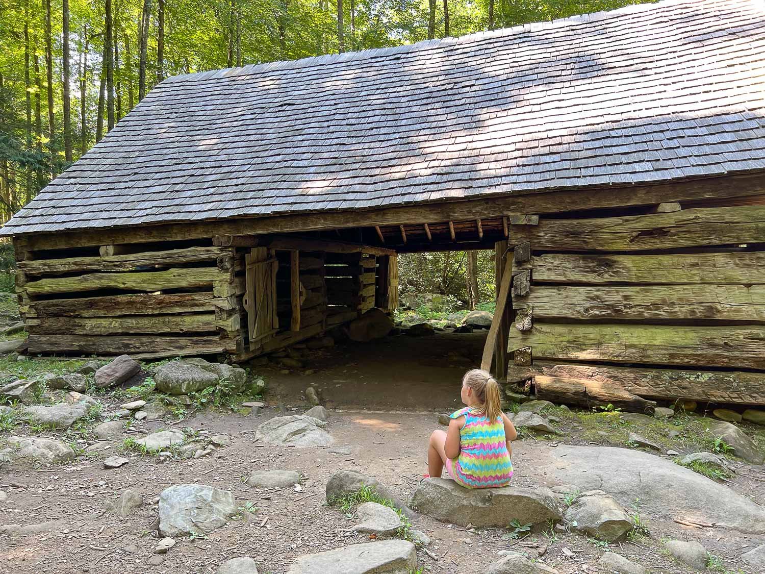
I think this is the Henry Whitehead Place. According to the tour brochure, the small building in the back was built with logs when a cabin was needed quickly. The larger house was built of square sawn logs and the two buildings are a contrast in construction types in the Smokies.

Another cantilever barn, a replica of an earlier one that was here. Hay could be stored above and fed to animals in the stalls below.

I think this is the Carter Shields cabin, build in the early 1900s.

We spent a full day exploring all the things to see on the Cades Cove loop and hiking to Abrams Falls. One of the most exciting things was on the drive at the end of the day when we spotted this black bear!
It’s about time that I sorted my photos and told the story of this trip. We finished the State Fair (blog post) on Sunday, July31. It was time for Kirby to get home to Texas after being in California for three weeks. I wanted to go to the Jacob Sheep Breeders meeting in North Carolina on the following weekend, so considered delivering her to Texas on my way to North Carolina. Instead, Katie had proposed the idea that became this adventure.

On Tuesday Kirby said her goodbyes to the sheep, giving Jade a last hug.

We boarded a Southwest flight in Sacramento that left at 6:15 p.m. and arrived in Nashville, Tennessee around 2 a.m.

Kirby and I gathered the luggage. I didn’t really need two big suitcases except that it was a way to transport Kirby’s birthday presents, including a Breyer horse stable (see photo at the end of this blog post), home. Katie had driven from her home in Texas to meet us. That was about a 14 hour drive for her. She’d been sleeping in the parking lot but was ready to continue the journey. We headed east towards our first stop, Great Smoky Mountains National Park.

Kirby had been asking for a meal at Denny’s, and we found one on our way to the park, in Pigeon Forge or Gatlinburg—I don’t remember which.
We all loaded up on breakfast, figuring that our next main meal would be dinner.
We made it to the park a little after 8 a.m.

Our first hike was on a nature trail along Fighting Creek behind the Visitor Center.

There are several cabins and other buildings left in the park, although many are gone. This is the Ownby cabin. There was once a school, store, church, and post office in this area.

One thing that struck me when I first started walking on these trails, was the fact that I didn’t know any of the plants. All my hiking has been in the western states. I may not remember all the plant names at this point, but at least the plants are familiar. This was a whole different world. The Visitor Center has a display that describes five different forest ecosystems—Spruce-Fir Forest, Northern Hardwood Forest, Cove Hardwood Forest, Hemlock Forest, and Pine-and-Oak Forest. Sadly, there are also serious threats to many of these forests from infestations of non-native insects and fungus.

The first of many species of butterflies that we saw.

One of the signs said that mushrooms “reach record diversity” here. I took photos of some that I had never seen.


We took a short trail to the farm of Noah “Bud” Ogle, who lived here from 1883-1925.
There is a barn and house still standing.

Signs said that the forest is reclaiming the land which once included cornfields.

The forest seems to be reclaiming this mill, complete with flume that directed river water to the grindstone.

Another view of the flume.

At the end of this day we stopped at a place called The Sinks. This is a spot of cascading water on the Little River created in the early 1900’s when loggers used dynamite to break up a log jam in the river. My photo doesn’t show the rushing water but part of the river that provided a refreshing break for visitors.
We ended our day at a motel in Gatlinburg. To be continued…

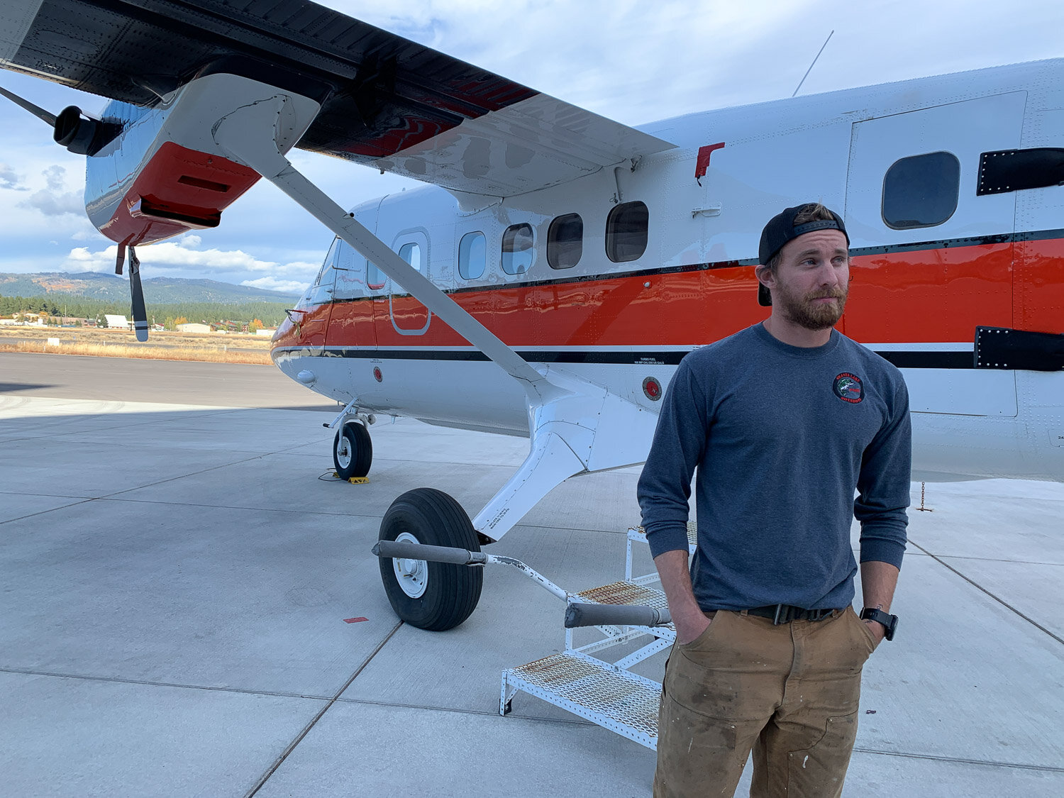
After our hike (described here) we went back to McCall and Chris gave us a private tour of the McCall Smokejumper Base.

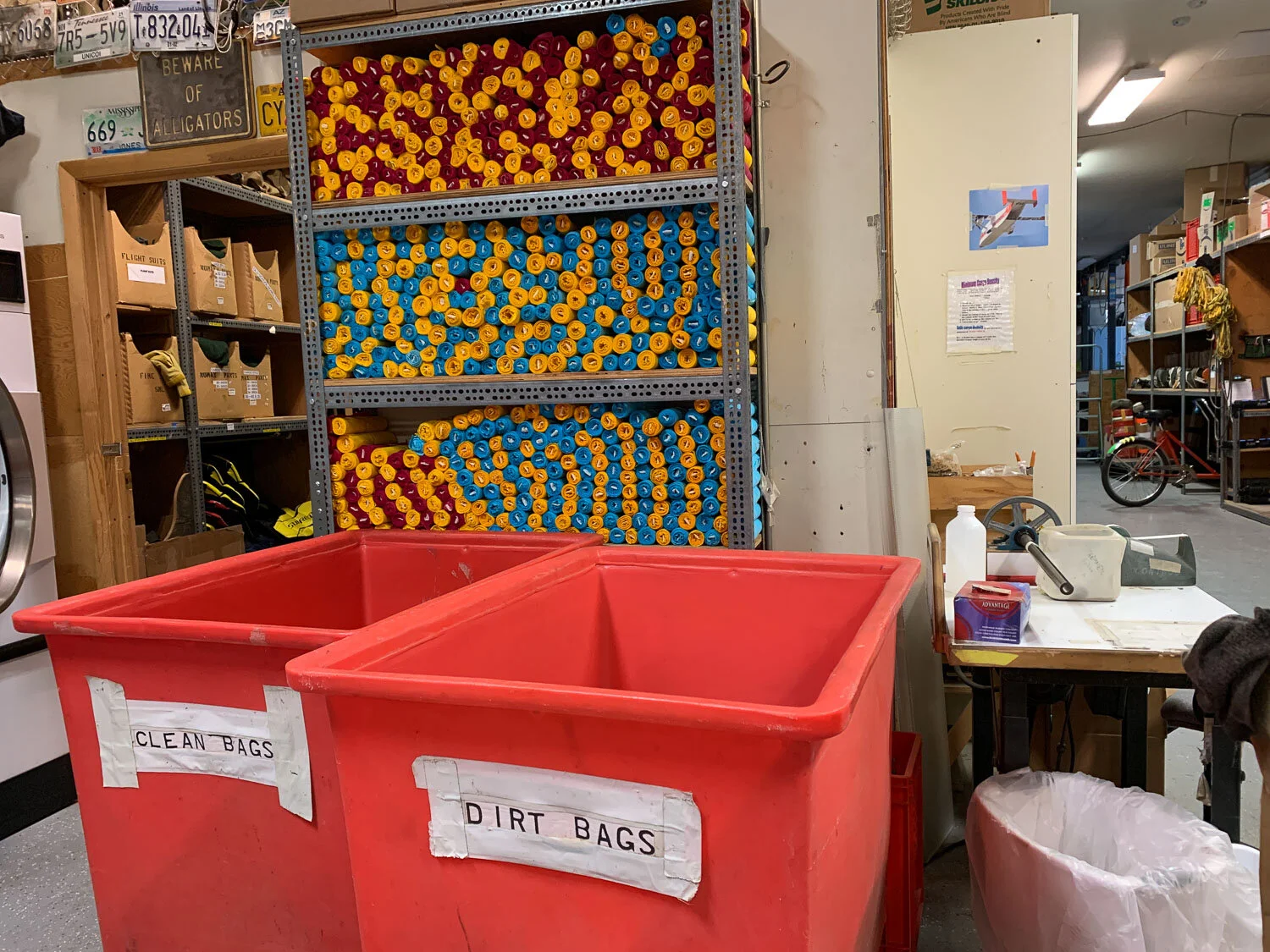
The season is over now. Chris was still there finishing additional EMT training, but most of the others have left. When the base is active the smokejumpers’ personal items are stowed in the blue lockers, and their jumpsuits (I’m not sure that is the official terminology) and gear are arranged on hooks along these racks. As a team of smokejumpers is dispatched they remove their gear to get on the plane.

This space adjoins the room where the lockers are. The shelves contain all the things that might be launched from the plane with parachutes, from sleeping bags to chainsaws to food and medical equipment.

This is a random comment, but when I see these boxes with the chainsaw sticking out the end it reminds me of a book I read over and over to my kids (Chris included). Do any of you moms remember the pop-up book, How Many Bugs in a Box? The last page, I believe, showed “10 Saw Bugs”.

One mode of transportation to get around the base. There are a number of bicycles that are used by all, but this is specialized to carry gear. Clever.

Sleeping bags above. There are instructions for packing supply boxes with food and other items.

More gear.

These are streamers that are used before the jumpers leave the plane to show the wind speed and direction. I think they drop one of each color at a time so that at least one will be more visible.
There is a gadget on that table that is used to roll the streamers to an exact size.

This is the room that can is enclosed by the tower seen in the photo of the base from the parking lot.

After each jump the parachutes are clipped to rails and lifted for inspection.

The fabric is inspected as well as making sure that all the lines are organized and not twisted or knotted.

Any parachute or other gear with a flaw must be fixed. This is just one rack of fabric used for repairs.

All the parachutes and gear are repaired at the base and they also make a lot of the bags and other items they use.

There are a dozen or so heavy duty sewing machines of various brands and styles. I found out that this was not Pete’s work station but the machine is named Pete.

Part of more advanced smokejumper training is in how to repair the gear.

Some of the components used in repairs or construction.

There is a whole room dedicated to rigging parachutes—that is spreading them out and folding them in a very precise way to pack for use. An important part of training is learning this task. Would you want to jump out of a plane using a parachute folded by someone who hadn’t had training in the precise way to pack the parachute so that you can count on it opening correctly? Hours and hours are spent on this training and practice.

This is the other half of that room where parachutes are packed.

Chris took on a project this summer to create this display that included all the season’s smokejumpers and their home towns.

This is another view that shows the tower where the parachutes are hung to dry and for inspection.

One of the planes used to transportr smokejumpers.

A tribute to the gear used by the original smokejumpers in the 1940’s.
After driving to Weiser Idaho to drop off sheepskins (last post) we drove onto McCall and stayed at the Rustic Inn. We met Chris for breakfast at his favorite diner in McCall.

6 Three 4 is an old gas station that has been repurposed as a cafe. Notice the counter top added onto the old truck and the roll-up garage door.
Additional seating.

Some old Hardy Boys books leveled our table.

After breakfast we drove east out of town to go hiking in the Payette National Forest.

Chris had heard of an unmarked trail to a lake a couple of miles up this main trail.

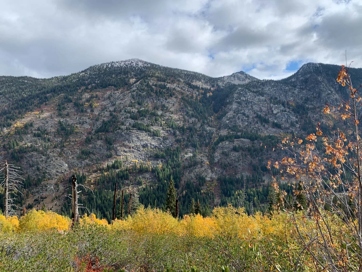
The fall colors were gorgeous...

…accented by a beautiful blue sky.

Chris found the unmarked trail…

…and we followed him down the other side of the mountain we had just hiked up…

…to Crystal Lake.

A panoramic view of the lake.

I keep looking at this photo and find it hard to acknowledge that the lower half of the rock is a reflection—it is so vivid.

The sky was gorgeous.


The fall colors were stunning.


It was a lovely day in the Salmon River Mountains and great to spend it with Chris.
We woke up early in our crummy rundown motel in Blythe, California and got on the road. There wasn’t any point in hanging around. Most of this blog post is drive-by photography on the freeway.


Near Palm Springs.

Kirby was a real trooper. She never complained about the backseat or the long drive. I think it would have been different if she hadn’t had the electronic entertainment of her tablet. There is a time and a place for that stuff and this was it.

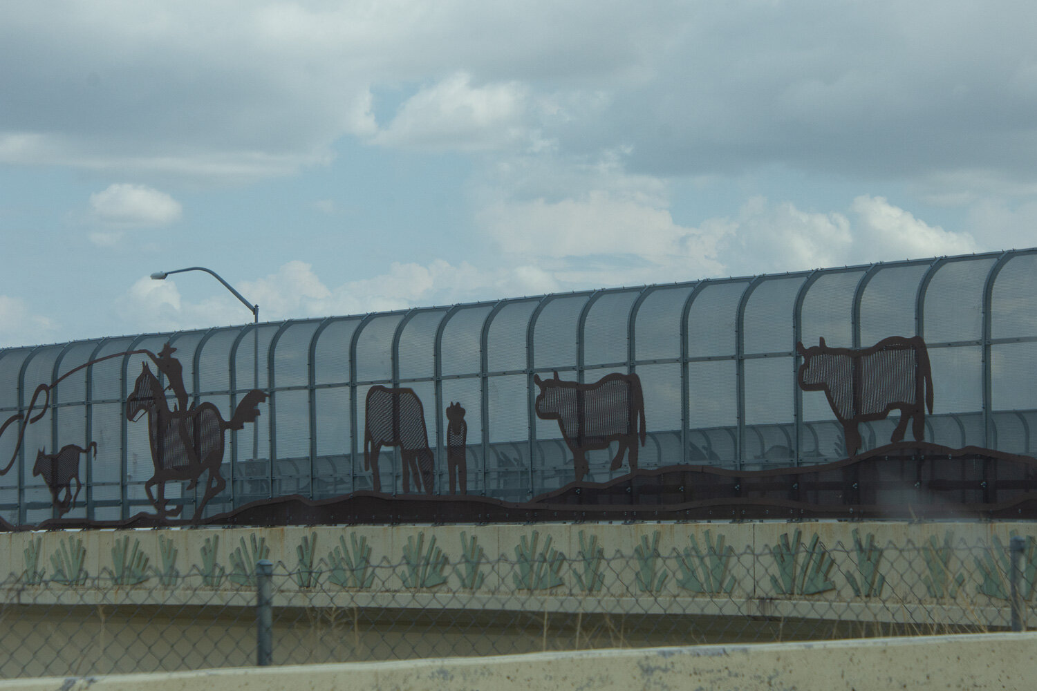
Freeway art.

More freeway art, a little harder to see.

Not art, but interesting to use a fancy style of lettering instead of just the standard freeway sign.

This is a very poor photo but I was lucky to catch a glimpse of the elusive pink brontosaurus and the clothed T-Rex. They aren’t often seen in California.


Its always encouraging to see a sign that says Sacramento even when you’re still several hours away.

Grandparents’ indulgence, a Happy Meal, was probably the most exciting thing for Kirby on this day.

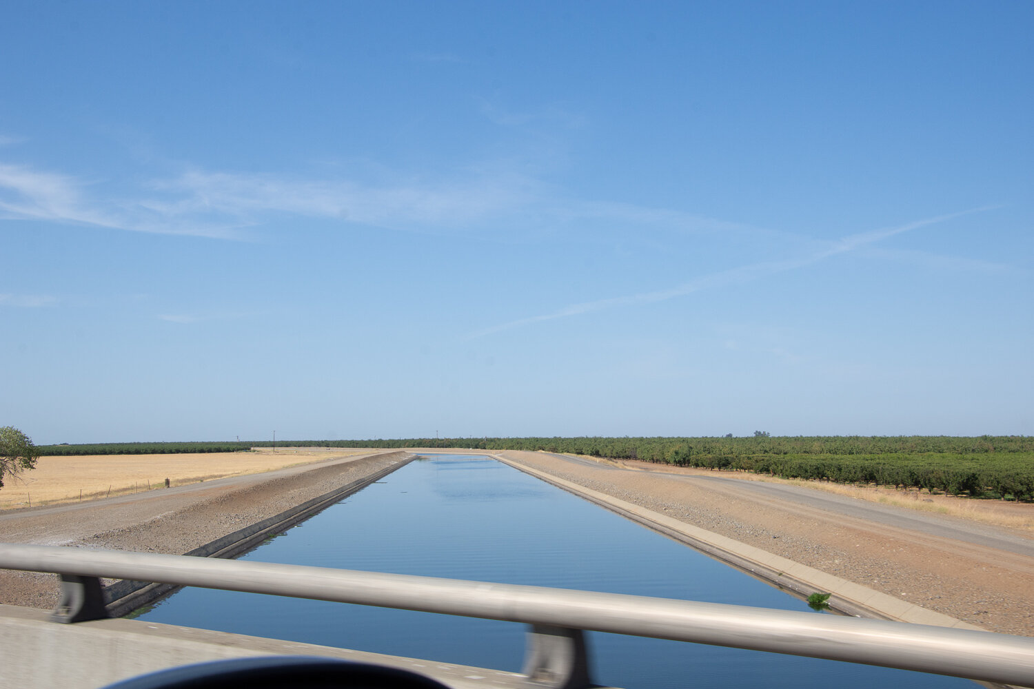
Agriculture dominates the drive up the San Joaquin Valley once you get beyond SoCal.

This is possible due to the California Aqueduct system, part of which makes up the curved edge of the field in this photo.

There is the aqueduct but also a massive warehouse which I think is the Amazon Fulfillment Center.

This is the last shot I took in the valley south of Sacramento. We made it home before dark. Yay!

After showing Kirby her room (now, after 10 years, finally fixed up into a guest room), which used to be her mom’s bedroom, we headed for the barn.


One of the best parts of visiting California for Kirby is hanging out with Aunt Meryl and Uncle Chris.
It’s sure taking me a long time to tell the story of this trip. (The first installment is here and the fifth is here.) This is the second day of the return trip. We left the motel in Alamogordo and headed to White Sands National Park, only 15 miles away.

The park borders the White Sands Missile Range and there is one road in and out with some parking areas and trails.

We stopped at the first trail.

The dunes are continually changing as the sand is blown into new shapes and this trail was marked by blue posts.

I kept thinking that this is the little girl who, 5 years ago in Hawaii wouldn’t get off the beach towel and let her feet touch the sand.

I have some great video clips of her rolling down these dunes like a kid rolls down a grassy slope but if I take the time to figure out how to post them here I’ll never finish this story.


It’s not all sand. This is a darkling beetle.

I looked this beetle up later and the “distinctive tracks” that we saw were described.

I have not identified these flowers—maybe primrose?


At the last place we stopped Kirby wasn’t too excited to get out of the truck. It was very hot by this time. I wanted to get a look over this dune so I walked up to get some photos while Dan and Kirby stayed in the truck. This view is looking back at our truck (with trailer) in the parking lot.

White Sands National Park protects about half of the largest gypsum dunefield in the world (275 square miles).

It was designated a National Monument in 1933 and became a Park more recently. We checked out the visitor center, let Kirby choose something from the gift store, and then got back on the road about noon.

The rest of this post is things seen along the road.

Remember, I try to entertain myself by photographing things of interest. I really don’t know the significance of this chili pepper. ..

…or this pink elephant.

I don’t remember what kind of inspection or border patrol station we passed through here, but that had a huge array of cameras and other devices as the truck drove through.

Crossing the Continental Divide was exciting for us…

…but a difficult concept to explain to a 6-year-old when there are no mountains in sight.
More freeway art. I’m not sure where this is—maybe still New Mexico.

We weren’t in New Mexico long though before reaching Arizona.

Freeway art cotton fields.
The goal was to make it to California before we stopped so that it would be only one more day of driving to get home. I hoped to redeem myself with a better hotel room choice on this night. We made it to Blythe and found a motel that seemed to have good reviews. It turned out that the motel had been sold and was in escrow and no one much cared about the business anymore. We all slept OK but it was not the kind of place where you could luxuriate in your surroundings. But it was getting late already and we all went right to sleep after a bedtime story with Kirby.
We left home on a Friday (July 16) and got to my daughter’s house Saturday night. We spent four days there. If you have followed along this was the last blog post you saw.

We started the long drive back to California on Thursday.

This time the trailer was empty but we had a back-seat passenger. This is Kirby, age 6.
As usual I entertained myself with photographing things I found interesting or amusing. Kirby entertained herself mostly with her tablet. Normally I’d object to hours of electronic entertainment, but there are exceptions. I was truly impressed with how Kirby handled the drive. Our truck doesn’t have a full back seat and Kirby was in a carseat, so she didn’t have much room. She was more patient that I was.
I’ve lost track of where I took some of these photos.

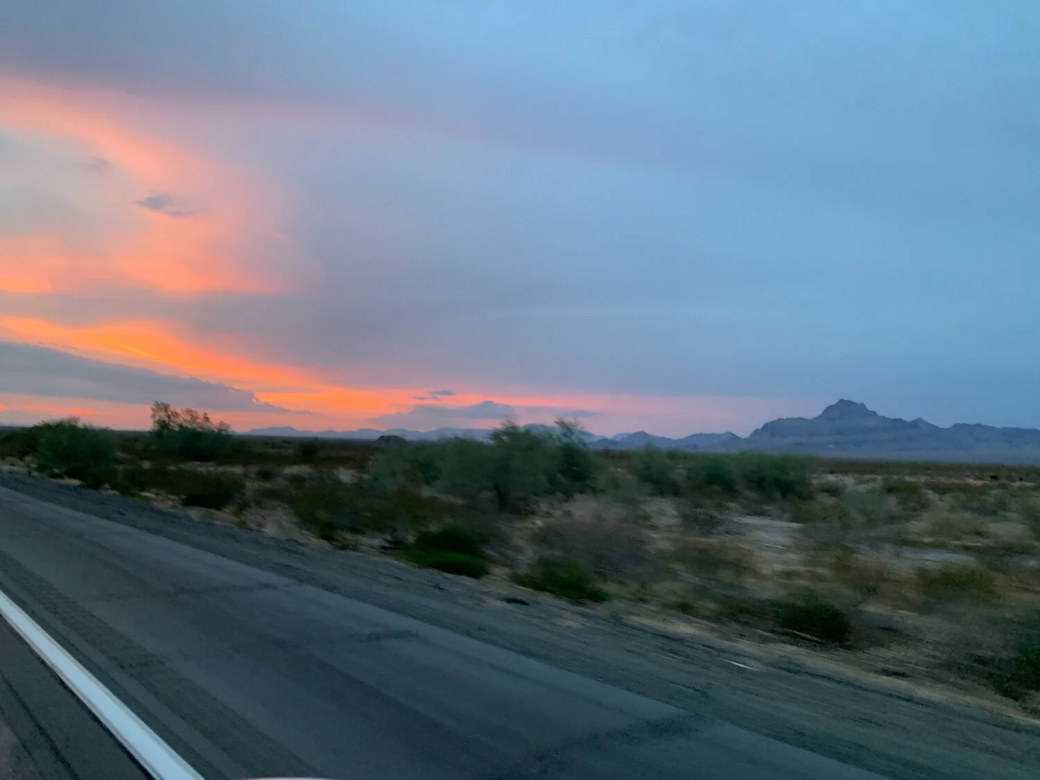
On the road in Texas.

We stopped more frequently for gas than we would have on our own. Usually we stop only when absolutely necessary for gas or for an interesting diversion of a historical marker or scenic overlook. The frequent gas stops allowed for more bathroom breaks and food. McDonald’s at the first stop was a big hit.
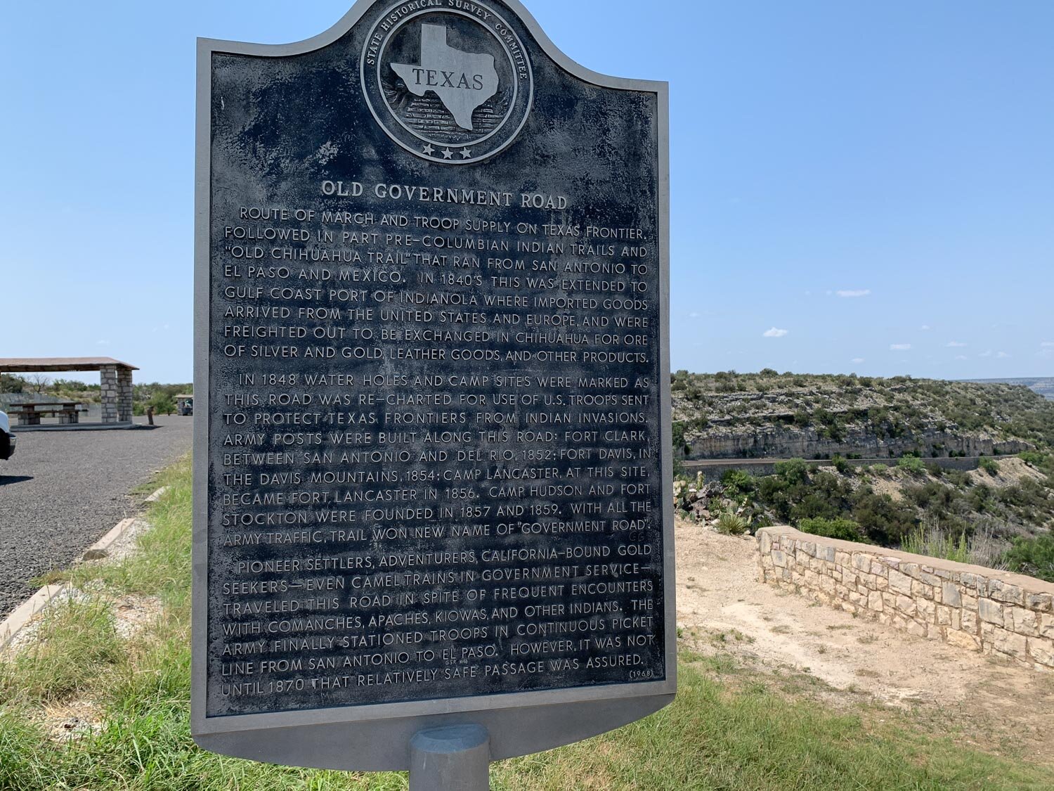
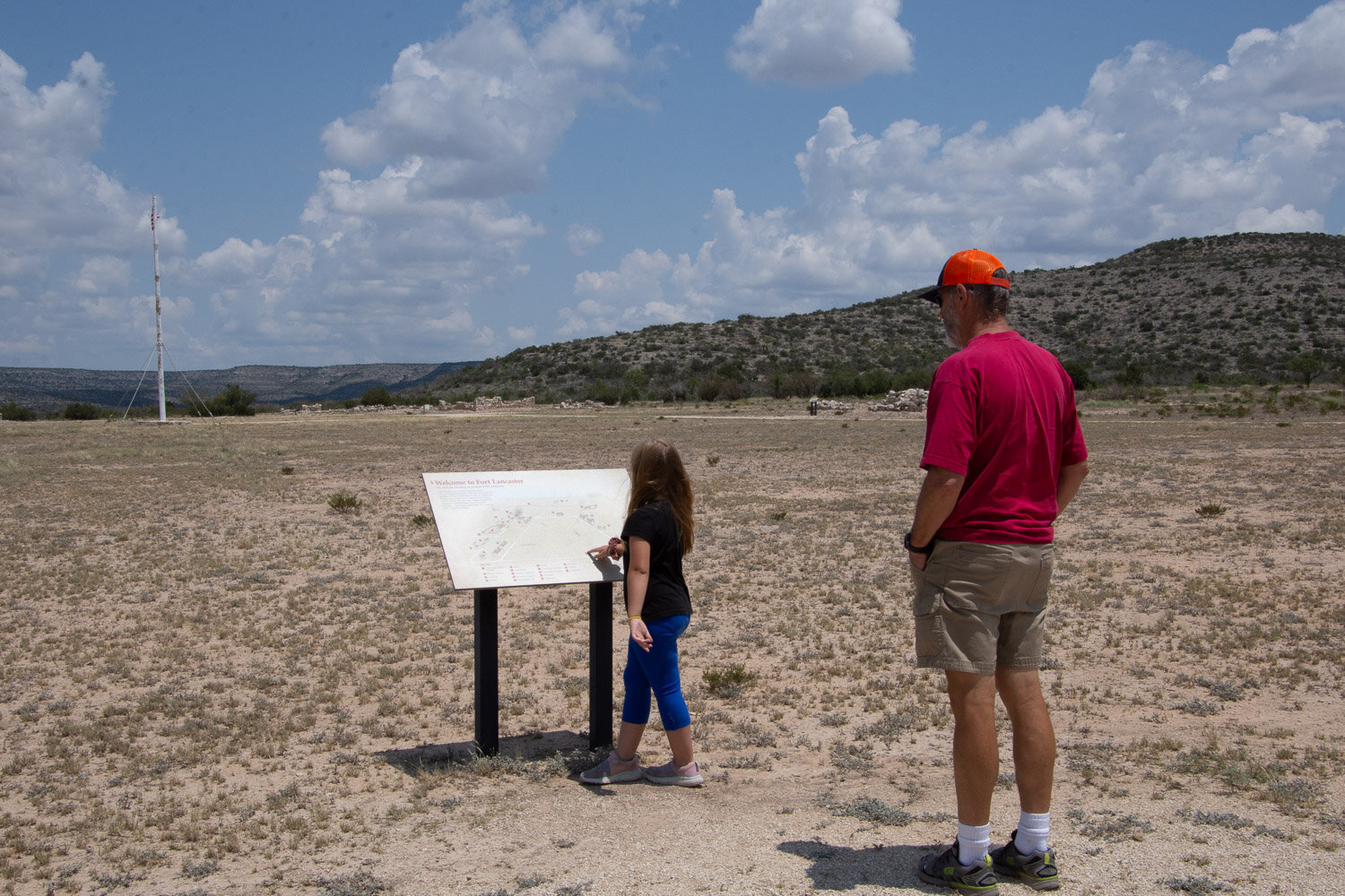
I always follow along with the big map books. I found what looked like an interesting diversion that didn’t take us too far off of I-10. We had been driving about 3-1/2 hours and took Hwy 290 to Fort Lancaster State Historic Site. First there was a overlook with picnic tables and a wall to keep people (especially 6-year-olds) from falling down the steep drop-off onto the road below.

The remnants of the Fort were in the flat land that you can see in the left of the photo. I always think about what it would have been like to be on a horse or in a wagon in “the olden days” and to travel over this kind of terrain.

The State Historic Site “preserves the remnants of the only post established in 1855 to protect the Lower Road between San Antonio and El Paso”. There is a small museum and the remnants of some of the 25 buildings that had been constructed.

Signs inside the museum told of the camel experiment in the mid 1850’s when it was thought that camels would be more suited to the area than horses and mules. As government attention turned to the more pressing issue of Civil War and Texas seceded from the Union in 1861 the camels were sold to private parties.

We went outside to walk around the fort and saw this bug (dead) that was the size of…well, the size of a little girl’s hand.
The site is 82 acres and includes remnants of officers’ quarters, a hospital, commissary, barracks, bakery, and more.

This is what is left of Officers’ Quarters, each with two rooms separated by a double fireplace.

The brochure I picked up says that by 1858 “Fort Lancaster housed approximately 150 enlisted men and three officers…opportunities for soldiers’ recreation were rare and frequently revolved around drinking and gambling.” The day was getting hot so our timing was good that we had stopped here in the morning. After walking around awhile we got back into the AC of the truck.

This bug hung on to the windshield for quite awhile.

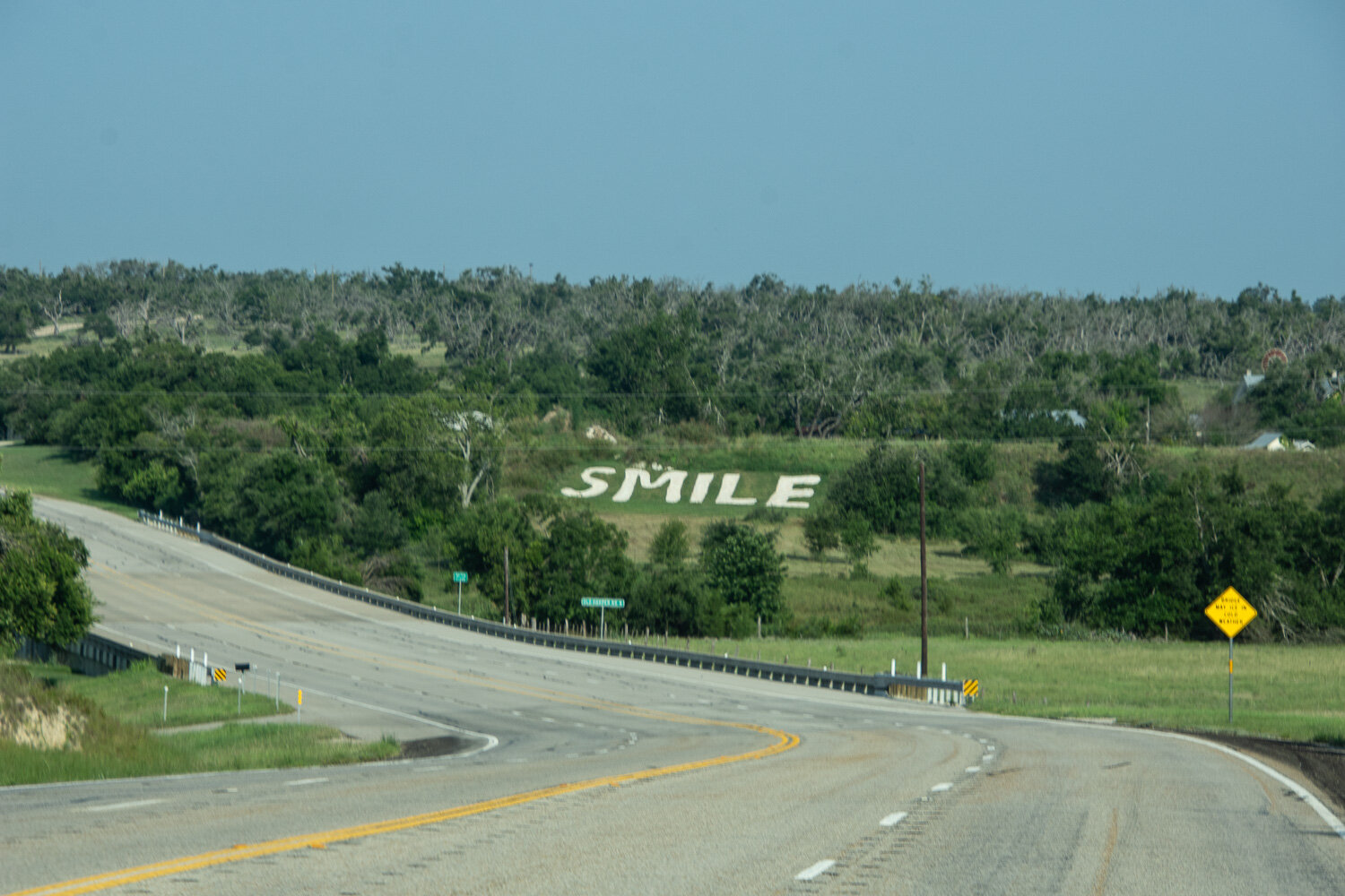
More of Texas.

We saw three of these trucks over the course of several miles. Each carried one of the huge blades of the windmills that are prevalent between Sheffield and Fort Stockton.

I have my big map books and I had bought a kids’ atlas for Kirby—it has maps of all the states and notes details (state bird, state animal, etc) for each.

I was impressed with this tile mural in the ladies’ restroom at one of the rest stops.
We planned to visit White Sands National Park the next morning and we wanted to spend the night nearby. Some of you know that on our typical road trips our night-time stops are usually impromptu and “rustic” . I had packed the tent and camping gear with the hope that we would enlighten Kirby about what it’s like to travel with Mama Robin and Papa Dan (as we are called). But better sense prevailed. It was hot, even at night, it was difficult to find a suitable place that was not privately owned, and we had a 6-year-old with us. We decided on a motel. We stayed at Alamogordo, New Mexico, but didn’t get there until well after dark. My frugality overtook better sense and I got a one bed room thinking that since all we were doing was sleeping, what would be the problem. To be continued.
It was daylight in the last photo I posted about Day 1, but we still hadn’t left California. We kept driving and now I don’t remember where we ended up, but it was somewhere along I-10 in Arizona.

We had our camping stuff with us because usually on our road trips we find a spot to camp along the way. This was different. For one thing we just wanted to GET THERE. Another factor was that it was HOT. Sleeping bags and a tent weren’t appealing. I think we stopped here at about midnight. Dan decided to sleep in the cab with the seat back as far as it would go. I opted to get in the truck bed on top of the stall mats that we were taking to Katie for her new barn. I really needed to stretch out and not stay in the truck seat a moment longer than I had to. Neither were great options. I was comfortable enough lying on a sheepsking, but the trucks keep their generators on all night and other trucks go by on the freeway all night. We started up again about 4 a.m.

When I used the map app on my phone to plan this trip it showed Home to Blanco, TX to be 24 hours. So after driving for probably 14-15 hours yesterday why did we still have 14 hours to go? That’s easy. We didn’t stop much but you do need to get gas and stop at the occasional rest stop along the way. Also, while pulling the trailer we weren’t staying at the posted limit, especially when it was 80 mph (in Texas).

This was at 6:20 a.m. so it’s somewhere in Arizona between Phoenix and Tucson.

Freeway Art somewhere around Tucson.

I wouldn’t call this Freeway Art, but it was interesting. Does McDonald’s have a new item on it’s menu?

Rest stop about 8:30 Saturday morning.

I want to say “Dorothy, we’re not in Kansas anymore”. You get what I mean, right?

9:30 a.m. Another state line to check off. One more to go.


View of the Organ Mountains/Desert Peaks outside Las Cruces.

About 1 p.m. That didn’t take long.

The phone showed about another 8 hours to our destination.

More Freeway Art. This is near El Paso. I think the Freeway Art deserves a blog post of it’s own.

This smoke plume, across the border in Mexico, was visible for miles. I tried to find out what was going on checking Google. No luck although I did find several links that brought up major fires over the last few years.

Border Patrol station. The dog who sniffed our truck didn’t think twice about the goats.

A Freeway Mural.

Before we got to Ft. Stockton (about 5:30 p.m.) the “low fuel” light came on. UhOh. Ft. Stockton was the next place where we could find gas and fortunately we weren’t too far out.

Both Dan and I are always very careful about not running too low on fuel, but around here it’s not that much of an issue. Town isn’t far away and even when traveling there is always a gas station nearby. That’s not the case when driving through the southwest. It turns out that we weren’t as close to empty as we thought when the warning light came on. I looked it up and our truck has a 25 gallon tank. However, we’d been driving with the trailer at elevation and into head winds and all of those things affected our gas mileage for the worse.
I called Katie from here and she had a Ft. Stockton story. That is where their truck broke down when she moved from California. They were stuck in town with a horse and a dog for a few days waiting for parts.

In Ft. Stockton there is no excuse for getting lost.

I love the expression on this roadrunner’s face.

Texas landscape from the truck. This is about a half hour past Ft. Stockton.

I took only a few more photos after this or maybe I just deleted most.

This isn’t Freeway Art but I think it is Inspiration for Weaving. Great colors and pattern!
We made it to our destination on this day but it was after 11:30 p.m.
Road trip to Texas with goats.
Read MoreExploring the petroglyphs and scenery of Dinosaur National Park.
Read MoreTraveling through Utah we stopped at Dinosaur National Monument.
Read MoreThe last day of my visit to Ohio—visiting the Holden Arboretum and Lake Erie.
Read MoreAt Meridian Jacobs farm we raise Jacob sheep and sell locally grown wool fiber, yarn, and handwoven goods. We teach fiber classes and sell Ashford, Clemes & Clemes, and Schacht spinning and weaving equipment. We encourage farm visits with field trips and our unique Farm Club.
Search blog posts since 2019. If the search says it can’t find a post try putting in your search word a second time. I don’t know why but the second time it seems to work.
Search the entire website, including older blog posts.


