
TN-NC Adventure--Day 3
/This was Friday, the last day we had for Great Smoky Mountains National Park. We were to be in Marshall, North Carolina by the evening for the next part of this trip. There is a main road through the park from north to south and Newfound Gap is half way across.

I cropped this photo from a sign that explained that the development of Great Smoky Mountains National Park was “led more by economic boosters than conservationists”. Auto clubs pushed hard for the park and in the late 1920’s crews from North Carolina and Tennessee worked to meet up at Newfound Gap and the road was completed in 1932.
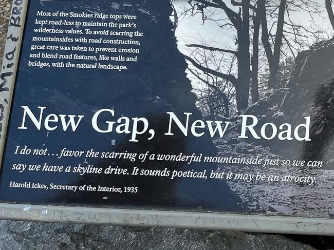
This is cropped from the same photo of that sign.
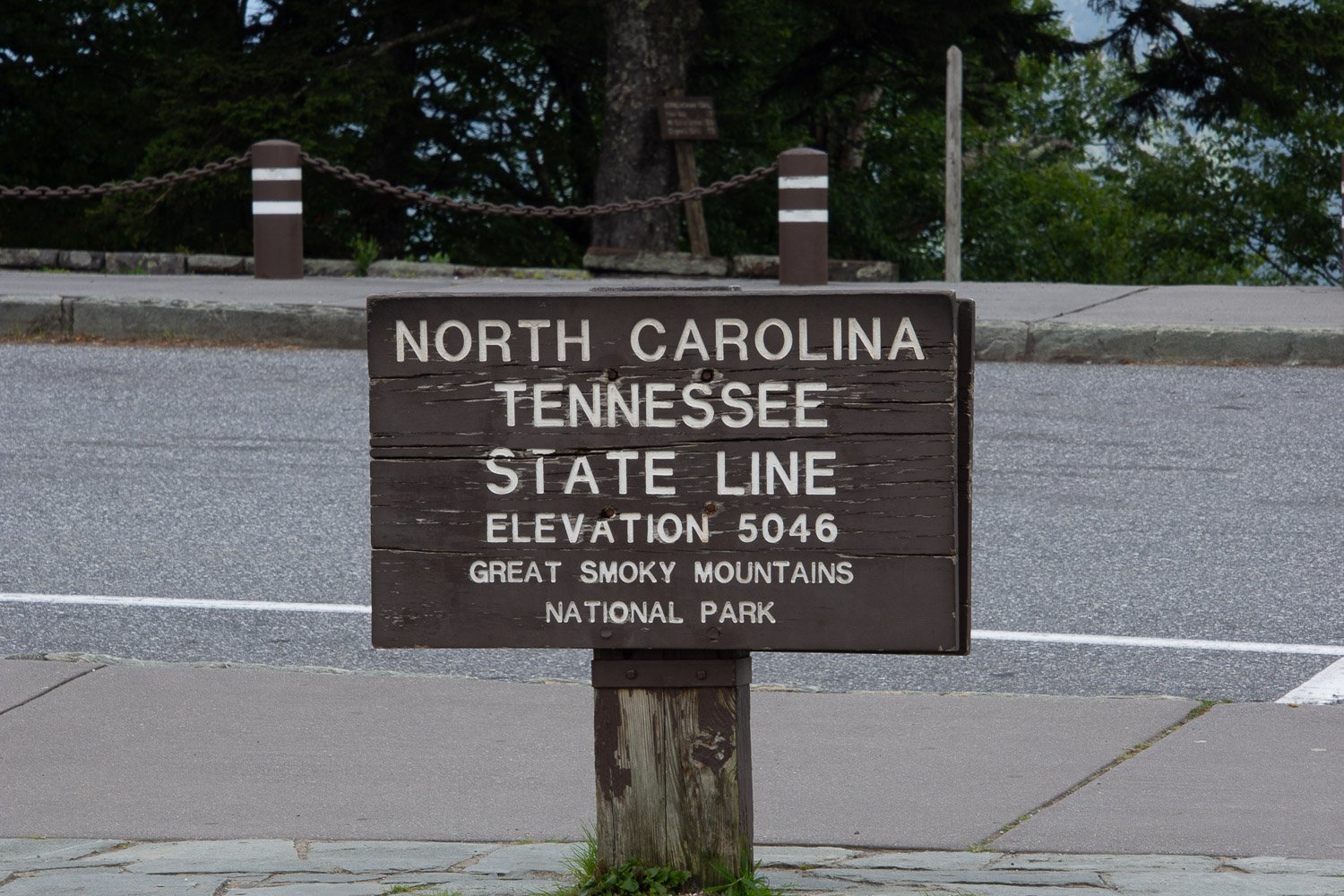
The current state line marker.


The Appalachian Trail follows the Tennessee/North Carolina State line almost all the way through the park from southwest to northeast borders. (At the western end the trail drops south off the state border before it reaches the Park boundary.)
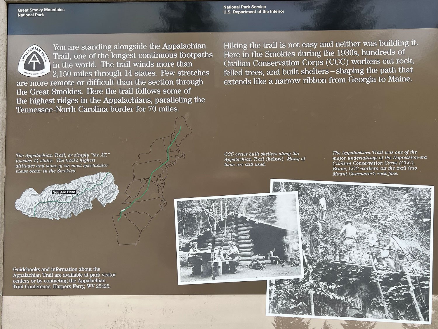
I wanted to remember these details and photographing a sign is the easiest way for me to do that.

According to that earlier photo we could have hiked all the way to Maine but this stop was our only experience with the Appalachian Trail.


We stopped at the trail to the observation tower on Clingmans Dome, at 6643’, the highest peak in the National Park and in Tennessee. The elevation is higher than the other parts of the park and the vegetation is different. We saw more flowers blooming here and plenty of pollinating insects.
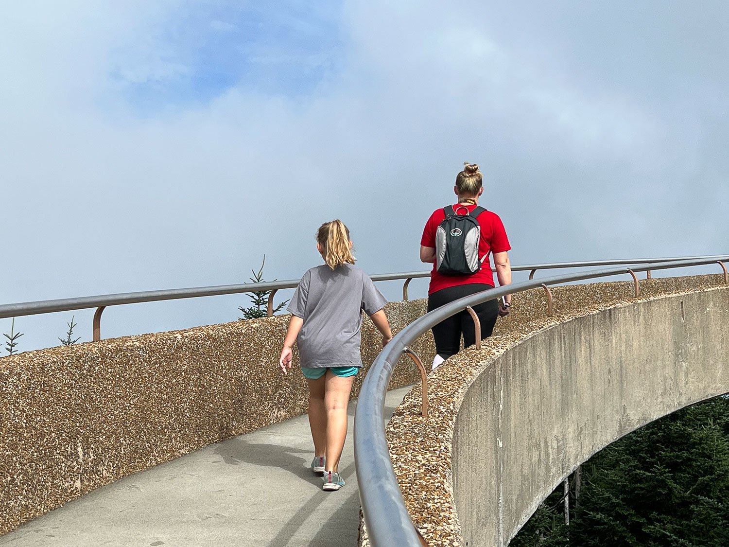
There is a half mile trail up to the peak and then this ramp to the observation tower.

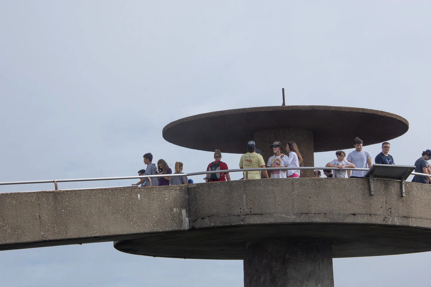
From the tower there is a 360 degree view of the mountains in Tennessee and North Carolina .


Selfie time.
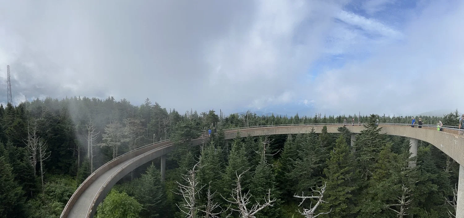
A panorama view of the ramp.

That’s Katie and Kirby heading down.


More flowers and insects along the trail.

Maybe there is such dense congregation of insects because it is too late in the season for flowers in the lower elevations.

Just an interesting leaf.

By early afternoon we were on our way to Marshall, North Carolina.

One last shot of the mountains near the park.
