...From the Redwood Forests... - part 2
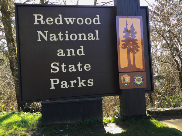
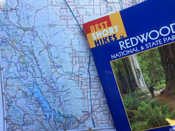
/Day One of our trip to the redwood forest is here. On the second day we drove north to spend time in the redwood parks that are north of Eureka. They are all managed together as part of the Redwood National and State Parks.
 From Wikipedia: "... the four parks, together, protect 45% of all remaining coast redwood (Sequoia sempervirens) old-growth forests, totaling at least 38,982 acres. These trees are the tallest and one of the most massive tree species on Earth."
 In 1850 there were 2 million acres of redwood forest along the northern California coast. After years of unrestricted logging the Save-the-Redwood League, created in 1918, was successful in establishing three State Parks in the 1920's.
 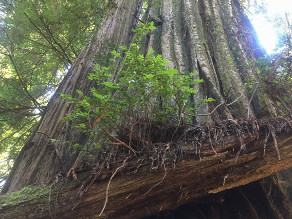 Redwood National Park was created in 1968 after 90% of the original redwood trees were gone. Now the State and Federal agencies cooperatively manage the forests and watersheds as a single unit.
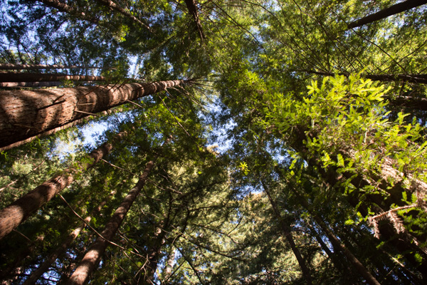 I'll mention here that all these photos were taken with my iPhone because the previous night I dropped my camera (on the carpet in the motel) and the lens popped off. I couldn't get it back on and knew that I wouldn't be able to get it fixed until after I came back from Texas (where I was headed as soon as we returned from this trip).
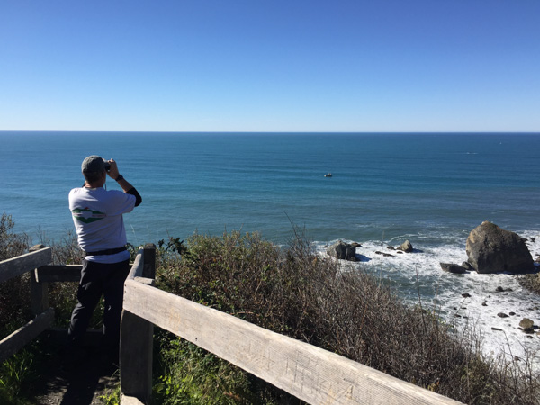 We took a side trip to the spot where the Klamath River flows into the ocean and walked down the steep trail to this overlook. That's Dan looking across the ocean for Meryl (my DIL who is in Australia right now).
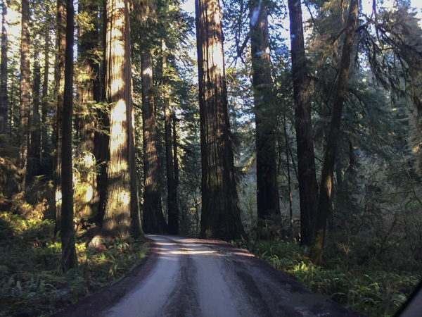 We drove farther north to the Stout Grove in the Jedediah Smith Redwoods State Park.
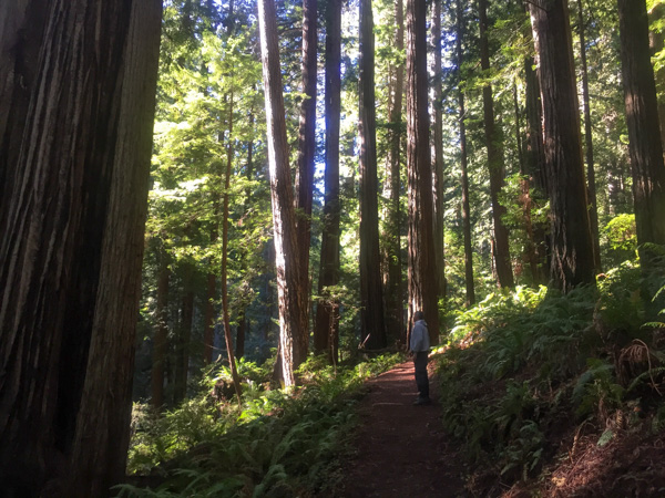
 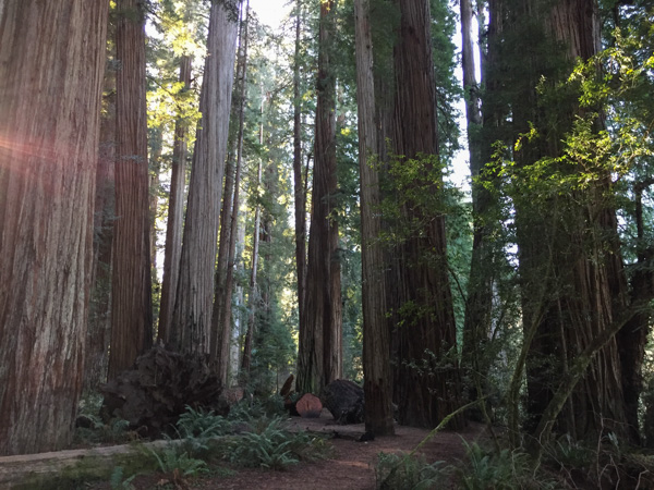 Every time we stopped we continued to be impressed with the grandeur of these trees and the forest.
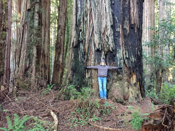
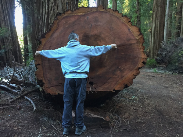 This tree had fallen and then was cut to clear the path.
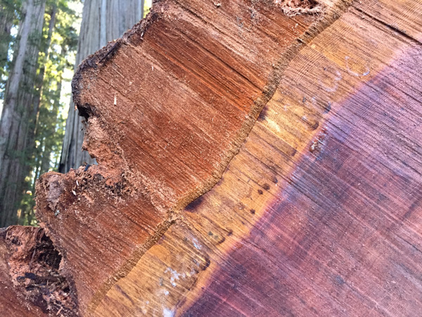 Look at that brilliant color.
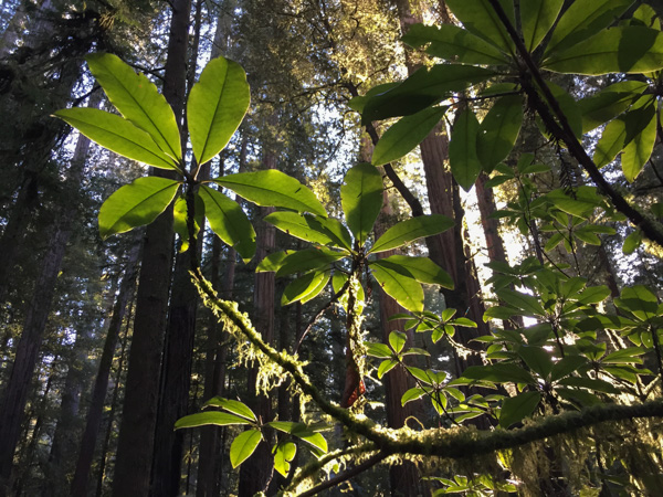
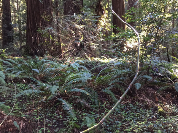
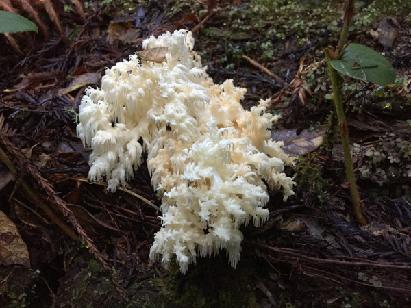 We were surprised that we didn't see more mushrooms and fungus, but this one did catch my eye. Late in the afternoon we headed toward the coast at Crescent City.
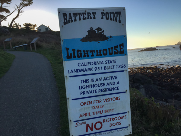 Our map book showed two lighthouses so we started with Point St. George. We found that lighthouse (manned from 1891 to 1975 and abandoned in 1995) but it was 6 miles offshore. The Battery Point Lighthouse is accessible at low tide so we were able to walk to it, but we were too late for a tour.
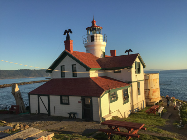
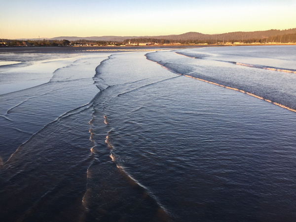 We walked along the breakwater (seen in the lighthouse photo) and then out on a pier. This is a view looking back toward Crescent City.
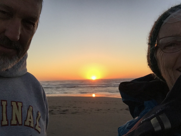
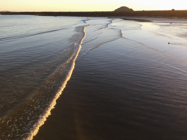 This is the view looking back toward the breakwater and the setting sun.
We headed home the next morning because I was leaving early the following day for Texas. This was a short trip (time-wise), but well worth it.
 Mini Road Trip!
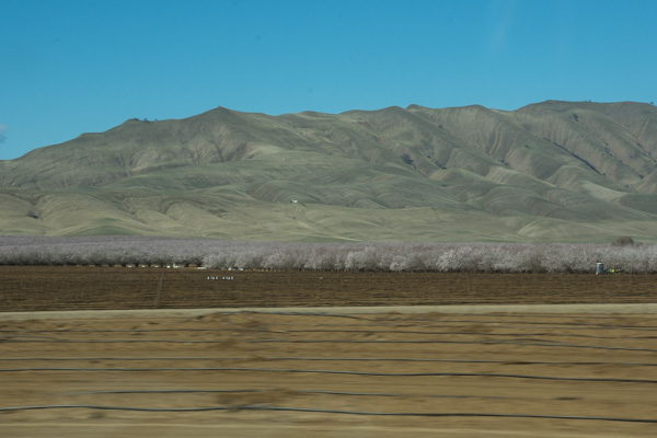 From the Central Valley you need to drive through the hills to the west. We turned onto Highway 20 at Williams. You can see a slight tinge of green if you look hard but this time of year they should be emerald green. That green is the grass that began to grow after our early January rain. We have had negligible rainfall since and there has been no more growth. This is the time of year that ranchers in the non-irrigated hills count on abundant forage for livestock. Very scary to think of another year of drought to this degree.
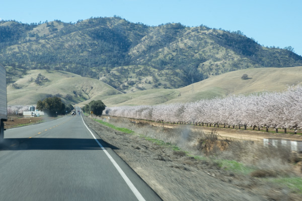 This is a view getting closer to the hills. The almond trees are beautiful this time of year but I am disturbed at how many acres of land all over California have been put into almonds now. That's a story for another time however. It seems I didn't take more photos until we got to our first stop.
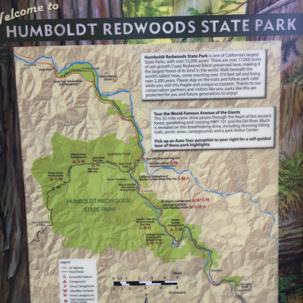 From the Humboldt Redwoods State Park website: "In the early 1900s, loggers came to what is now Humboldt Redwoods State Park to cut down lofty ancient redwoods for grape stakes and shingles. The founders of Save the Redwoods League thought that was akin to 'chopping up a grandfather clock for kindling.' From the acquisition of a single grove in 1921, the League has raised millions of dollars to build and expand this park. Today Humboldt Redwoods spans 53,000 acres, an area almost twice the size of San Francisco. About one third, or 17,000 acres, of the park is old-growth redwood forest—the largest expanse of ancient redwoods left on the planet."
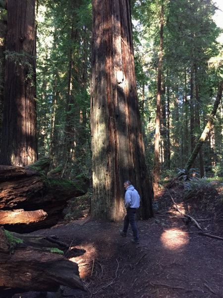 What is special about an old-growth forest?
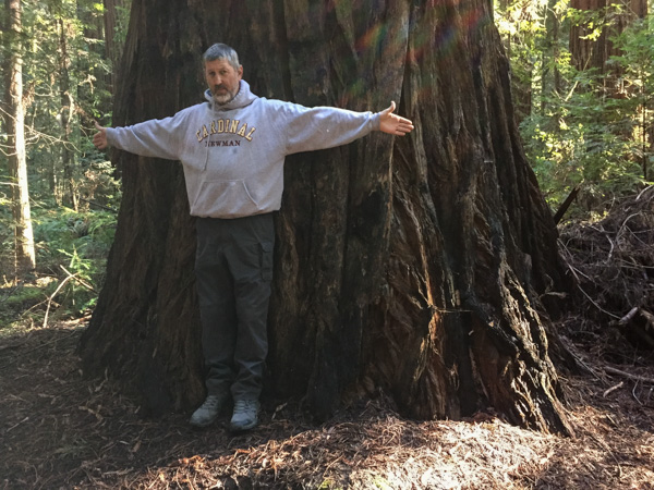 The size of the trees.
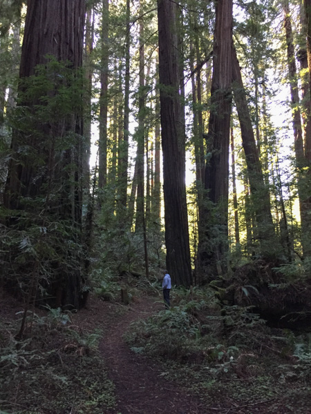 The mix of tree sizes. Unlike a reforested clear cut, there are trees of all ages and sizes and this makes for an open forest instead of a monoculture of trees and brush that you can hardly walk through.
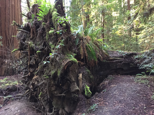 The ecology. When old trees fall they open up space for light to reach the forest floor and opportunity for new growth of other species.
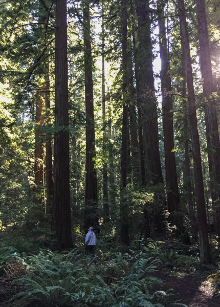 The grandeur.
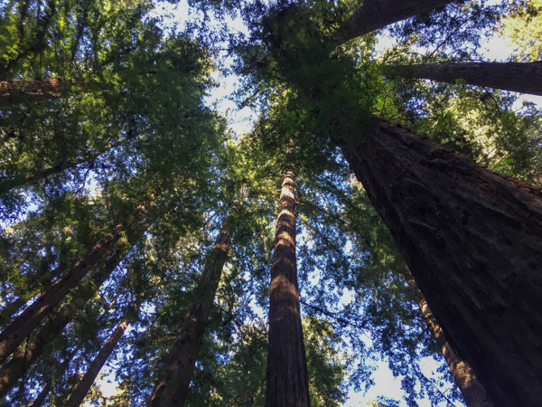
 We ended the day at the beach.
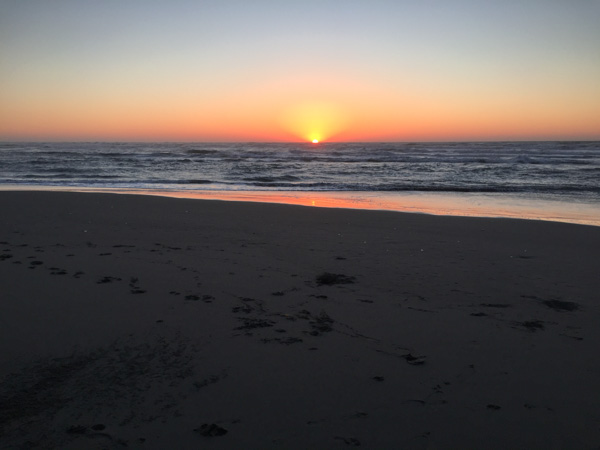
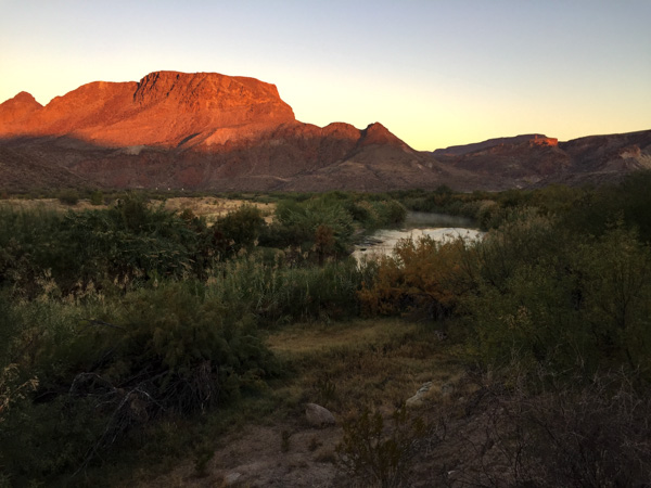 This is the area where we camped. I got up when I saw the sunrise to explore near the river. We had heard rapids but couldn't see the river from the campground.
 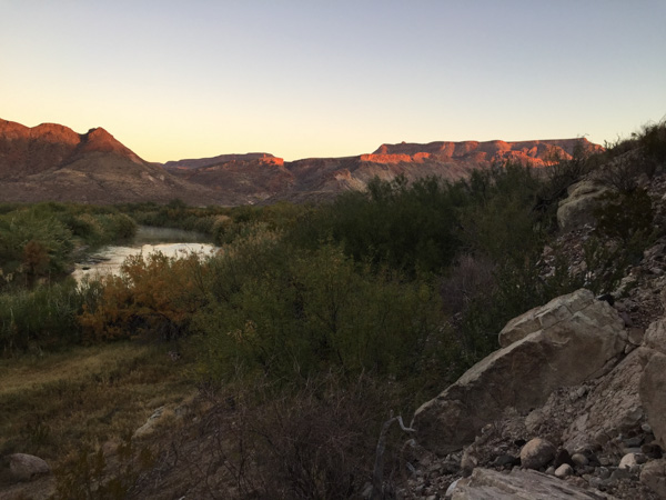 After all the signs at the previous day's stops I did start thinking about mountain lions as I walked along deer trails though those willows and brush to reach the river. So I made plenty of noise, but I also decided to move to higher ground where there was no cover.
 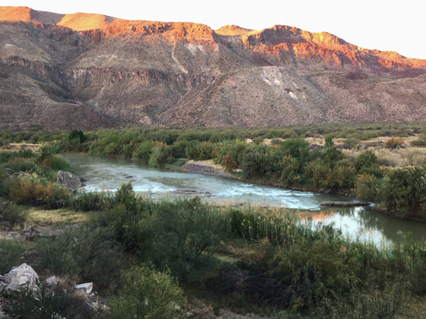 I was also glad when Matt showed up with the same idea (early morning photography) in mind.
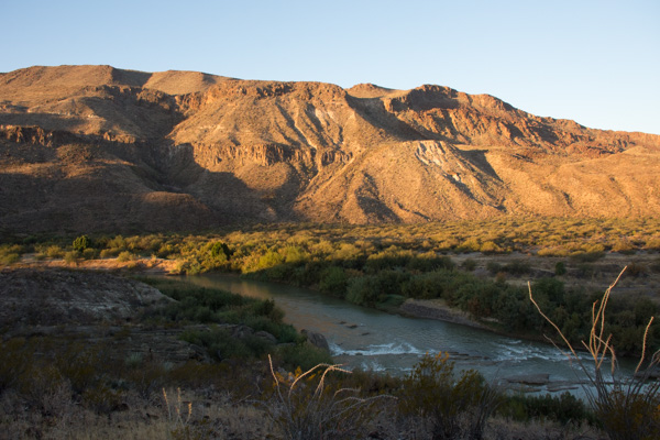 Logs and rocks in the river were enough to create the sound of rapids that we heard from camp.
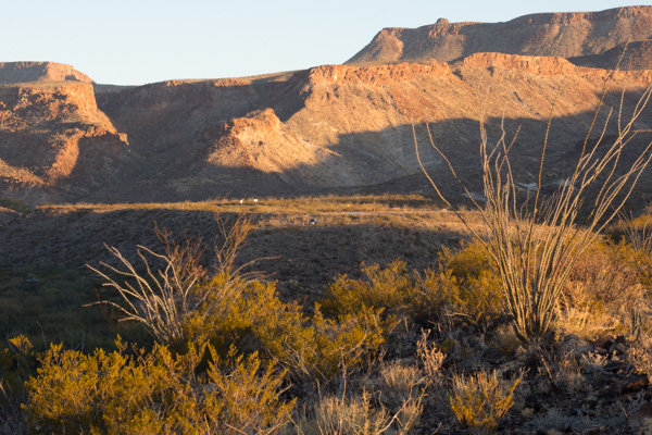 This is the view back to the camping area. That green speck in the middle is the truck.
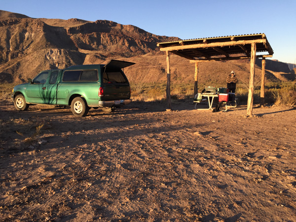
 We looked at the map to see where we might hike in this park and found Closed Canyon.
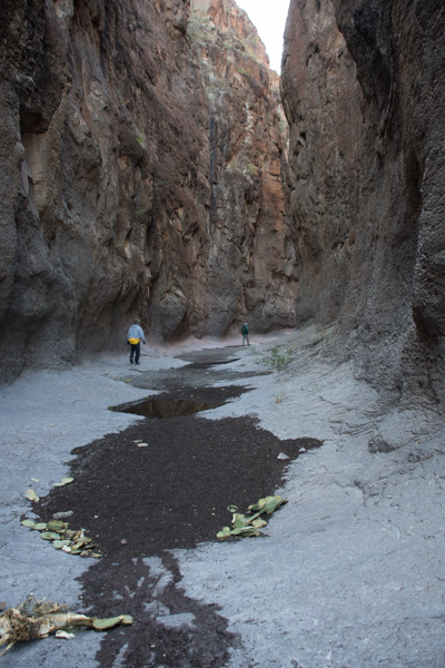 This is a canyon that leads to the Rio Grande.
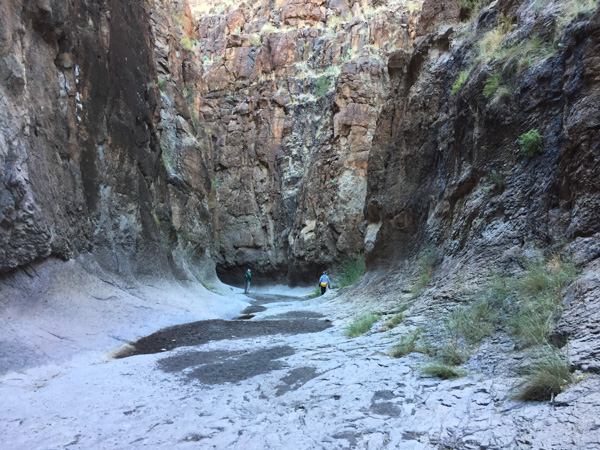 Absolutely stunning! The photos don't do it justice.
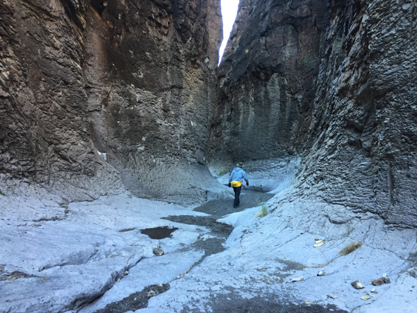
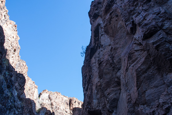
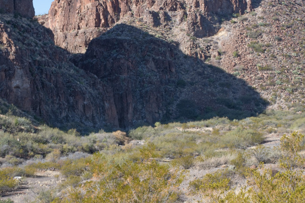
 You can walk in about 7/10 of a mile before you can't go farther.
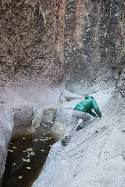 If you're a mountain goat you can try to go farther ... or if you want to get wet.
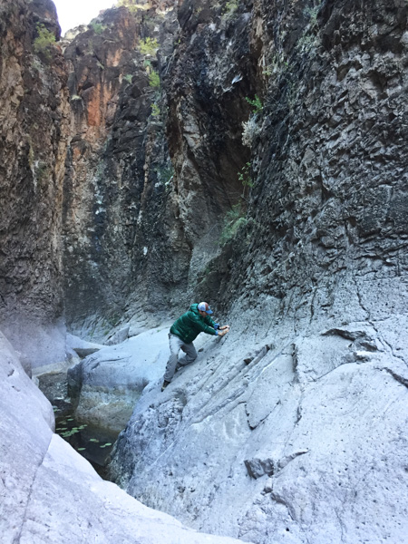 Matt went around the bend and came back. The map shows that it is a relatively short way to the river.
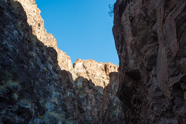
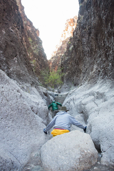
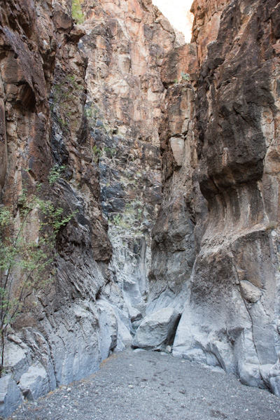 You wouldn't want to walk here in the flash flood season.
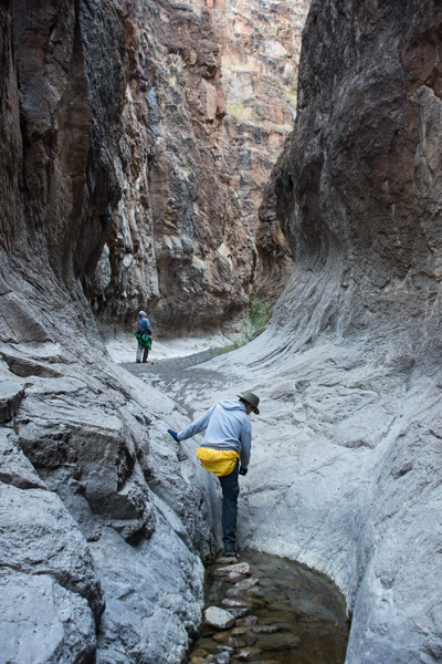
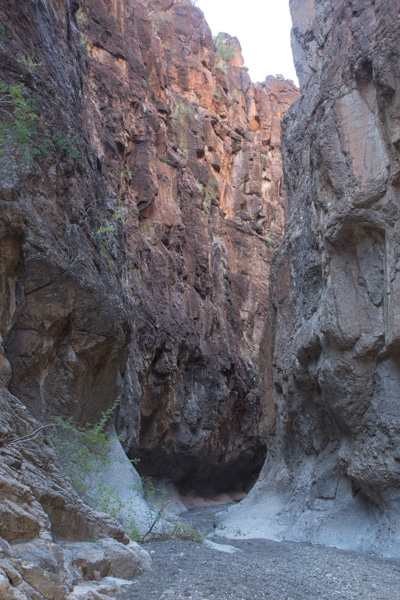
 That slot in the shadow is the entrance to this incredible canyon.
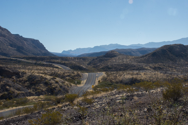 On the road again.
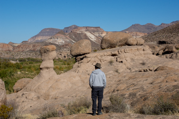 The next stop was the HooDoos Trail.
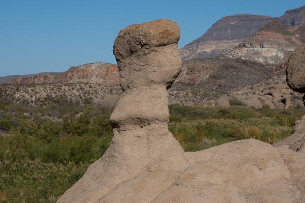 Hoodoos refers to these eroded formations.
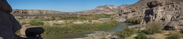 Matt showed me how to do photos with my camera that you can later turn into panoramas. This isn't distorted like the pano shots on the phone.
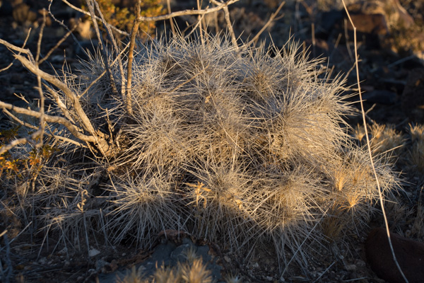
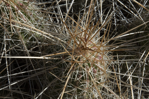 More spikey things.
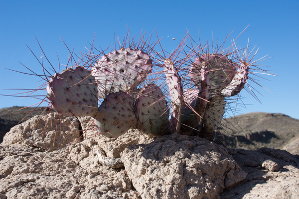 We left the park and were on our way to El Paso where we would spend the night and Matt and I would take an early flight home the next morning.
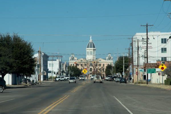 We entered the town of Marfa and Matt found on Trip Advisor that visitors could check out the dome of the city hall.
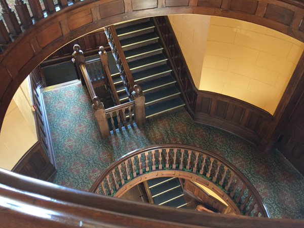 That was a good excuse to get out of the truck and stretch. This small West Texas town may be worth a second visit someday to investigate it's art venues and to find out more about the Marfa Lights (google that).
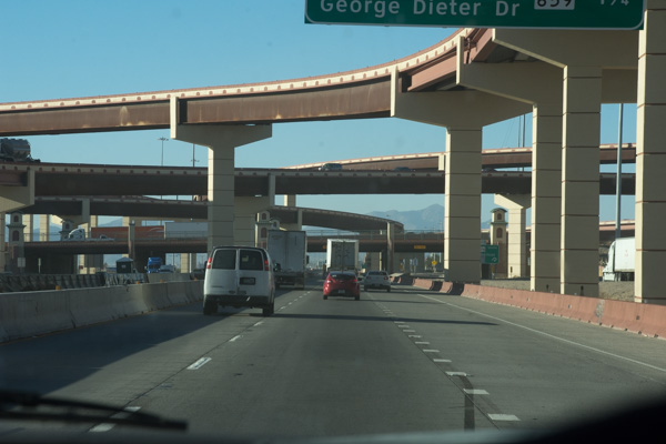 Entering El Paso.
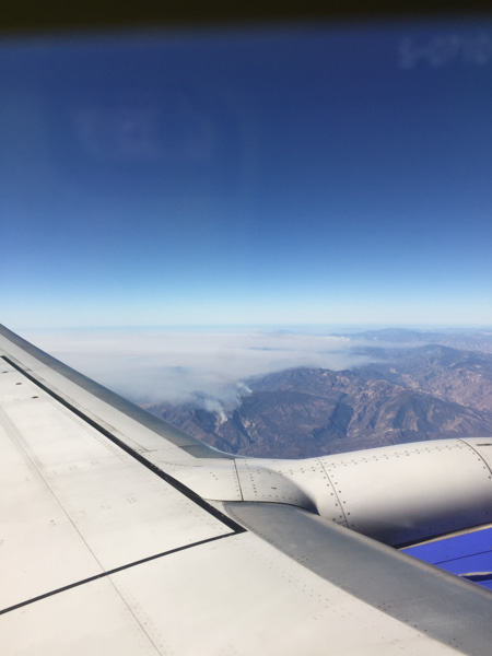 Flying over southern California where the fires were (are) still burning.
 Our first stop at the river was at raft/canoe take-out. Wildlife! I wish this was a sharper photo but I'm going to say that the javelina's coloring makes it look blurry. I just looked up javelina and learned something. Javelinas (collared peccary) are not in the same family as the pig. There are a multitude of physical differences including the type of stomach (complex versus simple), gestation length (5 months versus 3+ months), and structure of the leg and foot.
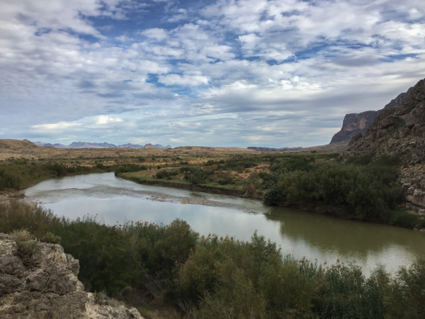
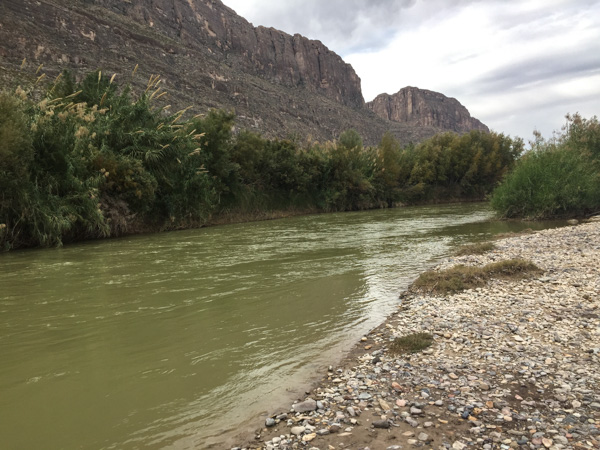 Here is a look at the river. Mexico is on the other side.
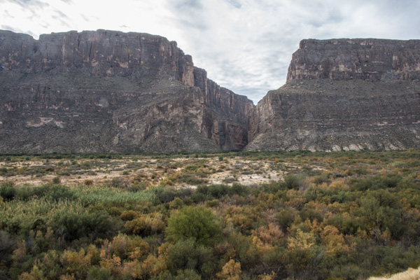 We drove on to find the entrance to Santa Elena Canyon. This is that slot seen from a distance in the previous post. It is hard to imagine from this view what it looks like in that canyon.
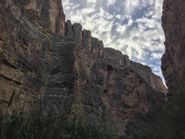
 The 3/4 mile trail into the canyon begins with rock stairs built at the lower part of the cliff.
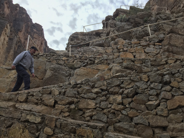
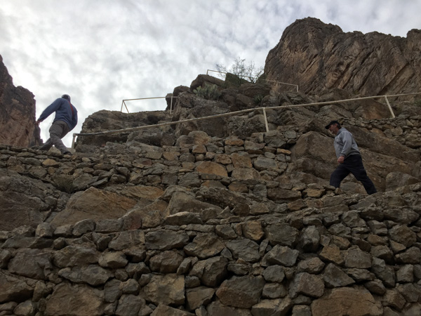
 The view looking back from the stairs.
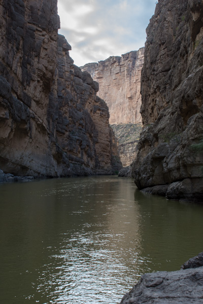
 The trail ends where the cliff walls go right to the water.
 At some points the cliffs rise 1500' from the water.
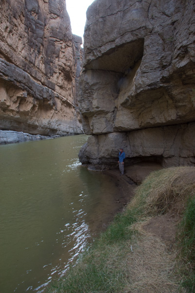
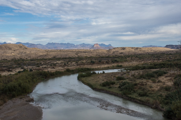 Coming back out of the canyon. In this view of the Rio Grande, Mexico is on the right. In the photos walking up the canyon, it is U.S. on the right and Mexico on the left.
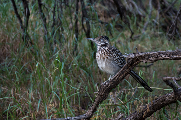 Roadrunner seen near the parking lot. We left Santa Elena Canyon and continued on a loop road that traverses the western edge of the park.
 We stopped at Luna's Jacal (Jacal: "a hut in Mexico and southwestern U.S. with a thatched roof and walls made of upright poles or sticks covered and chinked with mud or clay"), where Gilberto Luna raised "a large family"...
 ...and later when I spotted ocotillo that looked as though they had recently bloomed.
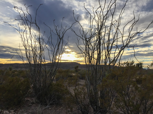 There were remnants of the red blossoms that grow at the end of the branches when there is moisture. Same with the leaves that cover the stalks for a few weeks after rainfall.
 We weren't able to find an open campsite to reserve, at least according to the person working the computer at the last visitor center (whom we had reason to doubt, but what could we do?)...
 ...so we ended our day at Big Bend and drove on to finding somewhere else to camp for the Next Adventure.
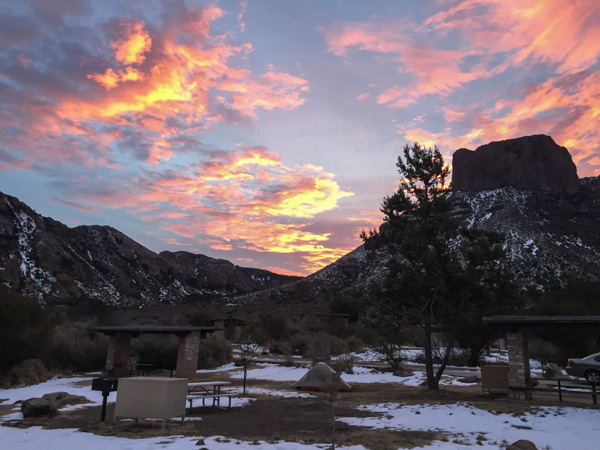 Sunrise from the campsite in the morning. I wouldn't have seen that from a motel room.
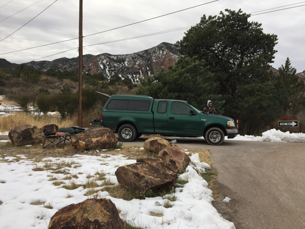 We spent the night in the back of the truck. Notice Matt's cot and sleeping bag. Fortunately no one was bothered by bears.
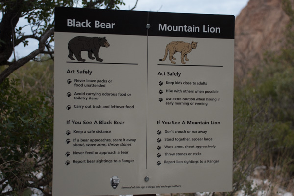 ...although we saw this sign at the trailhead right near our camp.
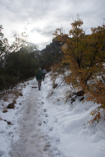 We left camp early and went for a hike up the Lost Mine Trail. I was glad that I had a walking stick with me because much of the trail was icy and slippery.
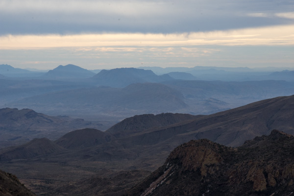
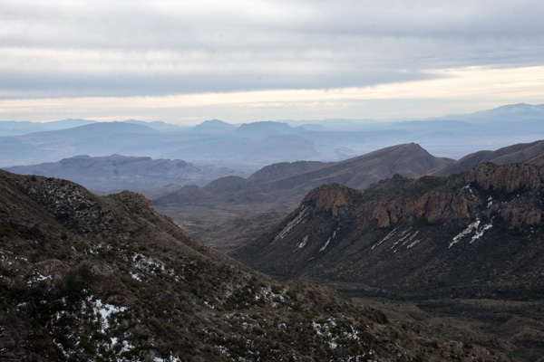 This is the view to the south from where we were standing in the last photo. The southern border of the park is the Rio Grande but I'm not sure which of these mountain ridges border the river.
 We had only a day and a half to spend in this area so we didn't plan to do any long hikes, but instead see as much of the Park as we could and get out where there were signs and shorter trails.
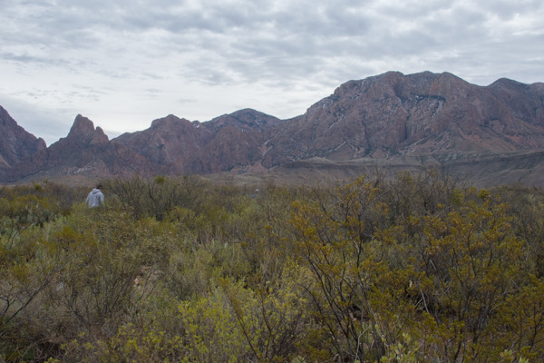 This stop was at the Sam Nail Ranch where there is a short trail to the remnants of an adobe dwelling built around 1909 when the Nail family lived here.
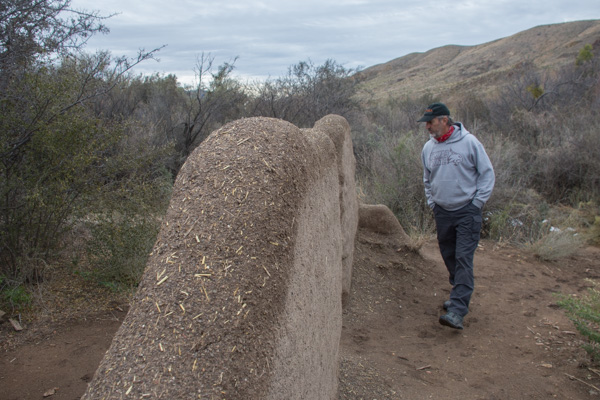 The family planted fruit trees and raised livestock, living here until the 1940's.


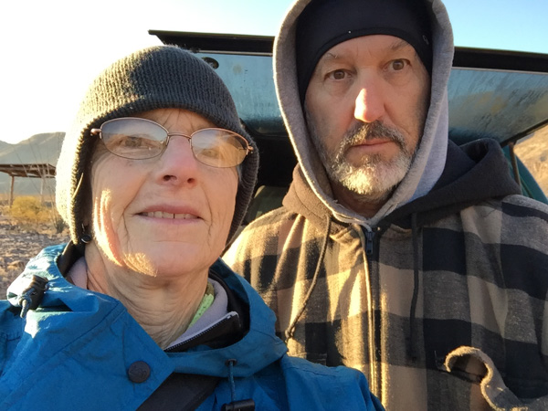
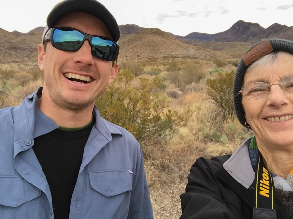 "Matt, hold still."
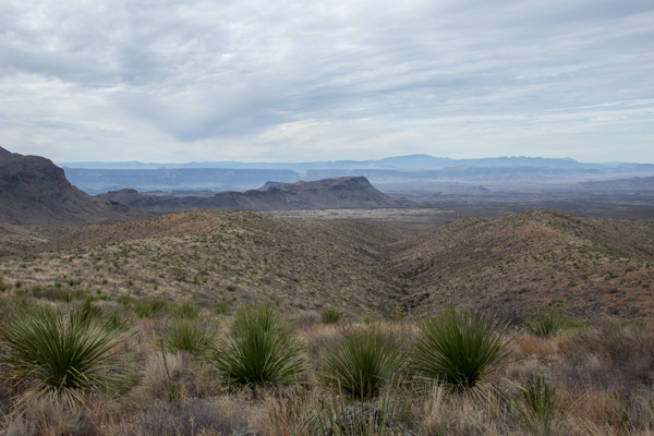 View from Sotol Vista. Do you see that slot in the middle ridge, just left of the photo's center? That is Santa Elena Canyon, about 12 miles southwest of this point, where the Rio Grande slices through the mountain, forming a narrow canyon with 1500' walls. That will be for the next post.
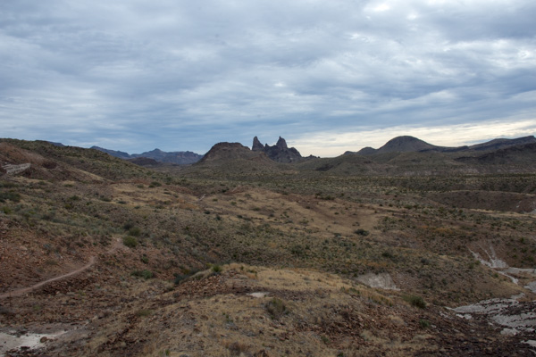 The Mule Ears View Point was the next stop.
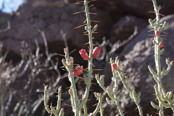
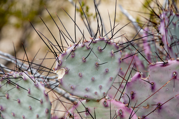 I didn't identify all the different kinds of cactus, but noticed some that were distinctly purple.
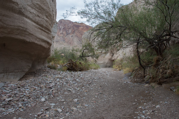 We walked into Tuff Canyon, so named for it's volcanic origins.
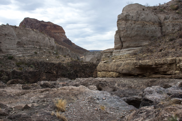 Spectacular!

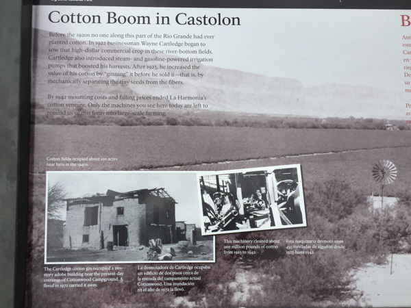 There were a lot of interpretive signs at this point. Castolon was first settled in 1901 and became a destination for refugees fleeing the Mexican Revolution. Barracks were built but never used by the army and in the 1920's the La Harmonia Company established a trading post and started growing and ginning cotton. That venture ended in the 1940's.
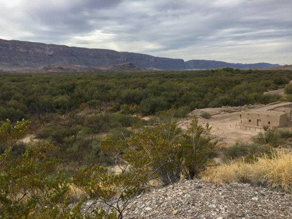 This is the modern day view of that same landscape.
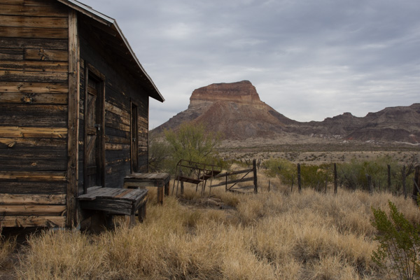 One of the old building that still remains at Castolon.
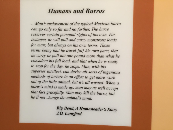 I think this statement is true.
 We stopped at the Dorgan House Trail, where there were more ruins.
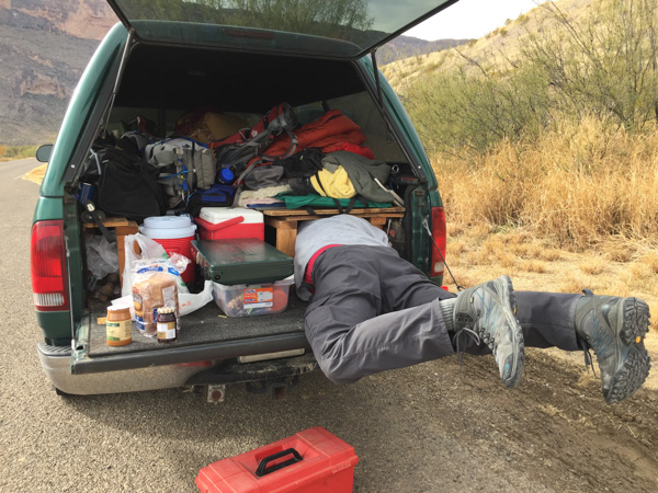 It felt like lunch time. Dan couldn't fit all the way in where he had stashed the box with my granola. Eventually I squeezed in there and he pulled me out by my feet because I was laughing too hard to get out myself.