Berryessa Snow Mountain NM
/We have traveled days to see some of our spectacular National Parks and Monuments, but there are some nearby that don't need as much planning to get to.
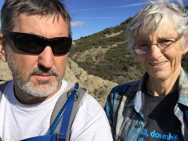
Now that Dan is retired he has more lots of flexibility and my schedule is the one that we have to work around. Last Tuesday was open. We wanted to see some of the spring wildflowers before they were gone for this year. We drove to one of the nation's newest National Monuments. Berryessa Snow Mountain NM was designated in 2015 (and was on DT's list to cut, but fortunately was spared). This is over 330,000 acres of mostly chaparral and spans a long corridor from Lake Berryessa into the Mendocino National Forest in the mountains west of Willows.
We first planned to drive up Bear Valley just east of the monument, where we'd heard the wildflower show is spectacular, and then find a hiking trail at the northern end. Then Dan suggested we drive north on one of the roads through the monument and come back on Bear Valley Road. So we turned north on an unpaved road, driving toward Indian Valley Reservoir.
 Wildlife!
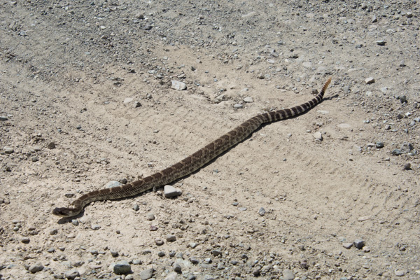
 I stayed in the car to photograph this one.
 After all, he (she?) was conveniently right in the middle of the road.
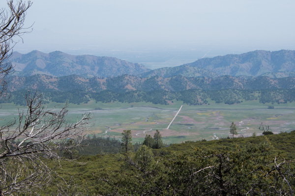 We got several miles in on a ridge line and got out to take in the scenery. The day was sunny, but the haze to the east was typical of summer in the Central Valley. We could just make out the Sutter Buttes in the valley but you can't see them in this photo. This is looking down on the road that we were going to take that goes through Bear Valley. Most of that color is displays of wildflowers.
 Looking to the west it was hazy/cloudy. This is Indian Valley Reservoir.
 The place where we stopped was strikingly green.
 From the Davis Enterprise: "Serpentine, scientifically called “serpentinite,” is a rock formed by combining water with rock that originally was part of the Earth’s mantle, the layer beneath the Earth’s crust. Soils formed from serpentinite rocks lack certain elements required by most plants."
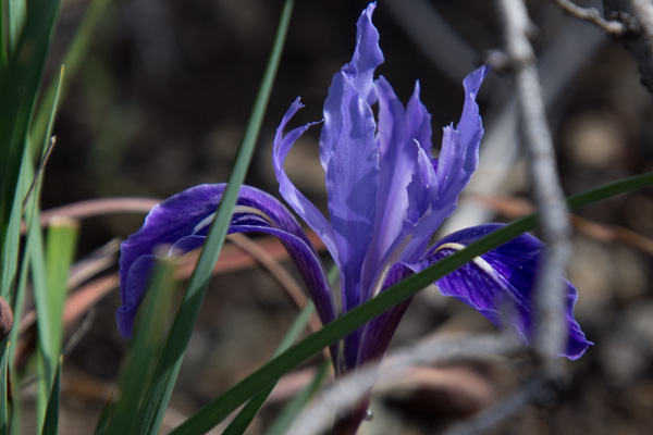
 There are a number of plants that grow only in this ecosystem. I haven't identified this one that hasn't yet opened its flowers. **Now ID'd by friends as Bitter Root, Lewisa rediviva".
 Here is another. **This one just ID'd as True Baby Stars, Leptosiphon bicolor.
 We continued to drive, getting out here and there to take in the scenery.
 Delphinium.
We did a lot of driving on the rocky somewhat rutted roads. Somehow we missed the road we were looking for to take us to the trails at the north end of the valley. We came to a fork and made the decision to head north. We drove probably a mile on an even more rutted, slower road and then came to a creek crossing with a drop off that I was sure my RAV-4 couldn't make--at least not without knocking off the bumper. And if we found an even worse spot further up I don't think we could have come back up that ledge. So we turned around there and took the better maintained gravel road that ended at Clear Lake. We'd left our house around 9:00 and it was around 4:00 by this time. We hadn't put in that many miles, but lots of hours in the car.
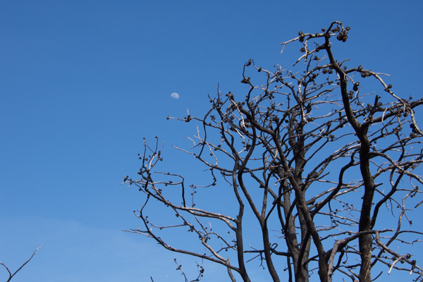
 There was one more trail in the direction home. We stopped at the Knoxville Staging Area which we found out is a staging area for ORVs, and walked for about an hour. This area was ravaged by one of the wildfires a couple of years ago.
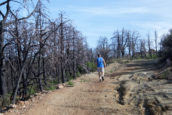


 As we walked back towards the car I first heard and then saw this scrub jay.
 It seems that he was hungry.
 It was getting late in the afternoon when we left this area and headed south towards Lake Berryessa.
 We didn't get out here and I didn't take many photos but this was one of the most beautiful places of the day. The road passes the site of the Homestake Mine.
From the Napa Valley Register : "The history books have it all wrong. For Napa County, the Gold Rush wasn’t in 1849. It happened less than 30 years ago in a remote corner of the county ruled by jackrabbits. From 1985 to 2002, Homestake Mining Co. extracted $1 billion worth of gold from the desolate landscape above Lake Berryessa. For a time, the McLaughlin Mine was the biggest producer in California and one of the largest in the world."
This area is now the Knoxville Wildlife Area owned by the CA Department of Fish and Game. The road follows the creek and the hills are covered with green grass and oak trees. I was in awe of the beauty at this time of year. I still love the hillsides in the summer, but I guess it's been a long time since I've been out in the California hills in the springtime when it is so green.
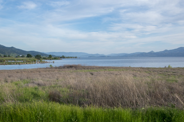 The road took us to the northern end of Lake Berryessa. I'm not a big fan of reservoirs but this time of year with everything so green it looked like a natural lake.
Most of the day was spent driving but what a splendid exposure to a little known region right in my backyard. Next time we'll hit the Bear Valley Road first and then get to those hiking trails.
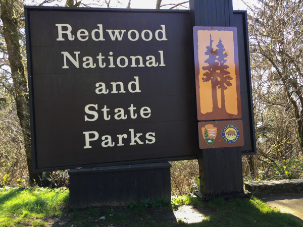 From Wikipedia: "... the four parks, together, protect 45% of all remaining coast redwood (Sequoia sempervirens) old-growth forests, totaling at least 38,982 acres. These trees are the tallest and one of the most massive tree species on Earth."
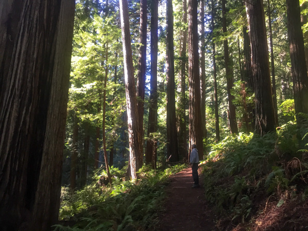 In 1850 there were 2 million acres of redwood forest along the northern California coast. After years of unrestricted logging the Save-the-Redwood League, created in 1918, was successful in establishing three State Parks in the 1920's.
 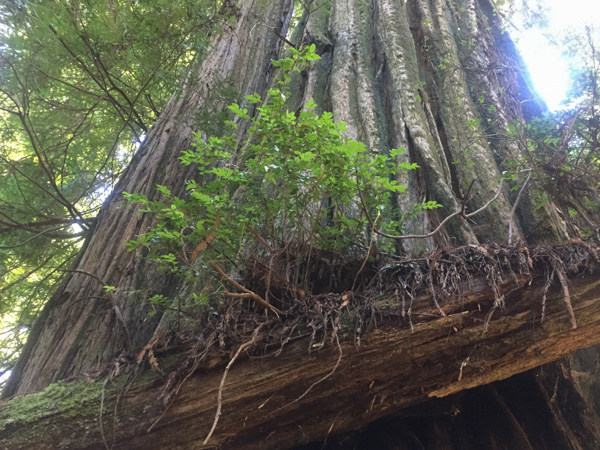 Redwood National Park was created in 1968 after 90% of the original redwood trees were gone. Now the State and Federal agencies cooperatively manage the forests and watersheds as a single unit.
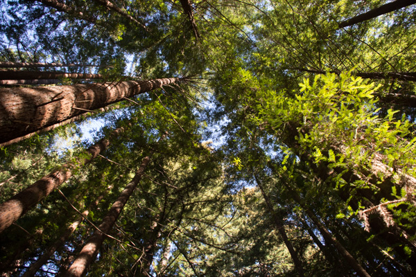 I'll mention here that all these photos were taken with my iPhone because the previous night I dropped my camera (on the carpet in the motel) and the lens popped off. I couldn't get it back on and knew that I wouldn't be able to get it fixed until after I came back from Texas (where I was headed as soon as we returned from this trip).
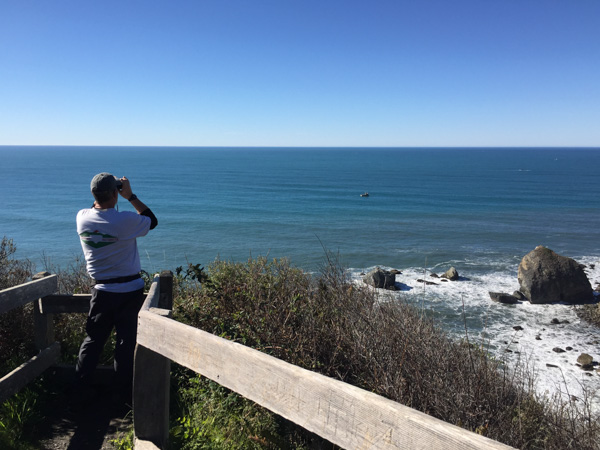 We took a side trip to the spot where the Klamath River flows into the ocean and walked down the steep trail to this overlook. That's Dan looking across the ocean for Meryl (my DIL who is in Australia right now).
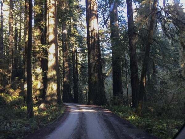 We drove farther north to the Stout Grove in the Jedediah Smith Redwoods State Park.
 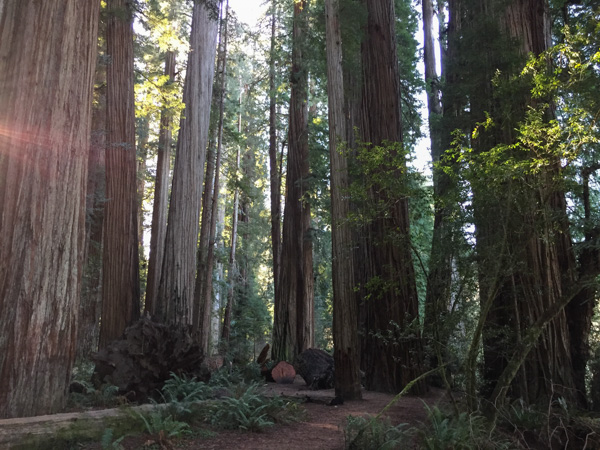 Every time we stopped we continued to be impressed with the grandeur of these trees and the forest.
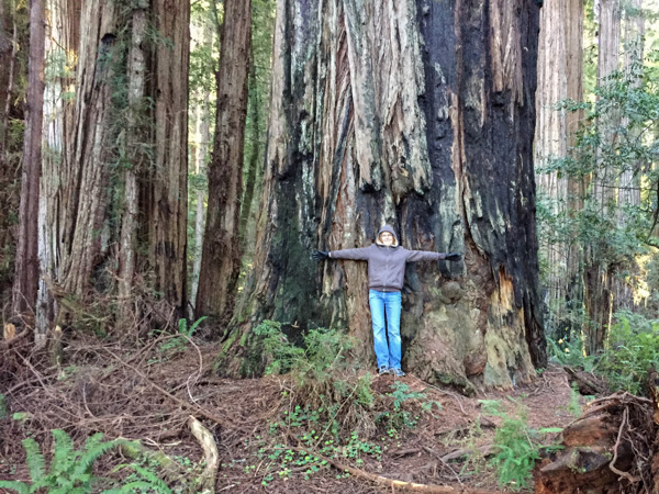
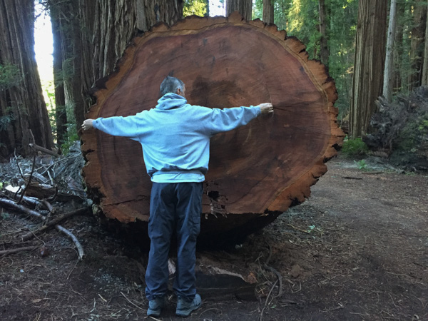 This tree had fallen and then was cut to clear the path.
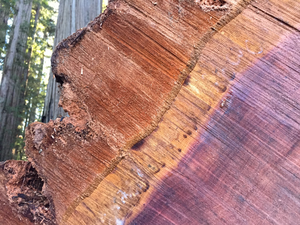 Look at that brilliant color.
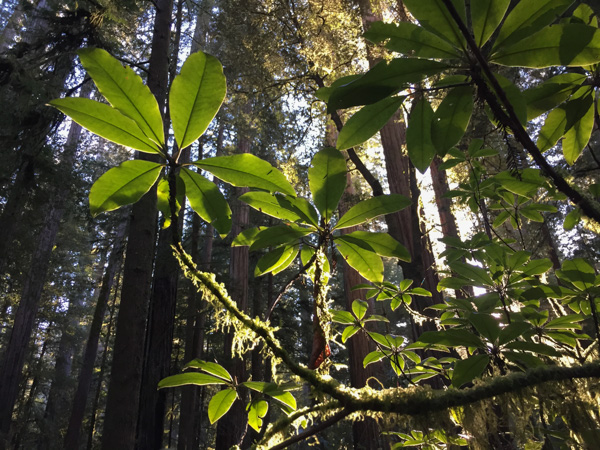
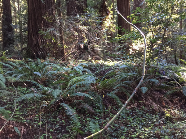
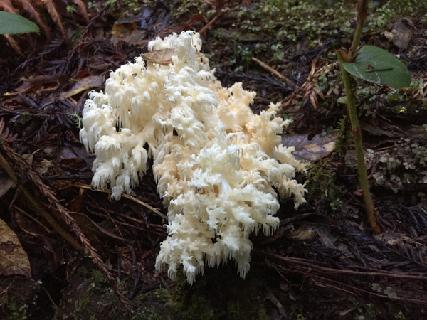 We were surprised that we didn't see more mushrooms and fungus, but this one did catch my eye. Late in the afternoon we headed toward the coast at Crescent City.
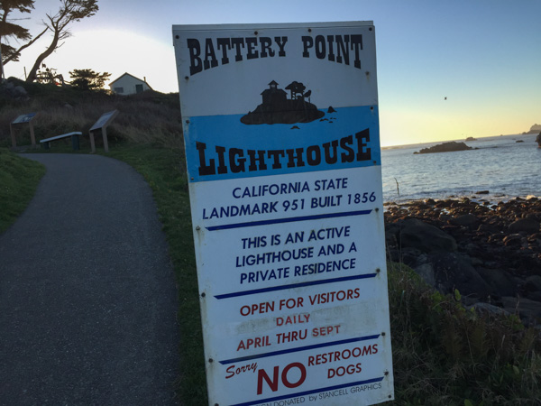 Our map book showed two lighthouses so we started with Point St. George. We found that lighthouse (manned from 1891 to 1975 and abandoned in 1995) but it was 6 miles offshore. The Battery Point Lighthouse is accessible at low tide so we were able to walk to it, but we were too late for a tour.
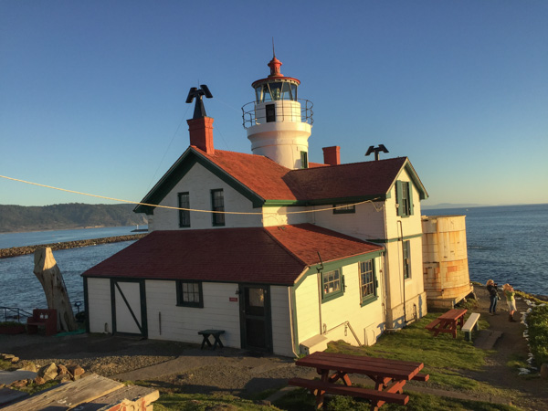
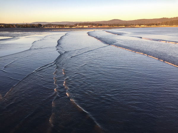 We walked along the breakwater (seen in the lighthouse photo) and then out on a pier. This is a view looking back toward Crescent City.
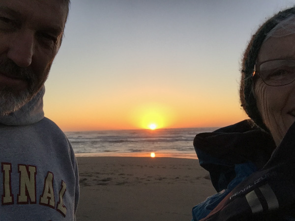
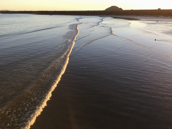 This is the view looking back toward the breakwater and the setting sun.
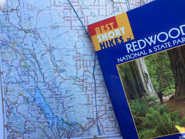 Mini Road Trip!
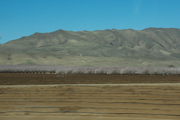 From the Central Valley you need to drive through the hills to the west. We turned onto Highway 20 at Williams. You can see a slight tinge of green if you look hard but this time of year they should be emerald green. That green is the grass that began to grow after our early January rain. We have had negligible rainfall since and there has been no more growth. This is the time of year that ranchers in the non-irrigated hills count on abundant forage for livestock. Very scary to think of another year of drought to this degree.
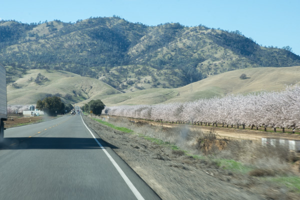 This is a view getting closer to the hills. The almond trees are beautiful this time of year but I am disturbed at how many acres of land all over California have been put into almonds now. That's a story for another time however. It seems I didn't take more photos until we got to our first stop.
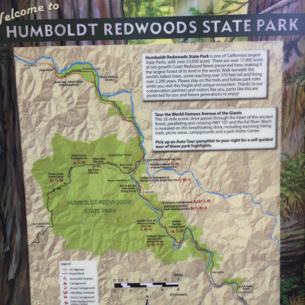 From the Humboldt Redwoods State Park website: "In the early 1900s, loggers came to what is now Humboldt Redwoods State Park to cut down lofty ancient redwoods for grape stakes and shingles. The founders of Save the Redwoods League thought that was akin to 'chopping up a grandfather clock for kindling.' From the acquisition of a single grove in 1921, the League has raised millions of dollars to build and expand this park. Today Humboldt Redwoods spans 53,000 acres, an area almost twice the size of San Francisco. About one third, or 17,000 acres, of the park is old-growth redwood forest—the largest expanse of ancient redwoods left on the planet."
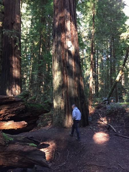 What is special about an old-growth forest?
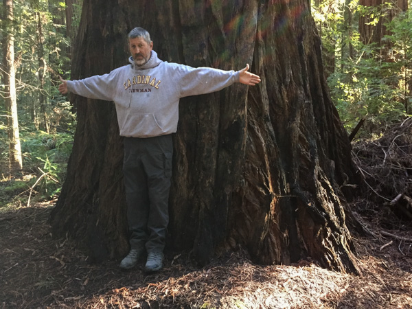 The size of the trees.
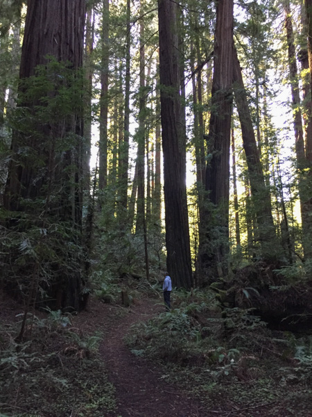 The mix of tree sizes. Unlike a reforested clear cut, there are trees of all ages and sizes and this makes for an open forest instead of a monoculture of trees and brush that you can hardly walk through.
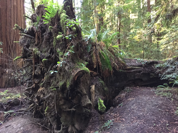 The ecology. When old trees fall they open up space for light to reach the forest floor and opportunity for new growth of other species.
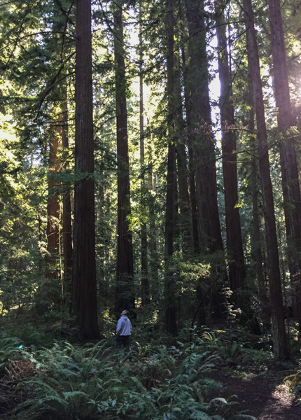 The grandeur.
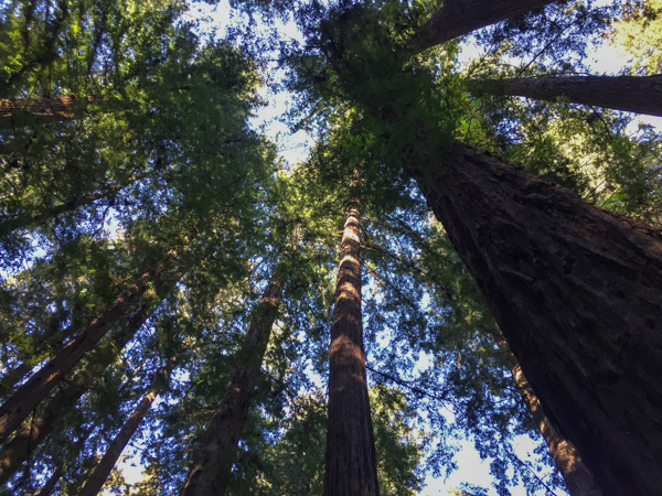
 We ended the day at the beach.
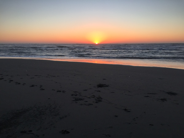
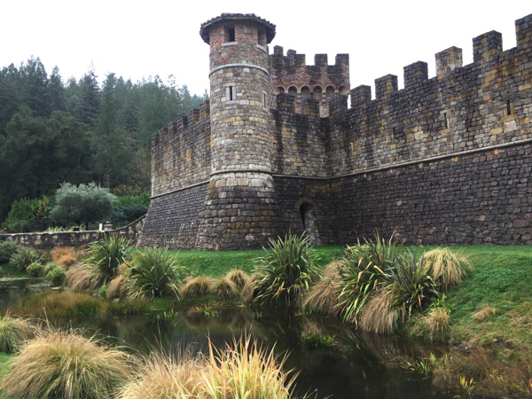 The Castle was designed by Dario Sattui who modeled it after European 13th Century castles that fascinated him.
 His
His 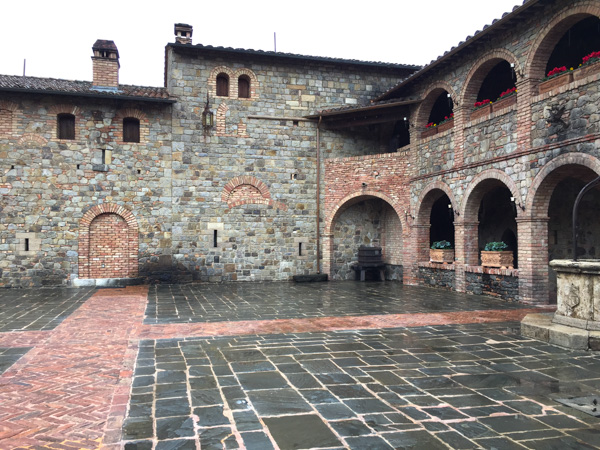 Sattui brought builders, brick-workers, and others from Europe and shipped containers full of old bricks, doors, hardware, and all kinds of other building materials that had been sourced from old castles in Europe.
 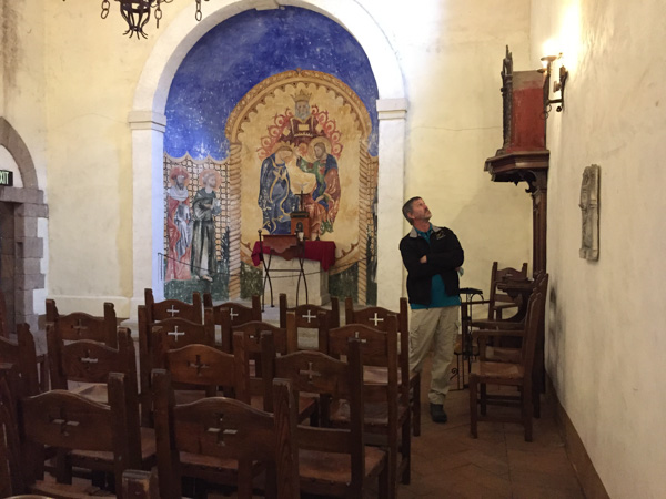 Although my first thought when I heard about this place was that I would the resent pretentiousness of spending this much money and "showing off", but this is a fascinating place and it is very cool to visit it.
 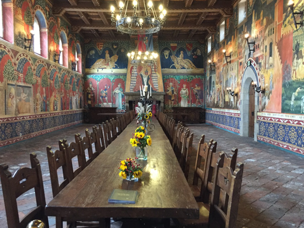 The Great Hall.
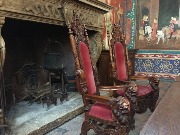 There is an authentic 13th century fireplace at the end of the Great Hall. The guide told us that those two chairs are "authentic replicas"--they were left behind by a movie company who used this setting.
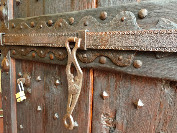 Dan noticed all of the iron work. All of it, including the bolts and nails was hand made.
 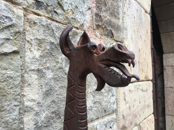 Stone is all hand-chiseled.
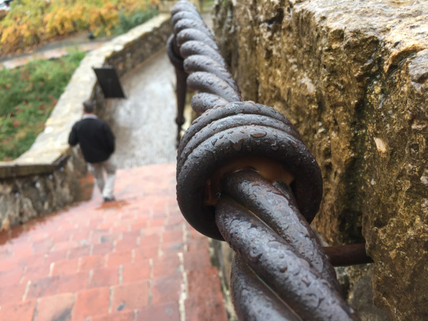
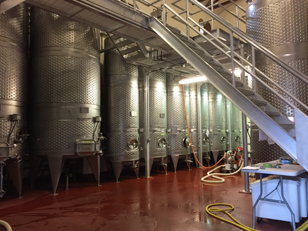 After walking through some of those ground-level rooms we saw the equipment that is used in modern wine-making.
 But then we went downstairs into the lower levels.
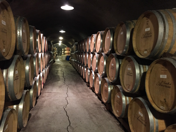 There are 900 feet of caves in four levels.
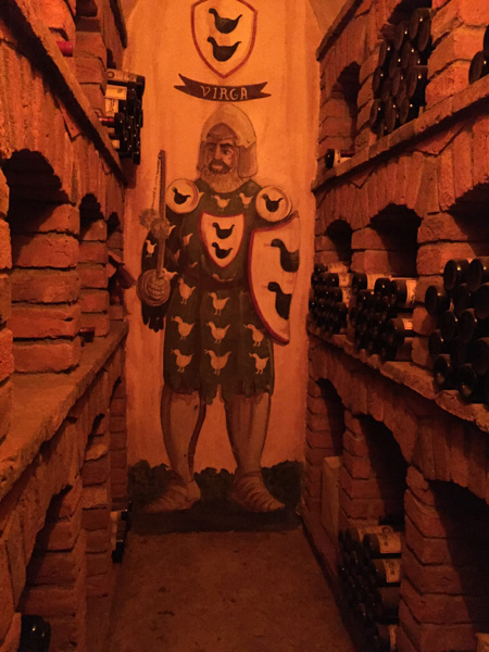
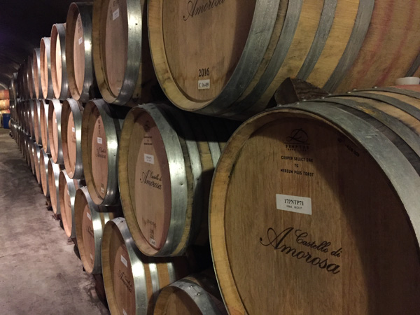
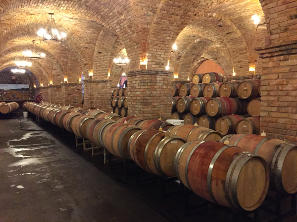 This barrel room is constructed with impressive brick Roman cross-vaulted ceilings.
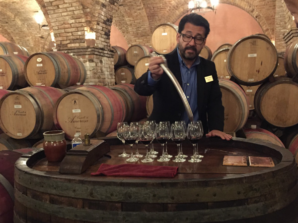 Barrel tasting in the barrel room.
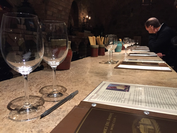 I will admit here that I am not a wine drinker. Dan and I were both more interested in the tour than the wine tasting but we stayed for that too. There were only about a dozen of us and the guide-turned-wine-expert poured about 8 or 9 different wines to sample.
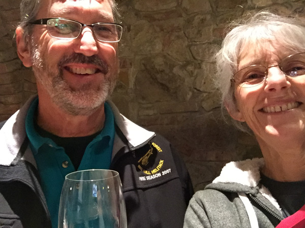 I finally found a wine that I liked...
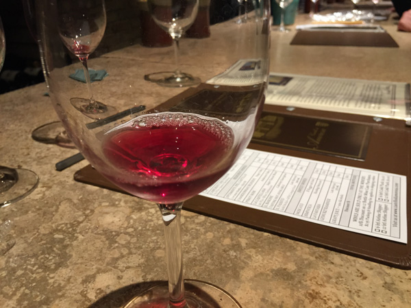 ... and I'll admit that it's sweet and a little fizzy so I might as well just buy fizzy juice at Safeway, right?
 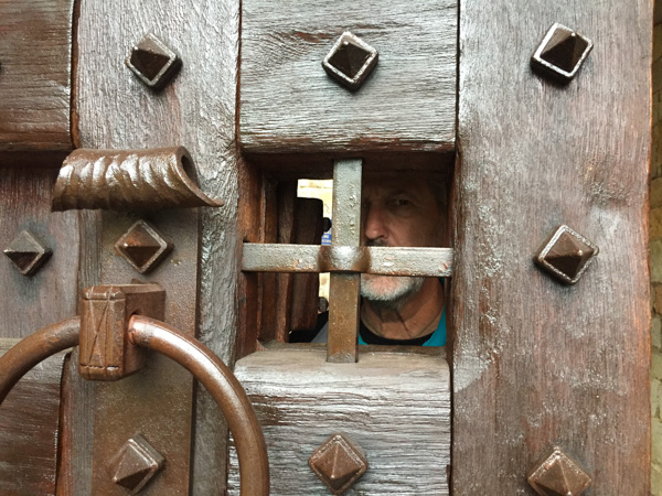 Leaving the castle. This door reminds me of the one in the Wizard of Oz moviewhere the wizard opens the little panel to look through at Dorothy.
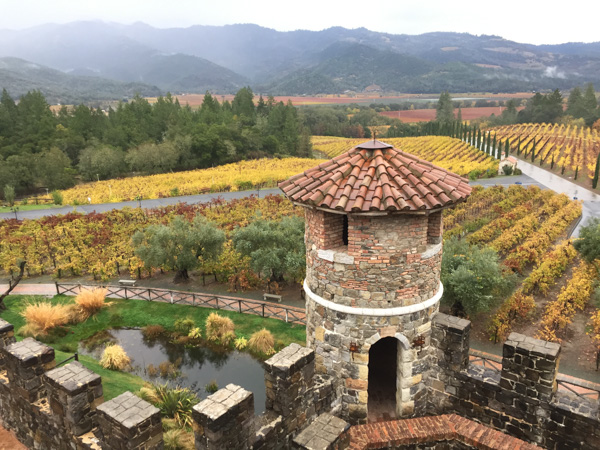 View from the Castle to the hills where we hiked the day before.
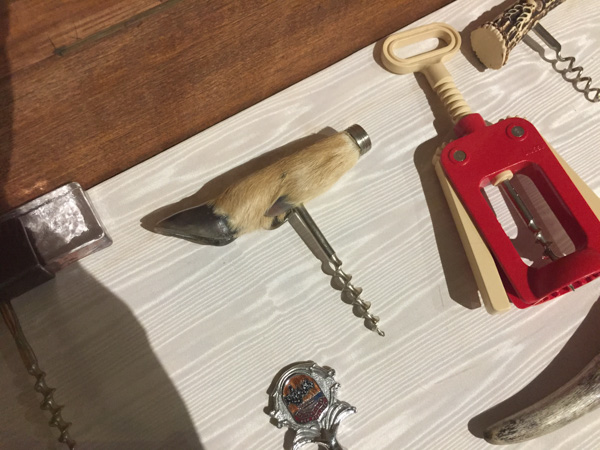 I took one photo and then my phone died. So this is it--one of hundreds of odd corkscrews and other wine related gadgets. You know, the feet are some of the few parts of the butcher lambs that aren't used at this time. Could this be in my future?
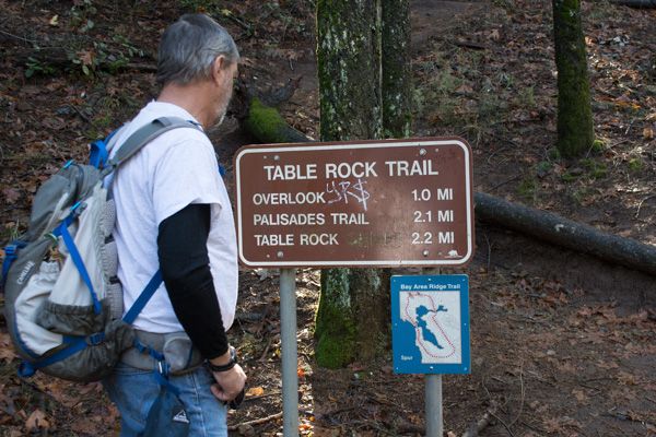 The Robert Louis Stevenson State Park to the north of the highway is closed but the Table Rock trail is south of the highway.
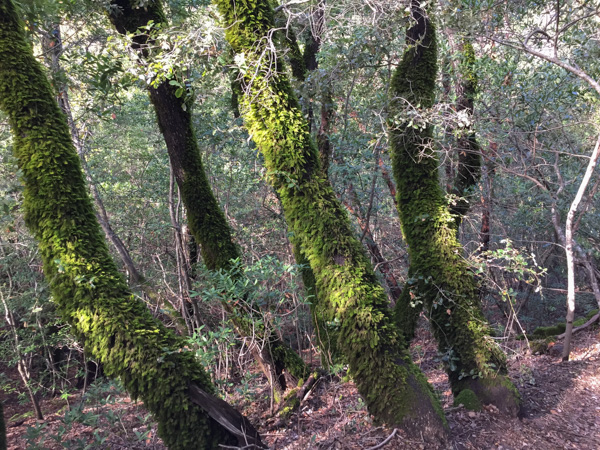 The trail starts out in groves of oak, madrone, and bay trees. This area was damp from recent rain and the trees looked as though they were covered with green fur.
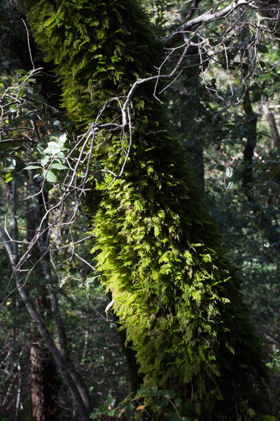 A new kind of
 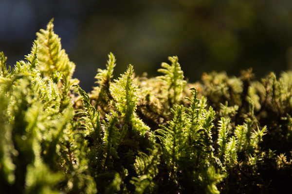 Making things larger than life through the lens.
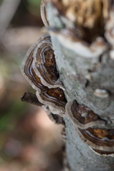
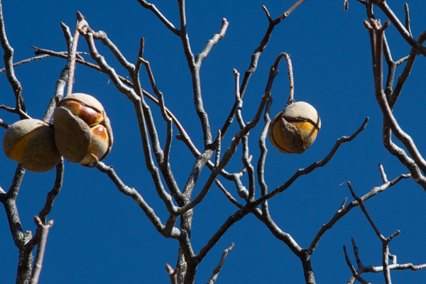 As the trail descended the other side of the first ridge the vegetation seemed more typical of California chaparral. These are the seeds of the California Buckeye.
 The California buckeye is one of the first deciduous trees to leaf out in the spring, but it also goes dormant and loses it's leaves in late summer. Although the "nuts" may seem similar to chestnuts, these are toxic.
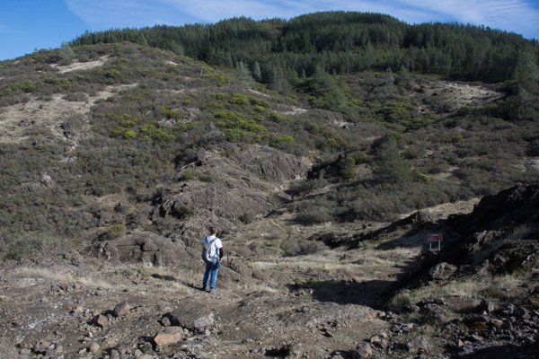 The trail leads to the western end of a formation called the Palisades, volcanic rock that towers over the northern end of the Napa Valley.
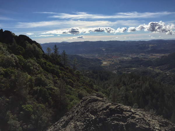 That is the town of Calistoga down below.
 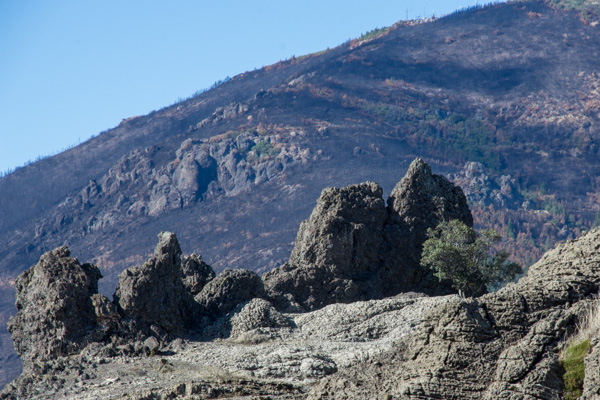 We sat on the rocks known as Table Rock for quite awhile, soaking up the sun and watching birds and the beautiful sky. The fire missed this area, but not Mt. St. Helena in the background and the lower area along the highway.
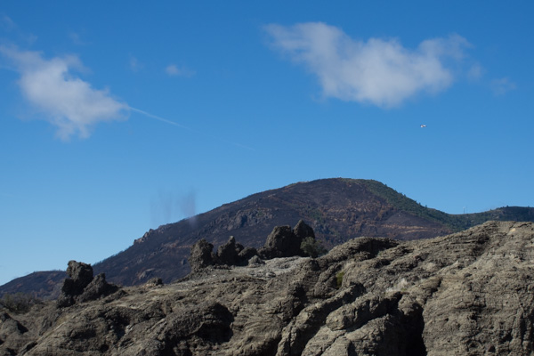 As we sat on the rocks Dan noticed a Cal Fire plane flying around Mt. St. Helena and then saw it drop something--we wonder of that is seed to help stabilize the burned landscape.