
Exploring Berryessa-Snow Mountain National Monument
/Long-time followers of this blog know that we love visiting our National Parks and National Monuments. There is one in our own backyard that we have hardly seen. Berryessa-Snow Mountain NM was created in 2015 and encompasses 330,780 acres. The website states: “Public lands managed by the Bureau of Land Management and Forest Service in the Berryessa Snow Mountain National Monument are some of the most scenic and biologically diverse landscapes in northern California. They range from rolling, oak-studded hillsides to steep creek canyons and ridgelines with expansive views.”
My wool was ready at Mendocino Wool and Fiber in Ukiah and we decided to pick it up rather than have it shipped and then have an afternoon of hiking on the way back. I researched (googled) where to hike and found some trails that were in the southern part of the Monument.
We decided to try the Judge Davis Trail in the Cache Creek area. According to the AllTrails that would be a 5 mile out and back trail for a total of 10 miles.

There were some signs in place, but it wasn’t until I started sorting these photos that I finally realized that we weren’t on the trail we thought we were. The very limited map I had printed from a computer screenshot was from the non-paid for access to AllTrails that showed Cache Creek Ridge and Judge Davis trails. It turns out that they were two separate trails and we didn’t even see the start of the Judge Davis trail from where we parked. No big deal—I just like to be accurate.

I’d read reviews of the trails in this area that warned about ticks (especially if you are hiking with dogs) and lack of shade and water. At this time of year we certainly didn’t need to worry about shade, but I can see how that would be a huge concern in the summer. This is a hot, rugged landscape.

Another sign—we were entering an area designated wilderness. I found it interesting that hang gliding is on the list of unacceptable activities in this area.


According to an app on my phone I think we’d gone about 2.5 miles be the time we saw this sign that pointed to the Judge Davis Trailhead (ahead of us on the trail).
There was a trail that took off to the left and this was the sign, burned in one of the previous years’ fires. We could barely make out that it says Cache Creek 4 miles. Acccording to the map I had we didn’t think the Judge Davis Trail made a loop so we continued down this Cache Creek trail.

The view to the northeast. The only other people we saw were on a trail near the ridge in this photo.

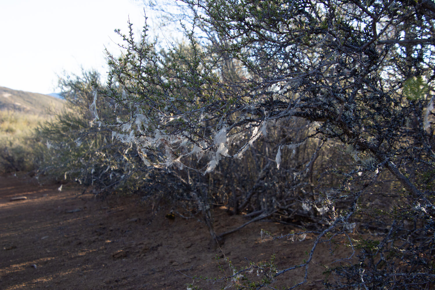
Along the trail in some areas I saw small bits of fluff caught on the brush. It was the most dramatic here and I wondered which animals were the right height to be rubbing and lose some undercoat. My guess is that it is the elk that had bedded down nearby.

View northwest. I’d like to know what mountain that is. We thought that Cache Creek is over a few ridges to the left of where we were standing. It was getting later in the day and we decided that we should probably turn back since we had to follow this same trail back and with all the uphill it would take awhile. The phone app said that we’d gone about 3.5 miles.

View south.

On the earlier part of the trail there was a lot of manzanita that glowed red in the sun.

Back at the parking lot I took a photo of this sign and we saw the beginning (and end) of the Judge Davis Trail, a short distance from the trail that we had taken. . I finally matched up the trails with our printed map. The trail we took is the one on the right side of that blue square and I think the signs we saw were at the junction where you can continue south or go northwest to the Judge Davis trail. We went south but not all the way. Now we’ll have to go back and try again. I’m sure the wildflowers will be fantastic in a few months.
