Road Trip to CO - Gunnison to Durango
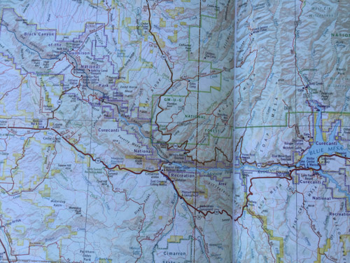
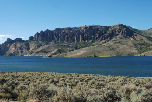
We left home on Wednesday and planned to get home on the following Wednesday. This was Monday. We had driven the road north of the Gunnison River the day before and camped near the Blue Mesa Dam. IMG_2788

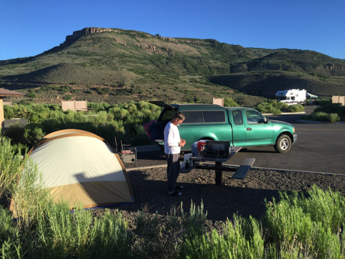
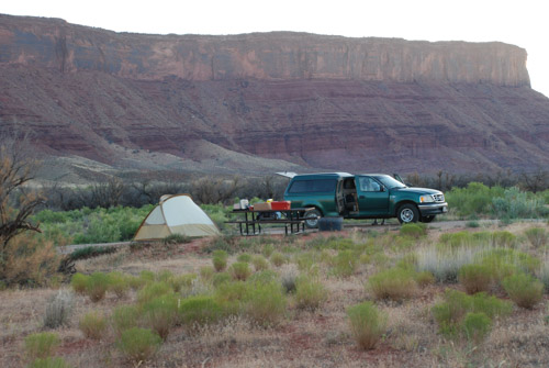
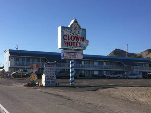
This campsite was essentially a parking lot for RV's, but we just needed a place to eat and sleep so it worked.

DSC_1131

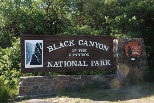
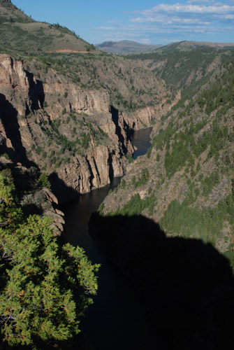
The Black Canyon of the Gunnison became a National Monument in 1933 and was made a National Park in 1999, over twenty three years after I spent a summer in the area. It contains 14 miles of the canyon's total 48 mile length.

IMG_2795

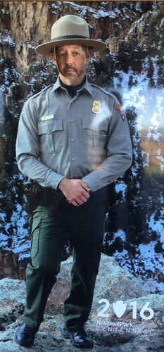
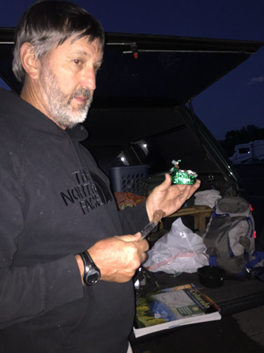
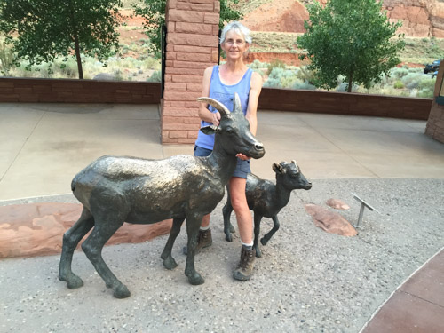
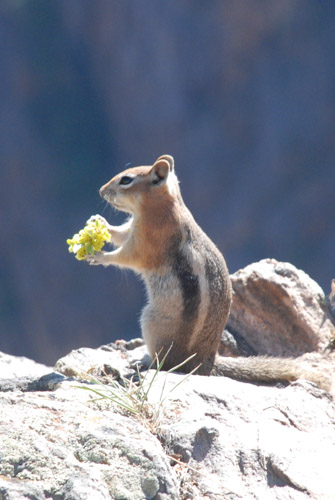
I guess they'll take anyone as a Park Ranger.

DSC_1132

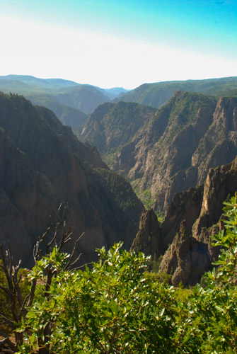
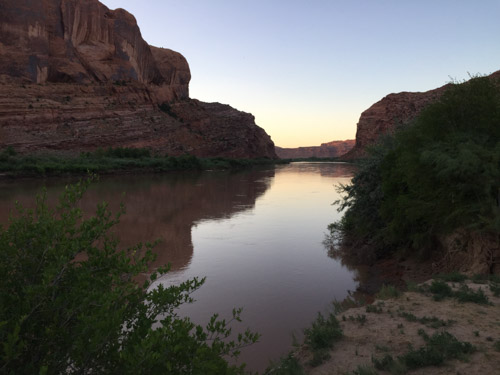
The canyon is so deep and narrow due to the power of the Gunnison River as it drops an average of 96 feet per mile.  The Gunnison loses more elevation in the 48 miles of the canyon than he Mississippi River loses in 1500 miles.

DSC_1194

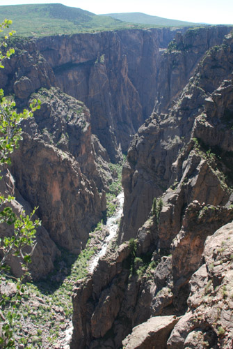
It is a sobering thought that the power of this river is forever harnessed due to up-river dams that lessen seasonal flooding. Therefore, build up of sandbars and more vegetation has changed the ecology of the canyon.

DSC_1200

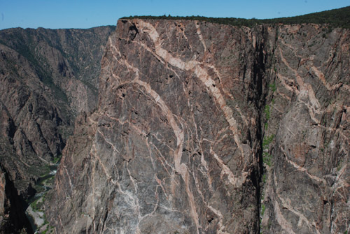
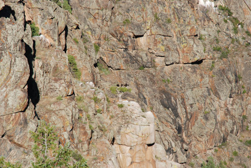
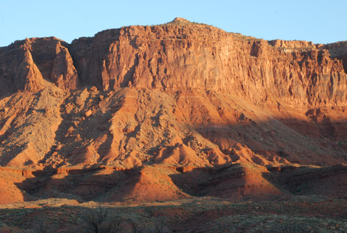
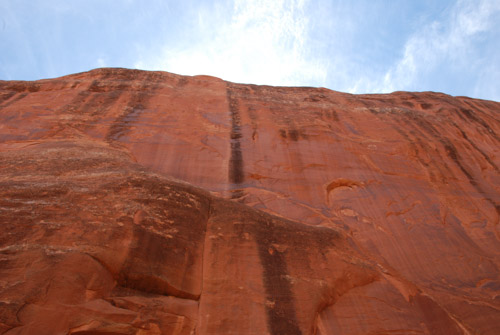
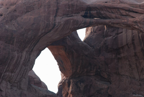
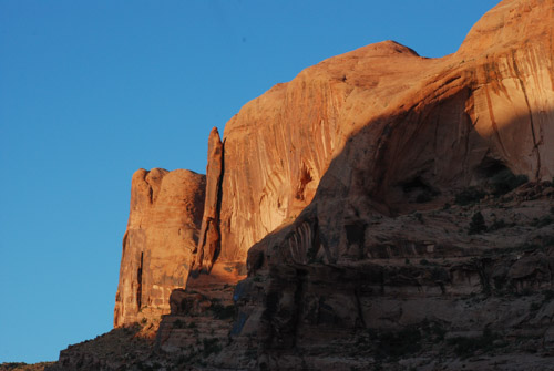
The Painted Wall was created over a billion years ago when molten rock flowed into fissures in the dark wall.

DSC_1177

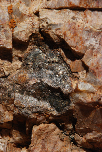
That molten rock cooled into crystals of mica, quartz, and feldspar. Amazing patterns were revealed as the river cut through the rock, forming the canyon.

DSC_1166

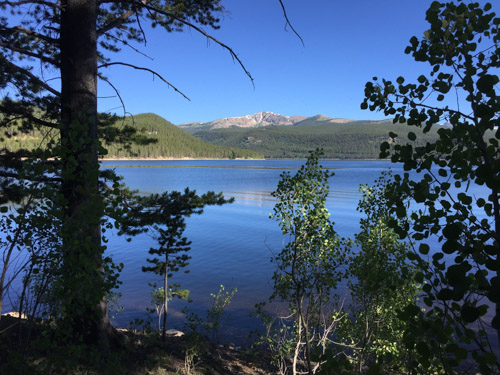
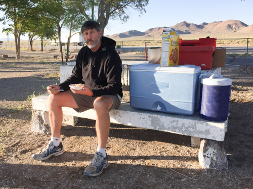
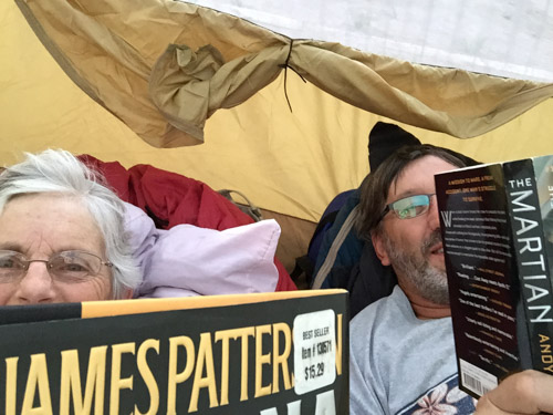
Breakfast with a view.

DSC_1218

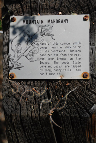
I enjoyed the signs along some of the trails to help with plant ID.DSC_1151

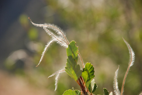
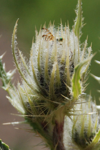
I recognized this bush with it's remarkable fuzzy seed dispersal method, but couldn't quite find the name in the recesses of my brain. Mountain Mahogany.

DSC_1206

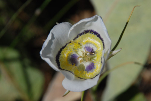
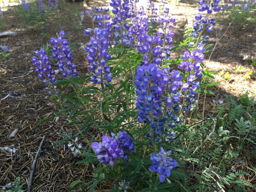
I also recognized this as in the Mariposa Lily family. It's called Gunnison Sego Lily.

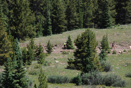
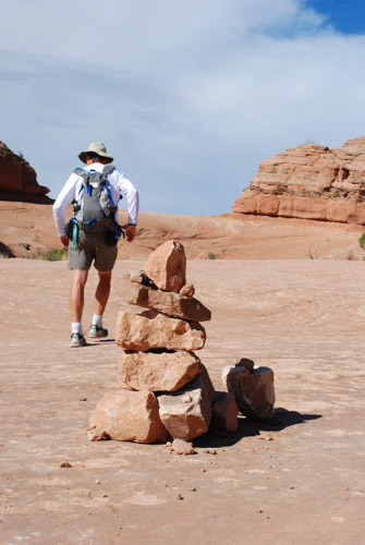
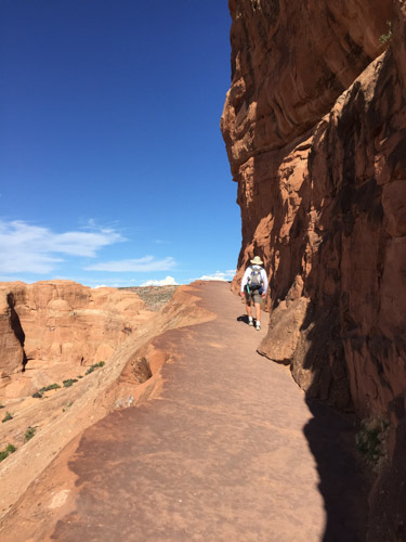
We spent half the day exploring the canyon from the rim. There are no trails to the river in the Park. We saw a couple of trails when we drove along the north rim east of the Park, but they are not for the feint of heart or casual hiker. The rim views are spectacular enough. But we had limited time and needed to get on the road.

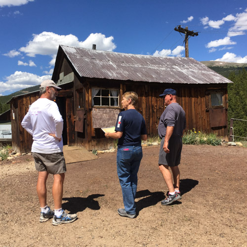
In the summer and fall of 1976 I worked  for the BLM in Montrose, Colorado. I had fond memories of renting a bunk house on property between Montrose and Ridgeway and spending weekends exploring the old mines and alpine meadows in the beautiful San Juan Mountains. I had never been back, but wanted to use this opportunity to drive through that country.

IMG_2812

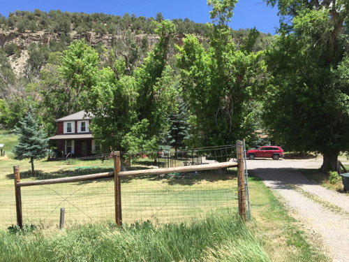
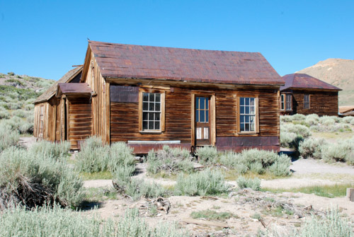
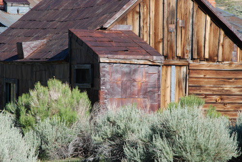
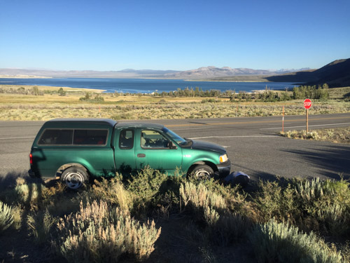
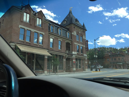
As we were driving down Hwy. 550 I wondered if I would recognize the place. The highway followed the Uncompahgre River but was on the wrong side of the river. Surely I would have remembered living right next to a major river like that. My memory was that the bunkhouse was up against a bluff and just south of the big house. We got to a point where the river shifted course for a brief period to the west side of the highway and there it was. I'm glad to see that they place hasn't been torn down and, in fact, looks as though it has been fixed up. The bunkhouse is just behind the red truck and, yep, there is a bluff behind it.

DSC_1239

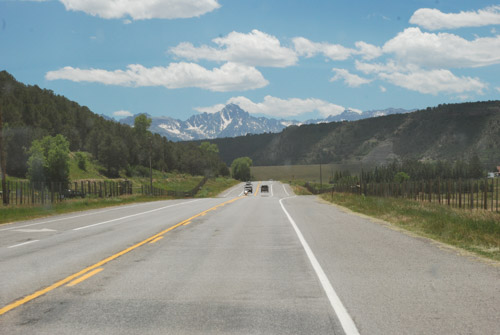
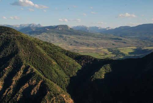
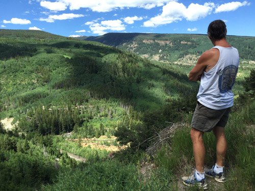
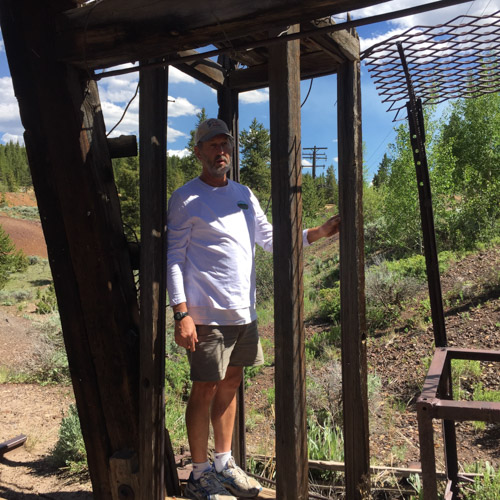
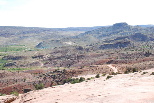
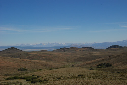
The view heading south from the house. Not a bad place to spend a summer...or a life (if you can deal with snow).

DSC_1245

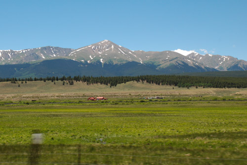
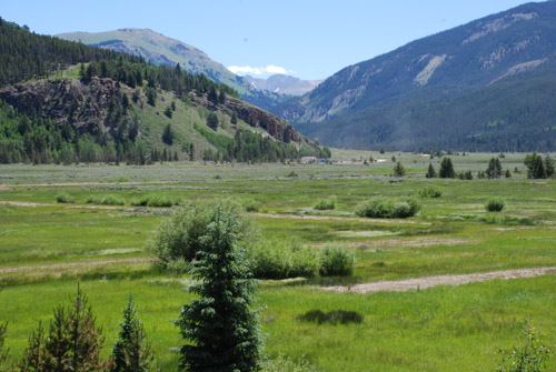
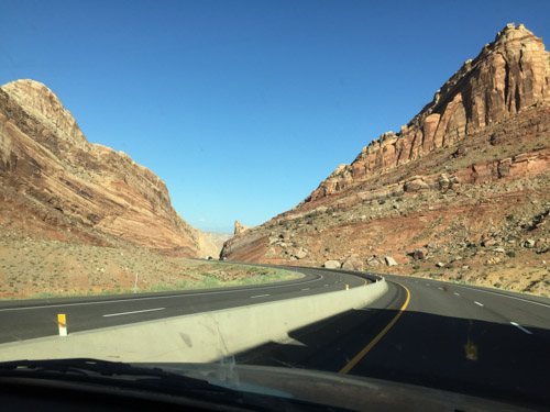
We drove south into the San Juan Mountains.

IMG_2814

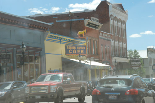
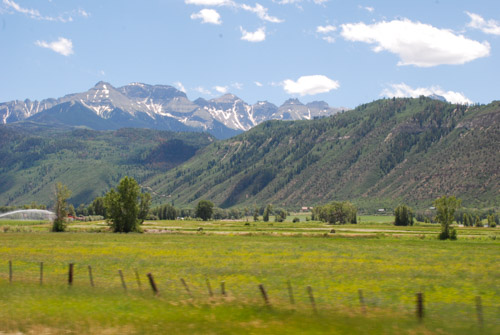
I have memories of driving to Ouray and heading out from there towards Telluride to explore the mountains. I don't think that these towns had the tourist appeal then that they do now.

IMG_2834

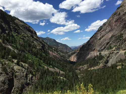
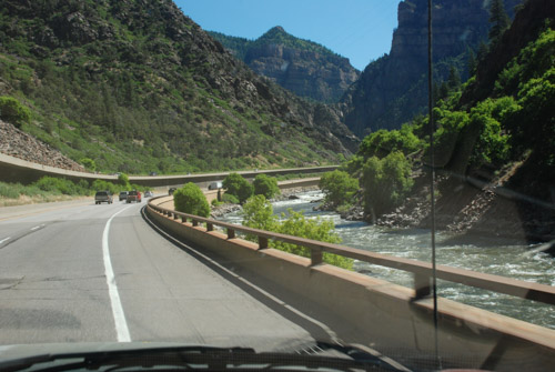
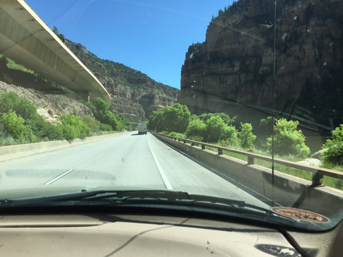
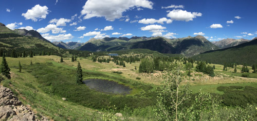
This is one of the most gorgeous places I can imagine. It's hard to get photos that do it justice.

From dangerousroads.org "In the state of Colorado...there’s a special highway built in the late 1880's: the Million Dollar Highway, part of the San Juan Skyway. It's one of the nation’s most spectacular drives...The road's winding design, providing stunning panoramic views, is very curvy and fun for a leisurely ride, so it pays to take it slow. Offering breathtaking mountain, valley and gorge views, the Million Dollar Highway is one of the most beloved roads in the country. This classic stretch of two-lane blacktop snakes its way through the San Juan Mountains, the wildest and most rugged peaks in the Rockies."

From another website: "Originally built in 1883 by Otto Mears as a toll way from Ouray to the now abandoned town of Ironton, this two lane highway offers spectacular views of the San Juan Mountain Range, and Uncompaghre Gorge. The road was extended to connect Silverton and Ironton over Red Mountain pass, and operated as a toll road until the early 1920’s when it was rebuilt and became part of the present day US Highway 550."

IMG_2829

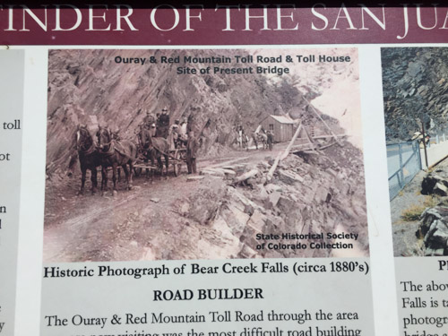
Can you imagine the road when it was first built?

IMG_2828

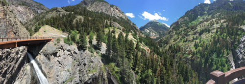
Here a a panoramic view of the modern day bridge over Bear Creek Falls.

DSC_1249

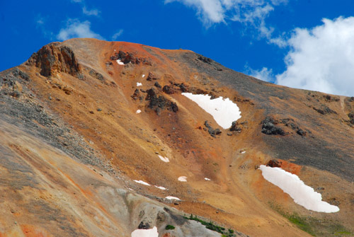
Originally the road connected Ouray with the Red Mountain Mining District to the south.DSC_0239

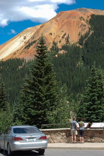
There are signs overlooking the site of the Yankee Girl Mine, one of the richest concentrations of silver ore found in the U.S. It started in 1882 and produced ore valued in today's market at over one hundred million dollars, but lasted only about 16 years.

DSC_1261

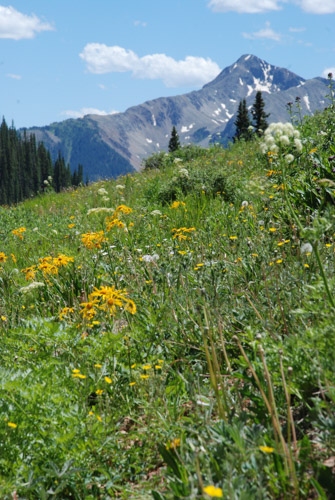
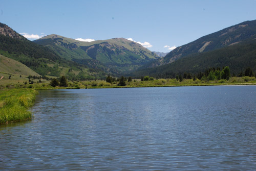
Just more pretty scenery.

IMG_2861

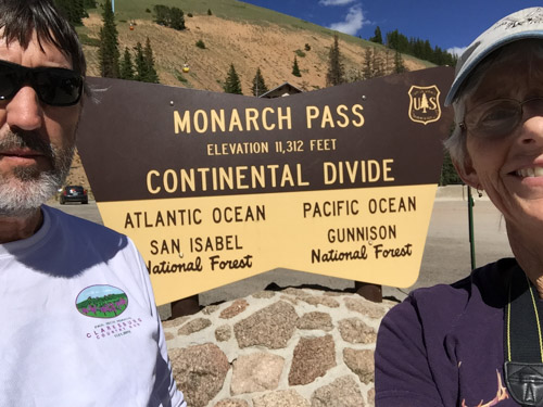
This is taken from Molas Pass (10, 910'), the second of three passes on this highway going towards to Durango.

IMG_2858

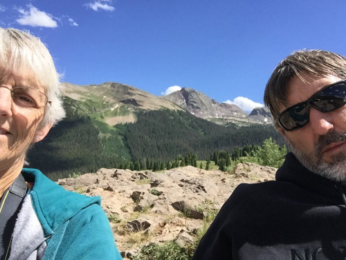
Loving the mountains.

IMG_2857

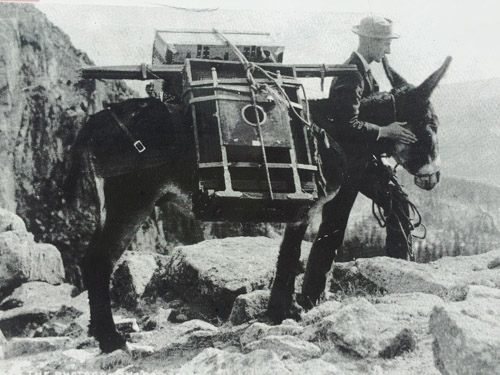
Fortunately I don't have to carry my camera gear the way William Henry Jackson did when he documented the West.

Onward to Mesa Verde where we would spend the night.

Road Trip to CO - Leadville to Gunnison

The main reason that we headed to Colorado on this trip was so that we could be in Leadville when Dan's brother competed in the Silver Rush 50, a 50-mile endurance run. We spent the previous afternoon walking around town and going on a self-guided mine tour. We had a pre-race meal of pizza and salad and went to bed. In the morning we split up. Dan got up early to be at the race start with Rob and Renee and I slept in and met up with Sally and John to explore Turquoise Lake.

DSC_0184

Dan took these photos of the first part of the run. Rob is ready to go.

DSC_0188

This run begins at an elevation 10,200' and goes to over 12,000'. The runners have no difficulty getting their heart rates up right away even if they just walk up the first hill.

DSC_0199

Rob wore neon green (although we discussed repeatedly whether he was wearing green or yellow--it's sure green in the photos) which was helpful when trying to pick him out on a mountain road.

DSC_0198

Personal support is allowed here, unlike in the Ironman last weekend.

IMG_2761

While Rob was running, my sister-in-law, Sally, and I went for a walk at Turquoise Lake, just a few miles from Leadville.

DSC_1026

DSC_0216

Rob was still on the trail...DSC_0213

...and made a shoe change...

DSC_0204

...while the spectators' attention was diverted from the runners by a moose who wanted to cross the road.

IMG_2760

Sally and I finished our walk and headed back to town.

IMG_2765

We walked through a few shops to find some t-shirts and postcards. There was a price tag on this sheep, but even marked down to $2700 it was out of my price range.

IMG_2770

We met up with Rob's support crew at the 25-mile turn around.

IMG_2764

As usual, I entertained myself with my camera while waiting for Rob to run through.

DSC_1034

I don't know what this plant or the bug is.

DSC_1036

You don't see a runner in a kilt everyday.

DSC_1041

We finally saw Rob coming in. Although he has run this event before, this wasn't his day for it. He wasn't feeling well and had been battling injuries. He had events coming up (including last weekend's Ironman) and thought it was prudent to stop at the 25 miles mark (as if running almost a marathon isn't enough for one day). So we ended the day in Leadville early and left town by mid-afternoon, following Rob and Renee to Buena Vista where we would meet for lunch.

DSC_1054

This is Mount Elbert, the highest mountain in Colorado. How do I know that?

DSC_1056

This is why we like these map books. We can follow along and identify points of interest. If we have cell service then I can look up more info, but on this trip cell service definitely wasn't reliable. We enjoyed a meal with Rob and Renee before they had to head home, we stocked up on groceries, and we continued on our trip.

DSC_1073

Smoke from one of the fires burning in Colorado.

IMG_2781

IMG_3402

We had decided to find a place to camp somewhere near Black Canyon of the Gunnison National Park. The park encompasses the narrow band of land (and cliffs) along the river below where it has been dammed (from center to upper left in this photo). It was late in the day when we got to the dam that creates Blue Mesa Reservoir (right in photo) and we had to decide what we had time to do. We decided that we would drive the road on the north side of the canyon along the narrow Morrow Point Reservoir (which is not in the park) and enter the park the next day by driving in at the southwest entrance.

DSC_1085

The Pinnacles on Blue Mesa Reservoir.

DSC_1099

It was a spectacular drive on the road that follows the canyon. There are plenty of places to get out and take a look into the canyon.

DSC_1101

We stood high above buzzards circling on the wind currents. That is three buzzards roosting in the center of the photo. I took lots of photos of the spectacular scenery as the sun was getting lower but this post is already over-full of photos.

DSC_1108

This photo was taken from the last overlook on this drive--or at least the point where we needed to turn around to go back to the campground we had seen. That is the San Juan Mountains in the distance, which we'd be driving through the next day.

IMG_2786

After our shopping trip in Buena Vista we had a hot meal planned, but the camp-stove wouldn't work. Tuna sandwiches for dinner again. Dessert was a deliciously gooey melted giant chocolate kiss.

Road Trip to CO - Moab to Leadville

I'm finally back to my photos of our Road Trip. I left off at the blog post about hiking in Arches National Park on our third day out. After a full day of hiking we headed northwest from Moab on Highway 128 that follows the Colorado River. Just after dark we found the Lower Onion Campsite just above the river. We enjoyed the mosquito-less evening while eating a hasty meal of beans and salad and went to bed planning on an early start the next day. DSC_0967

Here is a view of our camping spot in the morning...DSC_0968

...and the cliffs beyond the river as the sun came up.

DSC_0983

The red rock landscape of Moab changed to more typical desert as we headed north to I-70. We spotted our first prairie dogs along this stretch of road...

DSC_0985

...followed by pronghorn. Not a desolate road at all if you pay attention.

DSC_0996

Our goal was to get to Leadville, CO by noon to meet up with Dan's sister, brother, and their spouses, so we didn't stop much along the way, but I took photos from the truck. I marveled at the engineering of this stretch of highway between Glenwood Springs and Vail.

IMG_2695

The eastbound lanes are just above the Colorado River and the westbound lanes are elevated to fit within the canyon walls, sometimes overlapping the lower eastbound roadway.  There is also a paved bike/running path right at the river's edge. IMG_2696

At this point the highway is at about 8000' elevation. We turned south on Highway 24 that would take us to Leadville at over 10,000'.  As we climbed into the mountains we had to stop at top of one of the switchbacks to take a look.

DSC_1004

Farther up we came to the Camp Hale Memorial. This meadow is the site of a U.S. Army training facility built in the 1942 and decommissioned in 1945. According to Wikipedia "Soldiers were trained in mountain climbing, Alpine and Nordic skiing, cold-weather survival as well as various weapons and ordnance. When it was in full operation, approximately 15,000 soldiers were housed there."

DSC_1001

This is a view from that meadow looking east up the canyon to Sheep Mountain.

DSC_1010

A marmot posed for me while reading the roadside memorial signs...DSC_1013

...and this bee flew into this columbine just as I was taking a photo.

IMG_2723

Entering Leadville.

IMG_2706

We wandered around the downtown for awhile...

IMG_2712

IMG_2704

DSC_1022

...and then met Sally and John for lunch at the Golden Burro Cafe.

IMG_2716

After lunch we took a self-guided tour of the Matchless Mine. "The Mathcless Mine, a historic silver mine purchased in 1879 by H.A.W. Tabor, was estimated to have produced 7.5 million dollars during its peak operating years. Once fabulously wealthy, the silver market crash of 1893 devastated the Matchless Mine and the Tabor Family. Upon Tabor's death his widow, Elizabeth "Baby Doe" Tabor, returned to the Matchless where she remained in isolation for until her death in March of 1935." This is the cabin where "Baby Doe" lived until her death.

IMG_2721

Dan is standing in the phone-booth size structure that would lower miners hundreds of feet below ground. We watched a video that shows a 3-D image all the tunnels and shafts below us. I don't remember the stats but the distances are staggering to think about.

After the mine tour we met up with Rob (Dan's brother) and Renee and we all went to the Leadville Cemetery.

IMG_2739

My father-in-law's grandparents are buried here and following his death just this spring, this was an meaningful stop for the family. We spent some time here before returning to our motel, eating pizza, and making plans for the early morning start of the Leadville 50--an ultra run that Rob was had entered.

DSC_0171

This was our one "civilized night" and I spent a little time trying to catch up with e-mail and thinking that I'd start my blog posts. Nope. We were tired and I wasn't motivated enough to interrupt the vacation!

Road Trip to CO - Arches #2

We had only one day to spend in Arches National Park, but we took advantage of it all, hiking/walking/driving. I posted a lot of photos here, but there are more. DSC_0876

We spent the first half of the day hiking a 7-mile trail. After that we drove to various points of interest or overlooks where there were shorter trails to more arches.

DSC_0879

We ended up hiking about 12 miles that day.DSC_0883

The scenery was all spectacular. DSC_0886

This is looking back at the parking area from the trail to Delicate Arch.

DSC_0888

Much of the trail is walking across the slickrock.

IMG_2668

Then the trail becomes almost a shelf that winds around the side of a cliff.

DSC_0904

When you get the first view around the corner of that cliff you're almost blown away (literally as well as figuratively). What a site! It's absolutely amazing. I mean we saw a lot of arches and cool rocks and cliffs earlier in the day, but there was something about this one that is stunning. Maybe it's because you see it suddenly as you turn the corner. Maybe because it stand alone with no other features near it.DSC_0898

Maybe it's because of it's size. In this photo there are people. Do you see how small they look?

.DSC_0907

In fact, there were a lot of people. It took some patience to get a photo of the arch with no people. That's Dan sitting on the rock while others venture towards the arch. At this location the wind was so strong that it felt as though you could be blown backwards off the cliff.

IMG_2670

Wind effect in my hair. It's not standing up just from the sweat and 2 days of camping!

DSC_0919

As is the case with most hikes, the trip back to the truck took a lot less time. At the bottom there are petroglyphs. These images of a horse and rider, bighorn sheep, and dogs were carved between 1650 to 1850.

DSC_0922

We continued on the road through the park. This is an overlook across the canyon from Delicate Arch. You can see it right there in the center of the photo. The trail we took came from around the rocky cliffs at the left.

DSC_0929

It was getting dusk when we got to the trails to see the last arches. These were relatively close to the parking lot so there were lots of people there. If you look closely you will see people on the rocks under the arches and on the trail. That gives you a sense of scale.

IMG_2674

DSC_0935

IMG_2667

We followed another trail at this location...IMG_2675

...to get a different perspective...IMG_2680

...as the sun was going down.

IMG_2682

Interesting manmade patterns.

IMG_2690

We stopped at the visitor center to clean up and fill water jugs. I got in a bit of sheep showing practice before we left to find our camping spot for the night.

Road Trip to Colorado--Tonopah to Moab

After the tire problem the night before (this blog post) we knew that before we drove farther we needed to buy new tires. Tonpah rest stop

We had driven to a rest stop just west of Tonapah, Nevada, where we spent the first night of this trip.

Tonopah NV

We drove through town looking for a tire store and I remembered this motel from a previous trip through Tonopah when we were looking for a motel late at night. We chose something that did not advertise clowns. Sorry, Clown Motel.

Most of the rest of these photos are DBP (drive-by photography). The goal was to get to Arches National Park or close to it so that we would have all of Friday to spend at the park.

UT-0778 Hwy 50

Dan likes to drive and that's fine with me. I keep myself amused with following along on the map or with the phone (if there is service...which there wasn't for a lot of this trip) and by taking photos.

UT-0780 Hwy 50

UT-0780-cosmic ray

We saw these "things" regularly spaced on both sides of the highway for several miles in Millard County, Utah. All we could make out was what looked like solar panels on a framework and we speculated as to what they were--we decided that they were to monitor or measure something, but what? As we drove into Delta, Utah we just happened to see several of them in what looked like a parking lot beside a building that said Cosmic Ray Center. I googled "cosmic ray delta utah" and found a lot of references to the Telescope Array Project: "The Telescope Array project is a collaboration between universities and institutions in the United States, Japan, Korea, Russia, and Belgium. The experiment is designed to observe air showers induced by cosmic rays with extremely high energy. It does this using a combination of ground array and air-fluorescence techniques. The array of scintillator surface detectors samples the footprint of the air shower when it reaches the Earth's surface..." OK, you lost me. At first I wondered if this was for real (thinking of driving through Roswell, NM last year with it's focus on Aliens) but I guess it is. Who knew what we'd learn on the road?

UT-0782-shoe tree-

I also learned from googling, that "Shoe Trees" are a real thing, although of less lofty impact. There will be more about this in a future blog post.

UT-0785-Delta

Where there is water the desert is held at bay. There were plenty of alfalfa fields throughout this valley in Utah.

UT-0791

Towards the east the patterns and rock formations were impressive...

IMG_2612

IMG_2620

...and we began to see "red rock country".

IMG_2619

This is U.S. 50 in central Utah, which is known as the "Loneliest Road in America". I just looked this up and now I understand why there is a sign in Sacramento for Ocean City, Maryland (see my first blog post for this trip). U.S. 50 is also one of the longest highways in America, going between Sacramento and Ocean City. I always thought that it was just because someone in the Sacramento Highway Department has a sense of humor.

We drove U.S. 50 to Highway 191 where we turned south to Moab. Arches National Park is just east of the highway and north of Moab and seeing the spectaular scenery whetted our appetites for the next day's adventures.

It was late though and we needed to stay somewhere. Arches N.P. has very few campsites, but there are several in the Moab area. We found a BLM campsite on the Colorado River right outside of Moab.

DSC_0792

The sun was going down, giving intensity to the red rock cliffs.IMG_2621

The campsite was right next to the river. River + Dusk = Mosquitoes. They were relentless. IMG_2623

We quickly set up our tent and retreated until after dark when we ventured outside to heat up a couple of cans of chili.


Road Trip to Colorado-Bodie & Beyond

The first post about our trip is here. One the first day we made it to Bodie State Historic Park near the California/Nevada border with about an hour and a half before the park closed. DSC_0715

W.S. Bodey discovered gold here in 1859 but he died in a blizzard several months later, never seeing the town that was named for him (although spelled differently). A mine collapse in 1875 revealed a rich body of gold and the boom time of the town was during 1877-1881 when there were 30 mines, 9 stamp mills, and 60 saloons. As the boom years ended population declined quickly into the 1900's. Mining continued until 1942 and the family of the last major landowner continued to protect the town from vandals. In 1962 the CA State Parks purchased the town to protect it. It remains in a "state of arrested decay" without the intent to reconstruct it.  The  non-profit organization, The Bodie Foundation was created with the goal to raise funds to assist with stabilization of structures as well as education.

DSC_0730

View of what is left of the town from above. At it's height there were probably 8000 people living here. There is an interesting mix of eras remaining--houses built in the 1870's, gas pumps from the 1920's, and a school that was used until 1942. DSC_0725

DSC_0737


DSC_0721

DSC_0717

The walls and roofs of many of the buildings are covered with flattened tin cans.DSC_0726

DSC_0736DSC_0157

Dan took this photo because he liked all the different roof lines.DSC_0734

I like the design of the tin here, but I was really trying to take a photo of one of the violet green swallows that were zooming around. I got this one just as it flew into the corner of the roof.

DSC_0734-2

Do you see the wing tips under the roof line?

IMG_2581

IMG_2580

The brick vault is all that is left of the Bodie Bank after a fire in 1932.

IMG_2579

This is the safe inside the vault.

IMG_2577

Due to safety concerns the Standard Consolidated Mining Company's Stamp Mill and other buildings are not open to the public except by guided tour. It is on the hill above the town and was only one of thirty mining companies in the district.

After our visit to Bodie it was time to get on the road and drive until we found somewhere we wanted to stay for the night.

IMG_2596

Coming down the mountain towards Mono Lake the truck rattled and shook every time Dan used the brakes. Then we heard a thwump, thwump. One of the front tires was beginning to shred, but fortunately still held air. Dan changed the tire and we knew that we needed new tires. It was too late to find anything near Mono Lake so we decided to continue on. We turned east and spent the night at a rest stop outside Tonopah, NV.

IMG_3063

The lower pink line is the first day of this trip.

Next up: on the road to Arches National Monument.


Road Trip to Colorado-Day 1

VACAVILLE TO BODIE We just completed our annual Road Trip. Last year it was to see my daughter and her family in Texas, exploring Arizona and New Mexico on the way. If you're interested the blog posts about that trip start with this one. This year the goal was  to meet up with my husband's brother and sister in Leadville, Colorado on July 9 and do some site-seeing and camping along the way.

IMG_2563

I do use my iPhone for maps and interesting info along the way, but it doesn't do you much good when the phone says "no service", which it did a lot on this trip. Besides we like to follow along with the detail in these map books as we're driving. They are also invaluable at finding places to camp along the way.

DSC_0686

We started east on Hwy. 50. I always get a kick out of this sign when entering Sacramento.

IMG_2565

I'm glad that Dan likes to do most of the driving because it leaves me free to watch scenery and take photos from the truck. This was another journey for the old green truck.

DSC_0693

This is some of the evidence of last year's fires in the Sierra Nevada Mountains.

East side of Sierras

We joined up with 395 on the east side of the Sierras. Beautiful. Most of the country on the east side is considered the high desert, but the West Walker River is at the base of the mountains and other creeks flow out of the mountains that are east of the highway. The valley is lush and this is cattle country.

DSC_0696

Our plan was to first visit Bodie, and old mining town in Mono County, California. Bodie had been a favorite haunt of Dan's dad and he wanted to check it out.

Disclaimer: Let me say here that a lot of my travel photos are DBP (Drive-By-Photography). Some are from the open (or maybe not) side window and some are through the bug-splattered windshield.  I'd rather read (and write) blog posts that are more photos than text, so I'm using what I have. Even my good photos will never be National Geographic quality, but these posts are about the story. So here we go.

DSC_0706

We turned off of 395 onto Bodie Road (270). The country is mostly desert, but again, where there is water the desert is kept away. I was excited to see sheep on the way to Bodie. This was not a fiber trip, but sheep are always a good sign. I tried counting these from a photo and I think there are about 600 sheep with 4 guardian dogs and a herder. They were moving up this valley when we drove to Bodie. (The next post will  be about that.)

DSC_0745

When we left Bodie two hours later the sheep were back in the middle of the valley and had been going to water in an irrigation ditch at the right of the photo. They were moving away from the ditch and back into the valley. We stopped and watched awhile.

DSC_0750

When I enlarged the photos I could see about 17 black-faced rams in with the ewes.

DSC_0759

The band started moving up the valley on it's own but that was obviously not the plan the herder had. He and his Border Collie walked out to the road and up in front to cut them off. The Border Collie turned them while the guardian dog in the center of the photo went to get a stray.

Near Bodie

But back to Bodie. Here is the landscape without water.

DSC_0715

Stay tuned for the next post.