
Hiking Again
/Normally we would choose to visit Stebbins Canyon in the spring when the temperature is mild, the hills are green, and there are wildlfowers everywhere. But as many of you know we had complications this year. So this is my first hike since last summer (and thinking back that one would have been in September in Colorado.

We usually take the Blue Ridge Trail which is about 5 miles. When you look closely at this map you see that most of it is considered “moderate to difficult” or “difficult to hazardous”. We took our regular route which was to start with the southern part and walk up the trail above the creek which is dry this time of year.
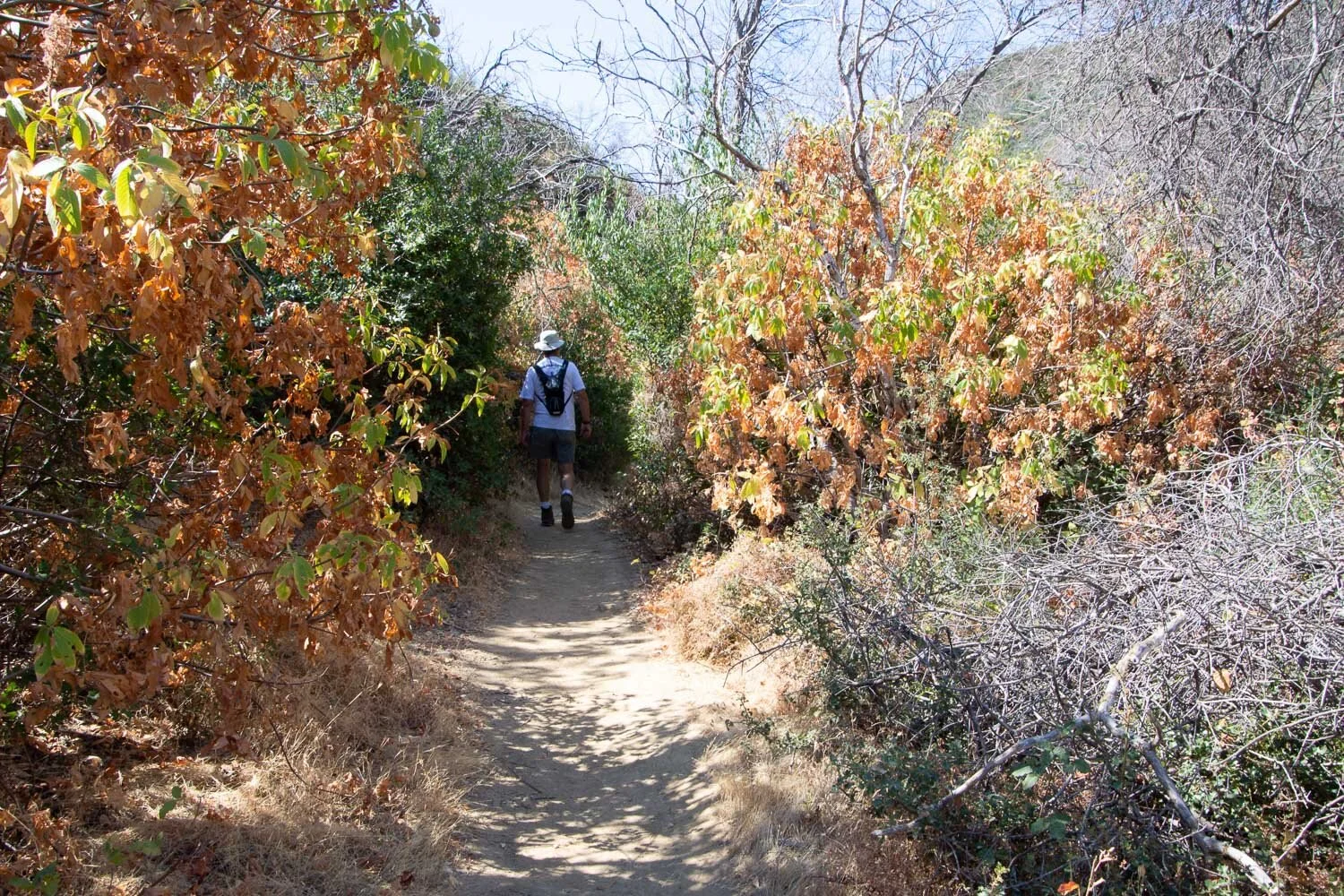
That is the easy part.

Everything is very dry right now but that doesn’t mean that its not interesting.

Pipestem Clematis gone to seed.

What an amazing plant!

The part that is described as “moderate to difficult” is mostly UP. There has been a lot of tail maintenance since I was there last. There was a very destructive fire a few years ago so some of the maintenance has been to replace the steps that were destroyed. There is also a lot of new signage which is appreciated.

Some includes plant ID like this.

There is also plenty of this plant…poison oak.

Speaking of hazards and signs, do you see all the potential hazards in this area? We didn’t see very many people on the trail but I got thinking that right now people (who may carry Covid-19) may be more feared than mountain lions or bears.

After you finish the “moderate to difficult” part of the trail you get up to the ridge and the “difficult to hazardous” part. From this point we still had to get to the top of the part to the left in this photo and the trail continues on to that point in the center of the photo—you can barely see the trail going up the ridge. That is not yet the end of the UP part and there is another smaller rise right after that. Then you descend on the trail that zig zags down the slope just to the right of that point in the photo. The first part of the trail is mostly shaded but there is no shade on this part of the trail along the ridge and then back down.

When you’re on the ridge you can see Lake Berryessa to the north.

This is a better view of the trail that continues up the ridge before you get to the downhill. It doesn’t look particularly hazardous here, but a lot of the trail prior to this involves climbing over rocks and not falling down.
Dan said that if I was getting a grade for my first hike this year he’d give me an A for perseverance and effort and maybe a B for agility and stabliity. We’re going to do it again next week so I can try for straight A’s.
