Road Trip to Washington - Day 5
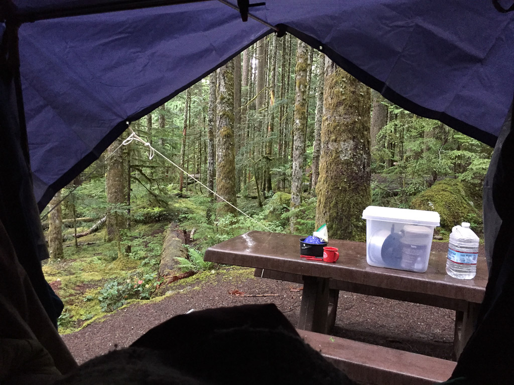
/I left off in the last post going to sleep in the mostly dry truck listening to the rain.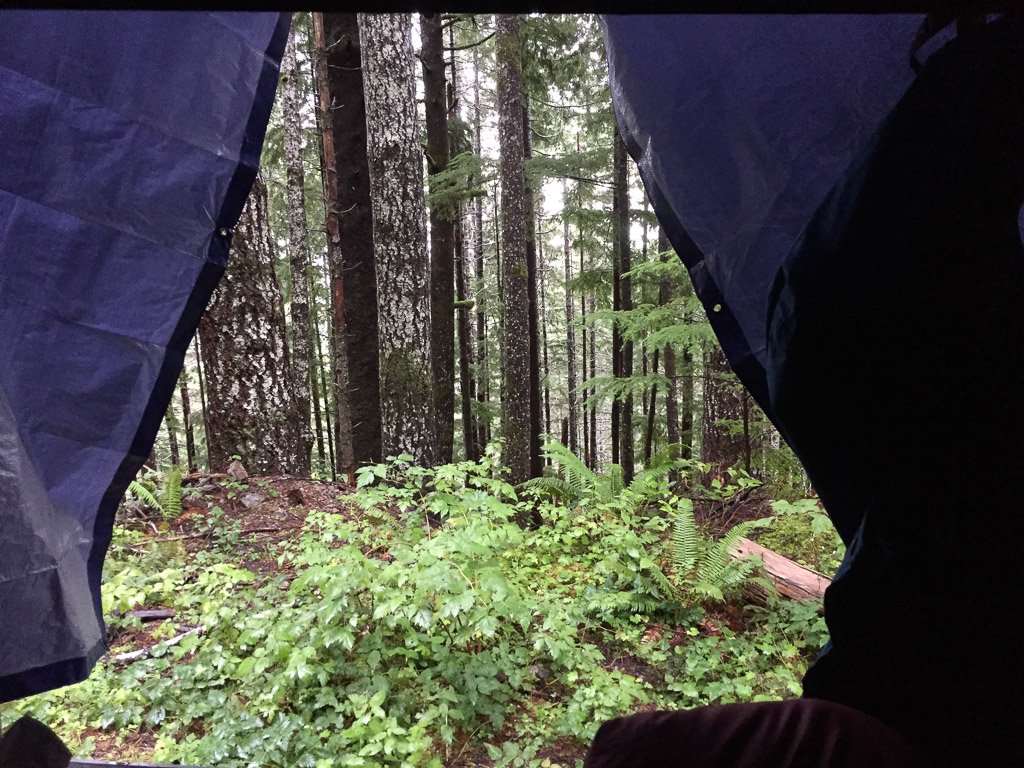 View from the sleeping bag.
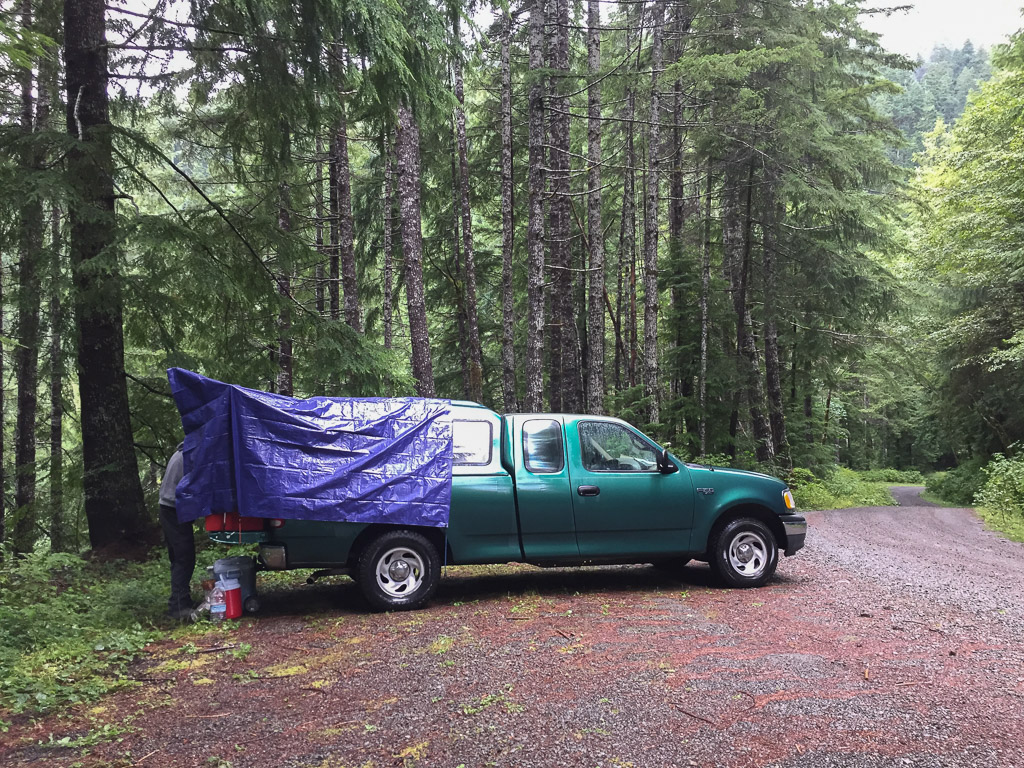 This is where we stayed. We didn't have a good look at it the night before when it was raining and dark.
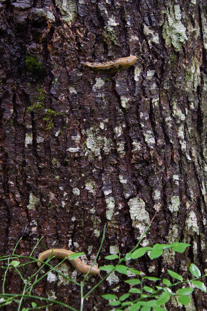 More of my slow-moving wildlife subjects.
We had spent the previous day on the east and north sides of Olympic National Park. We wanted to see the rainforest areas which are on the west side. The place we camped was near Lake Quinault and there are several access points to the Park along the road that follows the Quinault River.
More of my slow-moving wildlife subjects.
We had spent the previous day on the east and north sides of Olympic National Park. We wanted to see the rainforest areas which are on the west side. The place we camped was near Lake Quinault and there are several access points to the Park along the road that follows the Quinault River.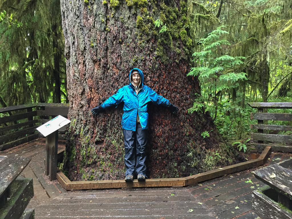 We started with the Rain Forest Nature Trail that leads to Willaby Creek Falls, one of the points on the Waterfall Trail we were following.
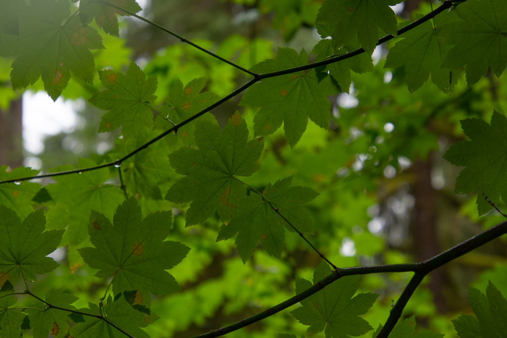
 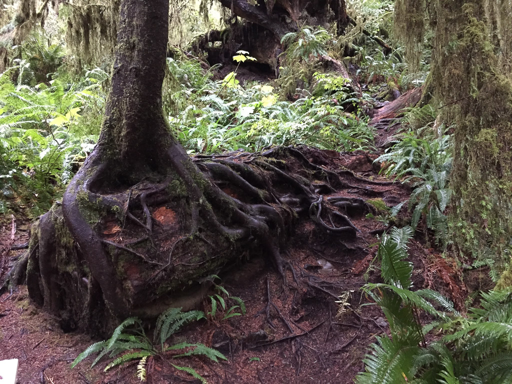 Everywhere you look there are trees rooted over fallen trees. Every surface seems covered with something growing.
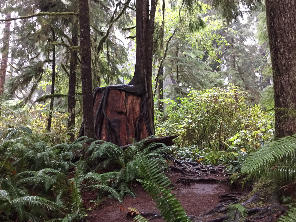 The park protects the largest old-growth forest in the Pacific Northwest. Rainfall varies from 12 feet (!) in the temperate rain forests on the west side to 40" on the east side.
 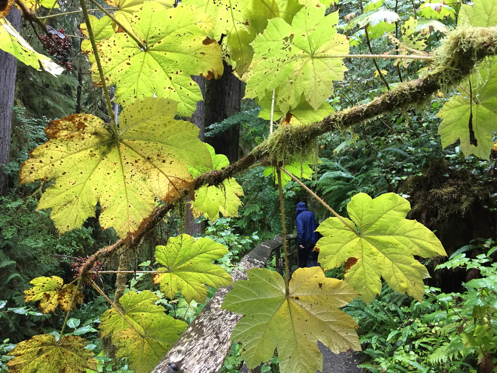 More of the Devils Club with a good view of he spines on the leaves.
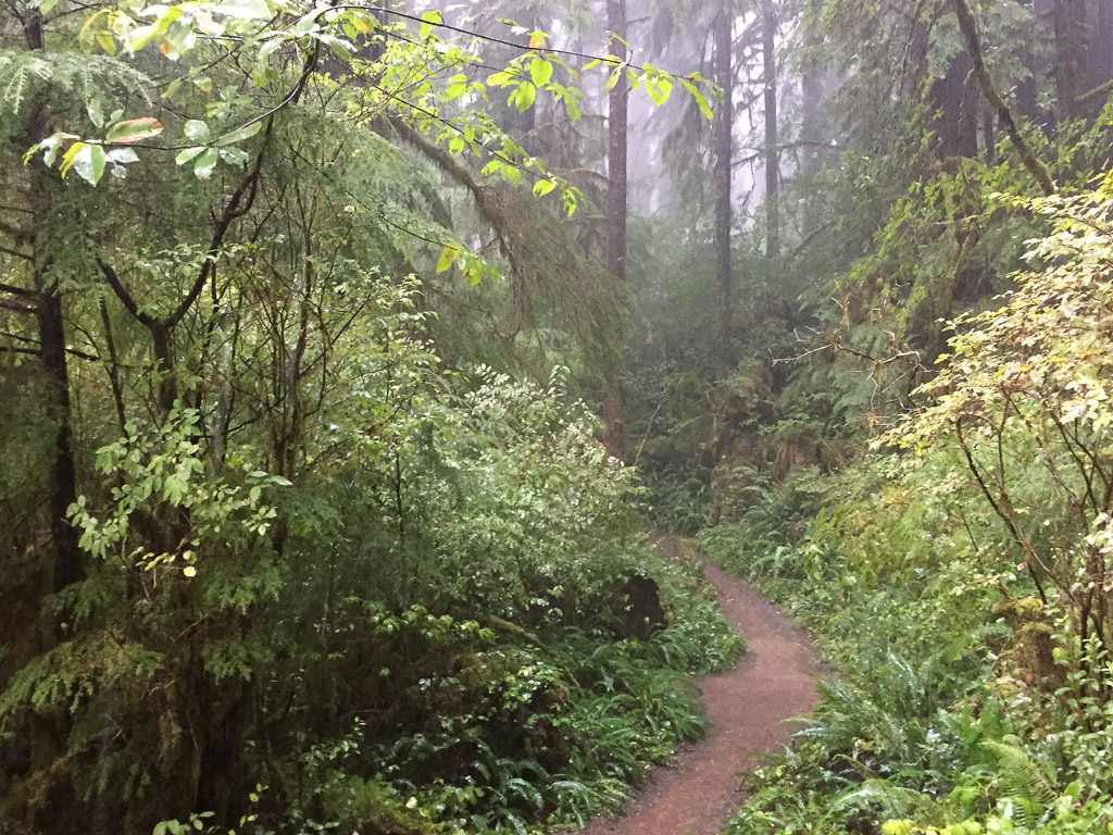 Did I mention that this was a walk through the rain forest? And rain it did. We stood for awhile under the umbrella because is was raining so hard. On our way back this path was filled with water.
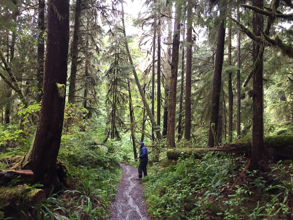 The forest was just beautiful.
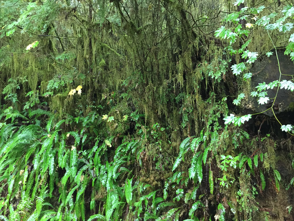
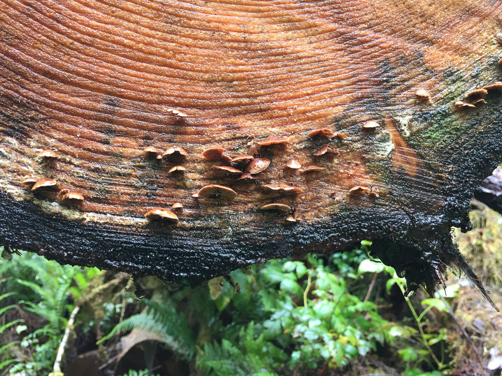
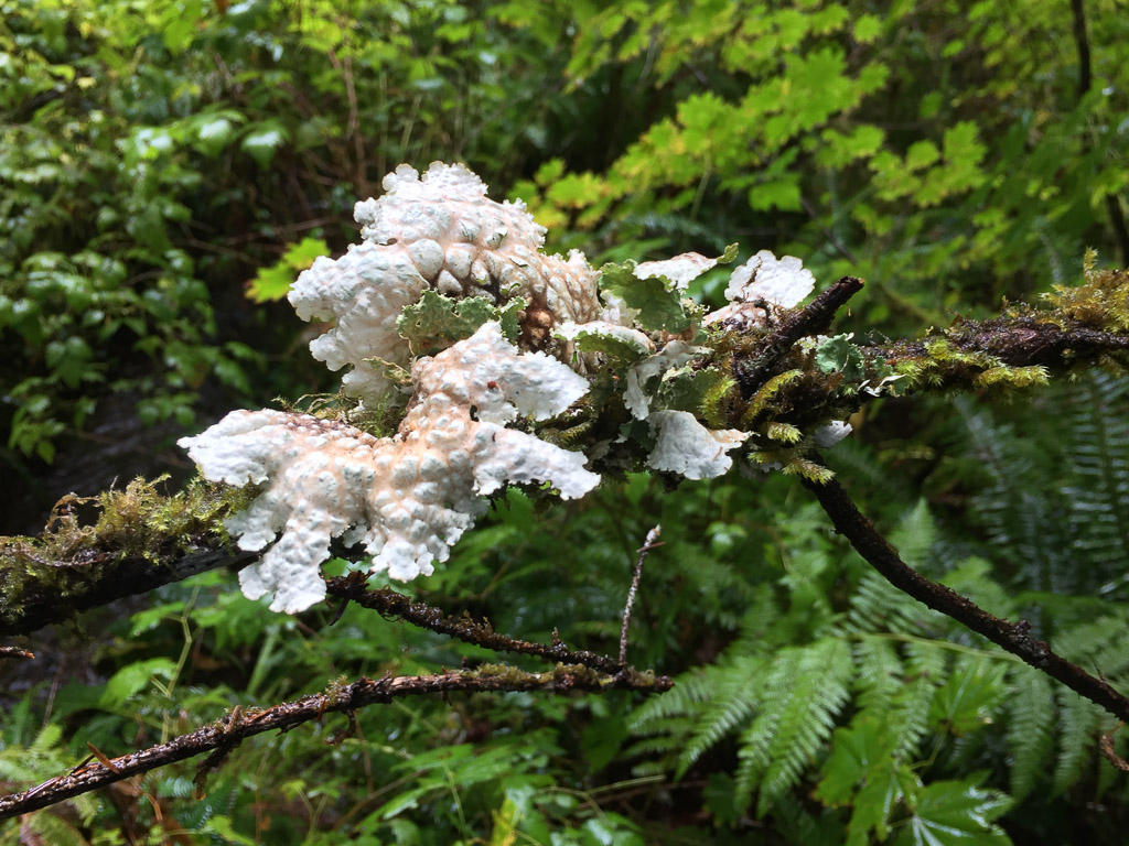
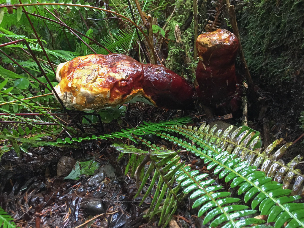
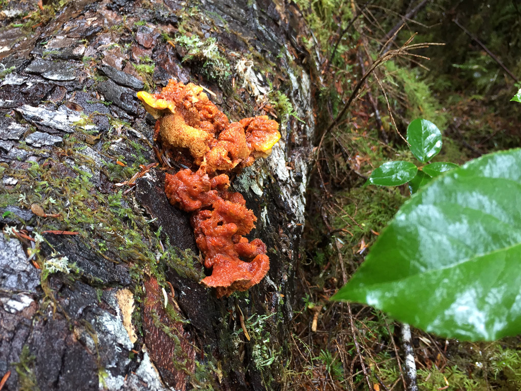
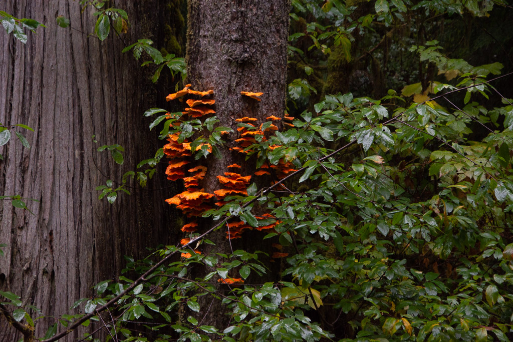 Lots of fungus in addition to the ferns, shrubs, and trees.
 Some of these photos were taken on the trails to Falls Creek and Gatton Creek waterfalls on creeks that flow into the lake. The next stop was at the World's Largest Spruce Tree.
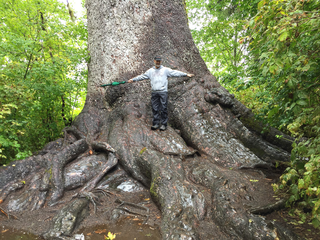 This Stika spruce is 58', 11" in circumference and 1000 years old.
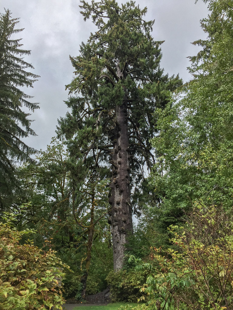 It is 191' tall and is one of six record breaking trees in the Park.
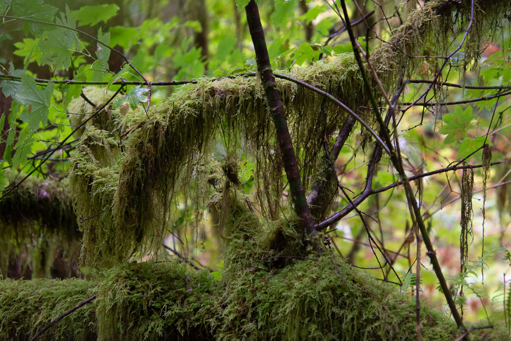
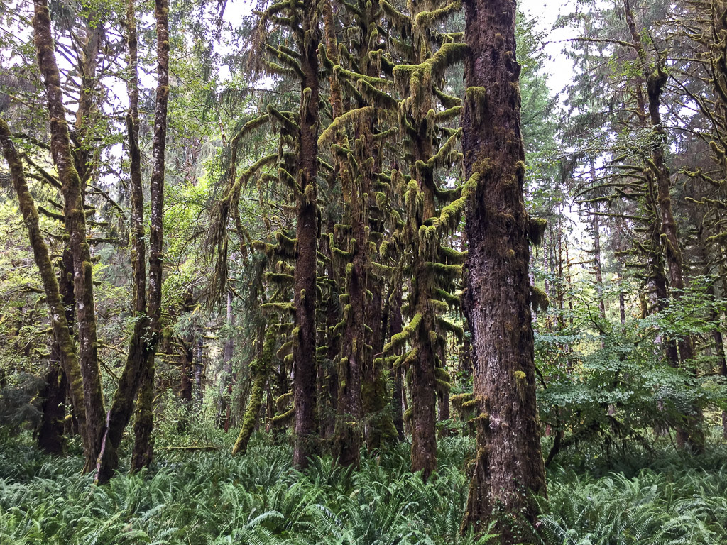 Sulightn was coming through the clouds as we drove down the road on the north side of the Quinault River.
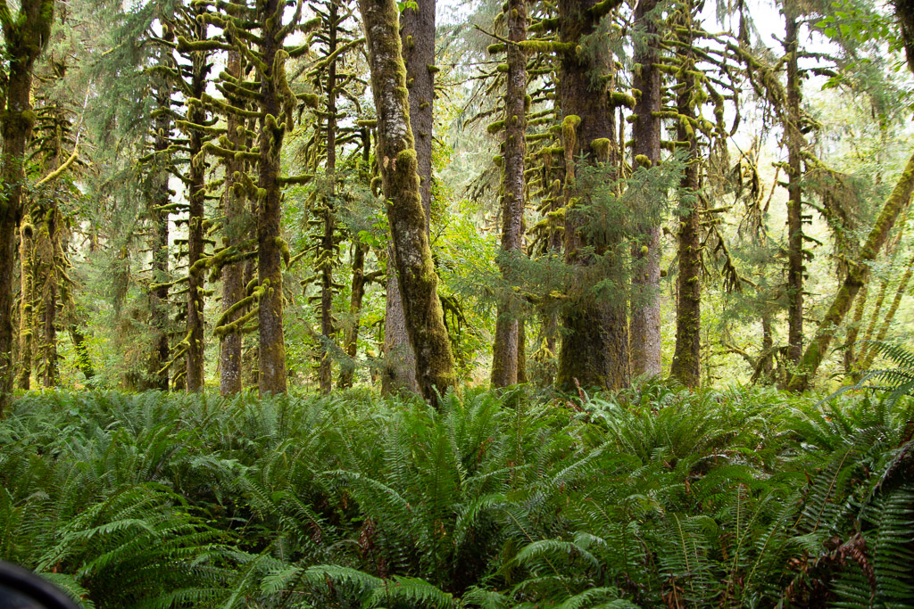 It gave a special glow to the moss covered trees in the flatland along the river.
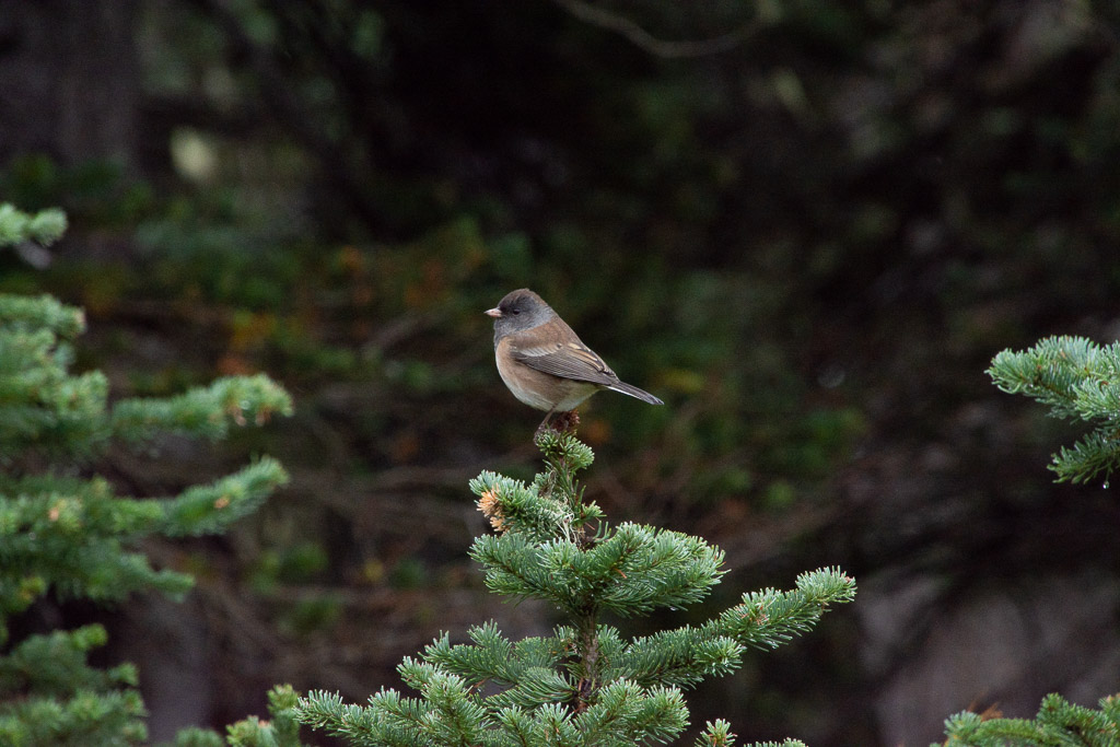
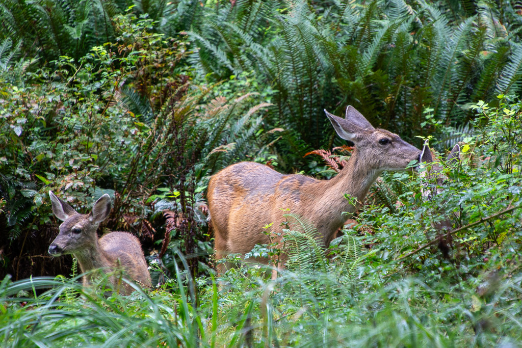 A wildlife shot of something other than a banana slug! Can you see the second fawn? I didn't even see it until I was looking through my photos.
 We left the rain forest and the Park and headed for the southwest corner of Washington and Cape Disappointment State Park where we hoped to spend the night.
 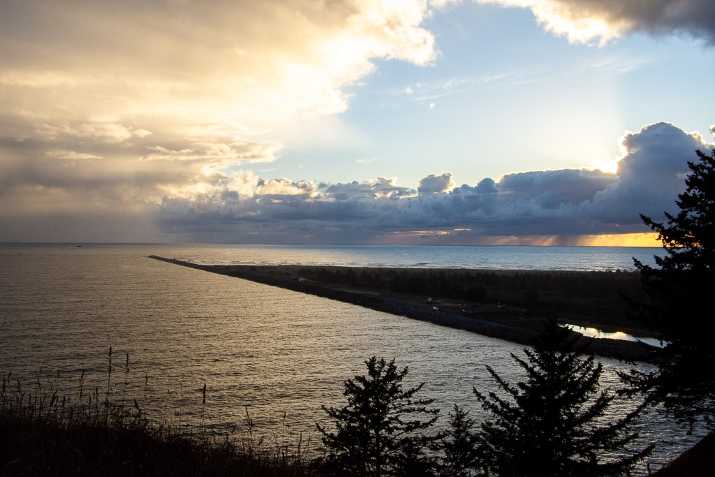 There were campsites available so we reserved one and then walked took one of the Park trails that follows the coastline to one of two lighthouses in the Park. This is the breakwater constructed on the north of where the Columbia River flows into the Pacific.
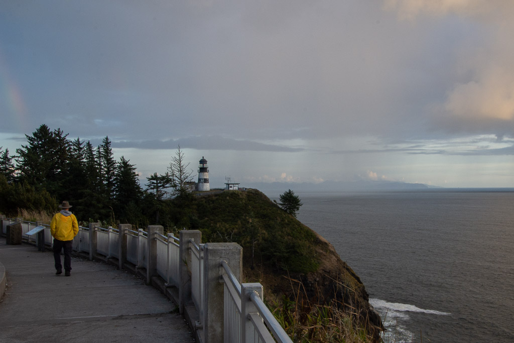 Looking south from the Lewis & Clark Interpretive Center you can see the Cape Disappointment Lighthouse and the Oregon coast in the distance, across the mouth of the Columbia River.
 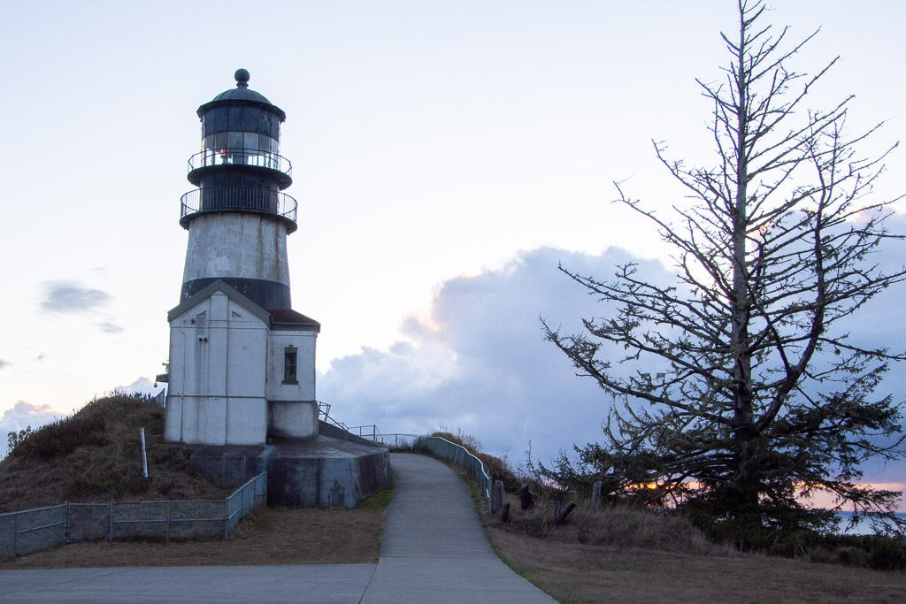 The Cape Disappointment Lighthouse was built in the 1850's. There is a Coast Guard Station nearby. According to Wikipedia: "The lighthouse had several shortcomings. The fog bell was sometimes inaudible due to the roar of ocean waves. It was discontinued in 1881 and moved ... Also, the light was not visible to ships approaching from the north. This problem was corrected by building a lighthouse at North Head, two miles from Cape Disappointment. The first-order lens was moved to North Head ... The lighthouse was electrified in 1937. In 1956, the Coast Guard intended to close the station, but retained the light when the Columbia River bar pilots protested. The light was automated in 1973. An observation deck has been built for the Coast Guard to monitor traffic and bar conditions."
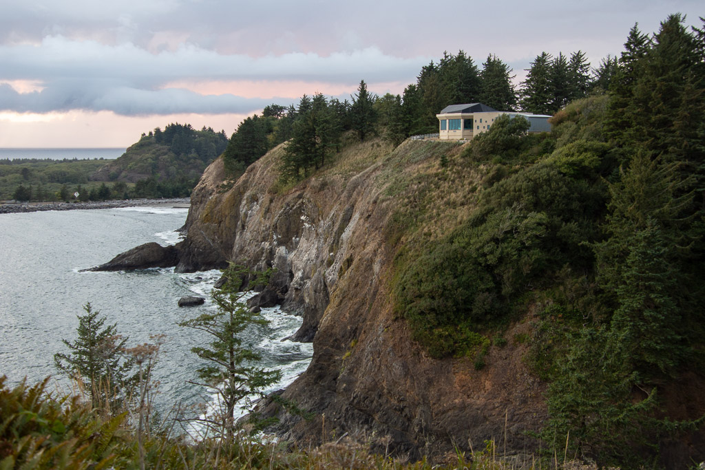 This is the view looking back north to the Interpretive Center (which we visited the next day). Also visible is the small cove called Waikiki Beach. The campsites were beyond that. We got back to camp about dark, our usual M.O., and ate an unexciting dinner, and went to bed.
 Here is the view from my sleeping bag the next morning.
 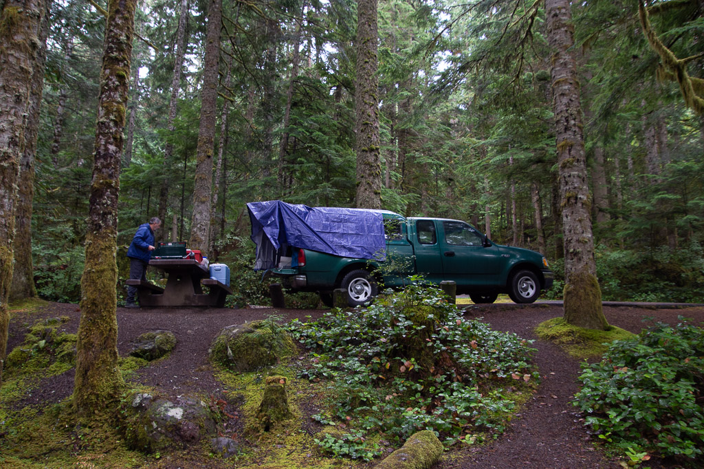 Later we wondered why we didn't buy a bigger tarp since then we could have covered the whole camper, although I wouldn't have liked not seeing out the side window. As it is there is some leakage around where the camper joins the truck bed and we had to make sure that our sleeping bags, clothes, etc didn't touch the edges or they'd soak up water.
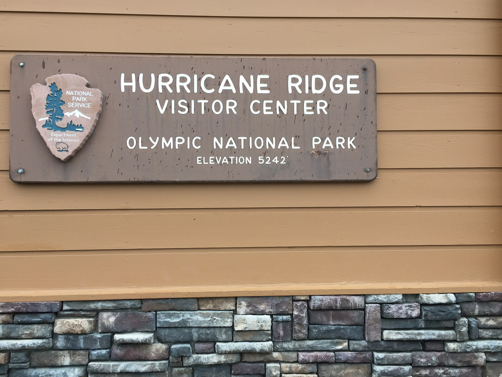 The name was a clue to the weather on the ridge.
 It was a wee bit
 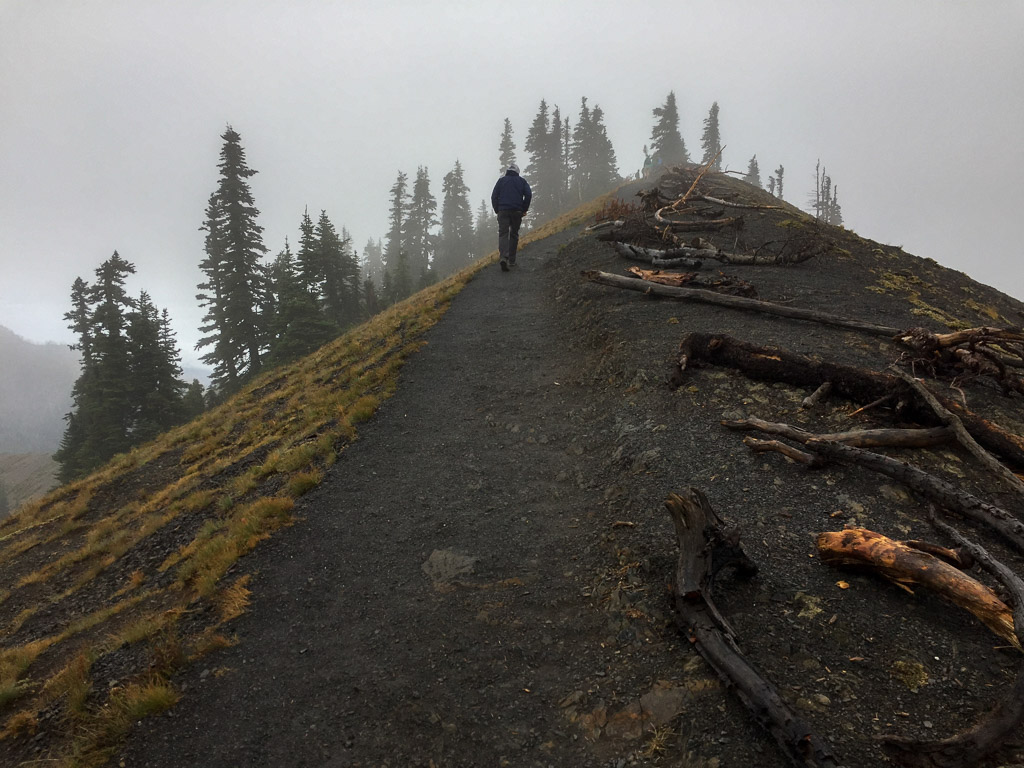 There is a trail from the Visitor Center to the top of the nearby ridge.
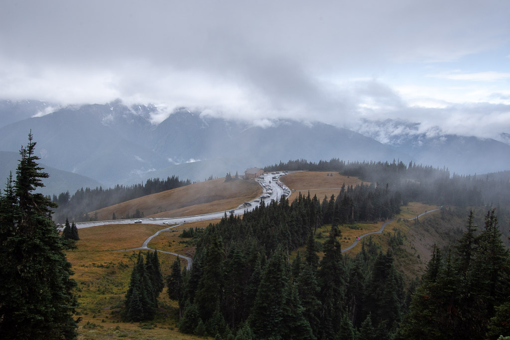 View looking down on the Visitor Center and Mt. Olympus in the clouds.
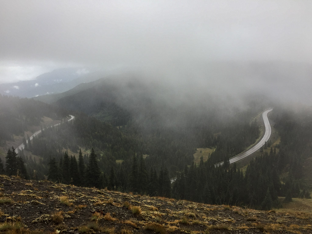 View to the other direction and the road to the Visitor Center.
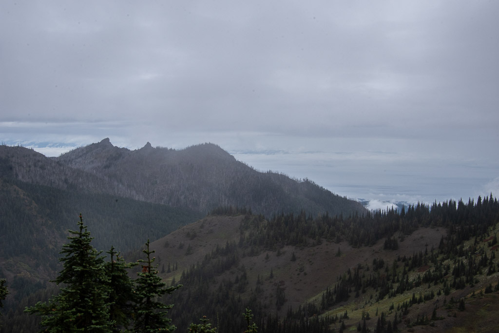 Walking along the ridge we tried to get a view of Canada. It's out there across the Strait of Juan de Fuca, but mostly in the clouds.
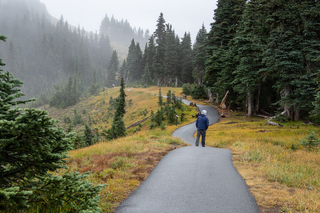 More views along the trail.
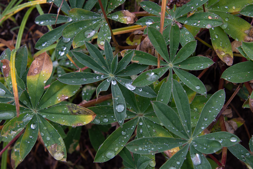
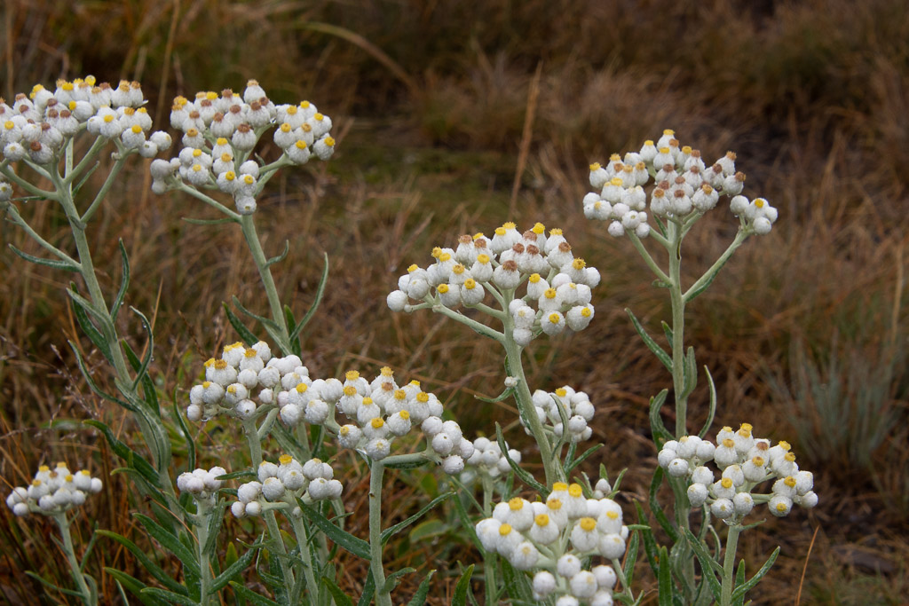 I admired these flowers blooming so late in the season. They are in the sunflower family: Pearly Everlasting.
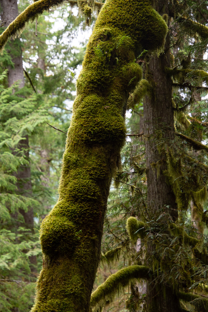
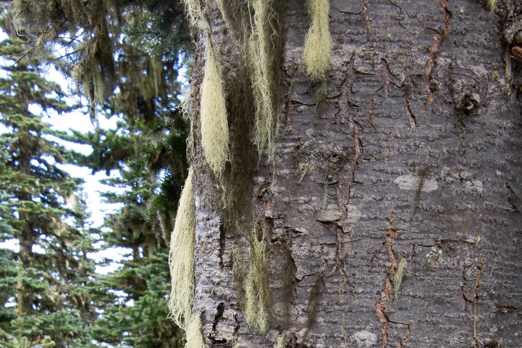 Goat's Beard lichen.
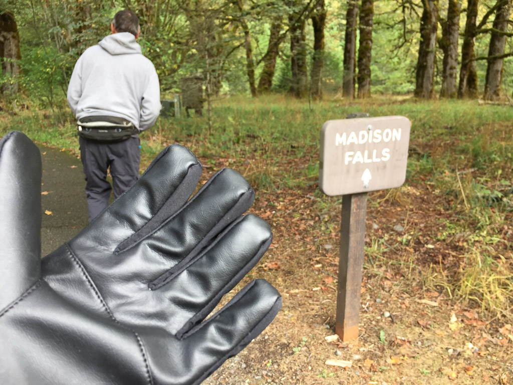 We both bought gloves. Next stop was Madison Falls at the edge of the Park near another road that follows the Elwha River.
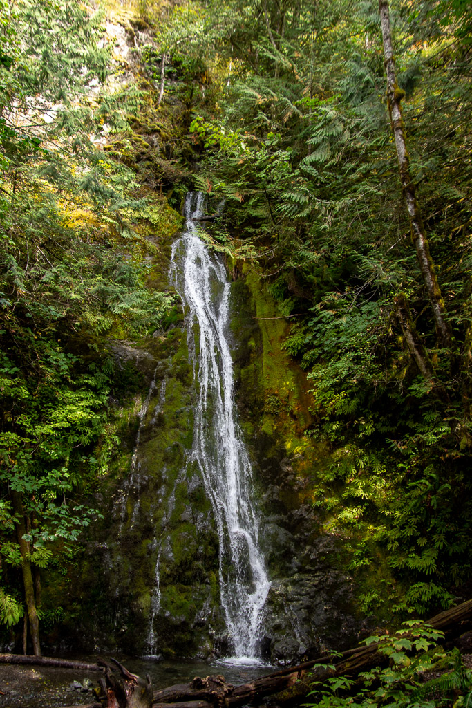 It is a short walk on a paved trail to see the falls.
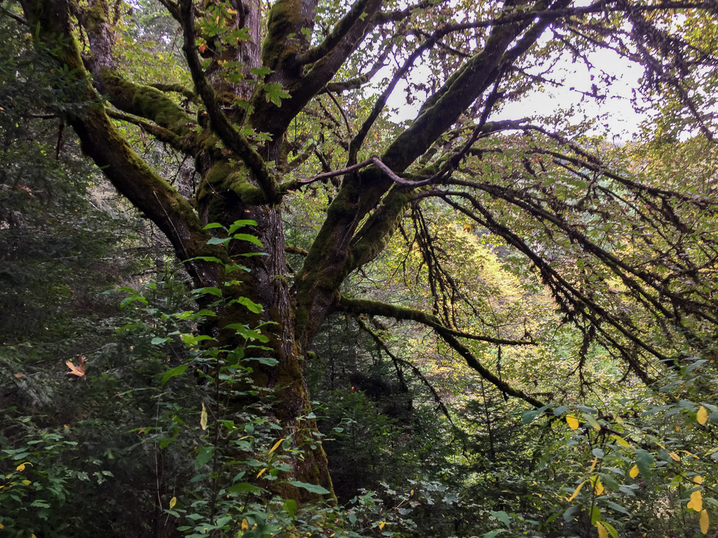
 At this point we were thinking about where we would stay that night. As on all of our trips there is always more to see than we have time for. This was Saturday and we needed to get home on Tuesday. That left Sunday and Monday for more time in the park with a long drive on Tuesday. The bulk of the Park takes up the northern part of the Olympic Peninsula but there is also private and tribal land along the northern coast, the far northwest corner of the state, and the western portion. I wanted to go to that farthest most point of the continental U.S. but we were going to run out of time to do that and spend time in the rainforest. There is a narrow sliver of land all along the Pacific coastline that is also part of the Olympic NP so we decided that we would camp there for the night. That decided, we stopped at the next waterfall on our Waterfall Map.
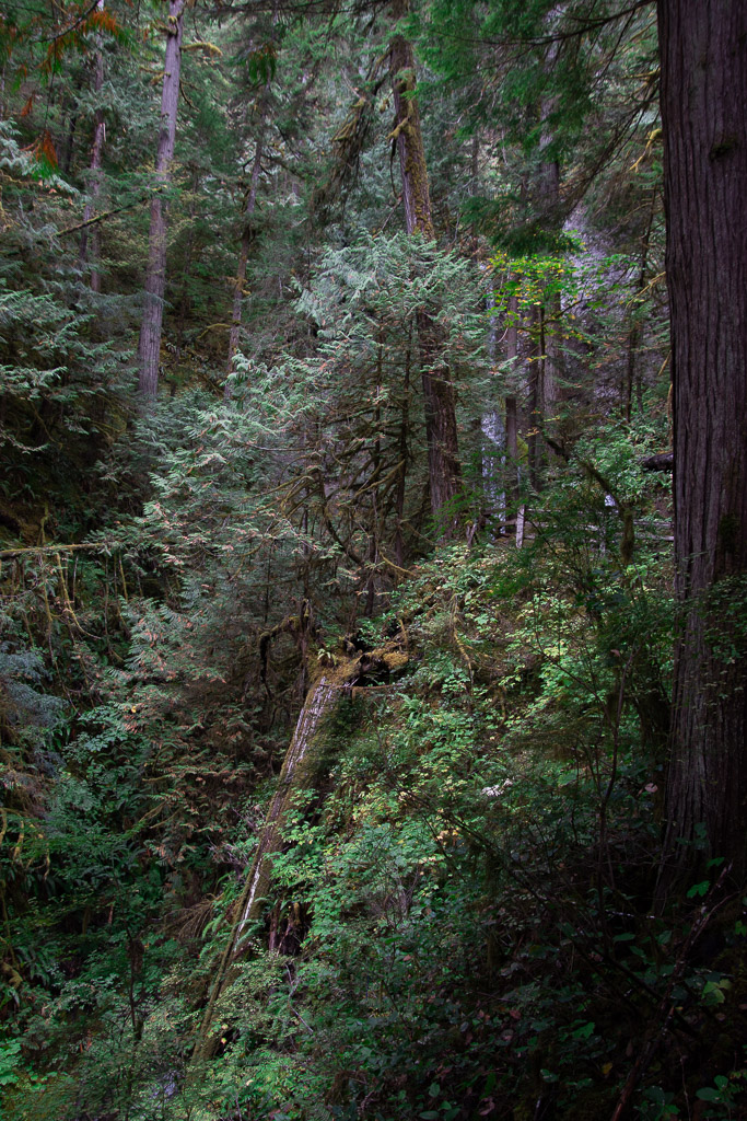 The trail to Marymere Falls was also within the Park.
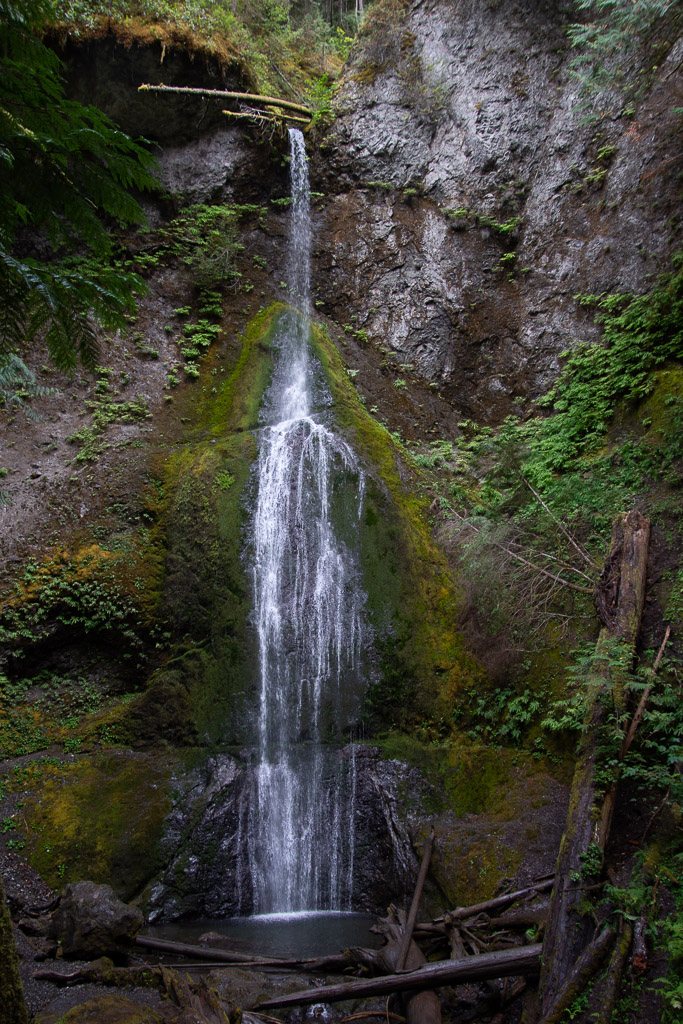 This waterfall is on Falls Creek and drops 90 feet. Take a look at the log at the top of the falls.
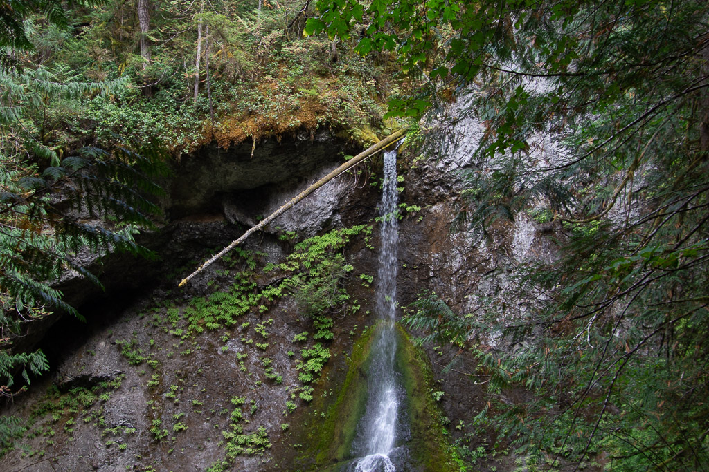 It made me think about the amount of water that must flow in this creek at times. That is a whole tree that is stuck at the top.
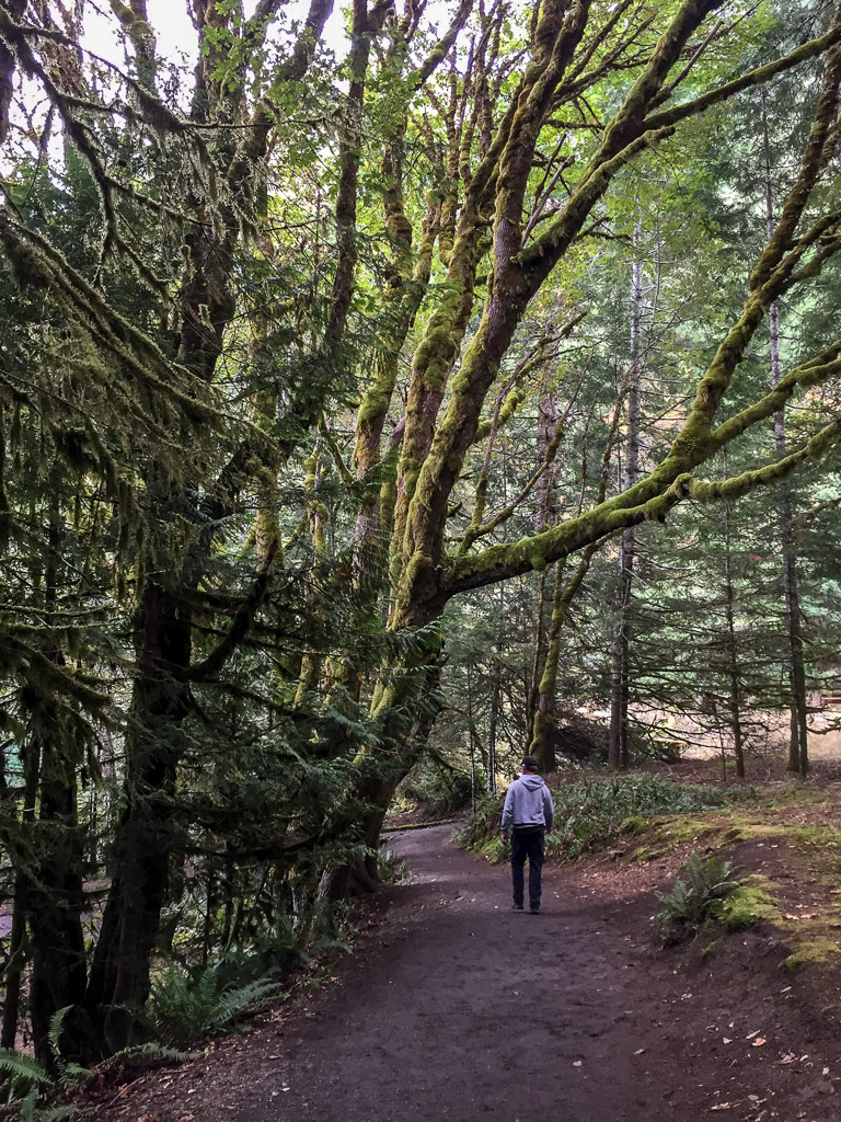 Magnificent trees.
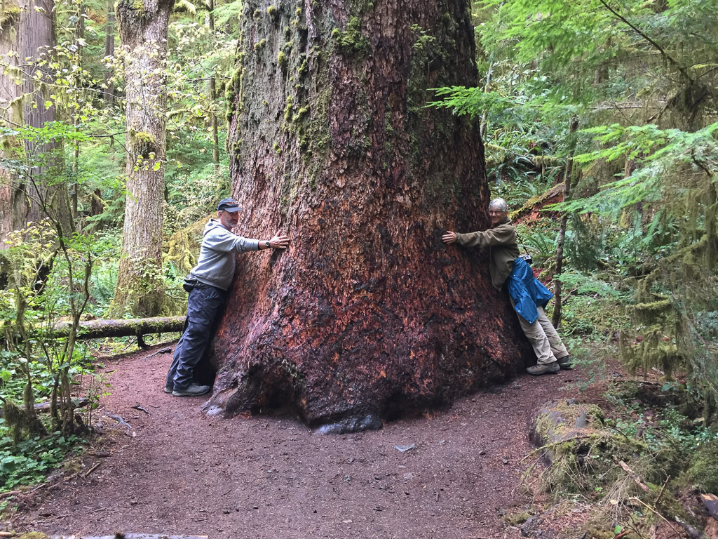 We were walking by this tree and I saw a young woman trying to prop her phone on the ground so that she and her friend could both be in a photo of this huge tree. I offered to take the photo and then she reciprocated.
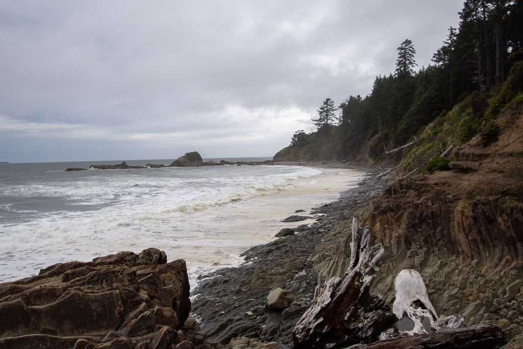 This was the first beach where we stopped. We drove south to find that the first campground was full. There was plenty of space in the other campgrounds where we stayed so we hadn't anticipated this. The beach. RV camping. Saturday night. None of the four beach campgrounds had campsites left.
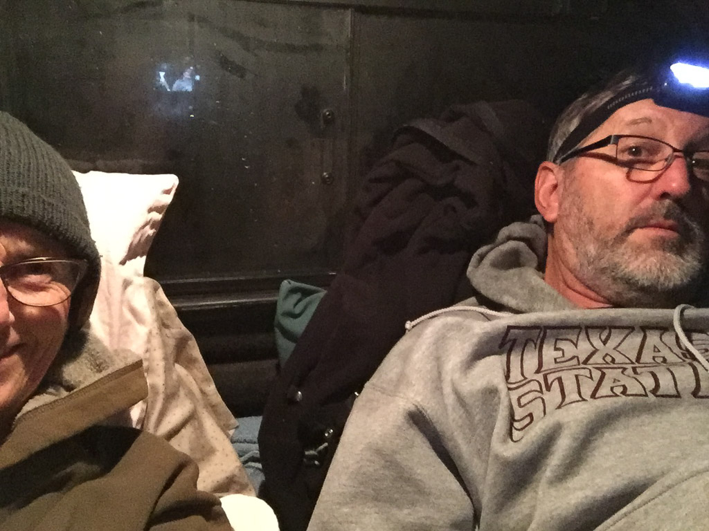 Saturday night lodging.
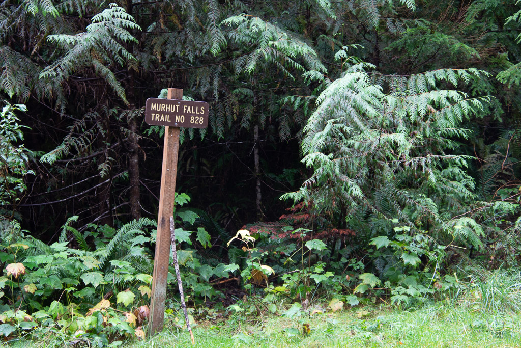 Our first waterfall on the trail, and before getting to the park, was Murhut Falls on the Duckabush River.
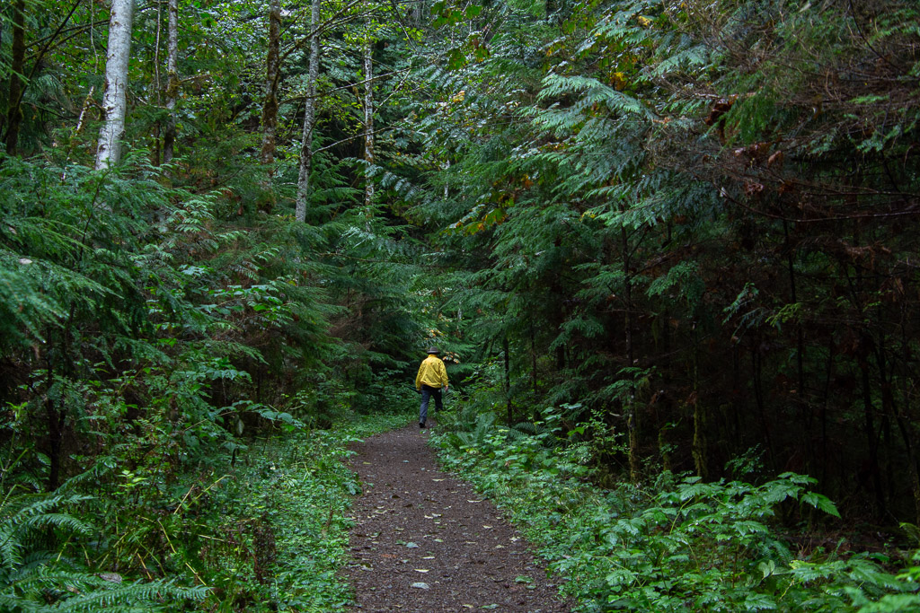 I first wondered about the name of the river. You have to duck under bushes if you don't have a ready made trail? No, in a side trip to Google I found that it is an Indian word meaning red face, referring to reddish bluffs in the area.
 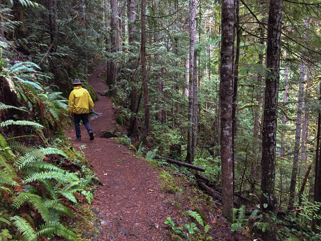 As we found in all our wanderings in this area, the forest is dense, damp, and spectacular.
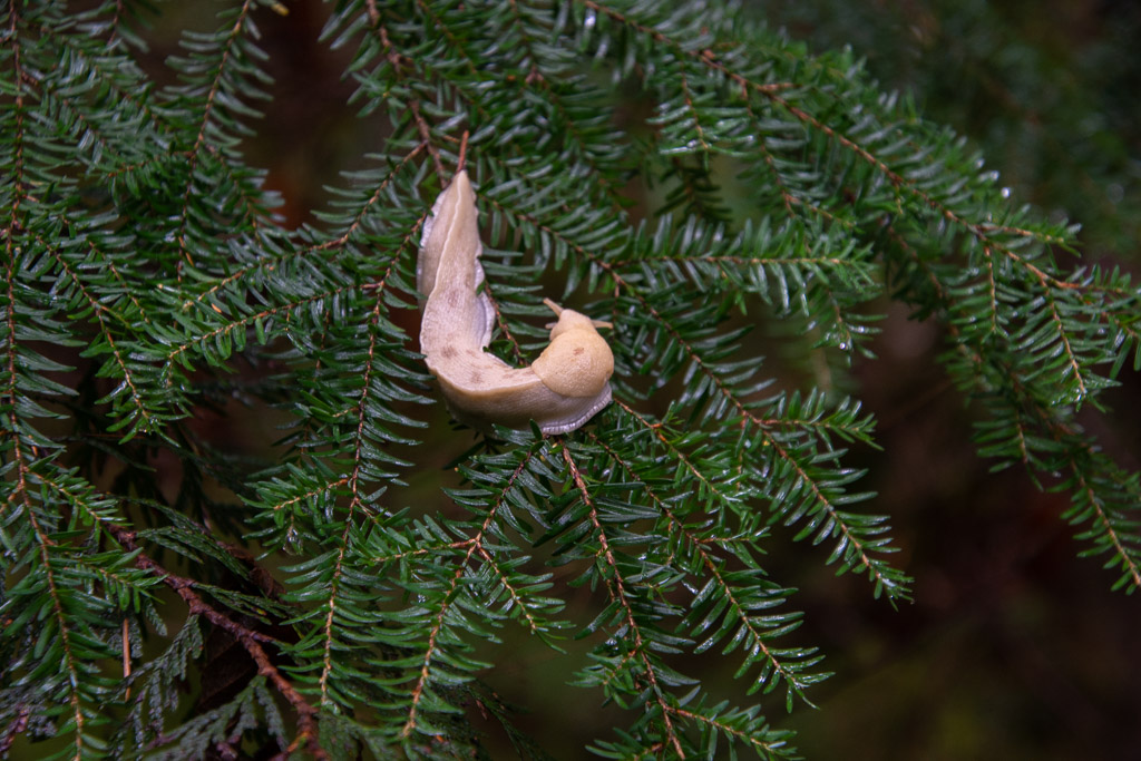 A wildlife shot along the way. So far the only wildlife I was photographing was slow moving.
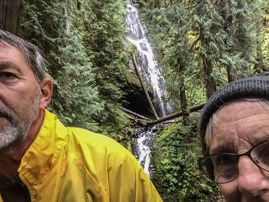 About 3/4 mile up the trail we found the falls.
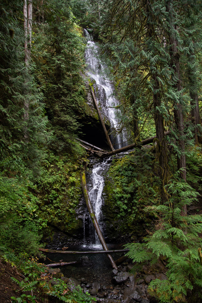 The waterfall trail guide says that this one is 120 feet with another 35 feet below this point. Photos don't do any of the forest scenery justice.
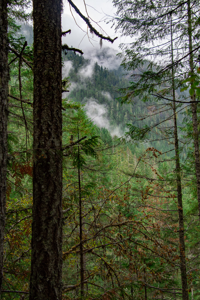 Weather continued to be damp and misty but not much real rain.
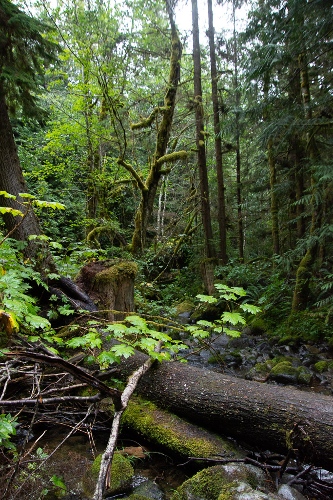
 You can certainly tell that this is a wet climate as opposed to most of the places we find ourselves hiking and camping.
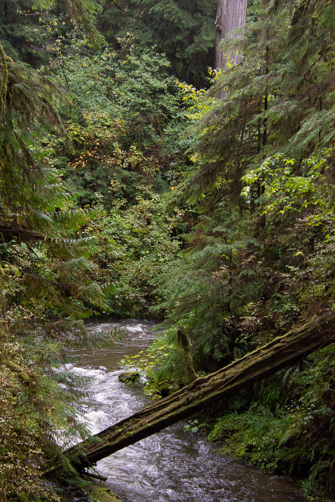
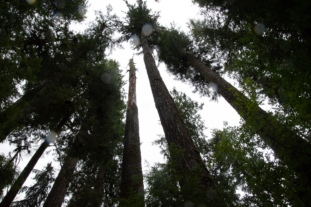
 The forest was stunning. The trees were massive.
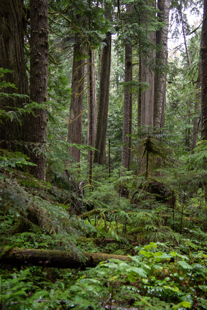 Vegetation is dense.
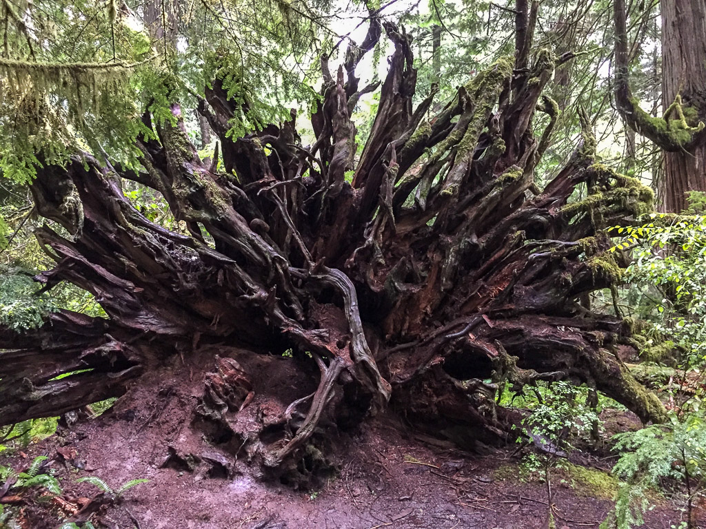 There were lots of trees down throughout this part of the forest, but it doesn't take long before ferns and herbaceous plants are growing on the downed trees and the forest covers them over.

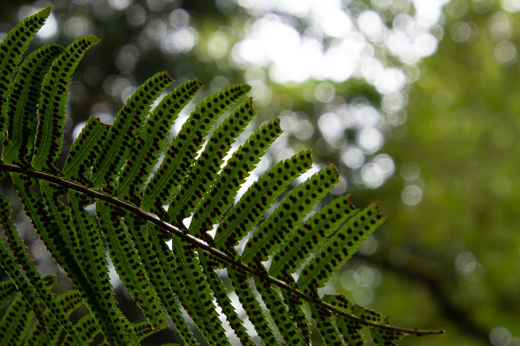
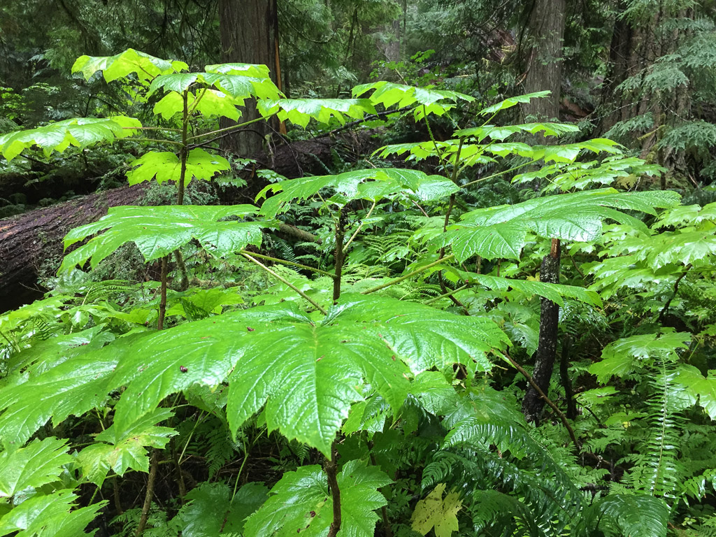 This plant with huge (up to 15") leaves was everywhere in the understory (see the three photos above). It is called Devils Club (Oplopanax horridus) and is endemic to dense, moist, old-growth forests of the Pacific Northwest. It has a long list of uses by Native Americans from medicinals to face paint and is covered with irritating spines.
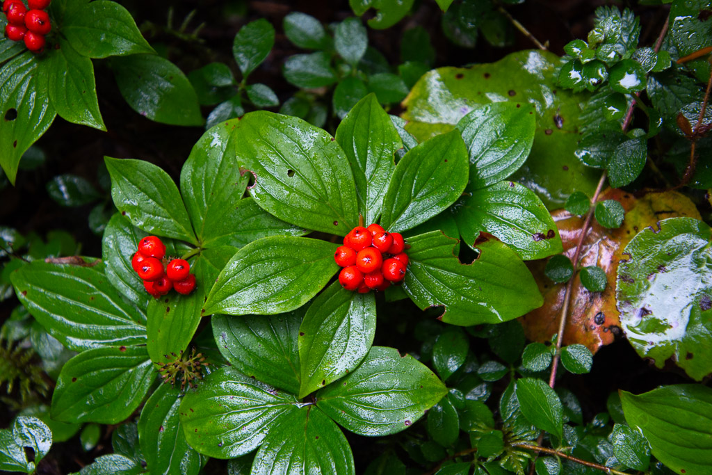 Dwarf Dogwood, Cornus candensis.
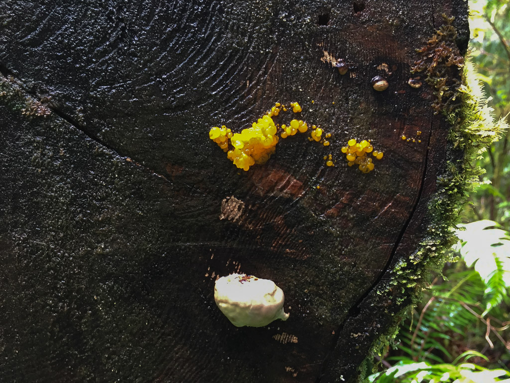
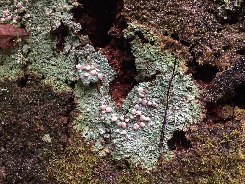
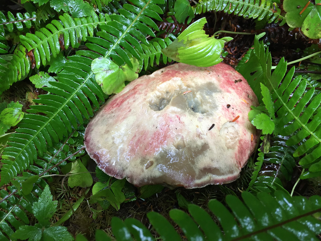
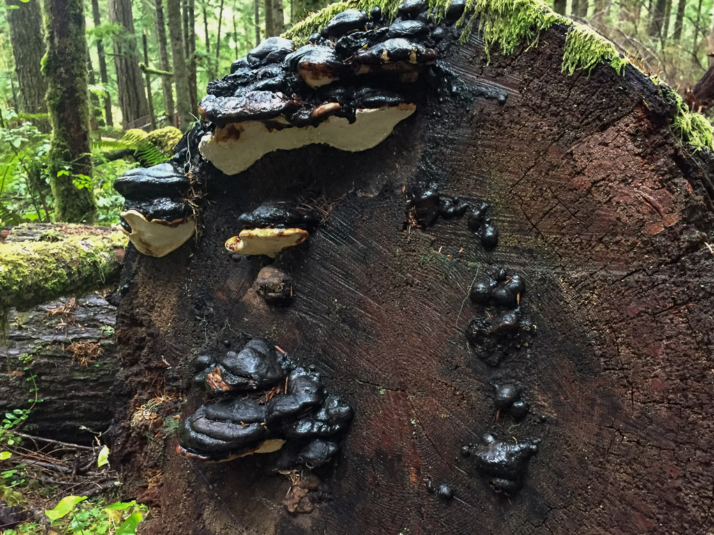 I didn't even try to identify fungi, but took photos because I like to share these with a friend who dyes with mushrooms.


 We walked until we reached the creek and were undecided how far the trail continued. But it was getting to be dusk and we decided that we'd better turn back.
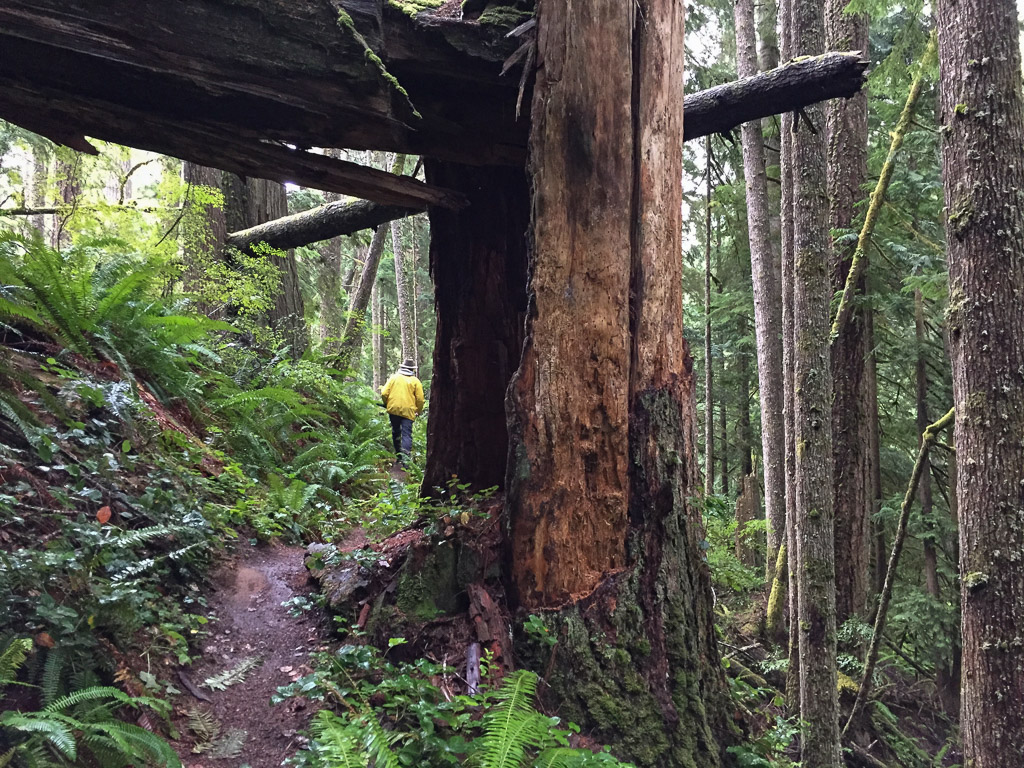 This forest would be pretty dark when the sun was down.
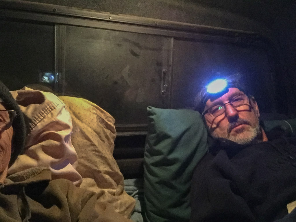 Fortunately it was warm enough with sleeping bag on top of my thick sheepskin. (Maybe it wasn't that warm, seeing that I'm wearing my wool beanie and a sweatshirt.)
 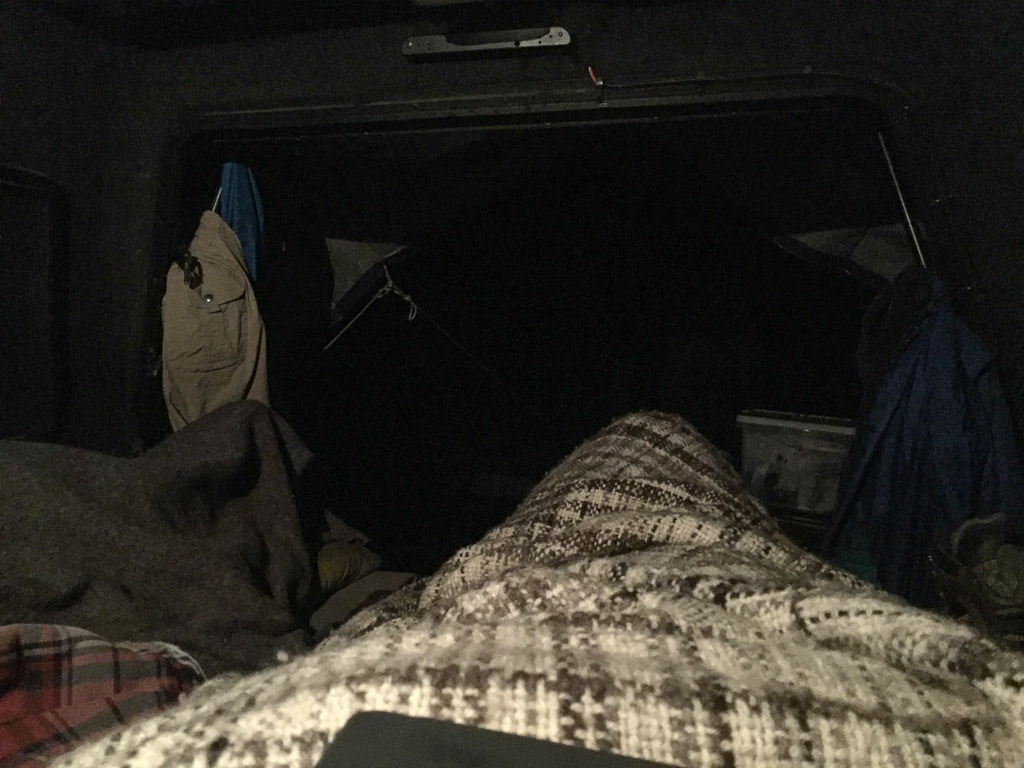 Oh, I have a wool blanket with me too (handspun Jacob by the way). This is the view out from my sleeping bag.