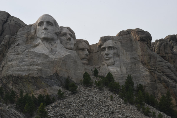
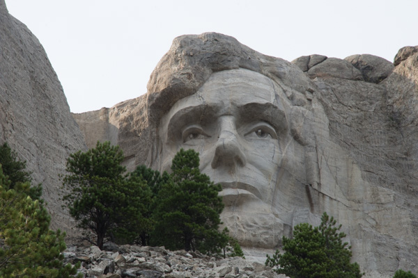
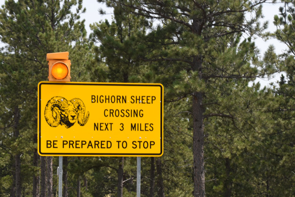
Road Trip to SD - Day 7 - Golden Spike & Rockets
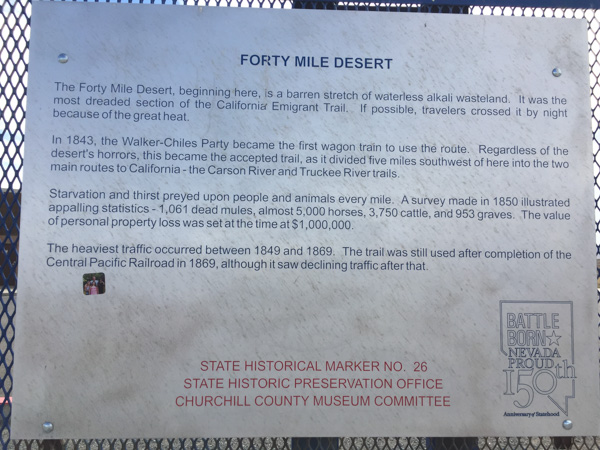
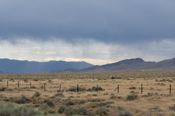
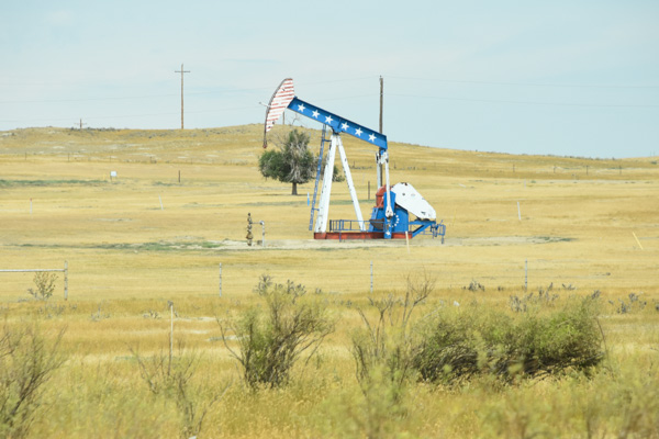
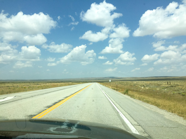
My Road Trip blog posts keep getting longer and longer. I can't decide which photos to leave out (and believe me, I've left out plenty) so I think each post has had more photos than the last. I know from feedback that at least some of you like the Road Trip posts so maybe you won't give up on this one. This trip has got to end some time because I have lots more blog posts in my head (and my camera) from stuff around here. So rather than break this one into two posts it will just keep on going until it's done. We left off with Day 6 at dark trying to figure out where to stay. We had the map book spread out in the Subway where we had sandwiches for dinner. It was too far to any of the national forest land we were seeing north of Salt Lake City and it was dark by this time. That makes it more difficult to find a spot that is not a designated campground.  I had seen, while perusing the map, the Golden Spike National Historic Site that we thought we'd check out in the morning but still we needed to sleep somewhere. Dan suggested a place off the frontage road where we'd seen climbers on our trip out.

IMG_1596

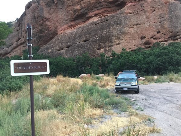
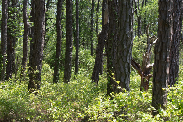
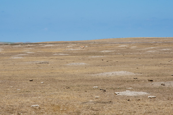
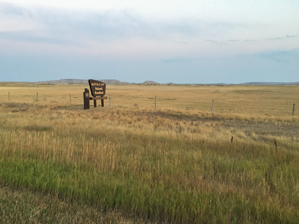
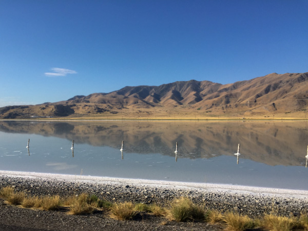
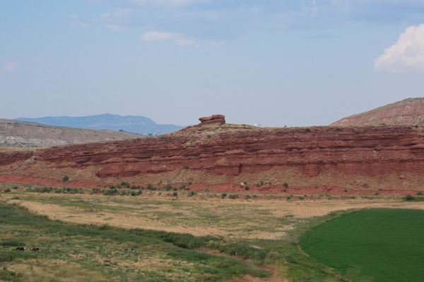
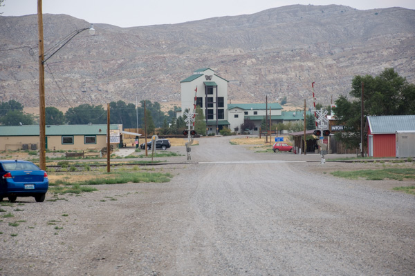
This is what the place looked like in daylight the next morning. Except for the train track next to us and the highway next to that we weren't disturbed. Can you read the sign that I saw the next morning? "Death's Rock."

DSC_3356

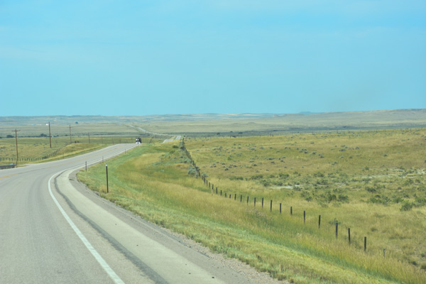
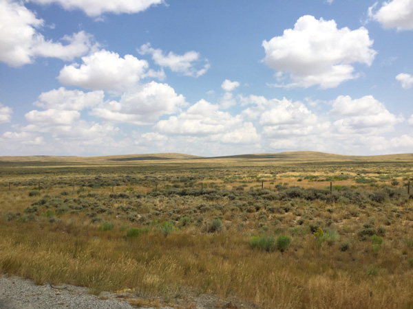
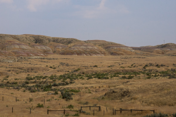
We took Highway 84 to get around Salt Lake City and north of Brigham City turned west to go to the Golden Spike site.

DSC_3359

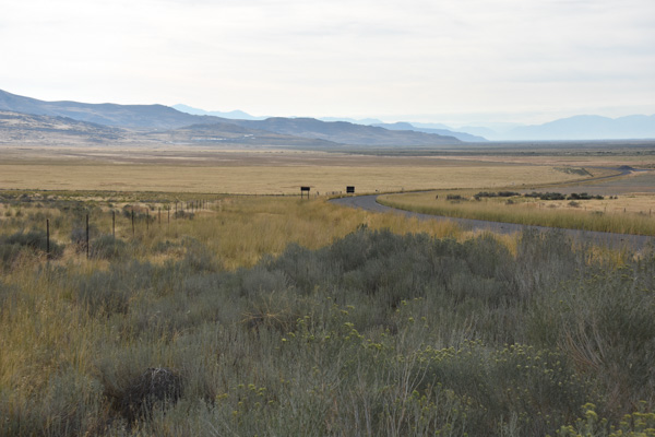
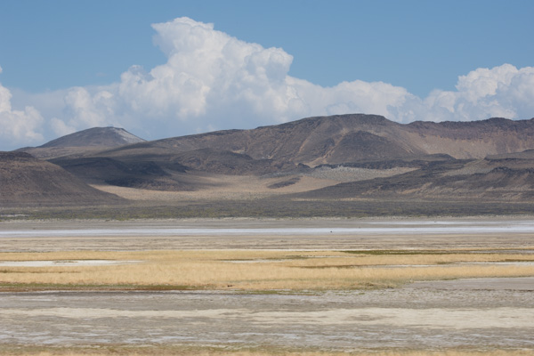
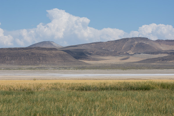
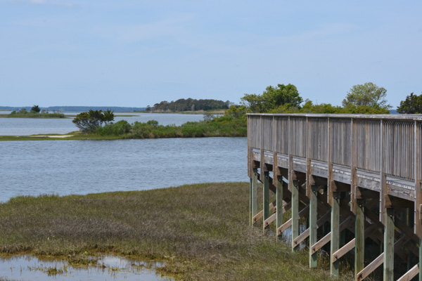
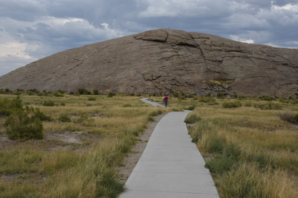
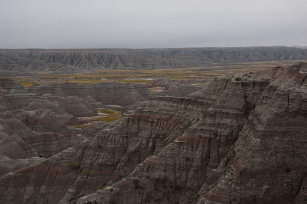
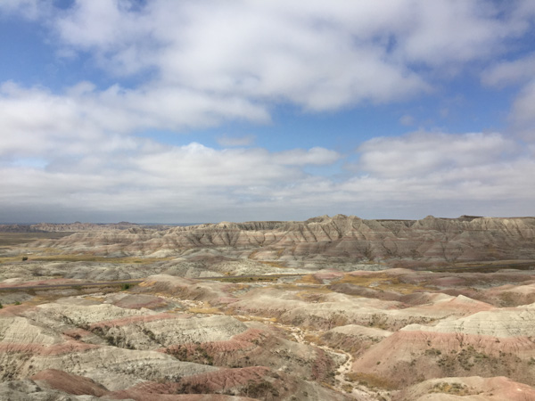
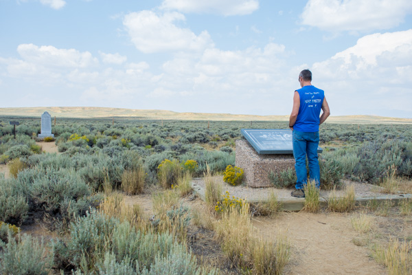
Before you enter the area near the Visitor's Center there are plenty of places to stop and read the interpretive signs. This was at the first site, looking back east.

IMG_1598

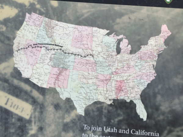
I knew generally about the building of the railroad in the 1800's but I never knew or had forgotten the details. By the time of the Civil War there were railroads linking states in the east. It was in 1862 that Congress authorized the Central Pacific Railroad in the west and the Union Pacific Railroad in the east to construct railroads that would meet somewhere in the middle.

DSC_3361

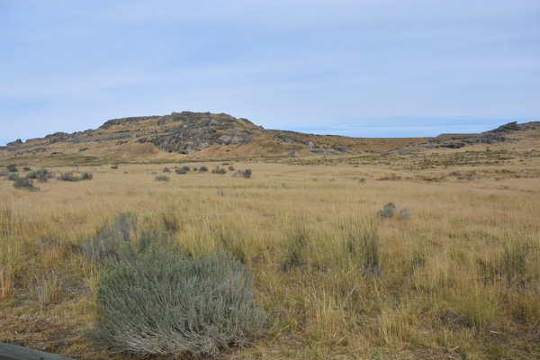
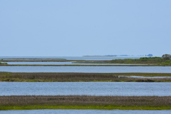
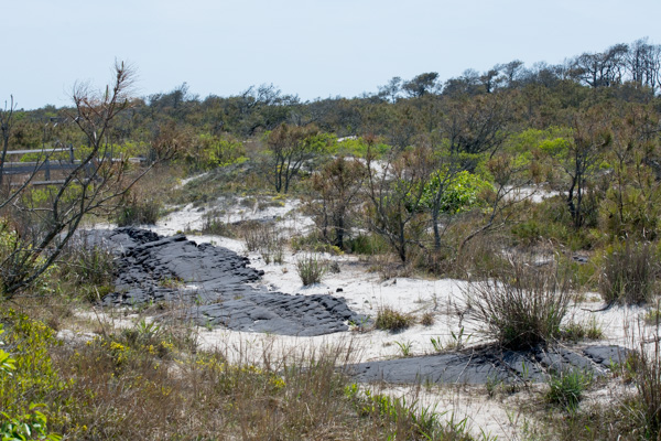
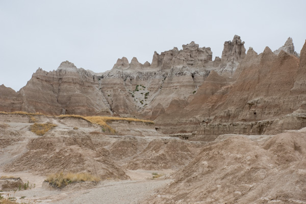
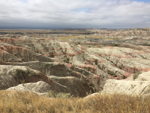
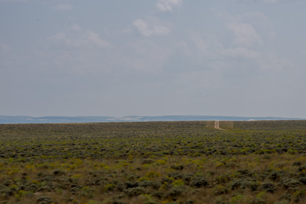
The details make a fascinating story, and if you're driving through Utah, this site is definitely worth your time. Before the meeting place of the railroads was finally chosen both companies continued to build grade ahead of where the track was laid. (The graders worked 5 to 20 miles ahead of the tracklaying gang.) The railroad companies were paid per mile depending on the difficulty of the terrain and they were given sections of land. So there was incentive to keep on going. The railroad grades overlapped by 250 miles before Promontory Summit was chosen as the meeting place. This photo shows the site of what is known as the Big Fill.

DSC_3361-2

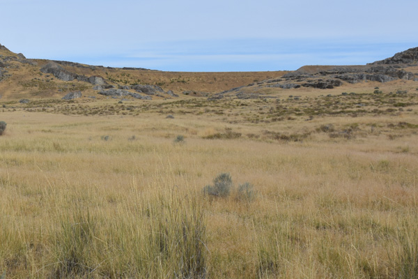
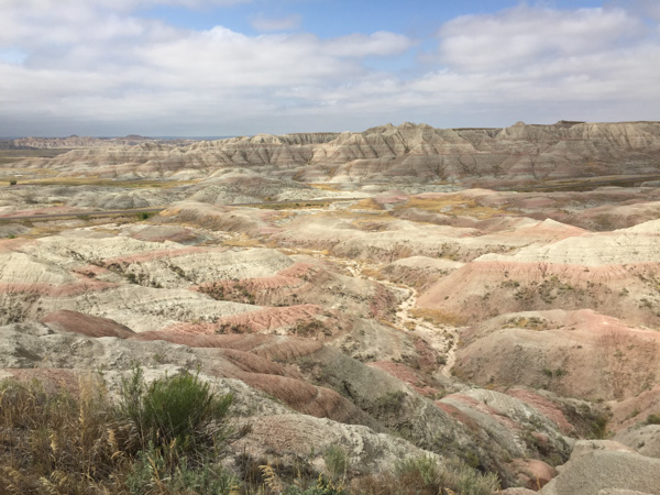
Here is an enlargement of part of that. This was a ravine to be crossed and the grade could be no steeper than 116 feet per mile. Let your eye follow the slope of the rocks--that marks the ravine. The line of dirt above that is the Big Fill. The Central Pacific built that grade by blasting rock and building up that area. The Union Pacific's solution was to build a trestle and you can see what's left of the rocky abutment on the left and just below the Fill. There are photos of the huge trestle that was built to span the ravine (but used only four times because it wasn't secure enough).

IMG_1600

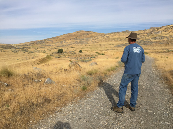
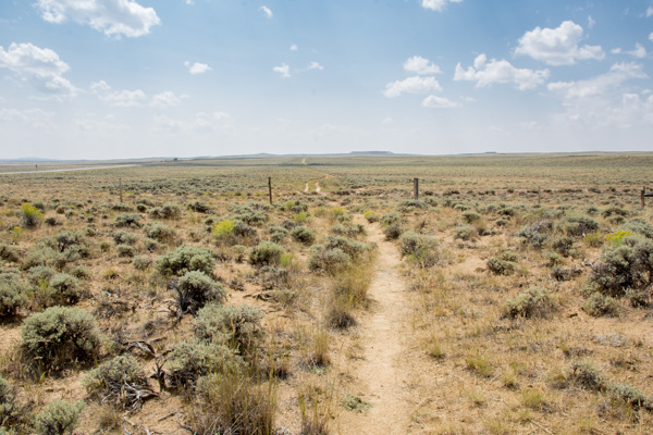
Here Dan is walking on the Central Pacific Grade and you can see the Union Pacific Grade to the left. When you walk on this trail you can use your cell phone at marked stations and hear the information about the points of interest along the way. I find it fascinating that these two crews would have been working this close to each other. And it is so hard to fathom the work involved. Shovels and picks, mule-drawn wagons. Other than using some dynamite, everything else was done by hand. I read that in the Sierra's sometimes they only progressed 8" in a day. DSC_3392

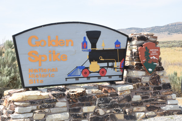
We got to the headquarters just after it opened and went to the Visitor's Center.

IMG_1602

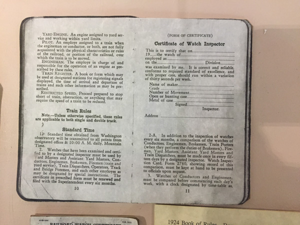
There was a display with watches. This is an example of one of those things that never would have occurred to me to wonder about. When did we start worrying about Time?  This is from a sign in one of the displays: "With the completion of the transcontinental railway, marking and maintaining precision time became more important than ever before. Prior to standard railway time, each city and town had it's own time, often connected to "sun time" which was based on the sun's movement across the sky. As rail lines crossed various local standard times, scheduling became increasingly complicated. Timetables and timekeepers, therefore, were essential parts of railroad operations."

DSC_3378

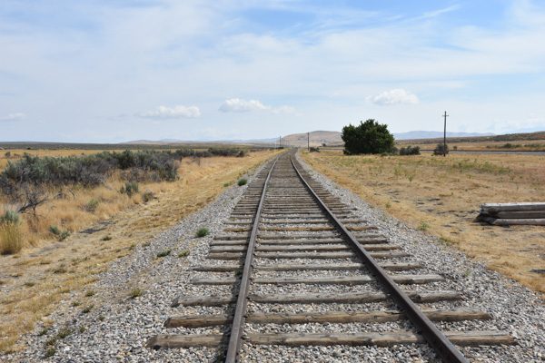
This is a view along the track (a replica now) at Promontory Summit...

IMG_1606

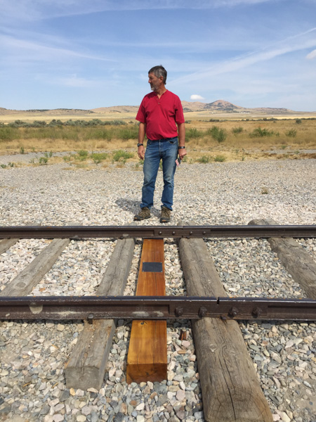
...and here is where the Golden Spike was symbolically tapped and the final iron spike was driven to complete the railroad. There can be many facets to every story and this is no exception. The material at the Visitors Center (as well as all the others that I've visited) speaks to the ramifications of our (humankind in general, and the White Man in the relatively recent history of the U.S.) relentless desire to control and often exploit our surroundings and each other. The achievement of this feat led to the decimation of the bison herds, destruction of the American Indians' way of life, and "progress". The West was opened up.

IMG_1610

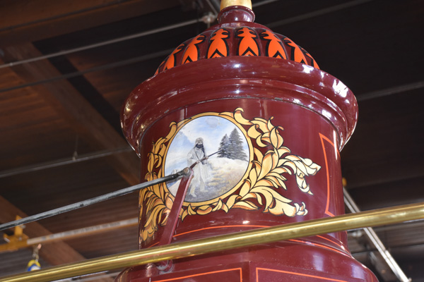
On that final day two locomotives met at Promontory Summit. The wood-powered Jupiter came from the West...

IMG_1613

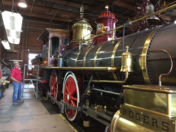
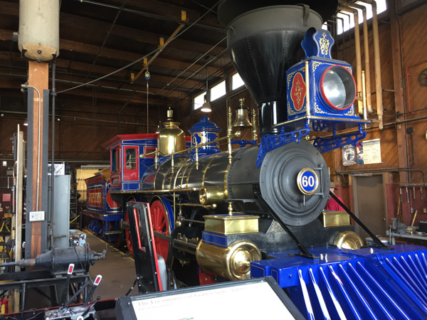
...and the coal-powered  No. 119 came from the East.

DSC_3386

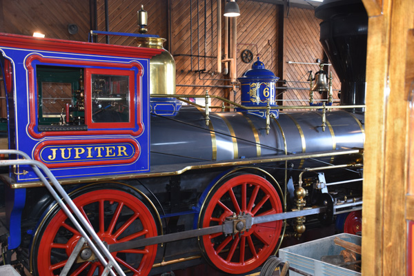
These engines are fully-functional replicas of the originals made in 1979.

DSC_3387

DSC_3388

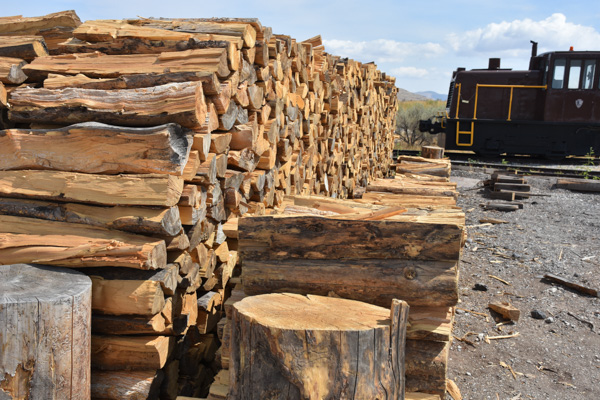
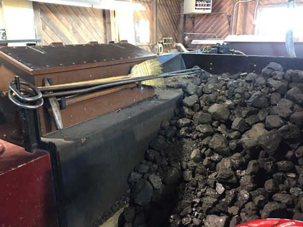
They weren't in operation when we were there because the track was being repaired, but    usually they are taken out during the summer...therefore they need wood and coal to operate them.

DSC_3385

DSC_3384

IMG_1618

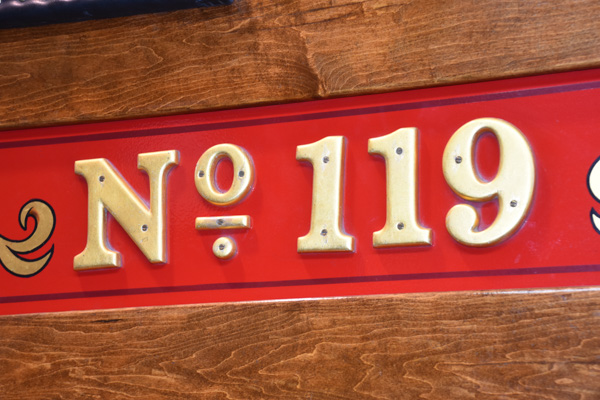
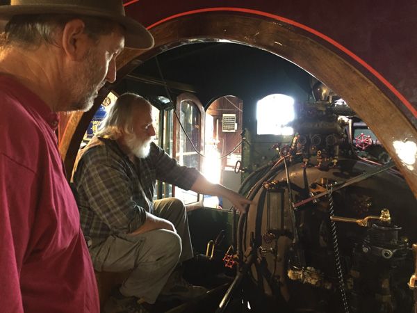
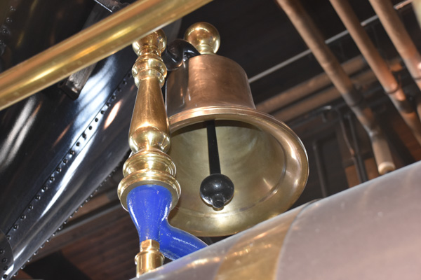
We spent some time in the No. 119 talking to the man who operates the engines.

IMG_1622

IMG_1621

IMG_1625

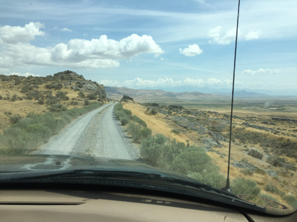
We drove part of the Union Pacific grade, now a road,  when leaving the site.

DSC_3401

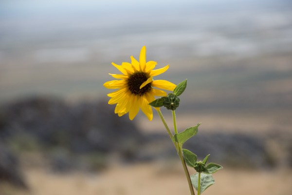
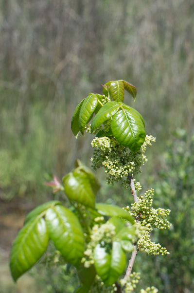
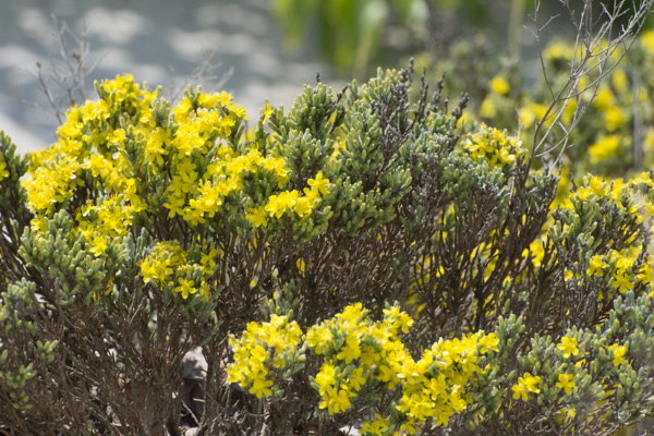
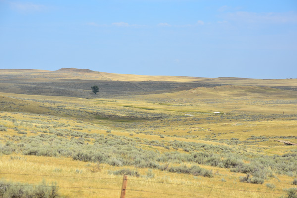
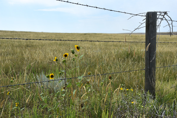
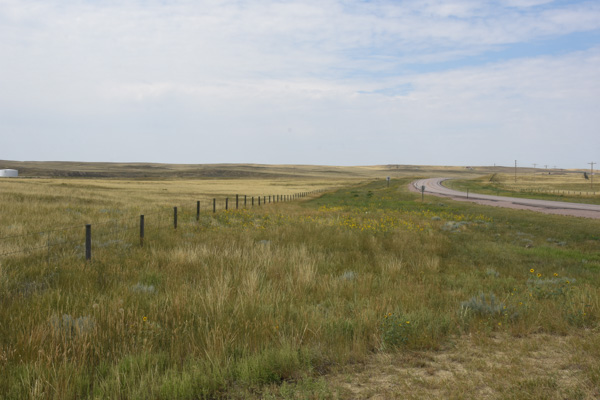
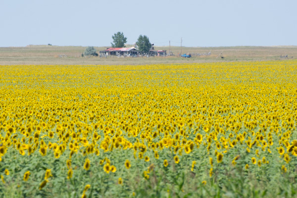
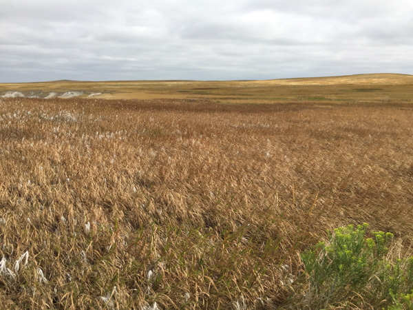
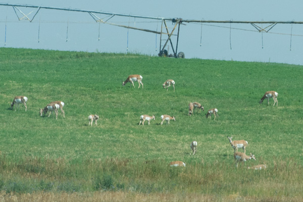
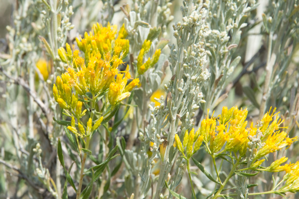
We made a couple of stops along the way. I didn't take many flower photos on this trip. When you're practicing 70 mph drive-by photography flowers usually aren't the subjects of choice. I did love seeing the wild sunflowers that were everywhere.

DSC_3404

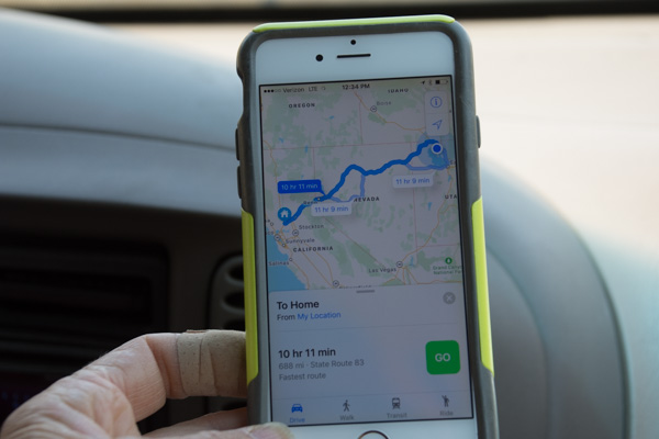
Time to head home. The map app showed 10-1/4 hours. Go!

DSC_3419

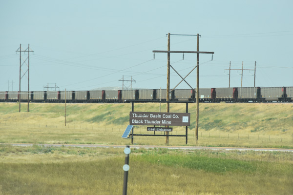
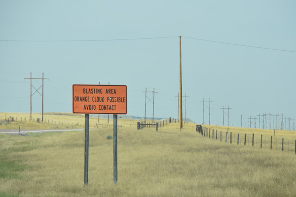
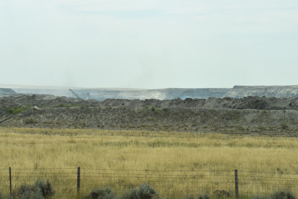
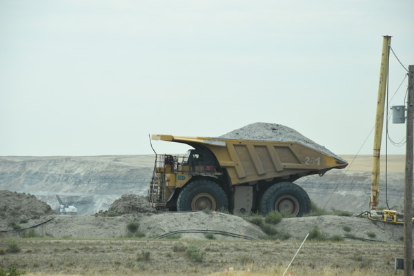
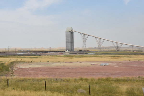
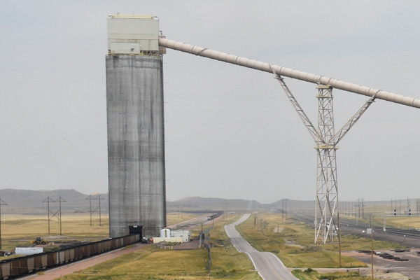
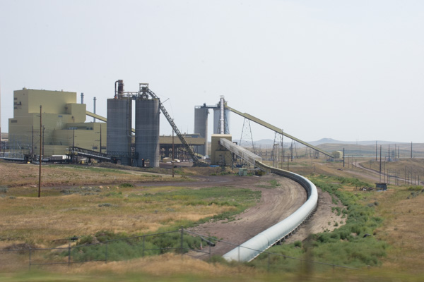
Wait! There was one more stop. From where we first got out to look at the railroad grades you could see what looked like industrial complexes covering the hills to the east. When we got back to the main road and turned north we saw that all the property to the east was part of the Orbital ATK complex. Their website says: "As a global leader in aerospace and defense technologies, Orbital ATK designs, builds and delivers space, defense and aviation-related systems ... Our main products include launch vehicles and related propulsion systems, satellites and associated components..."

IMG_1628

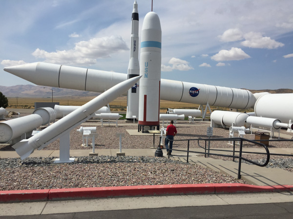
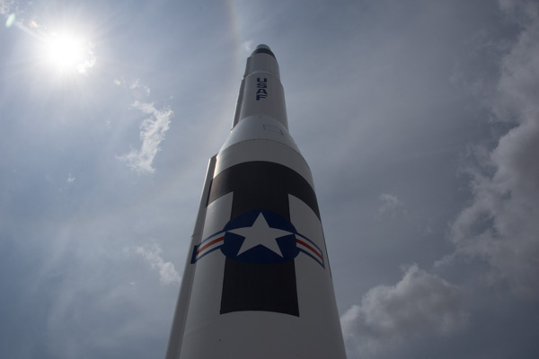
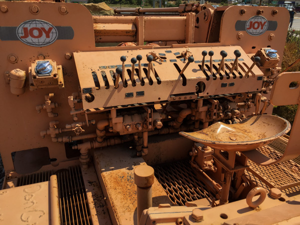
There was a Rocket Display outside the headquarters. Each piece was labeled with specs and details of use.

DSC_3418

DSC_3410

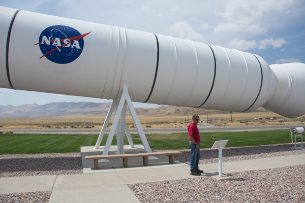
This is the reusable solid rocket motor from the Space Shuttle.

DSC_3415

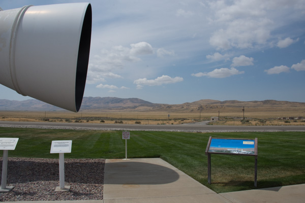
A sign that amused me is the one in red lettering that says "Please do not climb into the nozzle." I guess that wouldn't have occurred to me. The blue sign is shown below.

IMG_1631

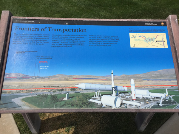
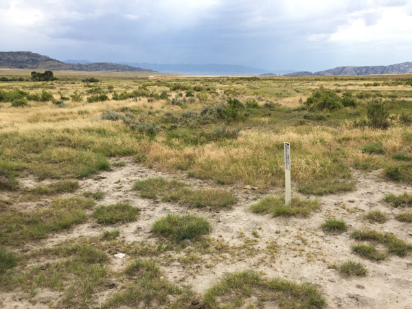
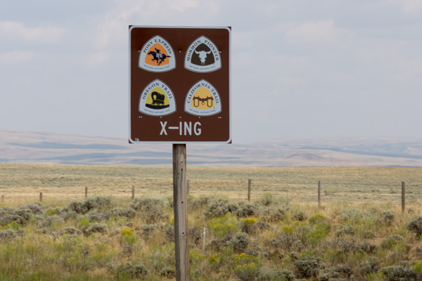
This one pointed out the railroad grades that we just visited (red for Union Pacific and blue for Central Pacific), site of the Big Fill, Promontory Summit, and the route of the pioneers, all of which were visible from here.

IMG_1639

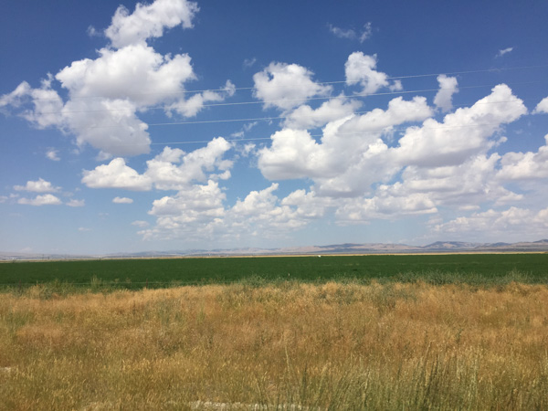
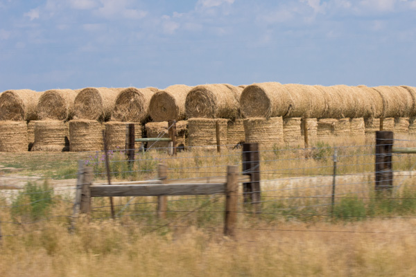
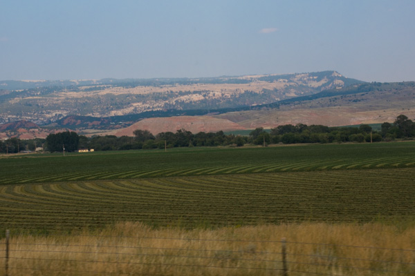
Now it was really time to start for home. These are alfalfa fields in Utah...

IMG_1640

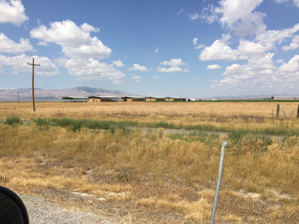
...and huge barns to store all that hay.

DSC_3435

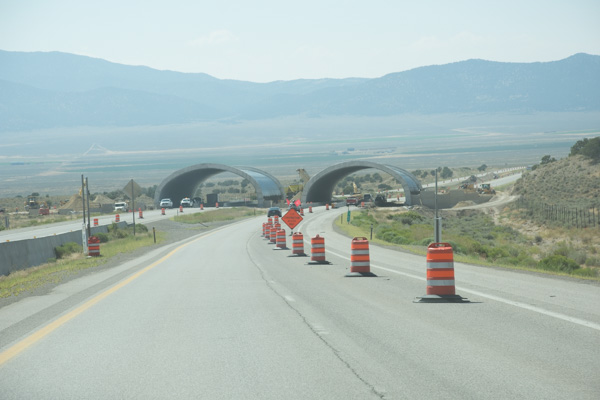
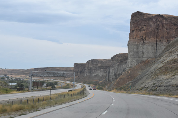
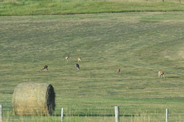
We had noticed these structures under construction when coming the other direction. I looked this up later and and found that they are overpasses for deer to try and reduce the high number of deer/auto collisions in  this area. They'll be filled in with dirt and vegetation and fences will be put along the freeway to funnel the deer to that area.

DSC_3427

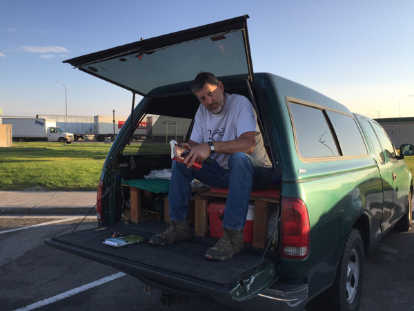
Usually when we drive on these trips I don't do much reading or other activity even though I'm not the driver.

DSC_3437

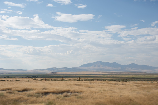
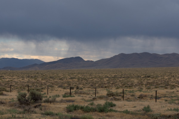
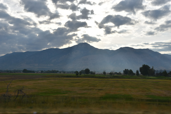
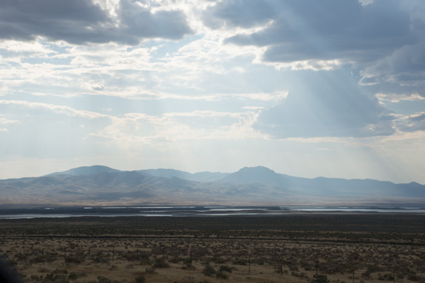
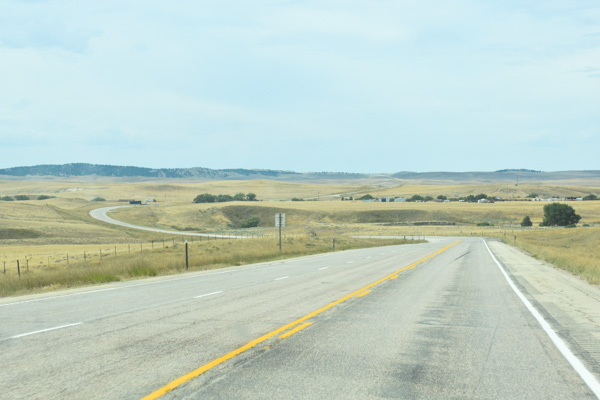
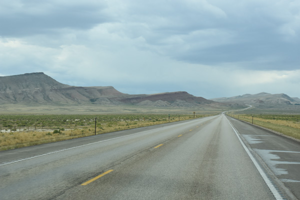
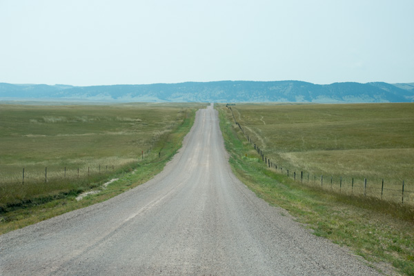
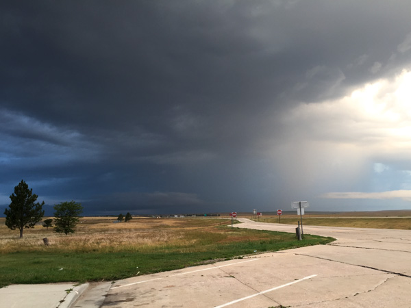
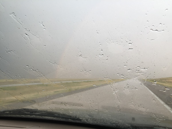
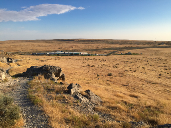
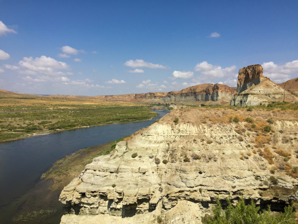
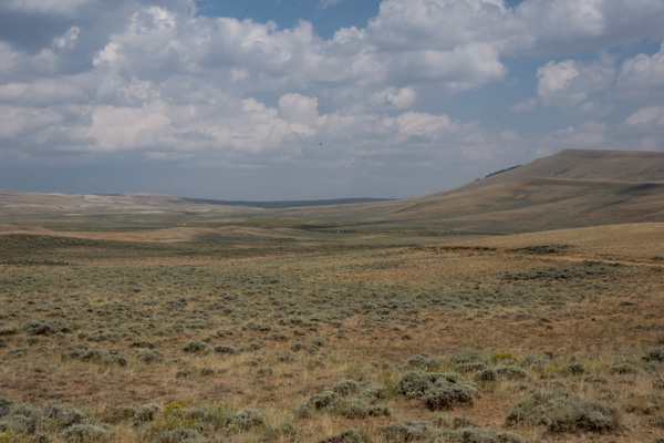
I enjoy watching the scenery. That is what a road trip is about. But driving home from Utah on I-80 isn't new anymore. And it's not as fun when you are driving straight through without stops.

DSC_3439

I still appreciate this landscape, but I ended this trip reading through much of the travel on this day and I read parts of the book to Dan. I read Overdressed: The Shockingly High Cost of Cheap Fashion by Elizabeth Cline. From the cover: “Overdressed does for T-shirts and leggings what Fast Food Nation did for burgers and fries.”—Katha Pollit. I've been immersed in these ideas for a long time with my Fibershed involvement but it was relatively new to Dan. Now he sees the ads in the paper in a whole new light. I could go on about that topic but I won't. I recommend that you read this book.

DSC_3444

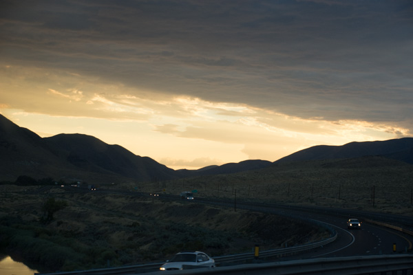
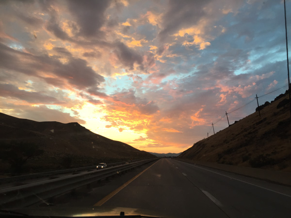
Heading west into the sunset. It was getting dark. No more reading.

IMG_1642

IMG_1644

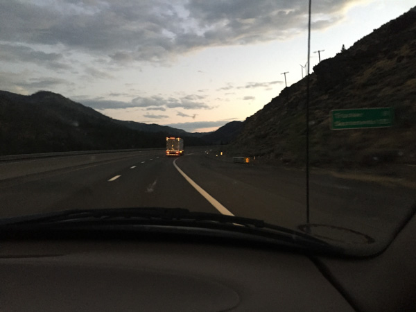
A blurry photo as we entered California.

IMG_2050

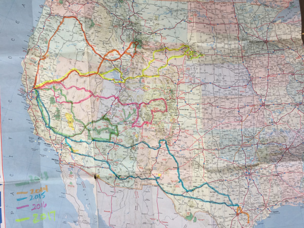
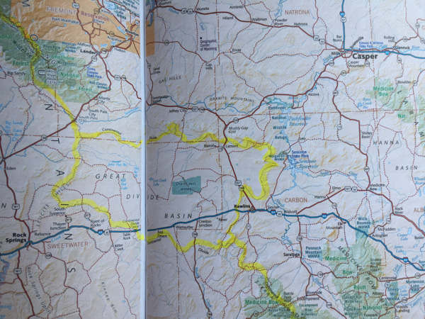
Here is a map of the trips we have taken over the last five years when we started our Road Trips. This year's trip is in yellow. Now that Dan is retired maybe we'll be able to do more than one a year. One of us isn't retired though and has a lot of animals to take care of.

Road Trip to SD - Day 6 - Following the Pioneer Trail

At the end of  Day 5 we had stopped at the Horsethief Lake Campground in the Black Hills National Forest, still in South Dakota. Black Hills NF, SD

We had looked at the map and planned the direction to start for home, wanting to roads that we hadn't traveled before as much as possible.

DSC_3223

We headed toward Wyoming...

DSC_3230

...and saw this along the road.

IMG_1563

I had been collecting postcards to send to my 3-year-old granddaughter but hadn't mailed many yet so today I was going to search out post offices in the small towns along the way.

Newcastle, WY

A gorgeous building across the street from the post office in Newcastle. From there we took Highway 450  west through the Thunder Basin National Grassland toward Wright.

Thunder Basin N Grassland

We were driving through the country where huge herds of cattle had been driven as far north as Canada, grazing along the way, and then shipped by railroad to eastern markets. Belle Fourche, where we had been a couple of days before was one of the important shipping points. (Lonesome Dove fans, note the sign on the post.)

Thunder Basin N Grassland

According to the sign 2500 head of cattle strung were strung out for a mile, traveling 10 to 15 miles per day. They could gain weight over the 300 to 500 mile trip.

Thunder Basin N Grassland

Alternatively picture the thousands of bison that once roamed here while the Native American's called this home. Same place. Different eras.

Thunder Basin N Grassland

Thunder Basin N Grassland

Black Thunder Mine,WY

Before we got to Wright near the western edge of the Thunder Basin National Grassland we saw the first glimpse of a major industry in Wyoming...and the sky was more gray.

Black Thunder Mine,WY

According to Wikipedia, the Black Thunder Coal Mine is the world's largest coal producer.

Black Thunder Mine,WY

This is an immense operation.

Black Thunder Mine,WY

I couldn't get photos to show the scale of what we were seeing. You can see a tip of the excavator down in the pit. Wikipedia says "Black Thunder’s dragline excavator is the biggest in the world and produces enough coal to load up to 20-25 trains per day."

Black Thunder Mine,WY

The excavator fills this truck with one pass of it's giant scoop. This is a huge truck--the driver is sitting in that little cab above the wheel.

Black Thunder Mine,WY

Take a look at the photo below to see the true size of this structure.

Black Thunder Mine,WY

east of Edgerton, WY

More of Wyoming prairie. This is between Wright and Edgerton.

near Edgerton, WY

Someone has decorated their oil/gas well.

near Edgerton, WY

I have included this photo because of the two dinosaurs and it reminded me of a photo op that I missed earlier in the trip. The dinosaur seems to be the mascot for Sinclair gas stations. We passed a gas station somewhere along the way  where they had a dinosaur the size of these and it was tied to a fence post with a rope around its neck. I still think it's one of the funniest things I saw on this trip. It would have looked natural to have a horse tied up right next to it.

south of Casper, WY

We drove through Casper and took Hwy. 220 towards Rawlins.

south of Casper, WY

We watched lightning in the distance. Do you know how hard it is to take lightening photos?

Independence Rock, WY

We were still following the trail of the pioneers...

Independence Rock, WY

...and we stopped as they did when we reached the Independence Rock, which is now a State Historic Site.

Independence Rock, WY

In one of the earlier posts (Day 2) we had stopped at South Pass. Then we were heading east, backwards from the direction the explorers and pioneers travelled. They would have been at Independence Rock first, looking west towards South Pass, 100 miles to the west.

Independence Rock, WY

Independence Rock was the first major landmark after leaving the North Platter River to follow the Sweetwater River to South Pass.

Independence Rock, WY

There is a trail around the rock for modern day visitors. You can see where early travelers left initials and names scratched into the rock.

Independence Rock, WY

This is the remnants of the trail heading on southwest.

Great Divide Basin, WY

We were back on our trail towards Rawlins.

Great Divide Basin, WY

We crossed the Continental Divide.

IMG_1971

I used to think that you crossed the Continental Divide once and then were on the other side. I found out that there is an exception in Wyoming (and when I looked at a map of the Continental Divide, also in Mexico). Wikipedia again: The Great Divide Basin is an area of land in Wyoming's Red Desert where none of the water falling as rain to the ground drains into any ocean, directly or indirectly." I highlighted this on the map so that I could see it more clearly. South Pass is near that northern route of the Divide.

Rawlins, WY

We found the Post Office in Rawlins (this was across the street)...

Great Divide Basin, WY

...and then crossed the Continental Divide again...

Great Divide Basin, WY

...and again.

East of Green River, WY

Near Green River on I-80. From here on we were backtracking where we'd already driven.

Evanston, WY

It was dark when we got to Evanston, just on the edge of the Wyoming-Utah border. Looking at the map book and trying to find somewhere to spend the night I had found one more point of interest for the next day. We still hadn't figured out a good place to camp so we stopped here for gas and Subway sandwiches and took the maps inside for closer scrutiny.

To be continued...

Road Trip to SD - Day 5 - Mt. Rushmore

After driving through the Badlands we decided to continue on the scenic roads rather than go to the highway. Some of them were a bit of a guess since all we had was a road map of the state. DSC_3163

Not far out of the National Park we stopped to watch a herd of bison. This is not much of a photo but it give you an idea of the number in the herd.

DSC_3196.jpg

Then we headed west on a gravel road that went through another part of the Buffalo Gap National Grassland. Most of the National Grasslands are located in or around the Great Plains and they are managed in the same way as National Forests. Until I looked up this information I didn't know that there is a National Grassland in California. In fact it is near the Klamath National Forest where I worked when I was in college--but it was designated as such until after that.

DSC_3183

As I had seen on a map in one of the Visitors Centers, the public lands are interspersed with private lands. We saw miles of one of my favorite crops.

Leaving the grassland we drove into the forest again. The engineering of the road to Mt. Rushmore is a marvel in itself. From Custer State Park you drive 17 miles on Iron Mountain Road to Mt. Rushmore. There are three pigtail bridges and three tunnels that were engineered to frame Mt. Rushmore.

IMG_1552

This very poor photo shows what I mean by framing the mountain. Each of the tunnels is aligned to present the view of the mountain.DSC_3209

I was surprised when we arrived to be directed to the roof of a parking garage built into the mountain. It makes sense--they have to do something with all the cars that come here.

IMG_1553

I knew what to expect of the mountain itself because I've seen pictures. But I didn't know about the infrastructure built around this National Memorial.

DSC_3211

There is an amphitheater facing the mountain. From there you can walk on the Presidential Trail around the base of the mountain (or the rubble left from carving the sculptures) and then to the Sculptor's Studio, where there is a plaster model and tools used by Gutzon Borglum, the sculptor of Mt. Rushmore. DSC_3212

This was an amazing feat in the 1930's. It took 400 laborers to do this work. DSC_3213

Look at the detail on Lincoln's face. The noses are about 20 feet long and the eyes are about 11 feet wide. Can you imagine what it would be like to be hanging in a basket here drilling holes for dynamite?

IMG_1555

Time for us to move on. It looked as though there were several campsites in the nearby forest and I didn't want to have a repeat of the night before. We stopped at the first one that we saw and found a good spot. We had time that evening to relax and read.

I finished a book called A Shepherd's Life by James Rebanks.

IMG_1843

The author grew up on the family sheep farm in the Lake District of England.  At the beginning of the book he describes how he felt as a boy when it was assumed by "outsiders" that he would (or should) want to do something better with his life, but all he ever wanted to do was to continue with the sheep farm. Also he was resentful with the interest that others (non-residents/city people) showed for the landscape but in a way that he didn't understand--they didn't respect the farms and the farming life but looked at the landscape as something with a "higher" purpose. I'm not explaining this very well, but as I was reading this book in the evenings on this trip I found similarities in his description of the visitors to their farm land and the fells above and to us in taking this trip and the others we've taken. We are grateful that there are National Parks and other public lands so that we can explore these landscapes that we'd never have a chance to see in depth otherwise. In this landscape we were the visitors, admiring the stunning views, the wildlife, and the agriculture. But we don't live the life there, don't have to deal with weather challenges, prairie dog invasions, etc. As an adult Rebanks learned to see the other side and understood the appreciation the "city people" had for the land, albeit without the understanding of the integral part that centuries of farming had played in those landscapes. He found a way in his career (second to shepherding) to promote the importance of farming and shepherding on this land while allowing tourism to benefit the communities as well.

I couldn't help but find parallels in this book to the experiences that we were having during this week vacation.

Road Trip to SD - Day 5 - Badlands in the Morning

I wasn't very complete in my description of Jewel Cave from Day 4 of this trip. I usually get out the brochure and re-read the info that is there. Those formations in some of the photos are called Dogtooth Spar, 6-sided calcite crystals formed completely underwater, and Draperies, formed as water trickles down, leaving deposits of calcite crystals. The brochure says that while the cave was forming it was completely submerged in groundwater that was rich in dissolved calcium carbonate. As conditions changed the calcium carbonate precipitated and formed calcite crystals off various depths and shapes on exposed surfaces. IMG_1507

Here is one more photo from Jewel Cave. There is another cave nearby--Wind Cave National Park but we just didn't have time for everything.

IMG_1521

I left off the last post with heading to a Rest Stop in the dark. That was not our best night but at least we slept. However we had chosen this plan after passing up the trailhead parking that said "No Overnight Camping". We didn't want to be federal criminals. I will admit here that we are now criminals in the State of South Dakota. The rest stop had a sign posted about a SD rule that you can't stay more than three hours at a rest stop and there was video surveillance for our safety. I keep expecting to get a summons in the mail.  The photo above is what we woke up to. That weather system was in the west, where we were headed to see the Badlands.

IMG_1524

We first had to drive east to find a place to turn around. We commented that South Dakota has big raindrops.

IMG_1525

Now heading west.

IMG_1526

Eventually we drove through the storm, or it passed us over as it was heading east.  This was the first time that I've been "on the ground" in the Midwest and I found this side of South Dakota as beautiful as the Black Hills in western South Dakota, although very different.

DSC_3109

Change of pace. A bit of commercialism near the entrance to the National Park.

DSC_3110

Now there was someone at the entrance station (it had been closed the night before) but there were no maps. It seems they had run out with all the motorcycle traffic. (We were able to get one at the Visitor Center.)

DSC_3111

The first view of the Badlands, although we had a glimpse from the other side just before dark the night before.

IMG_1529

The previous night we had driven through the Buffalo Gap National Grasslands on that road south of the Badlands NP, through the eastern end of the Park and north to the highway. If we had more time we could have gone to the National Grasslands Visitor Center further west on Highway 90 in the town of Wall and the  Minuteman Missile National Historic Site just north of the Park. (Note to self: take another trip to SD and buy the Map Book first.) We planned to explore the trails here at the west end of the Park and then drive through the Park, starting our drive home.

DSC_3113

We stopped at an overlook. You can't tell from this photo but the wind was blowing and it was cold. And what was weird is that this fog was rolling in. That sounds like something I would say standing over the San Francisco Bay. Fog rolling in here in the Badlands? In August?

IMG_1533

Maybe its not "rolling in". But it sure settled fast.

IMG_1534

The distance view was gone within ten minutes. In fact these photos were taken ten minutes after the first one right after the National Park sign.

DSC_3116

We drove on. The formations were stunning but the surroundings did seem cold and gloomy.

DSC_3122

At the next stop we saw bighorn sheep! Yes! This was the clearest photo I had of them as the mist seemed to get thicker. "Sheep in Fog". The sheep stayed around, in fact bedding down right there while we hiked on a short trail on the other side of the road.

Then we went to the Visitors Center to get warm, pick up a brochure and map, and see the exhibits.

IMG_1536

Did you know that my background is in Range and Wildlands Science? That's what the UCD degree was called after it changed from Range Management before I graduated. I admit that I can't identify most grasses anymore and certainly not these of the Great Plains, but I am interested. The grass is an extremely important part of an ecosystem, whether its these prairies or our irrigated pasture back home. This is a great exhibit.

IMG_1535

Remember the Dust Bowl? Well, most of us don't remember it, but we know about it. This explains why, when you plow up the prairie you have set up the system for disaster. The Park brochure explains that "the Badlands prairie contains nearly 60 species of grass, the foundation for a complex community of plants and animals. The prairie once sprawled across one-third of North America." Today there are only patchwork remnants of this prairie that "occurs in areas that are too dry to support trees but too wet to be deserts".

DSC_3129

We drove on to the Fossil Exhibit Trail. This area went from being a under a shallow sea, to a jungle after the land lifted up, and then covered with sediment and volcanic ash that turned to soft rock. Eventually erosion exposed all the colorful layers and the fossils they hold, so the SD Badlands in known world-wide for it's fossil record.

DSC_3139

From information found on this website: "Although by definition badlands contain very little vegetation, some plants, particularly prairie grasses, are found in South Dakota's badlands regions.  Sod tables, remnants of the prairie that have resisted erosion, provide platforms for vegetation."

IMG_1538

You can see the layer of soil that held by the roots of the vegetation but that isn't enough to prevent the sides of the sod table to continue to erode. In fact, the Badlands are retreating to the north in general as natural erosion occurs. Notice the holes at the top of this sod table. We thought that maybe birds used these holes.

DSC_3138

Then we saw that these are rodent tunnels that have opened as the erosion occurs. You can see that in this photo.

IMG_1539

Beautiful landscape. What would an early explorer have thought, having just ridden over miles of grassland?

IMG_1541

IMG_1542

IMG_1543

DSC_3154

Here is a different landscape.  I might not have known for sure what this was except for having visited Devils Tower NM two days before. (By the way, there is a pronghorn in the photo but I'm talking about the mounds and the lack of grass.)

DSC_3155

Here is the culprit. I can see how prairie dogs are considered a nuisance. The road took us past  acres and acres of this devastated landscape. As usual there are two (or more) sides to a story. I have to get on with other things right now and won't try to research this one. Here is one article that gives various perspectives.

The day wasn't over. We had another stop before camping for the night. That will be in the next post.


Road Trip to SD - Day 4 - Belle Fourche and Jewel Cave NM

We started Day 4 of our adventure after a restful night in the Black Hills National Forest in Wyoming. (Here is the campsite in Day 3.) I was up before Dan and walked off with my camera. Wildlife! DSC_3067

So what if it's just chipmunks! They were close enough for me to get decent photos.

DSC_3062

And they were fun to watch as they ran in one side of the cattle guard rail and out the other.

IMG_1462

This is a view of some of the forest outside the campground.

We got on the road and looked at where to go. Now I'll tell you why I had originally chosen South Dakota as our destination for this year's trip. Months ago I was reading a sheep magazine and saw a reference to a Sheep History exhibit in South Dakota. I looked it up and it was in an Ag Heritage Museum in Brooking, SD. There was a lot to see along the way so I suggested that as our turn-around point. However, Brooking is on the far eastern side of SD. After the first two days of driving and looking at all the things we wanted to see where we were now and our limited time I pulled the plug on driving clear across the state to see that one place. It seemed kind of silly to add another two days of driving to the trip just for a few hours in a museum (or to not add two days and be driving for that long a stretch).

So, back to the map. There was plenty to see in western SD: Mt. Rushmore NM, Jewel Cave NM, Wind Cave NP, Buffalo Gap National Grassland, Badlands NP. Dan still wanted to avoid Sturgis with all the crazy motorcycle stuff. So we looked for a road around it. I saw on the map "Geographical Center of the United State". Really? I looked at the U.S. map. That didn't look right. I googled it.

IMG_1466

If you include Alaska and Hawaii, yes, there is a place, not too far over the border of SD, that is the Geographical Center of the U.S.

DSC_3075

It turns out that the real center is in a privately owned pasture 20 miles north of the town of Belle Fourche.

DSC_3079

The town decided that there should be a more memorable and accessible monument for something as cool as being the Georaphical Center of the U.S. ...

IMG_1478

...so this was created in 2008. It is at the Belle Fourche Visitor Center and Museum.

IMG_1467

The museum turned out to be very interesting (and maybe a smaller scale of the one that we were going to miss in Brooking) and we spent some time there. There were exhibits about the cattle drives from Mexico to Canada, the importance of the railroad station in Belle Fourche (4500 train carloads of cattle per month in 1895), the Old West in  movies and TV, early settlers, rodeo history, wartime, and old-time bad guys. There was also an exhibit about the importance of the sheep industry in South Dakota. DSC_3074

This is a sheepherder wagon that is outside the museum. There were a lot of photos of the sheep history of the area.

IMG_1473

South Dakota is currently fifth in the U.S. for sheep production...

IMG_1474

...and the sheep industry is an important part of South Dakota's agricultural economy.

IMG_1468

This isn't a very big museum but there was a lot to see in the small spaces. In the area that showed something about life in "the old days" there was this device used to do something to women's hair. An early perm?

IMG_1471

it's kind of hard to see this bicycle but I thought it was interesting in that the handlebars, seat, and wheel rims are made of wood.

DSC_3087

After a few hours we decided that we'd better get on the road again. This is a view before we left town.

DSC_3088

What do you think of this one? It was kind of scary to have this view on the highway   but that truck was going the same direction that were are because it was being towed behind another.

South Dakota was not what I expected.

DSC_3090

We had camped in the Black Hills National Forest in Wyoming but it continues in South Dakota.

DSC_3093

We were headed now to Jewel Cave National Monument and took a road designated a "scenic drive" and it was. Beautiful country. This is an area known as Spearfish Canyon.

DSC_3101

This National Monument as well as many of the others we planned to visit are all within this area of the Black Hills National Forest.

DSC_3098

IMG_1487

I continued to find the scenery breathtaking. Too bad the drive-by photos can't really show that.

IMG_1493

We signed up for a cave tour but had some time in the Vistor's Center first. Jewel Cave was discovered by two prospectors in 1900. Only a mile of it had been documented when it was made a National Monument in 1908. Now it is known to be the third longest cave in the world with over 180 miles of passages that have been mapped and more that have not. The cave extends beneath about four square miles of land but there is only one known entrance. The areas in yellow are closest to the surface and the redder the color, the deeper the passage. The deepest point is 749 feet below ground.

Thirty of us gathered with our Ranger and rode an elevator down to a double set of doors that created an airlock when entering the cave. I am not a big fan of dank, underground place, preferring wide open spaces and sun. Nevertheless, this was a cool (no pun intended although it was sweatshirt weather below ground) tour.

IMG_1498

It was OK to take photos. I can't tell you what any of these formations are because (although once, for a very brief period, I thought I might be a geologist) I don't ever remember rocks and geologic time.IMG_1499

I can admire them however.

IMG_1500

There were lights placed strategically along the mile-long tour route and lots of walkways and stairs.

IMG_1503

At one point the Ranger turned off all lights and that is very eerie. I think of Tom Sawyer and Becky in the cave and running out of candles. Yes, I prefer wide-open spaces and sunlight. (By the way, no photos of lights-out in the cave.)

IMG_1505

This one reminds me of an ocean scene.

IMG_1513

IMG_1515

Here is an example of the one of the walkways. The tour was about an hour. After that I bought my patch at the gift store and we spent a little more time in the Visitor Center.

IMG_1490

We read about the ecosystems we were traveling through. I have lived most of my life in California, have traveled in many of the western states, including the desert southwest (where I lived for a couple of years) but have never been in the prairie. This sign and others explained a bit about the difference between the Short Grass Prairie and the Tallgrass Prairie, where we'd be traveling next. The Black Hills are in between.

DSC_3106

Bison grazing.


IMG_1519

We planned to visit Badlands National Park the next day. We knew that it might be tough to find a camping spot on a weekend without a reservation in the National Park but we thought that we'd be able to find a place to pull over and sleep somewhere in the National Grassland that surrounds the Park. We had been told by a couple of people that (as we know is true in the National Forest) if it's public land you can stay there. This sign indicated that we were in Buffalo Gap National Grasslands...

IMG_1520

...complete with buffalo.

My big mistake was not getting the map book for South Dakota before we left. I realized too late that we didn't have it and thought that we might be able to find one on our trip. Since neither of us like to spend time driving through cities even if its to a bookstore, we never got one, and instead had to rely on a road map of the state. That was totally inadequate for the way we are used to traveling. We couldn't tell where there was private land and public land and we had no idea where the little dirt roads went. Later I saw a map that would have been even better than the map book for our purposes. There is a map available of the Grassland that shows land ownership. No wonder we couldn't figure it out--it's all a big checkerboard of private and public land. We'll know for next time.

So we drove through the Grassland as it was becoming dusk. We couldn't identify anywhere that looked like we could stay. It is after all, grass, and all fenced. We're used to driving through the forest or even the desert and being able to drive off on a dirt road away from the main road and camp. Eventually it got dark and we continued driving into the Badlands NP. As we thought the campground was full. We continued on, entering  the Grassland again. We pulled off on one possible road that was clearly marked as a trailhead on public land. But law-abiding citizens that we are, we left when we saw the sign that said "No Overnight Camping". I was feeling less law-abiding than Dan, but I was not the driver. We tried another road that was still part of the Grassland and passed another place, Minuteman Missile National Historic Site, that would be interesting to visit in daylight hours. This gravel road was on our map and continued for a few miles. However, every time we turned on what looked like a possible side road, there was a gate, or an obviously cultivated field. We finally went back to the highway and drove east.

You might be wondering, why don't they just get a motel room? The first answer is that there were none around. However, eventually we got to the highway, and, yes there would be motel rooms. But, this was a camping trip and we had comfy sleeping bags and I had a sheepskin to sleep on and we could sleep in our truck. All we needed was a place to park. We saw a rest area on the map so we went there.

To Be Continued.


Road Trip to SD - Day 3 - Devils Tower

After a morning spent touring Mountain Meadow Wool we headed east toward Devils Tower National Monument. Coal mine-Gillette, WY

This is part of a coal facility near the town of Gillette, home to 12 coal mines which provide 1/10 of the jobs in the area. Up to 100 trains loaded with coal leave the town every day. We noticed that the sky over much of our trip was not as blue as we expected and that is evident in my photos. I am used to the Sacramento Valley haze in the summer, a result of dust, smoke from wildfires, and probably smog, but I didn't expect this in Wyoming. I wonder if these hazy skies are from all the coal mines.

DSC_2955

Artwork seem when driving through one of the towns.

North of Moorcroft, WY

I wouldn't call this artwork, but someone has a sense of humor. Am I the only one that sees these logs as weird animals?

North of Moorcroft, WY

As expected there were lots of cattle. This is north of the town of Moorcroft, where we turned off  of I-90 to head north to Devils Tower.

DSC_2978

First view of Devils Tower. The Tower rises 867 feet from the base and 1267 feet above the Belle Fourche River. The diameter at the base is 1000 feet and the area on top is 1-1/2 acre.

IMG_1447

There is a trail all the way around the Tower and it looks different on each "side".

DSC_3000

This is looking at its southeast face. Do you see the column that is much shorter and tipped a bit just inside the part that is in shadow and that looks like it is just above the tree in the photo? Then do you see the column that rises up about twice as high as the shorter broken one?

DSC_3002

This is a close-up of that taller column. There is a climber! Look above the next column over (about an inch on my screen). That gives you some perspective about the size of this huge rock.

DSC_3010

This is a detail of the outer third of the Tower from that first photo (where, due to camera perspective, it looks more tipped than it really is).

DSC_3011

Tisis a closer view of the middle of the photo above. Those things that look like sticks? Those are the outer edge of a ladder that was used to get up the first 350 feet in the 1890's. The ladder is anchored in the crack between the columns. Can you imagine? The lower part has since been removed and some of the upper restored by the Park Service in the 1970s.

DSC_3012

This is another view that includes the area of those close-ups just to give some perspective.

DSC_3019

The trail around the Tower is paved the whole way to accommodate the thousands of visitors  that come each year. Hot in the sun, it was very pleasant under the canopy of trees.

DSC_3023

Speaking of trees, these are pretty substantial trees at the base of the cliffs. Another measure of perspective.

DSC_3021

Look at those trees in this view.

DSC_3024

There were beautiful colors and patterns in the rock.IMG_1452

We were at the Tower for about two hours or so. Before leaving the National Monument we had to stop at the prairie dog town.

DSC_3034

These are certainly well-fed prairie dogs.

DSC_3047

But I didn't realize the damage that they do to the landscape. There are prairie dog mounds throughout this photo. I have some very severe photos to share later on in these blogs.

DSC_3055

We drove north and then east from the Monument...IMG_1456

...and found a campground in the Bear Lodge Mountains, part of the Black Hills National Forest. Again, we needn't have worried about the campground being over-run by motorcycles from Sturgis. Maybe the riders are not big campers. There was only one other person in this campground.

IMG_1455

This is a rare scene--not Dan reading a newspaper--but that we actually had time to relax and enjoy the evening in camp. Point #1: we got there early enough that there was still evening left before we needed to eat or get to sleep. Point #2: There were NO mosquitoes, it wan't cold, and there was no rain. So Dan read his newspaper and I read The Shepherd's Life by James Rebanks. I found that some of the author's points resonated with me on this trip. More about that later. IMG_1461

An after-dinner fire. This reminds me of the disembodied head of Oz.


Road Trip to SD - Day 3 - Wool Mill

We camped at the Lost Cabin campground in the Bighorn Mountains. We needn't have been concerned about being crowded out by hoards of motorcycle riders. There were only one or two other campers. It was hard, living and working outside in the Central Valley, to imagine needing wool gloves, hats, etc. I'm glad that I had brought those and that before we left I had grabbed my heavy chore coat off the hook where it had been since the spring. The night was cold camping at 9400 feet elevation. (I know, that's all relative, and some of you laugh at what I think is cold. But nevertheless I was cold.) It was almost dusk by the time we finished eating and cleaned up dishes and I was ready to get in a sleeping bag. I was warm enough, but spent a lot of time reading in the middle of the night when I couldn't sleep. Lost Cabin, Bighorn NF

We meant to get an early start, but it was already well into the morning when I woke up. Hey, it's vacation time! And there is a time zone difference too. Dan made his coffee and we got on the road to Buffalo.

DSC_2945

This was our destination.

DSC_2943

Mountain Meadow Wool is the company that spun this year's yarn and I was excited to meet the people there and see the mill.

IMG_1441

Here is the entrance.

IMG_1442

It opens into a showroom and sales area.

IMG_1438

There are well-made videos showing of local sheep ranches where the wool is sourced and the mill in production.

IMG_1392

Ben took us into the mill. He showed us this wall where bales and bags are piled waiting to be processed. This wool will be used for Mountain Meadow's own line of yarn. It was interesting that the wool stacked here is this year's production for the Mountain Meadow lines of yarn whereas for the "big" companies that might amount to only one days' production.

IMG_1393

The scouring line starts here.

IMG_1396

First, is the skirting table, very similar to mine with the PVC cross-pieces. One person checks all the wool as it comes through. He will pull out fiber that looks too short, too full of VM, or contaminated with paint marking.

IMG_1397

This was nice fiber, but Ben said that the paint wouldn't wash out so it is discarded. The fiber pulled out here goes into the baler that is behind the skirting table (photo above this one). I don't remember where Ben said that this goes, but there is a market for it when they get a large amount.

IMG_1399

The wool goes up this belt...

IMG_1401

...and through the bale opener before it goes through the scouring line, which Ben and his team have spent years developing to work for a mill of this size.

IMG_1402

Nearby there were several large plastic barrels (30-50 gallons?) connected by pipes and tubing that is Ben's work-in-progress to biologically manage the solids that become waste products of the scouring process. This includes lanolin and a lot of dirt. He is still working to perfect the system that includes lanolin-consuming bacteria (if I remember correctly). This jar is full of some of the waste products.

IMG_1406

The carder is right in the middle of this room but I didn't get any photos of it. After carding the wool goes through the pin drafter--5 times!

IMG_1403

This comb in the pin drafter helps remove short pieces and debris to create a smoother product.

IMG_1407

Spinning is next.

IMG_1408

It takes about 6 hours to spin up the fiber in each box unless they are spinning very fine yarn. Then it can take 2-1/2 days! No wonder it costs more to have fine yarn spun.IMG_1416

Combing is an additional process...

IMG_1413

...which creates a product called "top", that has no short pieces or cross fibers in it.

IMG_1420

There can be a lot of waste after combing but Mountain Meadow Wool uses that waste to create dryer balls. My dryer balls are here.

IMG_1421

Yarn is then wound on cones and/or skeined.

IMG_1426

Mountain Meadow Wool also has a dye kitchen for the yarn that they market.

IMG_1429

Ben took us into a room with finished goods, experimental products, R&D. Mountain Meadow Wool offers some pieces for sale and also the option to have some items made with a producers own wool. I admired the blankets being woven.

IMG_1432

People have sent fibers to see how the mill can handle them. The fiber above is a coarse plant fiber. I can't remember what it is--something like agave, or at least it reminded me of that plant family.

Bear hair

This one I remember. Someone sent Ben bear fiber to spin.

I appreciate Ben taking time out of his day, and at the end of a week when they have been short-handed, to show us around. It helped me to discuss with him fiber prep  and fiber quality. Quality control of the yarn begins at the producer's skirting table. I love the yarn they are producing at this mill and it's nice to know the family.

Where to next? It was about 1:00. We at lunch at a local sandwich place and looked at our maps. It wasn't far to Devil's Tower National Monument--only about two pages away in the map book. Onward!

Road Trip to SD - Day 2 - Wyoming

We left Day 1 in the middle of the night in the middle of Utah. Aragonite rest stop, UT

Several years ago Dan built a sleeping shelf in the truck (that comes out when we're not using it). That way we can put gear underneath and leave sleeping bags, etc on the shelf. So it was easy enough to pull into the rest area near Aragonite and sleep. Just to be accurate the map book shows two spelling for this: Argonite and Aragonite, about a mile apart, and both with the symbol for abandoned settlement or railroad siding (and both on a railroad). Aragonite Incinerator is shown as a Point of Interest. It turns out that it is a hazardous waste facility. All of these points are a mile or more from the highway and the rest area.

Aragonite rest stop, UT

This is a view, looking north to the rest area and all the trucks parked there. There is a trail from the rest area to a rocky hill and a sign that says something about wild horses--so of course I needed to climb the hill. It's not really as far as it looks--that's just the perspective of my phone camera.

Aragonite rest stop, UT

Some of the rocks on that hill.

Great Salt Lake

After my walk we got in the truck and started driving. There is one point where the highway crosses  the southernmost part of the Great Salt Lake. Notice the salt built up around those fence posts.

Wyoming

The highway goes over most of Salt Lake City and then heads northeast to Wyoming. We got there mid-morning.

Sheep west of Lyman, WY

Remember these are all drive-by photos, some with my camera and some with my phone. This is not sharp but a photo of range sheep along I-80 west of Lyman.

Pronghorn east of Lyman, WY

Where there were alfalfa fields there were often pronghorn.

Pronghorn east of Lyman, WY

I just looked up "pronghorn". I didn't know that they are not really an antelope and the closest living relative is the giraffe.

Green River, WY

At about noon we stopped at a Visitor's Center in the city of Green River. This is a view of the Green River from that point.

Joy Drill-Green River, WY

There was an outdoor exhibit about Trona. If you're like me you'd say, "Huh?" From the brochure that calls Sweetwater County the Trona Capital of the World: "a naturally occurring mineral ...is a much-needed industrial material because it yields soda ash. Soda ash is used to make glass, paper, laundry detergents and many other products. It is also used in the manufacturing of other chemicals...baking soda and sodium phosphates." Trona occurs in other parts of the world, but not in deposits of mineable quantities.

There is a plaque with information about the equipment in the photo above. This is a Face Drill and the plaque tells about a Joseph Francis Joy, who at age 12 in the 1890s, went to work in the coal mines as had his father and brother. I assume that he went on to create this company or to inspire the more sophisticated equipment, but the sign doesn't explain that. However any machine with this many levers seems interesting.IMG_1372

I found the Visitor's Center to be informative and interesting--a good way to break up our drive. I was curious about a reference to the Intergalactic Spaceport and looked that up later. Wikipedia: "On July 5, 1994 Resolution R94-23 of the Green River city council designated this landing field [the airport at Green River] as the "Greater Green River Intergalactic Spaceport", for inhabitants of Jupiter who might wish to take sanctuary in Green River in the event their planet is threatened by collisions from comets or meteors, in apparent reference to the contemporary Comet-Shoemaker-Levy9 impact". Evidently there is a sense of humor in this town.

Green River, WY

Back outside, there were two horses from the BLM's Wild Horse & Burro program.

IMG_1375

This is the code used for the freeze branding.

Rock Springs, WY

Speaking of wild horses, I saw on the map the BLM Wild Horse Corrals just north of Rock Springs. That is where we were turning north to head up Hwy. 191 so we stopped to look. You can request tours, but we hadn't made any plans, so satisfied ourselves with looking from the overview. The facility can hold up to 800 horses and is the only off-range holding facility in Wyoming. It also is a rest stop for horses being transported from the West to points farther east.

DSC_2851

Heading north. It looks like all the hay that is baled around here is put into round bales. I googled "weight of round bales". It can vary from 450 to 1700 pounds depending on size of bale, density of bale, moisture content, etc. So don't ask me how much a round bale weighs.

Rock Spring to Eden, WY

Between Rock Springs and Eden.Rock Spring to Eden, WY

More Wide Open Spaces.

East of Eden, WY

East of Eden, WY. Isn't that a book by John Steinbeck?

In case you are wondering about what we were doing meandering northeast through Wyoming, our first destination was to be Mountain Meadow Wool in Buffalo. We didn't decide the order of our trip until we were actually on the road and I talked to someone at Mountain Meadow to ask about the best time to visit. This was all pretty last minute although I had the time blocked out on my calendar for months.

DSC_2862

As you know if you've followed our road trips in other years (search back in Wordpress) we tend to stop at the historical markers we find along the way. Most of the main roads through the West were originally traveled by the Pioneers.

False Parting of the Ways, WY

A Wyoming History website says about the Parting of the Ways: "This may well be one of the most subtly dramatic sites remaining on the emigrant trails. Here, in the middle of an open, sagebrush plain, the trails diverge. Emigrants had to decide whether to stay on the main route and head southwest towards Fort Bridger or veer right and cross the Little Colorado Desert on the Greenwood or Sublette Cutoff. The cutoff, opened in 1844, saved about 46 miles but included some fifty waterless miles." This site, however, is the False Parting of the Ways, wrongly identified in 1956 and marked with the tall marker in the background. The correct site was identified about 30 years later and the flat plaque was installed here. The sentiment remains the same though--this is part of the Oregon Trail and the country looks pretty much the same.

Oregon Trail, WY

It is so hard to imagine traveling this "road" and covering 10 to 20 miles per day.

DSC_2870

Rabbitbrush near the trail.

Hwy 28, WY, South Pass

About 7 or 8 miles away we came to the South Pass Overlook and Interpretive Site. "South Pass is the lowest point on the Continental Divide between the Central andSouthern Rocky Mountains. The passes furnish a natural crossing point of the Rockies. The historic pass became the route for emigrants on the Oregon, California, and Mormon trails to the West during the 19th century. It has been designated as a U.S. National Historic Monument." Remember, we are following the trails backwards. The pioneers would have crossed this and then come to the Parting of the Ways and the deserts beyond.

Hwy 28, WY, South Pass

Our modern marker for South Pass.

Thermopolis, WY

After traveling north for another couple of hours it was hard to miss this sign on the mountain. We thought "sure, anyone can say they have the world's largest anything".

Thermopolis, WY

Then we saw it and thought they might be correct. This is in Thermopolis, population about 3000 in 2010. Back to Google and Wikipedia. "The springs are open to the public for free as part of an 1896 treaty signed with the Shoshone and Arapaho Indian tribes."

Thermopolis, WY

This is the landscape just north of Thermopolis. Beautiful green alfalfa contrasts with the red rock.

Thermopolis, WY

The landscape reminds me of southern Utah.

Kirby, WY

Look at what I saw on the map coming up! A town named Kirby, which happens to be the name of the cutest granddaughter ever. I should get a hat or a shirt or something there.

Kirby, WY

The Kirby Bar and Grill looks promising.

IMG_1383

Kirby is not a big town.

Kirby, WY

This is pretty much it, except for a few gravel roads with houses. That's the Bar and Grill to the left. There were people there, but no "Kirby" items to buy. We wondered about the big building at the end of the road. It seemed odd to be in this tiny town. This is Wyoming Whiskey, a distillery started and owned by a Kirby cattle ranching family. They give tours but it was closed when we were there.

DSC_2911

More landscape in the Bighorn Basin.

DSC_2916

Bighorn NF, WY

It was evening when we got to the Bighorn National Forest, part of the Bighorn Mountains. We hoped to find an open campsite. We had blocked out two weeks in which to take this trip and then chose the first week so that we would miss the hoards of people traveling to this area on Eclipse Weekend. What we didn't realize was that this was Sturgis Weekend, a motorcycle rally that draws 500,000 motorcycles, mostly (it seems) Harleys, to the small town of Sturgis, South Dakota, just over the border from Wyoming. The national parks and towns surrounding Sturgis gear up for the onslaught of people, but evidently, those people weren't interested in camping in the Bighorn National Forest.

Bighorn NF, WY

It was getting close to dusk and we saw people parked on a pullout along the road. Our Yellowstone experience taught us that where there are people standing and pointing there might be something to see. Two Moose!

Bighorn NF, WY

Check back for Day 3. At this point I am so jealous of my friends whose wildlife photography is outstanding in its clarity. Photographer or lens? Probably both.

Road Trip to SD - Day 1 - Driving

I frantically got ready for this trip that I had been thinking about for six months.IMG_1354 
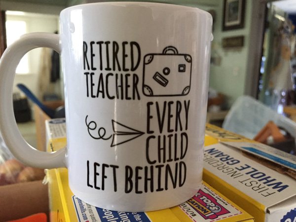
This is why we were able to take a road trip in mid-August. It is finally sinking in for Dan that he isn't going back after a summer break.

We still weren't ready on Wednesday, the day of departure. I had told Dan that we WERE LEAVING IN THE MORNING. We did, but it was almost noon before we drove out of the driveway. The plan was to drive as far as we could, not stopping at all of the California and Oregon trail markers like we usually do because we wanted more time at the other end of the trip. For that reason and because I was not the driver-in-charge I have a lot of  "drive-by" photos. Many were deleted but some are OK and those are what I'll share.

Fernly Sink & Hot Springs Mtns, NV

We were driving I-80. I love the scenery of the west, even in the Nevada desert. This is the Hot Springs Mountains that rise above the Fernley Sink.

Fernly Sink & Hot Springs Mtns, NV

According to Wikipedia, an irrigation system was constructed in the early to mid-1900s and "a drainage system was also constructed to carry away excess water and mineral salts from the farmlands. This system consists of channels (5 to 15 feet deep) dug adjacent to fields; it eventually terminates in the sink northeast of Fernley."

40-mile desert-NV

We didn't stop at all the roadside points of interest but this was at a rest stop. Throughout this trip we thought about the pioneer trails. They are well marked in the road atlases that we have for each state and along the highways. I can't even imagine what it would have been like to pack up the family and head west in the way that the pioneers did. We drove through the 40-mile desert in a little over 1/2 hour.

East of Valmy, NV

The mountains east of Valmy, Nevada.

East of Valmy, NV

We remember Valmy for it's rest stop where we slept on one of our road trips a couple of years ago when there was a tremendous moth invasion. We didn't need to stop to sleep here this time. Still daylight.

Humboldt Range, NV

Humboldt Range, southeast of Wells, Nevada.

West of Wells, NV

These photos were looking back west as the sunset.

West of Wells, NV

I had to lean over the seat and reach behind Dan while holding and pointing the phone and the camera in the general direction.

Even though it was getting dark we weren't ready to stop. If we had left earlier in the day we would made it to Salt Lake City. So Dan kept driving. There is a distinct difference in the town of West Wendover (NV) and Wendover (UT). Bright flashing (gaudy) lights and Last Chance To Gamble on one side of the border and dark and "normal" on the other side. Dan kept driving. We passed through the Great Salt Lake Desert in the dark and finally stopped at a rest stop at the east side of the salt flats.

Those of you who read my blog know that I have written a sort of travel journal with photos each year for the past several years when we have made our annual road trips. I have no idea how many people actually read these, but I write these blog posts because they substitute for the old scrapbooks and photo albums that I was never able to keep up with. I also like reviewing the photos and looking up some of the information that I may have forgotten. It helps me keep it all organized in my brain. If you are one of the regular readers, I'd love to know about it. Stay tuned for Day 2.


Getting Ready

It is always work to get ready to go somewhere. In my case I cram in all the things that I would probably put off if I were here, but now feel like they have to be done before I go. Part of it is to try and make things as foolproof as possible so that the people taking care of things don't face issues. IMG_1334

Now that the tractor finally works (sort of) I spent some time mowing. Then I wanted to try "spreading" manure. Spreading is in quotes because we don't have a manure spreader. I have a tractor with a bucket and me with a shovel. Not practical...

IMG_1329

...even though I have made some darn fine compost.

IMG_1328

To make good compost the manure pile needs turning now and then, but the dryness on the top is deceptive. It's wet underneath and it's easy to get the tractor stuck--which requires me with the shovel again. Move onto other things that need doing.

IMG_1338

The ewes are on pasture and the white net fences are moved around to change the paddock to be grazed. I moved the ewes to the side of the pasture where there is less risk of them rubbing on a gate and inadvertently (or on purpose) pushing things out of wack while I'm gone.

IMG_1339

It's hard to see in this photo but I set up the next three fences so that my kids don't have to do it. They will have to close one but then the sheep just go to the next. There are always tricky things (like where there is concrete so the stakes for the fence don't go in all the way and where you have to block off the irrigation ditch so they sheep can't go under the fence, etc)

IMG_1341

I had the ram lambs grazing in the back but don't want fence-to-fence contact with them and the ewes so they had to be moved. These are the panels that were keeping them away from the ewes while grazing the back. There is no water in that back field so they needed access to the corral for water. I'm going to leave this in place so that the ewes won't be near the big ram fence (not a big fence, although it is double, but the big rams). I don't need any more reason for the rams to try and mangle their fence while we're gone.

IMG_1317

They did this just yesterday.

IMG_1335

Here is a temporary fix. They also beat up the other wall and pushed it away from the corner post. That green panel in the upper photo is keeping them away from that part of their shed. Not fixes, but hopefully stopping further destruction for now. I expect when I get back that wire panel over the hole will be mangled as well.

IMG_1336

Rusty doing his job of keeping the rams away while we put up the wire panel.

IMG_1321

I said that I need to move the ram lambs out of the pasture. Ginny helps with that.

IMG_1323

You can see Ginny behind here. She doesn't work with finesse, but she can do the job.

IMG_1315

Back up at the house, the birds are starting to get to my black sunflower seeds. These are for future dyeing projects.

IMG_1316

I put net bags and bird netting over the flowers.

IMG_1343

I water the garden and picked coreopsis. A friend will come and pick during the week to keep the flowers blooming and take squash from the plant that is taking over. The beans in the foreground look great but haven't produced anything yet.

IMG_1340

This is the wether in with Peyton. He had his leg through the front of the coat the other day so I caught him to take it off. Don't want that happening while I'm gone and I didn't have a needle and thread handy to make it smaller.

IMG_1351

I was watering my barrels that have been neglected. Ginny knew where my attention was and placed her ball appropriately.

When condense into a few photos this doesn't seem like much but I was going non-stop yesterday. I realized at about 9 p.m. that all I'd eaten was granola in the morning and watermelon through the day--it was too hot to want anything else. I am now  gathering up the last of the stuff to take. Where is that book about my camera?

IMG_1353

Here is a hint about the road trip. Do you think I have enough reading material with me?

MJ Adventure Team Goes to MD - Day 7 - Ponies!

It's been almost a month since we started embarked on this trip so I guess I've had extended enjoyment while organizing photos and thinking about the blog posts.  I don't know how many people really read my posts, but there have been some who have asked "what about the ponies?" Day 6 was spent learning about Fort McHenry and exploring Harriet Tubman Underground Railroad. We spent a comfortable night at our AirB&B in Berlin and got on the road in time to get to the Assateague Island National Seashore...  DSC_1017

...when the Visitor Center opened. The area is managed jointly by the National Park Service and Maryland Park Service.

DSC_1019

Assateague Island is a barrier island that is 37 miles long and separated from the mainland by Chincoteague Bay and Sinepuxent Bay. The northern two thirds is in Maryland and the southern one third is part of Virginia. If you were a horse-crazy girl once then what you know about these islands is that there are wild ponies living there, made famous by Marguerite Henry's book, Misty of Chincoteague.  We had come to find the ponies.

DSC_1025

Only part of  the island is accessible on a paved road that connects campgrounds and trails. We hadn't gone far when we found them. Ponies!

DSC_1021

Just pretend that you don't know that they were in a parking lot near the bathrooms. Signs everywhere warn people to leave the ponies alone and don't offer food. It's the same kind of warnings that you read in Yellowstone about not feeding bears and packing food away. People are kicked and bitten by ponies and the ponies are hit by cars when they get used to people offering food.

These ponies didn't seem to be going anywhere soon...

DSC_1029

...so we walked to the beach.

IMG_9633

We had made it to the Atlantic.

DSC_1035

That is Ocean City, about 10 miles north. Can you see the ferris wheel and the amusement park in the middle of the photo? What a contrast when looking from the National Seashore.

DSC_1038

The barrier islands are "among the most dynamic landforms on earth". There is constant change. Assateague Island is moving west, at an accelerated rate after jetties were constructed near Ocean City in the 1930s.  At one time Assateague Island was to be developed, and in the 1950s a 15-mile road was created on the Maryland side of the island. A hurricane in 1962 wiped out structures and covered the road, and legislation in 1965 created the National Seashore.

DSC_1070

The ponies are most likely descendants of horses that were brought to the island 300 years ago by farmers who took advantage of the natural "corral" made of water. Farmers were required to pay taxes on their livestock and by turning them loose on the island, they could avoid the tax. I usually try to be scientifically accurate about what I write, but there is some artistic license here. The documentation from the Park Service says that genetically these are HORSES, not PONIES. The small stature is a result of years of adaptation to a diet of abundant, but nutrient-poor salt-marsh grasses.

DSC_1064

Sorry. I will continue to call them ponies while I'm talking about our visit. They are used to paparazzi. We were lucky to be visiting in the off-season and on a weekday. There were very few people around. It would have been a very different scene if the parking lots and roads were full.

DSC_1044

The ponies wandered off and we drove on to find more.

DSC_1078

This looked like a very old pony at an empty campground. The Maryland ponies are managed as wildlife are. From the brochure, "While action may be taken to end the suffering of a gravely ill, seriously injured, or dying horse, no measure are taken to prolong the lives of Maryland's wild horses. As with other species of Assateague wildlife, horses that are sick or weak do not survive." The population is controlled using a non-hormonal, non-invasive vaccine, administered by a dart, to prevent pregnancy. With this method the birth rate has been lowered to fewer than ten foals each year which maintains the population at under 125 horses.

A fence that separates the Maryland and  Virginia herds. The Virginia herd is privately owned and produces 60-90 foals each year. The foals are sold at auction after the annual swim from Assateague Island to Chincoteague Island and the proceeds go to veterinary care, the fire department, and various charities. There are week-long festivities around this event and you can see videos at this link.

DSC_1103

There are three nature walk trails through the marsh, the forest, and the dunes. We started with the marsh trail.

DSC_1100

DSC_1088

We spotted this osprey that had caught a fish.

DSC_1107

We watched for quite awhile while it circled, still carrying it's fish.

DSC_1116

Diamondback terrapins.

American Oystercatcher-Laughing Gull

Two laughing gulls and an American oystercatcher...

American Oystercatcher-Laughing Gull

...who was not welcome.

Short billed dowitcher

Short-billed dowitcher.

IMG_9649

DSC_1189

We drove down another road...


DSC_1190

...where we saw a group of people gathered. From my Yellowstone experience (people stopping in the road when wildlife is spotted), I figured that that meant Ponies!

DSC_1200

This group was a little more picturesque, being "in the wild" instead of "in the parking lot".

DSC_1203

DSC_1210

DSC_1245-2

There was a Pony Patrol volunteer with that group of people answering questions and making sure that ponies aren't harassed.

We drove to the next trail--the forest nature trail.

IMG_9650

Loblolly pines are the dominate forest species.

DSC_1301

DSC_1299

DSC_1297

Poison ivy.

IMG_9652

IMG_9645

IMG_9641

DSC_1275

At the end of that trail we saw the same group of ponies, but from a different view. Notice the paddle-boarders in the marsh. What a great way to see the marsh and the ponies.

One more interesting pony fact: "The Assateague horses drink over twice the amount of water that domesticated horses will due to their salty food supply. All that drinking combined with a high salt diet contributes to their bloated appearance."

DSC_1307

We drove to the Dune Nature Trail.

IMG_9653

Chris needed some beach time so Kathleen and I walked the trail while Chris enjoyed the beach, albeit a bit cold and windy.

IMG_9655

DSC_1328

DSC_1332

Remember the road that I said was built in the 1950s? Part of it is still visible.

DSC_1341

DSC_1323

IMG_9630

IMG_9631

As we left the park we were faced with that age-old question.

DSC_1351

"Why does the pony cross the road?"

DSC_1352

Because the grass is greener?

This was another full day (and a very full blog post) but there is more Maryland scenery. That will be another post.