MJ Adventure Team Goes to MD - Day 6 - Ft. McHenry
/It is taking me a long time to tell the rest of the stories about this trip but I want to finish. One reason I do this is that it makes me sort through my photos and jot down some notes before I forget. I also do a little more research into the history part to solidify that in my brain, at least temporarily. That is also why I don't get too it right away, because I need the time. I left off in the last post seeing Gettysburg National Military Park and staying in the town of Gettysburg. We planned on two stops on Tuesday before getting to our final destination.
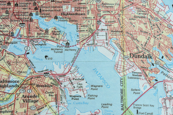
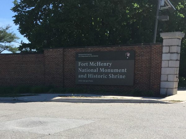
The first was Fort McHenry National Monument. It's on that point in the northwest quadrant of the map. Living on the West Coast I haven't paid much attention to the geography of the East Coast. Until I started trying to figure out where we were going on a map I hadn't realized how big Chesapeake Bay is and how much water is within the state of Maryland in the form of rivers and marshes.
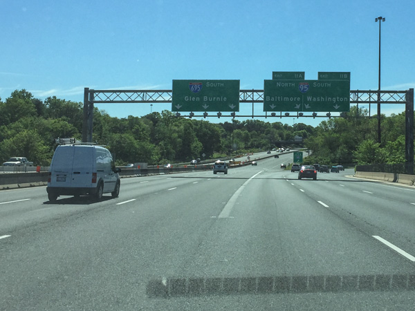
I was driving this morning so just got a few shots through the windshield. Seeing signs for Washington stood out for me.
This is in Baltimore not far from Fort McHenry. I was surprised at how little traffic we had getting through this industrial area to the fort. In fact, we had little traffic and a relatively small number of people at all the national sites we visited. The wonders of off-season and mid-week travel!
We got to the Visitor's Center just in time for the 10 minute film about the Battle of 1812 and the writing of the Star Spangled Banner, originally called "Defense of Fort M'Henry", in which Francis Scott Key described the his sighting of the American flag over the Fort after 25 hours of bombardment by British ships.
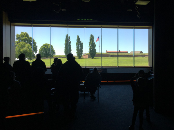
The Star Spangled Banner was sung at the end of the film and people stood as the movie screen lifted, revealing the flag flying over the fort. My telling of this doesn't invoke much emotion, but the film was so well done and the ending so dramatic that when Chris and I looked at each other we both had tears in our eyes.
After that one of the Park Volunteers invited everyone to come outside and participate in a flag ceremony.
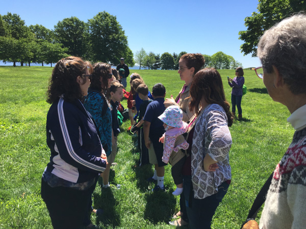
Everyone lined up in two rows facing each other.
A flag was brought out of what looked like a large duffel bag and was carried down the line of people. When the entire length was being supported then we all stepped back.
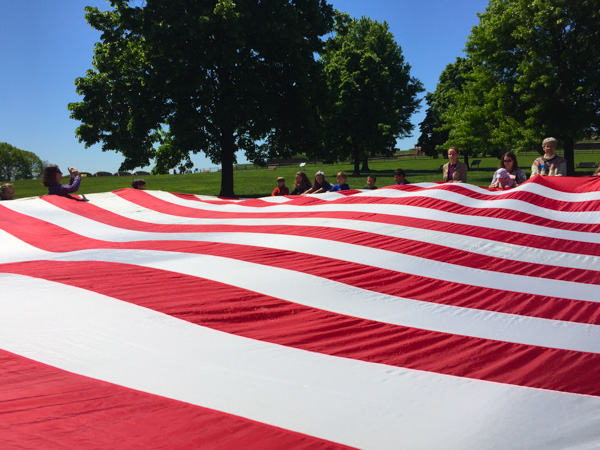
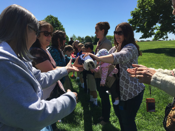
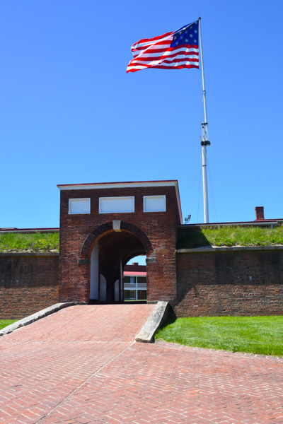
This revealed a replica of the 32' x 40' garrison flag constructed by Baltimore seamstress, Mary Pickersgill for Fort McHenry.
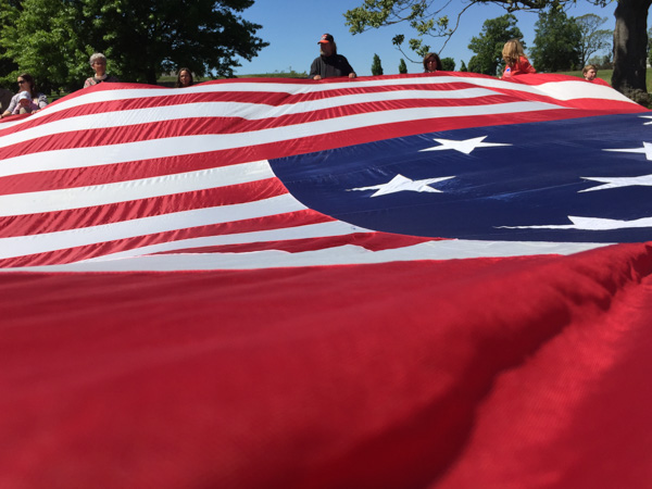
Major George Armistead, who commissioned the flag, wanted it to be large enough "that the British will have no difficulty in seeing it from a distance." 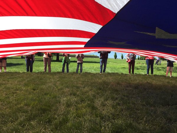
We learned that the original flag, which is in the Smithsonian, was made of dyed English wool, except for the stars which were cotton (and are 2' across!). There were 15 stripes, each 24", because in 1794 Congress had approved two additional stripes for Vermont and Kentucky be added to the original 13. It wasn't until 1818 that the stripes were reduced back to 13 to represent the original colonies and a star was added for each new state.
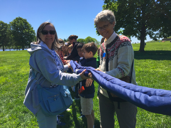
As the Park volunteer tested our new-found knowledge of the flag we rolled it back up stripe-by-stripe. We were then encouraged to learn more at the Fort.
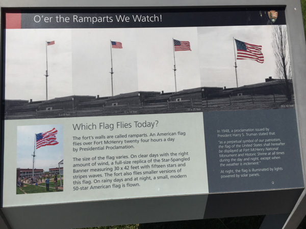
Mary Pickersgill made two flags, the large garrison flag and a smaller storm flag, 17' x 25'.
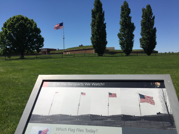
That was the one flying on this day. They use the larger flag on days with less wind.
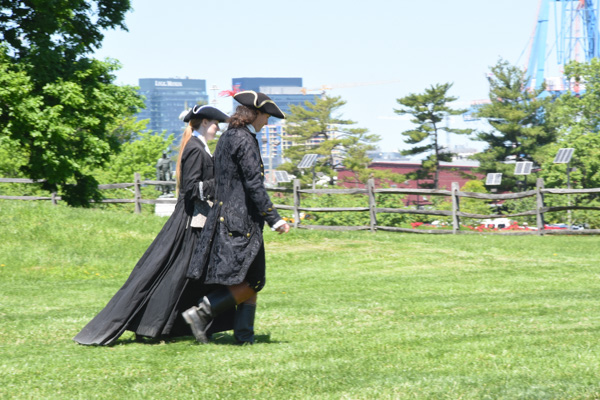
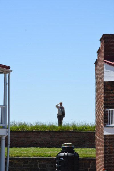
As we walked to the fort we saw this couple, an interesting contrast with the buildings in the background.
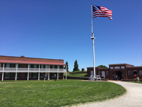
Inside the Fort, many of the rooms on the lower floor have more information and interpretive displays.
I wonder what how you'd know!
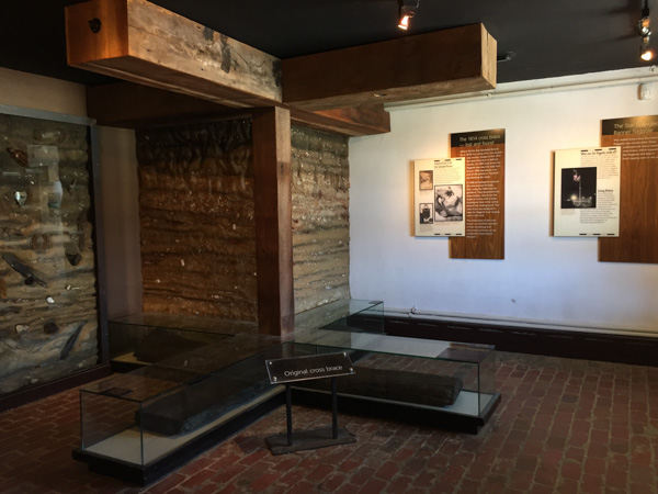
I thought it was interesting to get this perspective. The glass case encloses part of the original oak cross-brace that was underground and anchored the original flagpole. The replica cross-brace above gives perspective of the size and the depth of the lower section.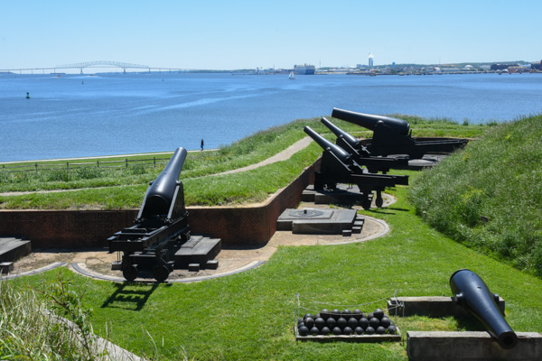
The fort is star-shaped. These cannons point down the Patapsco River where the British bomb ships were stationed and toward Chesapeake Bay beyond.
We could easily have spent more time at the Fort, absorbing more of it's history, and driven around Baltimore to see the other relevant sites, but that will have to be on the list for a future visit.
Places to go. More things to see. Stay tuned.


 This is the Virginia Memorial, including a statue of Robert E. Lee, at one of our first stops. I love horse statues.
 At this site we saw a couple of groups of school kids having a lesson in Civil War history. We listened awhile to the guide who explained things that I never thought about (importance of flags and drummers as a way to signal, for instance) and then had the kids line up in formation and "right face, left face, etc" It was cute to see most of them turn together but there were always a few that went the opposite way. Watching them reminded me of when my oldest son was in middle school and his history teacher, who was a film buff in addition to teaching history, led the kids in making a film of Pickett's Charge. The kids were dressed in home-made or scrounged clothing to look the part and carrying home-made weapons (that wooden rifle is still around here somewhere I think). The school band participated as well as some of the kids who owned horses. They played out the event and made the film out in a field owned by a local farmer. I took a photo of these kids to send Matt as a fun reminder about that, but it became less "cute" and more sobering the more we read and the more we delved into the history of what actually happened here.
  This is a view from where the kids are standing and where the Confederate troops were positioned on Seminary Ridge. Union troops were across the valley on Cemetery Ridge. This is part of a Valley that extends a couple of miles and there are significant points to the Battle of Gettysburg throughout. It is incongruous in this beauty to think of thousands of dead and dying men. And no one ever says anything about the dead and wounded horses. Add that in to the scene.
 In this idyllic view you can see the Pennsylvania Memorial across the field and to the right. There are places along the route where you read (in the guidebook) about what the aftermath of a battle looks like--the biology of death--blood, flies, bloated bodies, etc. I think that people need to hear that--does it help if we (they) are given mental pictures to try and internalize the horror of war? If kids hear that? What it really looks like? In person? Does it sink in at all what it means to kill another person? To be a bully in the most final sense? This kind of atrocity is being played out in other parts of the world now. Do kids realize how lucky we are to live here? How about us adults too?
 This is a view from the tower that includes, in the foreground, the Eisenhower National Historic Site, the home and farm of Eisenhower that he bought in 1950. We ran out of time to visit that.
 This view is from Little Round Top, a point controlled by Union soldiers. The rock formation below is known as Devil's Den and the foreground is Slaughter Pen. There was fierce fighting as Confederate soldiers in a line a mile long approached from the far ridge and the Union soldiers tried to defend it. That description is too simplistic; there is detailed documentation about each battle site and each battle.
 I don't remember details of this house but it is along the tour route.
 Near the end of the tour we were at what is known as the High Water Mark, the farthest point reached by Confederate soldiers during the Battle of Gettysburg.
 From the Park brochure: "July 3...Some 12,000 Confederates advanced across open fields toward the Federal center in an attack known as 'Pickett's Charge'. The attack failed and cost Lee over 5,000 soldiers in one hour. The Battle of Gettysburg was over."
 Completed in 1914, the Pennsylvania Memorial is the largest State Memorial in the Park and is near the High Water Mark.
 The auto tour was almost over. Instead of the 2-1/2 to 3 hours described in the brochure I think we were there for about 5 hours.
 The tour ended at the Soldier's National Cemetery, created after the battle, and where 3500 Union soldiers were later buried. Remains of 3,320 Confederate soldiers were removed from the battlefield to cemeteries in the South. Veterans from 1898 War with Spain to the Vietnam War are also buried here.


 Chris drove and I got into my usual Road Trip mode--Map Book and phone.


