Road Trip to Texas - Day 10 (part 1)
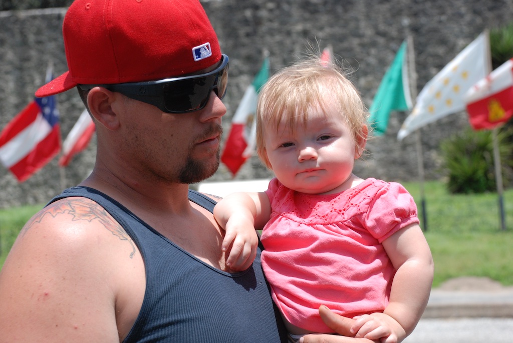
It may seem silly to go back three weeks to finish up my Road Trip blogs, but I don't want to leave it unfinished. This blog has become my scrapbook that I would never do on paper.  And I have had a lot of feedback that you who read the blog like the Road Trip series. I left off on Day 9, so here is Day 10, split into two parts because that's how the day seemed. I'll warn you now; there are a lot of photos.DSC_7386We were packing the truck. I wondered if Kirby would miss us for a little while because we'd been there for four days. Probably not, but I hope that she will remember me next time I see her.DSC_7404
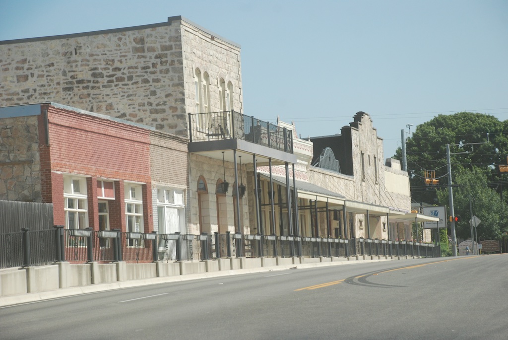
Saying goodbye was hard for Dan and me.DSC_7395 KirbyTime to leave. I needed to be home by Friday.

Blanco? 
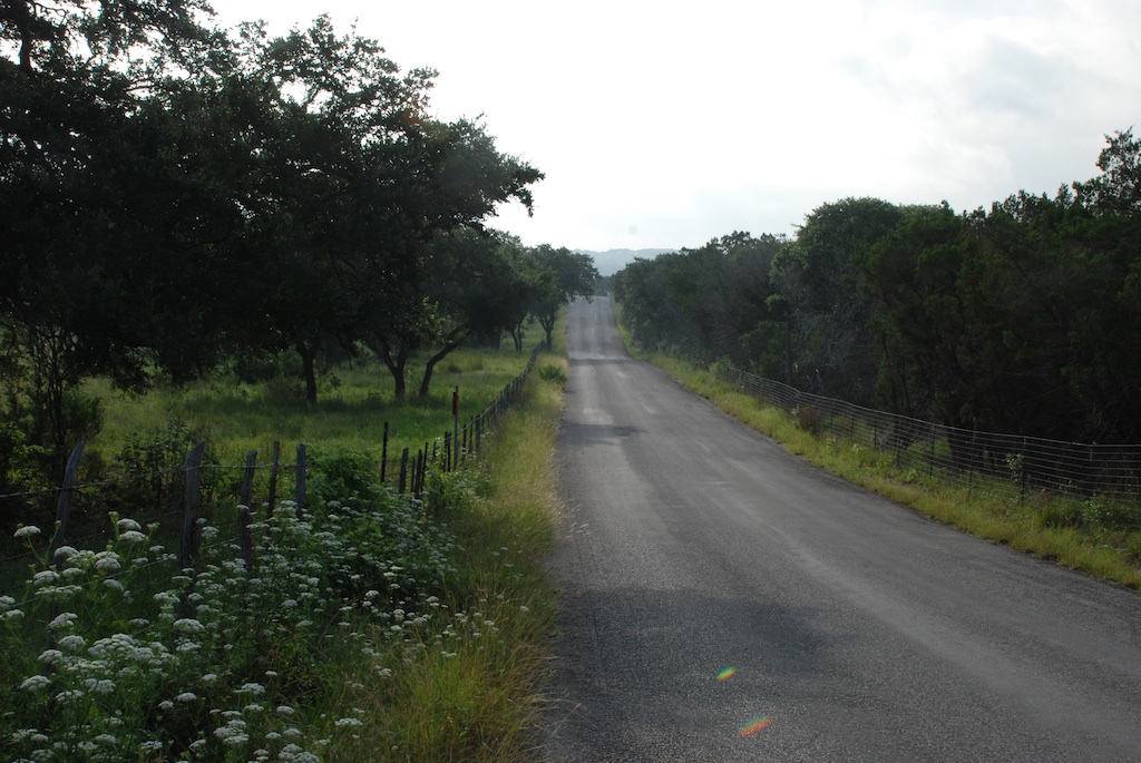
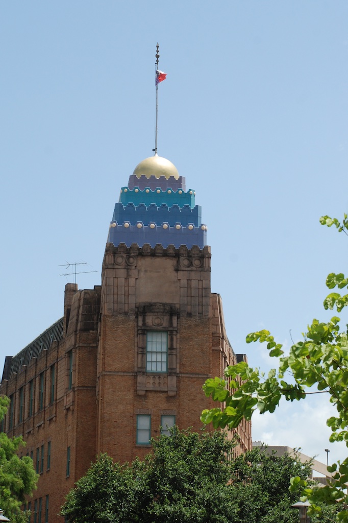
Now that it's been so long until I sorted this batch of photos I forget where some of them were taken. I think this is the town of Blanco, the closest town to where we were visiting.

This is peach season in the Hill Country and wanted to make a stop and maybe pick up a few more gifts for farm-sitters.
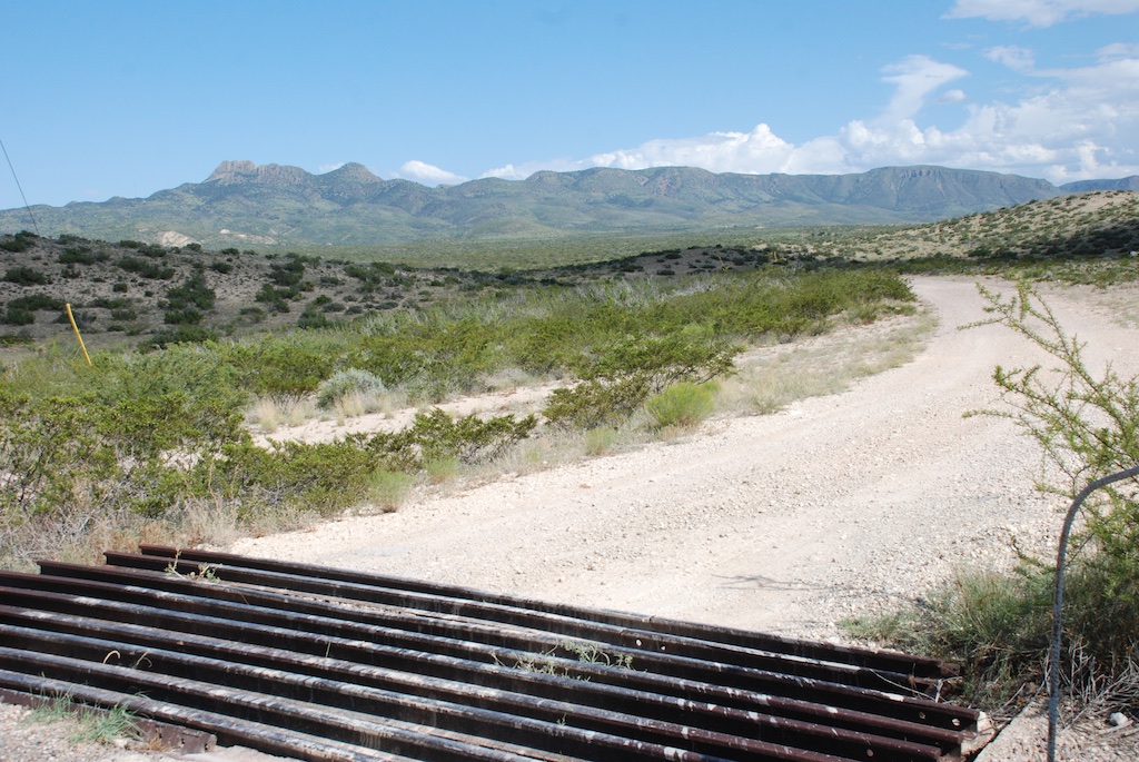
peach stand

peaches

peach stand (1)Here is where they sort the peaches.peach stand (2)And here is where they bake pies and other delectables. It smelled wonderful inside. I was so tempted to buy a pie, but instead I bought fresh peaches and jam and...peach ice cream...this for the road...trying to ease the sadness of leaving our family behind.DSC_7444I amused myself by taking photos on the road (thinking that I would remember where they were taken).  I have not cropped or edited these photos. They include the squashbugs (as my brother and I used to call them) and glare on the windshield.

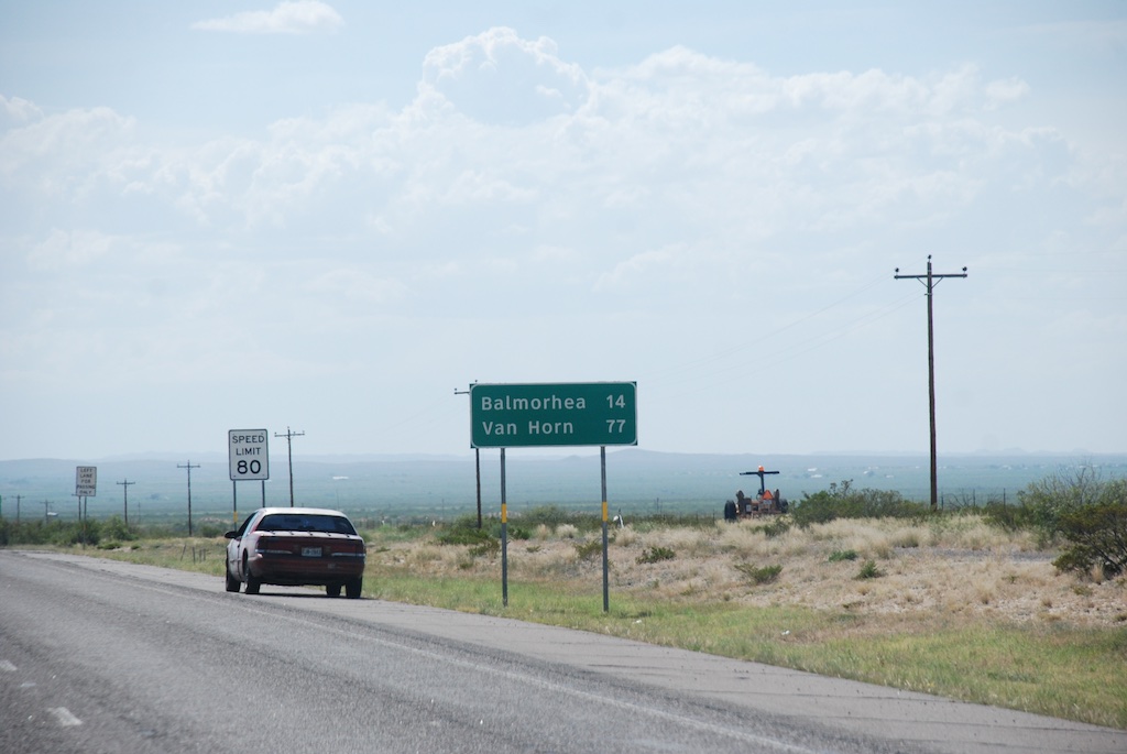
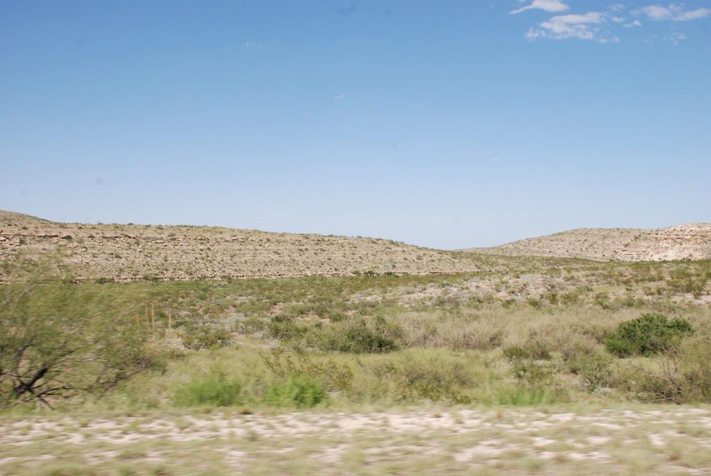
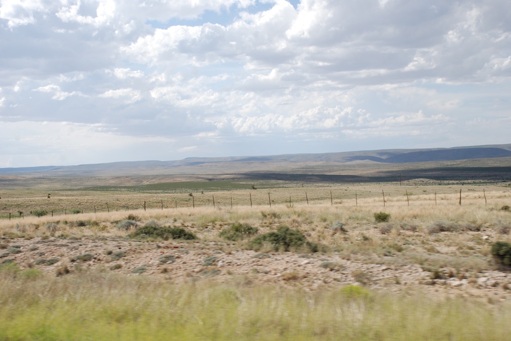
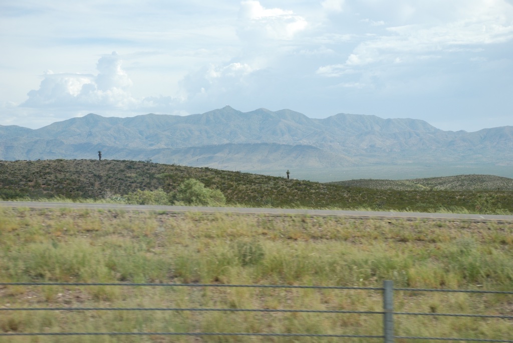
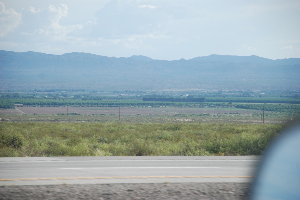
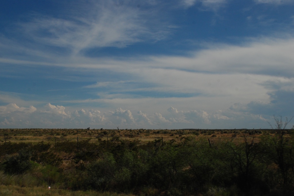
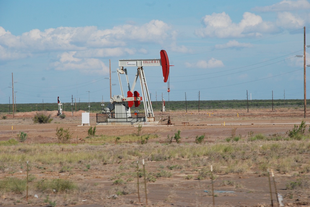
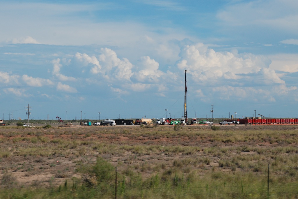
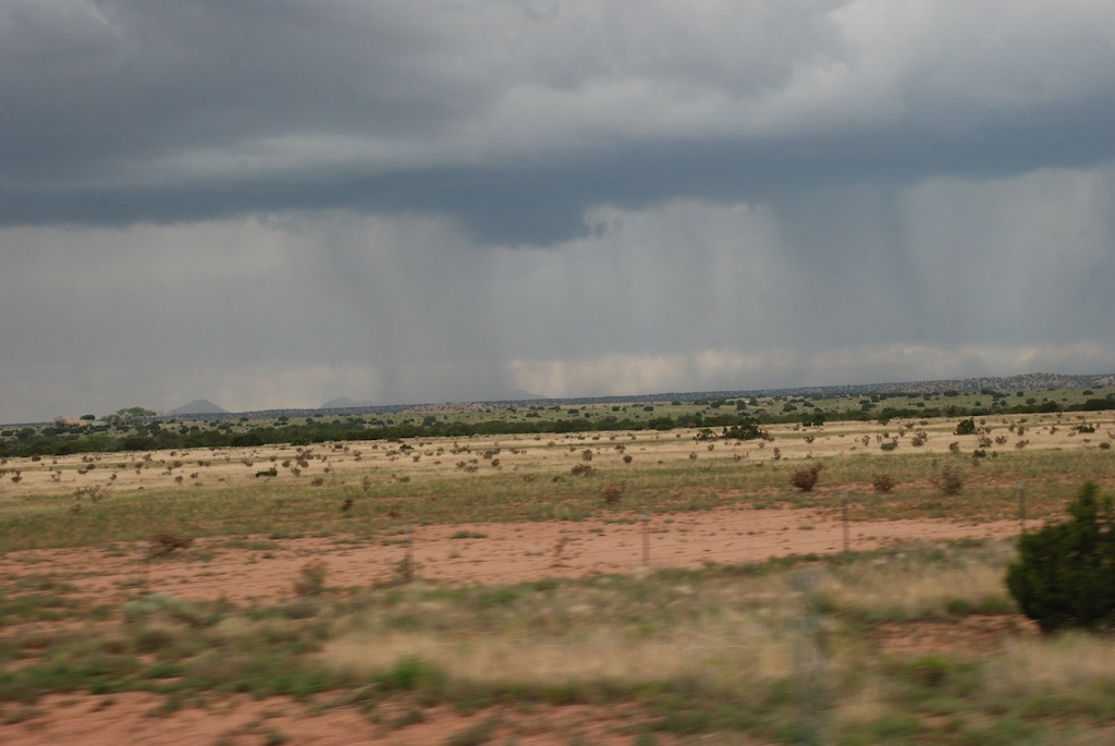
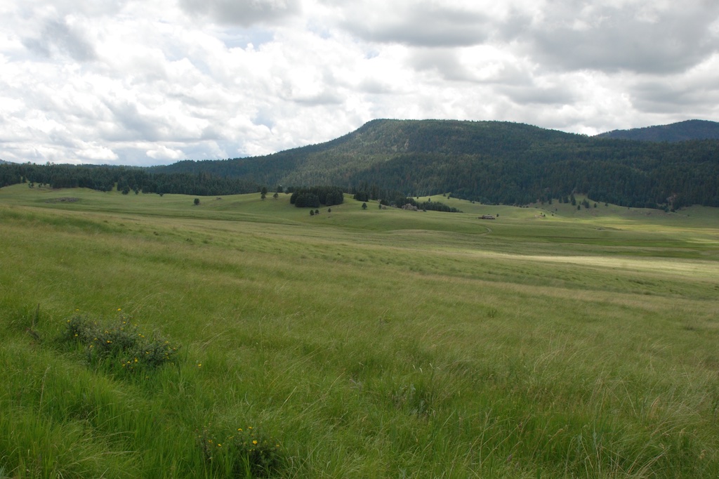
Texas is a big place. The country is not all what I had envisioned. DSC_7458
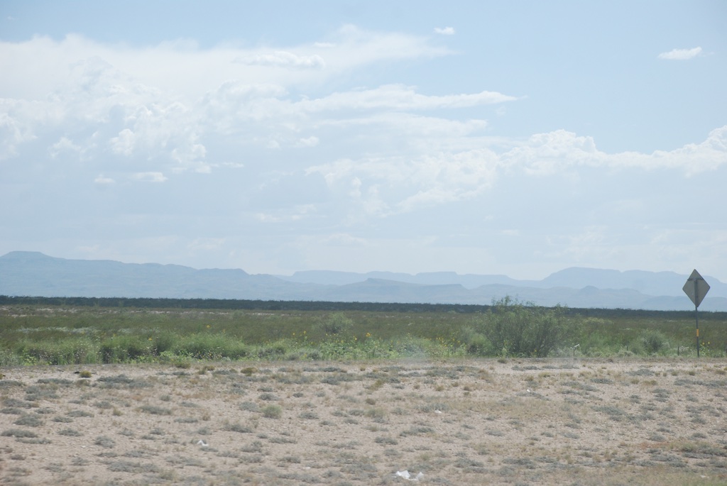
There are more mountains than I expected.DSC_7469And more greenery. Even towards West Texas there is agriculture anywhere there is consistent water.DSC_7454

DSC_7463

Hwy 10, TXAt this gas stop I walked out back...Davis Mountains, TX...and took photos of the gorgeous Davis Mountains to the south.

DSC_7467 DSC_7471 DSC_7473 DSC_7487 
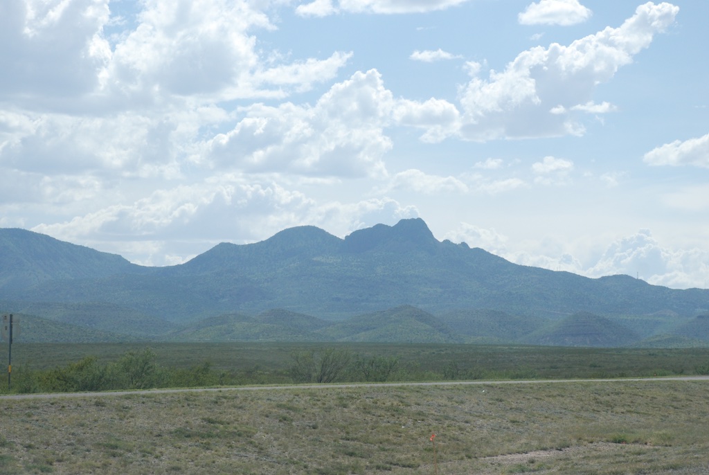
The simple descriptor I kept thinking was Big.

DSC_7488 DSC_7498 DSC_7499

Rio Grande Valley
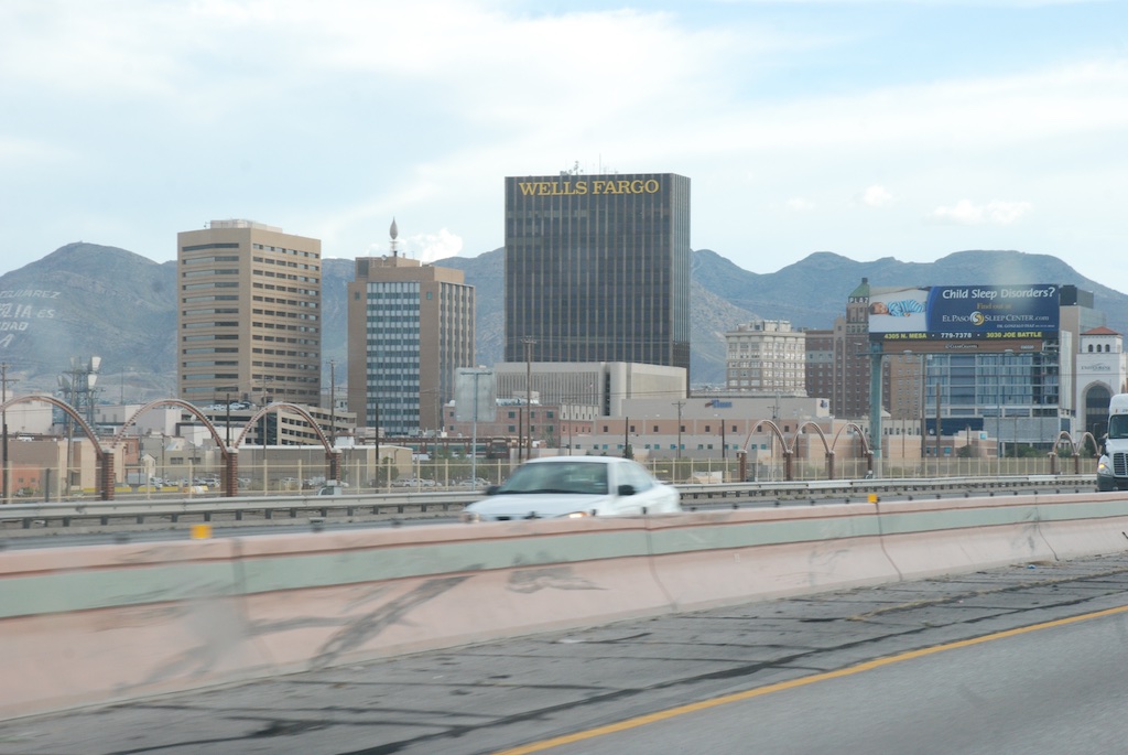
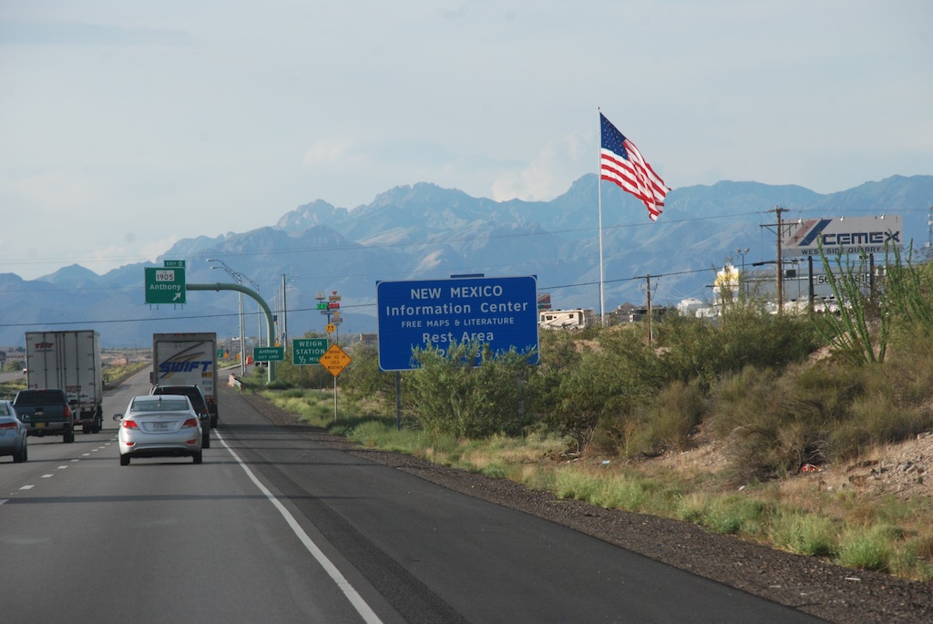
Dropping into the Rio Grande valley.El Paso, TX
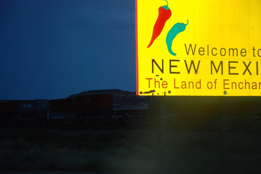
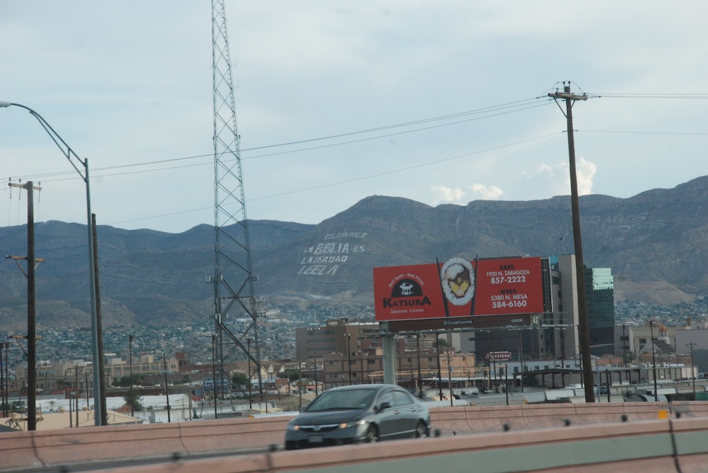
El Paso, on the U.S./Mexico border.
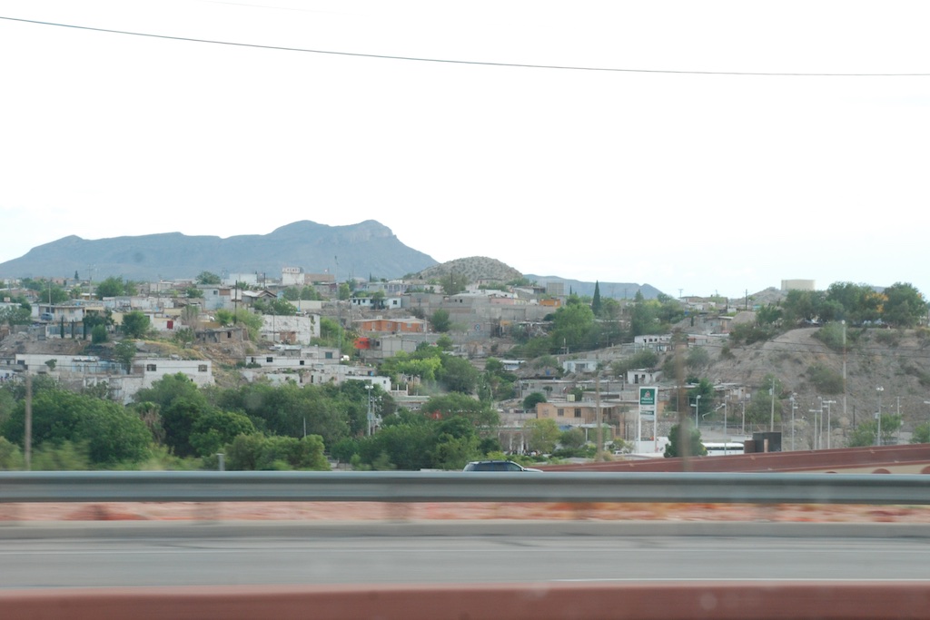
DSC_7520 DSC_7521 DSC_7525

US-Mexico fenceThe border fence.

DSC_7530 The end of this blog post but not the day. More in the next post.

Road Trip to Texas - Day 9

We had been in the car for 8 days. We stayed in place for most of this day, our last day to visit Katie, Kurtis, and Kirby.DSC_7380I babysat (grandmothered) most of the day while Dan and Katie worked outside. DSC_7376 Surprisingly (or maybe not when holding a squirming baby) I didn't take many photos.

At dinner time we went to "get BBQ". IMG_5348I hadn't realized that I'd never had "real BBQ".

IMG_5347 Kirby had been asleep in the car. She's wearing one of several outfits given to her by her Aunt Meryl.

IMG_5349 At a real BBQ place you buy your main course by the pound...IMG_5353...and add "sides" like pecan cobbler, peach cobbler, sweet potatoes (with marshmallows on top) and beans. Katie made sure that we didn't miss out on pickles, onions, and bread.

IMG_5352   I think you'll agree that this is one nice looking family.

IMG_5355

IMG_5356I took this photo inside the bathroom because I liked the idea, maybe because I'm using tin (albeit rusty and full of holes) for my upcoming State Fair display. The chalk boards in the bathroom and in each stall seemed to prevent grafitti on the walls.

Not a lot of excitement for this fourth day in Texas, but we were leaving the next day and an easy day was just fine.

Road Trip to Texas - Day 8

After our visit to the Alamo two days before we were ready for another trip into Texas history. We headed a couple of hours southeast to Goliad State Park, the location we knew as the site of the the 1836 Goliad Massacre, when General Santa Ana ordered the murder of Texas soldiers who had surrendered. But there is much more history than that.Goliad State Park-Mission E.S. (1)Our first stop was at the Mission Espiritu Santo, built in 1722, moved in 1749 to it's current location, and restored in the 1930's by the CCC, where the Spanish began "civilizing and Christianizing" the native people with the intention of making them Spanish citizens and, in doing so, destroyed the traditional cultures of the three tribes. Eventually ranching became the main occupation and there were thousand of cattle and horses on the mission lands.Goliad State Park-Mission E.S.Some of the original limestone walls exist and are left unplastered here.Door of Death at Mission Espiritu Santo
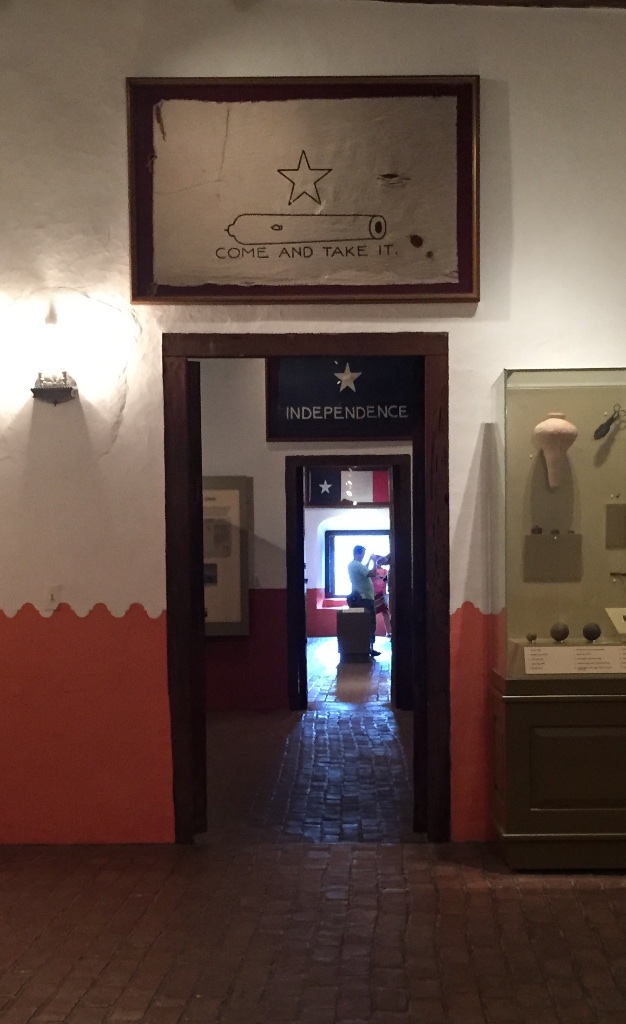
We entered the church through the Door of Life and left it through the Door of Death. Dan-conquistador helmet Dan tried on a replica of a Conquistador helmet.

DSC_7340 Kirby seemed unimpressed.Horse lubber grasshopperThere was a short nature trail outside the mission. I later identified this huge insect as a Horse Lubber grasshopper. Yikes!Goliad State Park-PresidioThe next stop was just across the San Antonio River, at the Presidio La Bahia,"the only Spanish fortress for the entire Gulf Coast from the mouth of the Rio Grande to the Mississippi River" (Wikipedia)IMG_5310Nine flags indicate the changes in control of the region.DSC_7374Kirby and Kurtis outside the Presidio.Goliad State Park-Presidio (1) There was a 15 minute film about the historical events at Goliad but Kirby wasn't ready to sit through that. So I took Kirby through the Presidio building where you can walk through a timeline of the history. Mescalbean, Mtn laurelAfter our tour of the Presidio Dan and I sat in the shade while Katie fed Kirby lunch in the air-conditioned car. Look at what I saw on the ground under this tree:Mescalbean, Mtn laurel (1)First I noticed the red beans. Then I saw that they came out of these pods that, honestly, look like something I'd clean up in my yard full of dogs. Later I googled "red beans from tree in southern Texas" or something like that and found that this tree is the Mescalbean or Mountain Laurel, not related to the alchoholic drink, but still with psychoactive properties.

IMG_5320  Tired girl after a long drive and a lot of sight-seeing.

Road Trip to Texas - Day 7

On our first morning in Texas I took a walk up the road, a familiar route from my time spent here a year ago while waiting for Kirby to be born.Katie's road Just as we had seen in northern Arizona and New Mexico everything was green. Summer monsoons are the norm, but there have been several dry years so this particularly wet year is a welcome change. However there can be too much of a good thing. We saw the signs on the Blanco River of the recent high water and were amazed at just how high it was. Katie's road (1)
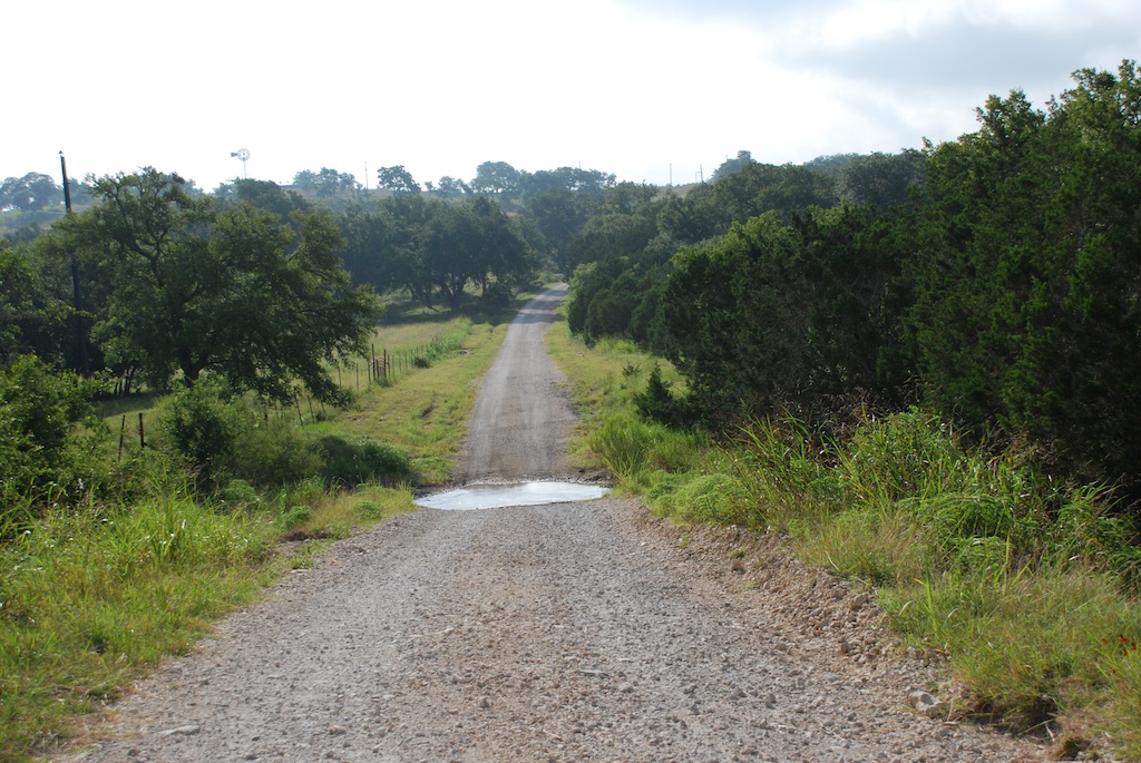
Katie and Kurtis live on high ground between Blanco and Wimberly (where the horrific May flooding swept houses and people away) so they were in no danger. This wash just down from their driveway has running water now but during the flooding was many feet higher and impassable. Hard to imagine.
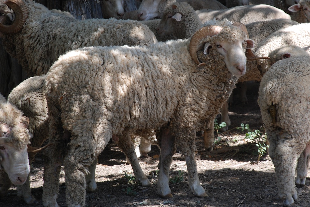
Western Horse-Nettle, Solanum dimidiatumWestern Horse Nettle All this rain has caused crop damage and postponed harvesting to the detriment (or loss) of crops in some areas. However, it sure brings out the wildflowers. I took photos of 20 different species on this short mile and a half walk and identified some of them.Green thread, Thelesperma filifoliumGreen thread, Thelesperma filifolium ButtonbushButtonbush, a memorable flower that I first saw last year.

Our plan for the day was to visit a sheep farm that I found on-line. I was looking for "local wool" and this farm, only about 45 minutes from Katie's house, popped up. Dan and Annette of  Stonewall Fine Wool and Lambs were gracious enough to allow us to visit, although they usually don't have on-site customers.

Most of the flock of Delaine Merino x Corriedale x Ramboulillet sheep, descendants of the original flock owned by Annette's family, were somewhere else on the 129 acres but ...Ram at Stonewall Farm...the rams...DSC_7231...and some lambs for sale were near the barn.DSC_7261Dan had fleeces ready for me to see and we spread them out on the table. He shears the sheep himself, although he has to fit shearing in around another full-time job.  DSC_7258DSC_7243He showed me these boxes of fleece--sorted, but unscoured staples on the left and washed wool on the right. What a transformation!DSC_7251The washed wool is very, very soft. I think it passed the "soft as a baby's skin" test.DSC_7255I was also impressed that Dan had made himself a drop spindle and taught himself how to spin.DSC_7267You know that I don't really NEED any more wool, but some of it followed me right into the car. I plan to share with my farm-sitting friends. Thanks very much to Dan and Annette for taking a couple of hours on their weekend to entertain us.

Next stop only a few miles up the road was the Wildseed Farm,  a  working farm that grows and sells wildflower seed to wholesale and retail customers.DSC_7274We were planning to go to this farm two days ago after a brief tour of the National Museum of the Pacific War in Fredericksburg, but as I explained in this post, the Museum requires a several hour visit to do it justice.

We missed the true wildflower season when all 217 acres are blooming, but there was still plenty to see.steel cactusThose saguaro, barrel cactus, and beavertail cactus  and are all metal! butterfly garden (1) We walked through the Butterfly Garden.butterfly gardenMore plants from the butterfly garden.DSC_7283

butterfly garden (2) More of the butterfly Garden.

DSC_7323Last we admired the fields of red and white zinnias and sunspot sunflower...

DSC_7328 ...and then piled back into the car. Kirby was a real trooper.

One more place to stop on the tour of points of interest near Fredericksburg and Stonewall, since it was on the way.

LBJ State Park (1) There is a visitor's center and a tour through the LBJ home but, due to one of our party being under a year old and it had already been a busy day, we opted for the 8-mile driving tour of the ranch where LBJ was born, died (1973), and is buried. Someday we'll return for the whole experience.

LBJ State Park (2) This is a beautiful estate, a portion of which was donated to the National Park Service (by prior arrangement) after the death of Mrs. Johnson in 2007.

LBJ State Park A stipulation of Johnson was that this remain a working cattle ranch rather than become "a sterile relic of the past". The cattle on the ranch descend from the horned Herefords that he raised and he kept a close watch on management even during his tenure in the White House.

Road Trip to Texas - Day 6

We had done our Texas homework by watching Texas Rising, a five part fictionalized series about Texas Independence. It was not, in my opinion, great TV, but it prompted me to google the historical events as we were watching. So we felt prepared to see some of the sites that are important to that part of Texas history. Today's goal was to visit the Alamo, about an hour away.Kirby at the officeFirst we stopped at Katie's office and went to lunch with her co-workers. Then we drove to San Antonio.Old & New-AlamoThe Alamo site is an interesting juxtaposition of the old and the new. The lower stone wall  surrounds the Mission grounds.Old & New-Alamo (1)The Alamo site encompasses a block in downtown San Antonio with newer buildings rising around it.  DSC_7112 Photography is not allowed inside the church at The Alamo. There was a long line waiting to go in, but the line moved quickly.Kirby at the Alamo I was amused to watch Kirby's reaction to waiting in line. It is as if there are two separate worlds--the upper level and the stroller level. There were plenty of strollers and wheelchairs to keep Kirby interested during the wait and the walk around the grounds.oak treeOne of several magnificent trees on the grounds. Dan and I have commented that we have seen some of the most beautiful big oak trees while driving through Texas.

mural-riverwalk After touring the church and walking around the grounds we walked along the downtown's River Walk.San AntonioI admired this building for it's colorful tower and the unusual shape.Kirby in poolAfter a long drive and a lot of walking around in the heat what better way to end the day?

Road Trip to Texas - Day 4

We woke up in Roswell and left town fairly early so that we would have plenty time to explore Carlsbad Caverns National Park.Roswell, NMYou can't miss the main attraction as you drive through town. Winslow has The Corner. Roswell has Aliens.Carlsbad caverns NPWe made it to the park by mid-morning. Carlsbad caverns NP (1) Most people enter the cave at this entrance where you can also watch the flight of 400,000 Mexican bats leaving each evening. (Fact: A bat eats half it's body weight of insects every night.) 

These photos don't begin to show the enormity or the depth of this cave. The main room and caverns are over 750 feet (75 stories) below the surface.IMG_5202The main entrance is a series of switchbacks--those squiggles on the far left of this diagram.IMG_5183
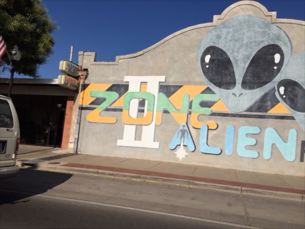
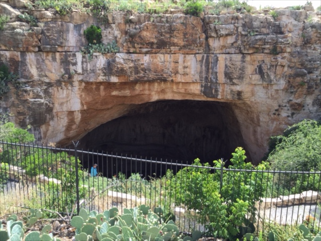
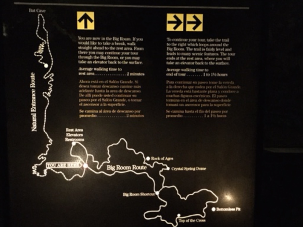
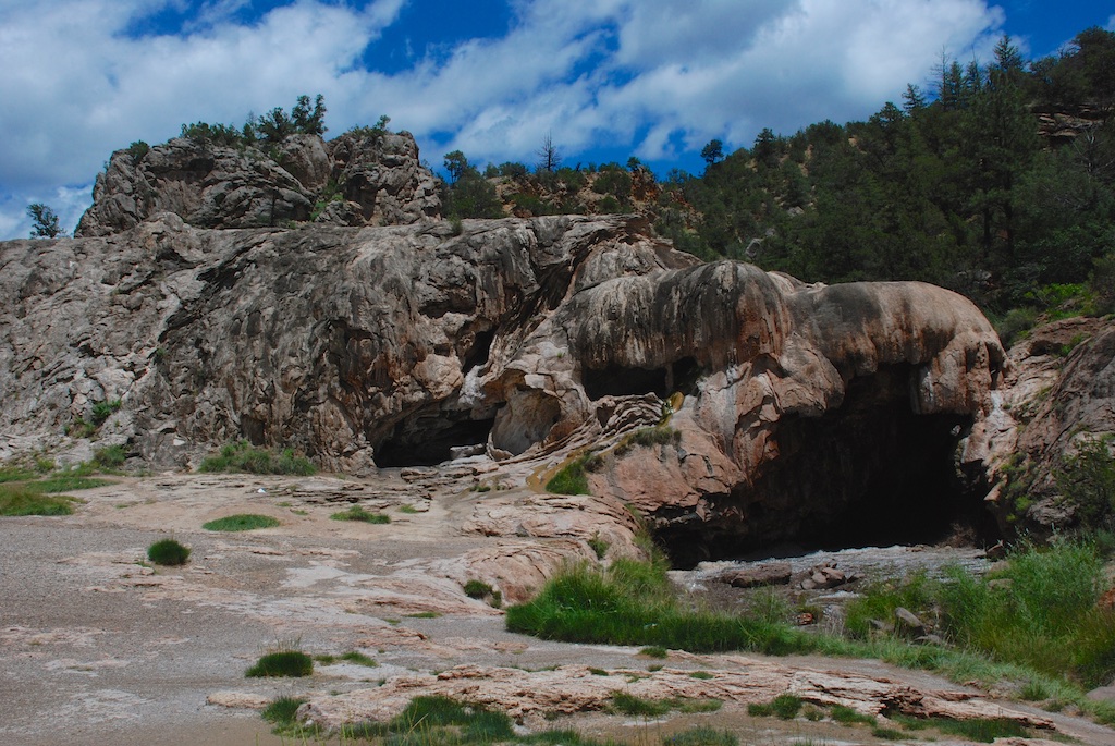
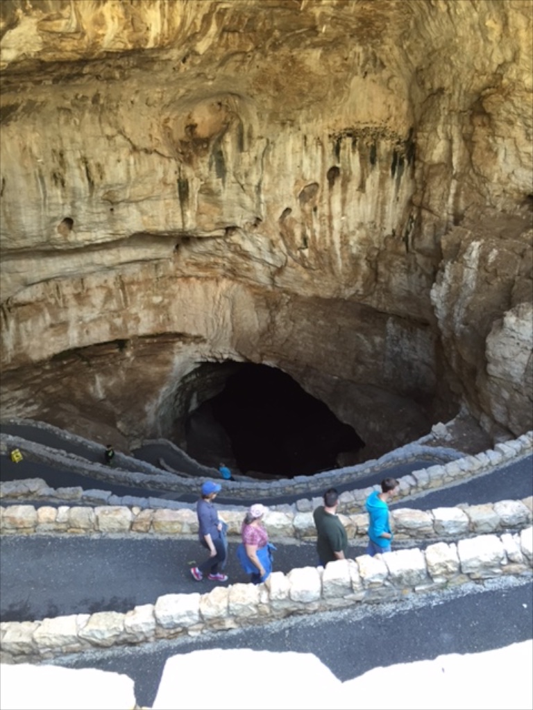
The bats roost inside the cave in an area closed to the public. Cave swallows roost in the entrance.IMG_5185

IMG_5190This is still on the descent where there is just barely enough natural light for a photo. The rest of the cave is illuminated enough so that flashlights aren't necessary but I had the thought that it is good that the trail is asphalt and well maintained because you really can't see where your feet are stepping. (It is also necessary because of the number of visitors to the cave. There were one million by 1937.)

Carlsbad caverns NP (2) This is how people explored in the early days. Yikes! I think the sign said that this ladder drops down 90 feet.IMG_5206I have very few photos from inside because you just can't do it justice without a tripod. We walked both main loops of the trail which covers about two miles. The Big Room is the largest known natural limestone chamber in the Western Hemisphere and floor space is estimated at more than 600,000 square feet. There are other portions to explore if you go on a guided tour and there is another level that extends for a mile 90 feet below where we were. In addition they said there are over 100 miles of passages  beyond.

Carlsbad caverns NP (3) This model in the visitor center shows the visitor center at the top and the extent of the cave that is open to visitors below. The entrance is that upper portion at the back of the photo and the trail descends the switchbacks along the wall. When you finish walking the trail you return to the visitor center via an elevator (the tube in the photo) that takes you the 75 stories up.

Not only is the cave impressive, but it is amazing to think of the first explorers and later the engineering and construction feat to develop the cave for visitor access. The first elevators were constructed in the early 1930's.

After touring the cave and the visitor center we drove the 9-mile Walnut Canyon loop which gives a look at a bit of the above-ground part of the park.Pano of Walnut CanyonAs during the first part of our trip the desert was green from the recent rains. This is the Chihuahuan desert, the last of the four desert landscapes (Mojave, Sonoran, and high desert) we drove through on this trip. prickly pear

DSC_7047

We left the National Park in mid-afternoon and headed tor Texas.TXI was all ready with my camera for the Welcome to Texas sign but there was none on the road we were on, however the landscape changed.

TX (1) TX Oil well (1) West Texas is known for it's oil fields...TX Oil well ...and that was the predominant feature over most of the landscape. I passed the time looking up towns and features on the iPhone. That gave insight to the history and settlement of the area.

We drove as far as San Angelo where we spent the night.

Road Trip to Texas - Day 3

On Tuesday night we drove into New Mexico  in the middle of a heavy storm. After a night in a motel we headed out for a full day of sight-seeing. We over-estimated what we could actually do in the day. It's easy to pick out all the places you want to stop when you're looking at a map but it doesn't always work out that way when you're on the road. We thought we had planned a reasonable amount of driving to see Valles Caldera National Preserve and Bandalier National Monument. After all, they are right next to each other. But as it turned out we barely got out of the car--certainly not to do any exploring of either of these parks.East of GallupWe began our drive by crossing the Continental Divide not far east of Gallup. The terrain is quite different than where we crossed the Divide last year in Yellowstone but spectacular in it's own way.DSC_6986

We drove Hwy. 40 on the way to Albuquerque and I took photos out the window.

DSC_6991  From the drive through Mojave National Preserve on Sunday to Wednesday (when I'm writing this post) I have been using my iPhone to look up information about towns we are passing. A continuing theme is the significance of the railroad in the history of the west and the rise (and fall) of many of the towns. We saw plenty of trains during this drive, starting with the grade in the Tehachapi's in California.

About ten miles from Albuquerque we turned north to drive a scenic loop which would take us to Valles Caldera and Bandalier.Jemez River-Soda Dam We stopped along Jemez River at a sign for Soda Dam. This dam was formed over centuries by deposits of calcium carbonate and is still forming as the river runs under it. It is 300 feet long, 50 feet high, and 50 feet wide at the base. The river was flowing fast.

Jemez River, muddy water  We were surprised by the muddy water, a result of the previous night's storms.

The drive continued to Valles Caldera National Preserve. I had read that this is a Preserve formed by volcanic activity and I had expected to see lava and cinder cone types of landscape as we have seen in other parks. I had no idea that we were going to see a gorgeous grassland. Valles Caldera Natl PreserveThis is some of the most spectacular country I have seen. We stood over this caldera in awe and the photos certainly don't do it justice.Valles Caldera Natl Preserve (1)
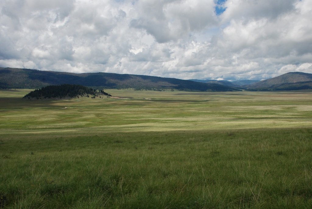
According to the sign we were standing on the rim of a collapsed super-volcano, 12 miles in diameter and magma is only 5 miles beneath.

Here we faced a dilemma. We had just arrived and what a beautiful place to explore, but it was already mid-afternoon. We had another park to see, a potential errand in Santa Fe, and, as Dan reminded me, our real goal of this trip was to get to Texas by Thursday. So we passed up this beautiful spot and drove on.

We saw a sign at the Bandelier National Monument that entrance was by shuttle only and the shuttle was caught at another location. At that point we knew that we had hopelessly overestimated what we could do in a day and decided to just head for Santa Fe.

I had a thought that maybe I could find some "locally produced wool" in Santa Fe, a city with the reputation for being an art and fiber mecca. Maybe that would have worked had I known ahead of time that I was going to be there and had done some research and planning. But this last minute attempt was an exercise in frustration. Googling "local wool in Santa Fe" got me a yarn store/coffee shop combo but all they had was some alpaca yarn from a local source--not what I was looking for. I tried again and found a woman who does sell fiber from her farm but with all the recent rain she not only hadn't shorn yet, but her road was impassable.  Lesson learned. If I had planned ahead maybe I could have managed some local wool, but not at the spur of the moment. I have been on the other end of this--people calling me to say that they are in the area and would like to shop and am I home? I also thought of my friend Stephany (and her wool-related blog) who started on a journey that led her from a San Francisco tech job to shearing sheep and to Farm Club all because she was trying to find local wool in the Bay Area.

Wow! That was a digression. My frustration about overestimating our ability to see what we wanted to and then failing at the simple task in Santa Fe was on top of needing to eat because we hadn't taken time to dig out the ice chest. I felt a melt-down coming on. Then I had an emergency call from friends who were helping take care of sheep. Wait until you read about that one in the next blog. That crisis was solved (by multiple phone calls and texts) and we made peanut butter sandwiches. All was better and Dan and I drove on heading south for Roswell, New Mexico.central NM, south of Santa FeWe had been lucky with the weather the whole day. Other than the previous night we hadn't been rained on. But we could watch the weather while we were driving. There is lots of flat landscape on the drive through central New Mexico, but I am just glad to see that there is so much unpopulated land in our fabulous country. The tune "wide open spaces" continued to run through my head (as did "standing on the corner..." from yesterday).Train in central NM
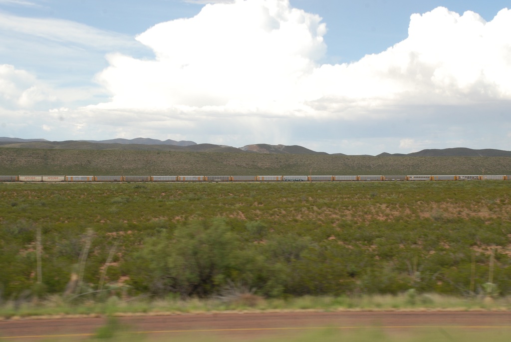
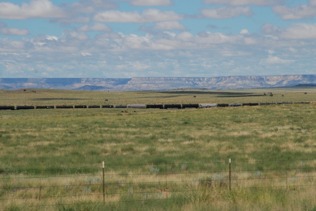
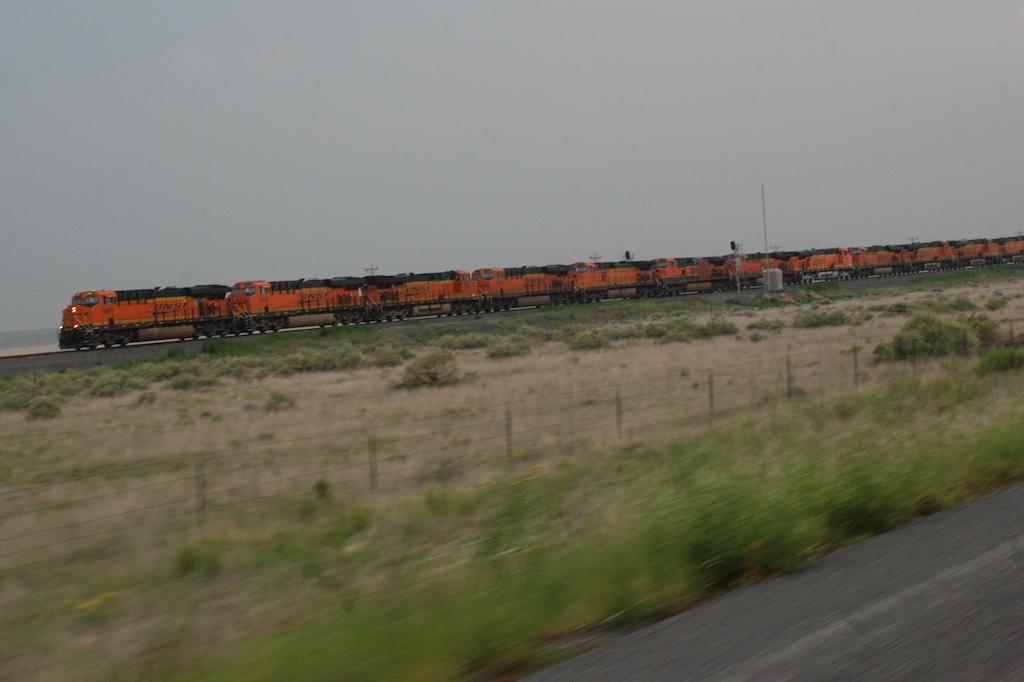
Another train view but this is a train made up of a dozen engines. We saw this the previous day also. Mulitple engines are used to pull (and push?) trains up the long grades and I guess they send those engines back to be ready for the next train. Many hours of driving later and about dusk we got to Roswell, infamous for it's UFO reputation.Motel in Roswell NM

Road Trip to Texas - Day 2

After being pleasantly surprised about our camping spot chosen in the dark I went on an early morning walk in the Mojave National Preserve. Mohave National Preserve Catclaw acacia, Acacia greggii Catclaw acacia.DSC_6847

jack rabbitAfter stowing our gear we set off north to see what the town of Kelso looked like. Have you ever seen a sign with a flashing light that cautions you to watch for tortoises? I never had and I wish I had stopped for a photo. It was one of those things that I thought I'd do on the way back but we ended up making a loop through the preserve.

DSC_6892First stop was Kelso, a ghost town and defunct railway depot. Most of the building in town are gone but the railway depot was restored and serves as the visitor center.DSC_6891This is a jail cell that was used from the mid-1940s to1985 to "confine drunks or other unruly individuals for a night or two". The placard said that there was a corrugated shell to protect from rain and sun but that "prisoners rarely spent more than one night in the jail".

The Preserve contains three major desert ecosystems--Mojave, Great Basin, and Sonoran, as well as the world's largest and densest Joshua tree forest.We wound our way through the Joshua tree and then pinyon-juniper ecosystems and also saw the affects of the previous night's rain--flooded gullies and washes. Our next stop was at the "Hole in the Wall"...

IMG_5143 ...where we did a one-mile hike that took us through Banshee Canyon.Mohave National Preserve (1)Mohave National Preserve (2)IMG_5147Petroglyphs on the other side of the bluffs.

I was glad to spend some time in the preserve but our goal was to get to Texas and we hadn't even left California. So we got in the truck and headed for Arizona. DSC_6926We wanted to see as many "points of interest" as possible but since our real goal was to get to Texas we considered this mainly an on-the-road trip, seeing the country along the way, but without a lot of time to spend in any one place.

DSC_6932 About 10 miles southeast of Flagstaff we stopped at Walnut Canyon National Monument, but the trails to the cave dwellings were already closed for the day. However we could view them from short trail along the top of the canyon. Can you spot the dwellings just below that ridge on the right?

DSC_6933 So that was a quick walk on the nature trail and a chance to stretch our legs and we took off again. I told Dan that we had to stop in Winslow. IMG_5151 (1)He was a good sport about standing on the corner. But it turned out to be the wrong corner. The green sign points to the other corner. IMG_5156 IMG_5158It turns out that there were a lot of people also standing on the corner. You almost have to wait in line for your turn at the corner. A quick stop in a souvenir shop and we got on the road again.

All the next photos were taken from the truck.

DSC_6947 Beautiful sky and landscape.

DSC_6949 DSC_6956 We needed to figure out where to spend the night but most of the land on the way to New Mexico is either privately owned or reservation land, so camping wasn't an option. Seeing the clouds and lightening to the east was the other reason to find a motel for the night and we decided to make it to Gallup, New Mexico. These shots were taken on the way to Gallup, starting about 15 miles away. Incredible rainbow.

DSC_6961 DSC_6966 DSC_6971 DSC_6973   

DSC_6978

More tomorrow.